

GIScience News Blog
-
Version 1.0 of the ohsome quality API and ohsome dashboard
At HeiGIT and in particular within the ohsome team, we strive to provide valuable insights into OpenStreetMap (OSM) data. The ohsome API offers aggregated statistics on the evolution of OSM elements since 2020. These are made easily accessible by the ohsome dashboard. With the ohsome quality API, previously called ohsome quality analyst (OQT), we continue…
-
Happy, Green Cities: Nina Krašovec’s Geospatial Exploration of Urban Vegetation
Until recently, Nina Krašovec was a research assistant at the GIScience research group. This article is the result of an interview, where she spoke about her work at the time and her motivations. We would like to use this article as an opportunity to express our appreciation of her work at HeiGIT and to wish…
-
Taginfo goes ohsome
Did you know that the OpenStreetMap (OSM) taginfo site now lets you access the ohsome dashboard? This allows you to gain refined insights into the usage stats of specific keys and tags. Taginfo is the main source for statistics about keys, tags and current tag usage. In most cases, you have to acces a localized…
-
HeiGITs Disaster Portal in Radiobeitrag vorgestellt
Campusreporter Nils Birschmann hat mit Prof. Alexander Zipf über unser Disaster Portal gesprochen. Das Interview wurde über Radio Regenbogen ausgestrahlt. Hier könnt ihr euch den Beitrag in voller Länge anhören: Audiobeitrag: Das Disaster Portal – sichere und schnell verfügbare Datengrundlagen im Katastrophenfall Darum geht’s: Im Katastrophenfall sind Hilfskräfte auf aktuelle Ortsdaten der betroffenen Region angewiesen: Welche…
-
Visualizing OQT API Results in QGIS
Using the ohsome dashboard, it is possible to explore quality estimation for OpenStreetMap (OSM) data from the ohsome quality analyst (OQT) for arbitrary regions. Also, OQT does provide an API to programmatically fetch quality estimation for a lot of different regions in one request. Chances are that one wants to visualize the results on a…
-
Bachelor’s thesis: Using OSM for location analyses of residential real estate projects – an extrinsic analysis of data quality
In his bachelor’s thesis, supervised by HeiGIT’s apl. Prof. Dr. Sven Lautenbach, Lars Reckhaus examined the suitability of OpenStreetMap (OSM) for location analyses in the context of residential real estate projects. Typically, such analyses require the use of a variety of data sources and are mostly performed manually. For this reason, they tend to be…
-

Introducing ohsomeNow stats: Real-Time Monitoring for OpenStreetMap Contributions
You can now monitor contributions to OpenStreetMap (OSM) in real time with ohsomeNow stats! We developed this new dashboard as part of our long-term cooperation with the Humanitarian OpenStreetMap Team (HOT), an international organization dedicated to humanitarian action and community development through open mapping. This dashboard replaces the Missing Maps Leaderboard with a comprehensive overview of…
-
Recap Road Quality Mapathon
Last Monday, on July 31st, we hosted a road quality mapathon, which saw the participation of students and researchers alike. Their collective efforts led to the classification of nearly 50% of all the pre-selected road pictures in 34 African countries. These valuable data points will be instrumental in training machine learning algorithms to identify paved…
-
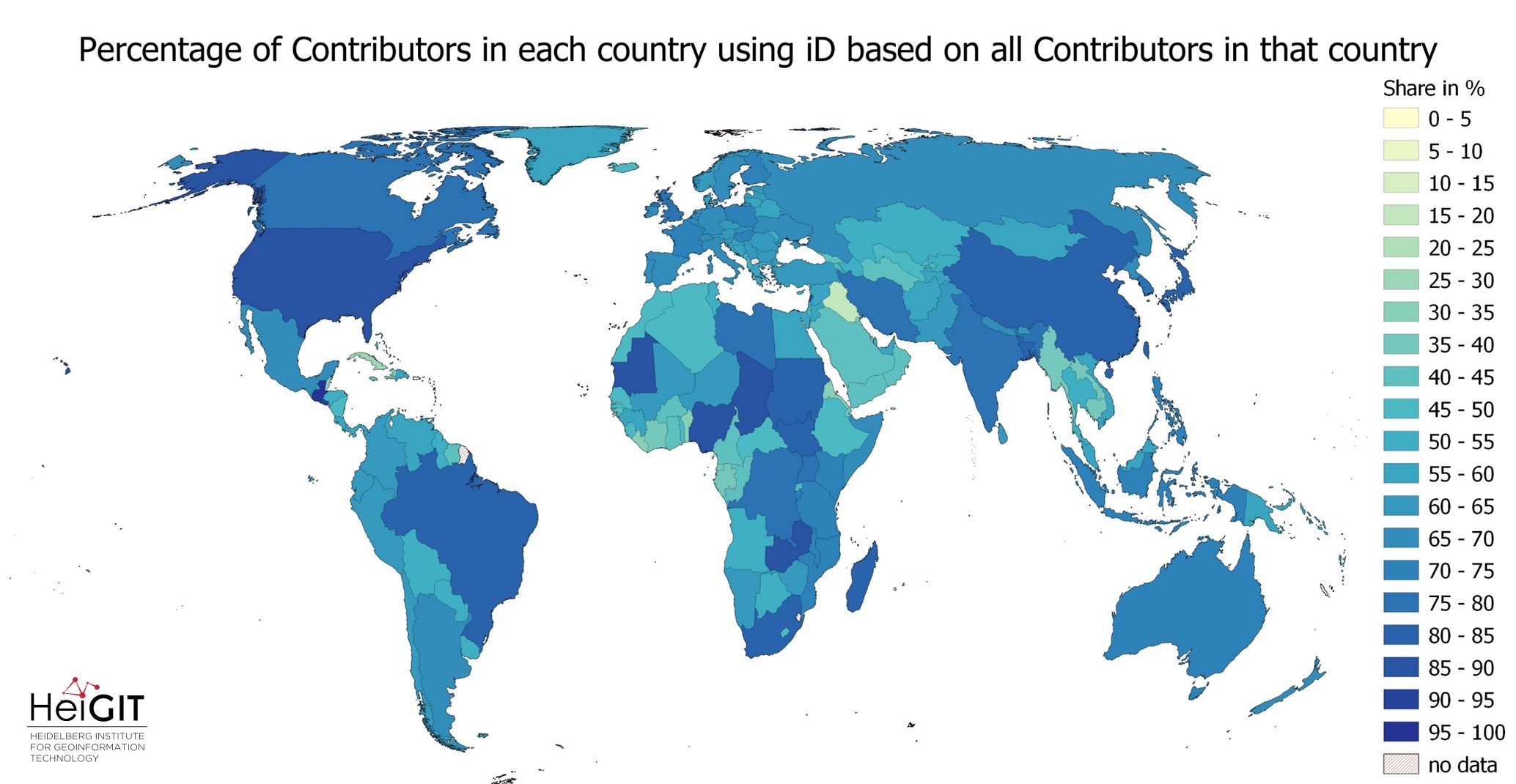
Exploring OSM editor statistics by combining data from OSHDB and changeset DB
OpenStreetMap (OSM) marks one of the most successful and powerful open source, crowdsourced geomaps, with over 10 million registered users by 2023. Since 2008 this number has increased steadily. In this blog post we want to look behind this success from the perspective of editing software used to add, modify and delete data in OSM.…
-
HeiGIT at Summer School Disaster Risk Reduction 2023
Today we’d like to tell you about the Summer School Disaster Risk Reduction 2023 event hosted by the Environmental Campus of UAS Trier in Germany and organized by the German Committee for Disaster Reduction (DKKV). During this one-week course that took place from the 9th till the 15th of July 2023, students and people interested…
-
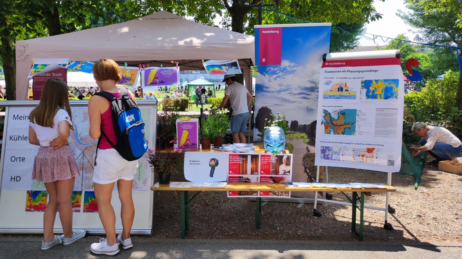
Safely through the heat with HEAL: Transdisciplinary project helps at-risk groups in everyday life
The transdisciplinary project HEAL involves citizens in the research process on heat stress in the city: The aim is to make everyday life easier for at-risk groups during heat waves. The Heidelberg Institute for Geoinformation Technology (HeiGIT), supported by the Klaus Tschira Foundation, the TdLab Geography and the GIScience Research Group of Heidelberg University are…
-
Research Visit at Universidade Federal Fluminese (UFF) in Rio de Janeiro
In context of his research on mosquito monitoring and inner-urban dengue occurence, PhD student and GIScience team member Steffen Knoblauch visited the “Universidade Federal Fluminese” (UFF) in Niterói, State of Rio de Janeiro, Brazil. He was invited to meet collaborators and professors of UFF and to present his work in “Dengue Risk Modelling at an Urban…
3D 3DGEO Big Spatial Data CAP4Access Climate Change Conference crisis mapping Crowdsourcing data quality deep learning disaster DisasterMapping GIScience heigit HELIOS HOT humanitarian humanitarian mapping Humanitarian OpenStreetMap team intrinsic quality analysis landuse laser scanning Lidar machine-learning Mapathon MapSwipe Missing Maps MissingMaps ohsome ohsome example Open data openrouteservice Open Source OpenStreetMap OSM OSM History Analytics Public Health quality analysis remote sensing routing social media spatial analysis Teaching VGI Workshop