
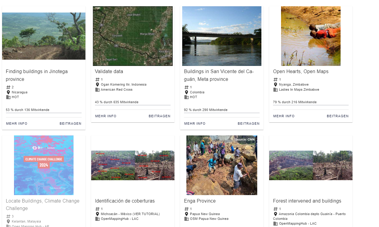
Tag: MapSwipe
-
The new MapSwipe Web App is here!
No matter where you are or which device you are using, you can now do voluntary work and make a difference, all from your browser with MapSwipe Web App! Since 2015, MapSwipe has harnessed the collective force of volunteers to actively contribute to geoinformation-related projects. In science and in fields such as city and traffic…
-
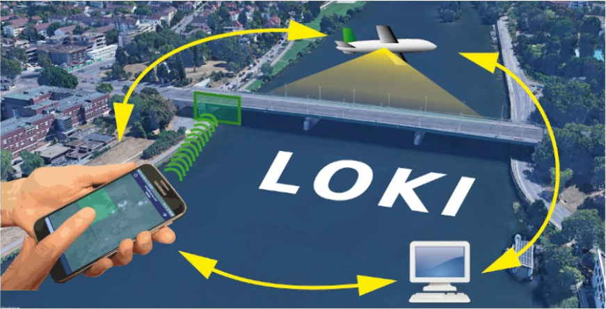
The LOKI Project: Rapid Earthquake Damage Assessment
In the aftermath of earthquakes, rapid and accurate assessment of infrastructure damage is crucial. The LOKI project (Airborne Observation of Critical Infrastructures), funded by the Federal Ministry for Education and Research and active from January 1, 2020, to March 31, 2023, aimed to tackle this challenge. Bringing together expertise from diverse research fields including earthquake…
-
HeiGIT and GIScience at AGILE 2023
Earlier this month, the Association of Geographic Information Laboratories in Europe (AGILE) held its 2023 conference, and GIScience and HeiGIT team members contributed presentations, analyses and papers toward this year’s theme of “Spatial data for design.” At the conference’s host university Delft University of Technology (TU Delft) in the Netherlands, the team members contributed work uniting design…
-
HeiGIT at MSF Geo Week 2022
This June, MSF (Médecins Sans Frontières) GIS Week 2022 was held in person again in beautiful Prague. Nearly the entire MSF team dealing with geo-data and geospatial analysis congregated at the event, which presented a fantastic opportunity to learn more about the current use of GIS within MSF and to discuss its future strategic importance.…
-
Räumliche Daten für die Gesellschaft – HeiGIT in die Zukunft geführt
Unterführungen, Treppen und hohe Bordsteinkanten sind für Menschen mit Gehbeeinträchtigungen eine große Herausforderung. Ein maßgeschneiderter Routenplaner kann aber ihre Mobilität erhöhen, indem er Wege mit möglichst wenigen Hindernissen berechnet. Dieses Beispiel zeigt, wie Geoinformationstechnologie und Geoinformatik speziellen Gruppen in der Gesellschaft ganz konkret helfen. HeiGIT, das Heidelberg Institute for Geoinformation Technology, entwickelt nicht nur passgenaue…
-
HGG Vortrag: Digitale Geographie im Katastrophenmanagement
Einladung Vortrag Online: Dienstag, 14. Dezember 2021, 19:15 Uhr Melanie Eckle-Elze, Benjamin Herfort, Dr. Carolin Klonner Digitale Geographie im Katastrophenmanagement Klimawandel, Bevölkerungswachstum, Verstädterung und weitere zunehmende Landnutzungsveränderungen führen dazu, dass immer mehr Menschen in Risikogebieten leben. Um die vorhandenen Risiken zu verstehen und angepasste (Vorsorge-) Maßnahmen zu ergreifen, bedarf es der Zusammenführung von Expertenwissen als…
-
HeiGIT and GIScience at Virtual Conference of the Red Cross Red Crescent Urban Collaboration Platform 2021
On Friday, November 26th, Dr. Carolin Klonner (GIScience Research Group) and Melanie Eckle-Elze (HeiGIT) will be supporting the Urban Context Unit of German Red Cross (GRC) in the “Data and Digitalisation in Urban Humanitarian Action” session at the Virtual Conference of the Red Cross Red Crescent Urban Collaboration Platform 2021. The focus of the session…
-
FOSS4G 2021 Videos with HeiGIT contributions online – OSM data quality and MapSwipe
Recently videos with our contributions by HeiGIT to the FOSS4G conference were put online. Did you miss the event? Now you can watch whenever you like 🙂 Benni by HeiGIT explains who to use the ohsome.org framework to develop an OSM Confidence Index to support humanitarian mapping https://www.youtube.com/watch?v=DWkISL4qbME FOSS4G 2021 Using the ohsome framework to…
-
MapSwipe is App of the Day in Apple AppStore
MapSwipe has ben announced as ‘App of the Day‘ in the Apple AppStore! (27.08.2021) Thank you to all our volunteers for the continued help and support which keeps the app going. Read the blogpost here: https://apps.apple.com/ca/story/id1559236909 The team at the Heidelberg Institute for Geoinformation Technology (HeiGIT) and the GIScience Research Group at Heidelberg University has shaped MapSwipe’s…
-
One step forward for “25 Mapathons” – today Online Mapathon at Humanitarian Congress
The project “25 Mapathons” made an important step forward by successfully completing the first four Mapathons of the project. Two Mapathons were conducted with German Red Cross (GRC) members from the Red Cross Regional association of Westfalen-Lippe. Another two Mapathons where hosted by local GRC chapters from the City of Heidelberg and the nearby town…
-
OSM completeness mapping for airborne situation assessment following an earthquake
As part of the LOKI project (Luftgestützte Observation Kritischer Infrastrukturen), a first test run of a newly launched OpenStreetMap (OSM) completeness mapping project in MapSwipe has been conducted yesterday. The aim of the LOKI project is to develop an interdisciplinary system that enables fast and reliable airborne situation assessments following an earthquake. The system will…
-
HeiGIT gGmbH is One Year Old Today!
Today (1st July 2020) marks the first birthday of HeiGIT gGmbH! Over this first year, HeiGIT, the Heidelberg Institute for Geoinformation Technology at Heidelberg University has been involved a large number of events, projects, publications, and press coverage. Founded on the 1st July 2019, HeiGIT is a non-for-profit organisation receiving core-funding by the Klaus Tschira…