

Tag: Conference
-
3DGeo April Recap: Conferences
It was an exciting month for the 3DGeo research group in April. Three major conferences took place: Let’s give you some impressions below! JISDM The Joint International Symposium on Deformation Monitoring (JISDM) brings together experts on deformation monitoring from a range of fields such as photogrammetry, remote sensing and of course geodesy. It is a…
-
EUGEO 2025: Call for Papers on greenhouse gas emission inventories and active mobility indicators
The Call for Papers for the 10th EUGEO Congress 2025 is open! The Climate Action team at HeiGIT is looking forward to actively participate in next year´s congress with two sessions chaired by Kirsten von Elverfeldt, Maria Martin and Sebastián Block.
-
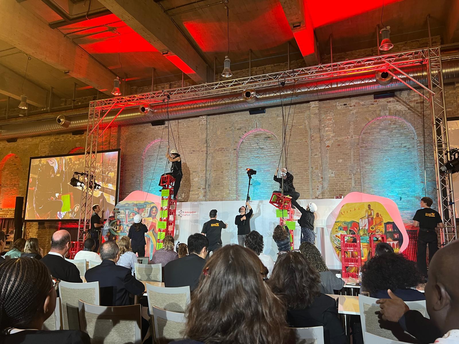
HeiGIT at the Global Dialogue Platform Berlin
Stuntmen, jugglers, humanitarians stacking and climbing boxes, wildcard sessions – not the usual things you would expect at a conference. But all of these shaped this year’s Global Dialogue Platform and helped participants to leave their usual comfort zones. In dynamic discussions, interactive workshops, plenaries and side sessions, humanitarian practitioners, policymakers, tech experts and many…
-
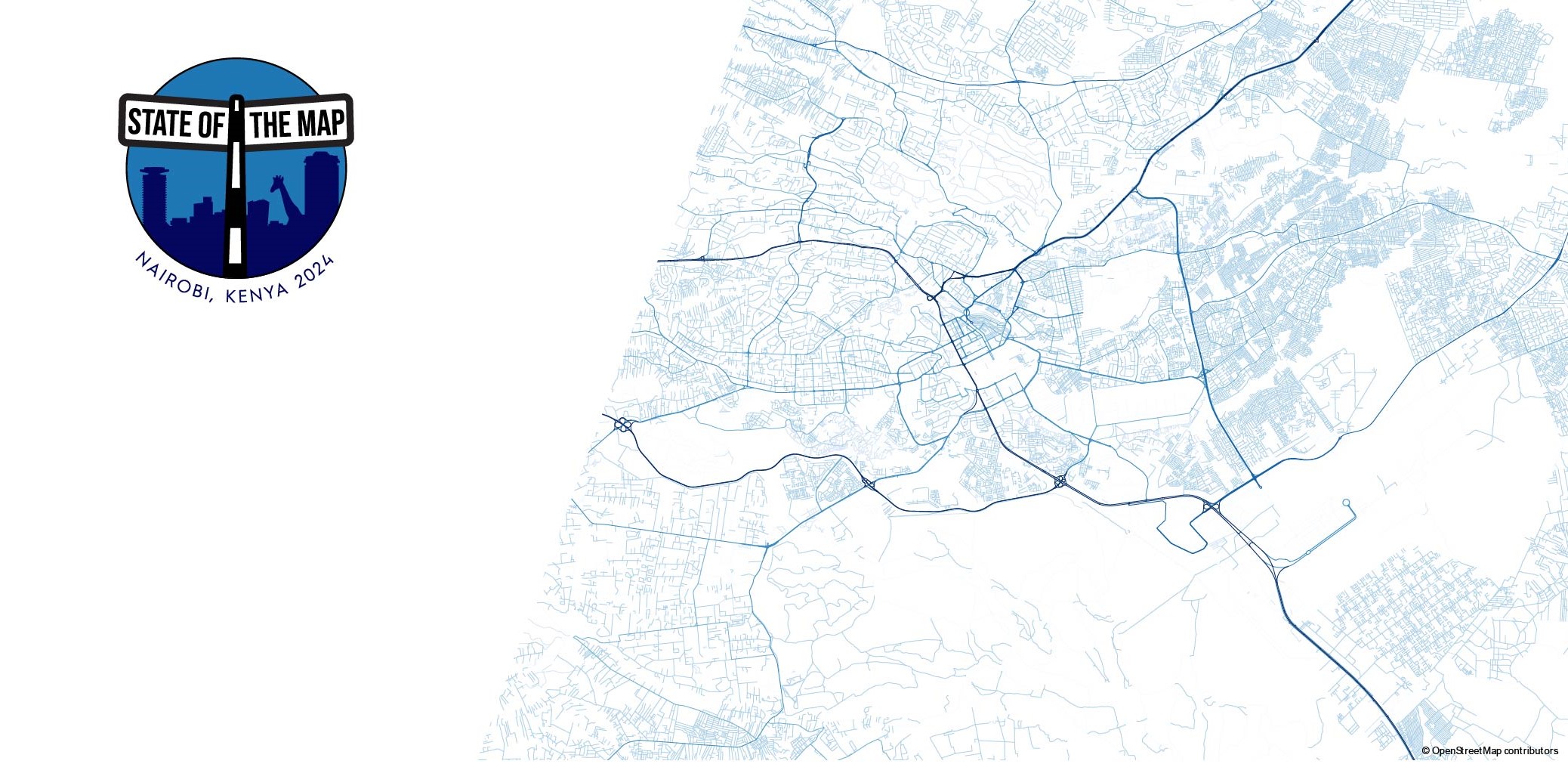
HeiGIT at State of the Map in Nairobi, Kenya
State of the Map is the annual event for all mappers and OpenStreetMap users. In 2024 the State of the Map conference will be taking place from September 6 to 8 in Nairobi, Kenya as well as online. The conference programme contains talks, workshops, discussion rounds and more. Four talks as well as a workshop…
-
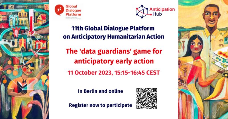
HeiGIT at the 11th Global Dialogue Platform on Anticipatory Humanitarian Action
In October 2023, the 11th Global Dialogue Platform on Anticipatory Humanitarian Action will take place as a hybrid event in Berlin, allowing for people to attend either in person or online (register here). Under this year’s main theme “People at the centre: scaling up anticipatory action”, the platform offers a plethora of workshops and discussion…
-
HeiGIT at the GIScience Conference in Leeds
HeiGIT and GIScience members Adam Rousell, Anne Schauss, Christina Ludwig and Nir Fulman were invited to present their work at the 12th International Conference on Geographic Information Science in Leeds. The conference took place from September 12-15. The first day was dedicated to workshops and tutorials, while short and full papers, as well as posters…
-
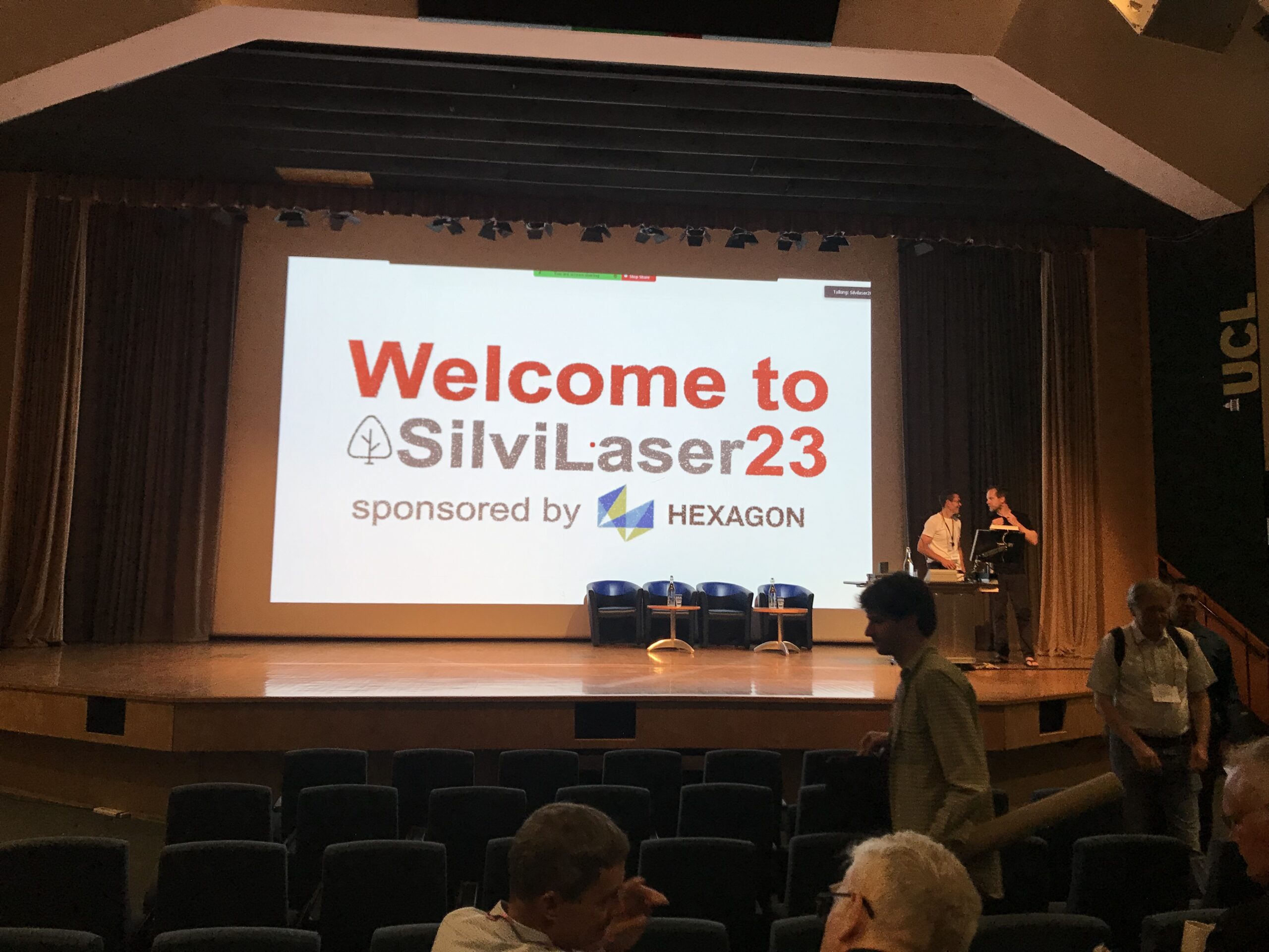
Impressions from Silvilaser 2023
Last week, our PhD student, Hannah Weiser, joined Silvilaser 2023 at University College London (UCL). The conference covers cutting-edge science and technology from the laser scanning and forest communities, which is a perfect match for Hannah’s PhD topic and 3DGeo research in general. The week started off with interesting workshops on Tuesday using some of…
-
Advancing Geospatial Techniques for Vector-Borne Disease Research: Insights from GIScience-CSIAD Collaboration – a conference recap
Recently, Hanse-Wirtschaftskolleg hosted its meeting which brought together experts from GIScience and CSIAD lab, along with renowned researchers from universities in Germany, Thailand, and Ghana, serving as a platform for interdisciplinary collaboration on vector-borne diseases. This event brought together esteemed researchers to share their expertise and insights into combating mosquito-borne illnesses. As an invited speaker,…
-
Looking back at FOSS4G Conference 2023
Figure 1: FOSS4G 2023, QGIS daily openings This years FOSS4G conference took place from 26 June – 2 July 2023 in beautiful Prizren, Kosovo. Since 2006 FOSS4G, the largest global gathering for geospatial software, is organized by the Open Source Geospatial Foundation (OSGeo). This year workshops, presentations, discussions, cooperation and developing of geospatial tools and softwares…
-
HeiGIT and GIScience at AGILE 2023
Earlier this month, the Association of Geographic Information Laboratories in Europe (AGILE) held its 2023 conference, and GIScience and HeiGIT team members contributed presentations, analyses and papers toward this year’s theme of “Spatial data for design.” At the conference’s host university Delft University of Technology (TU Delft) in the Netherlands, the team members contributed work uniting design…
-
GeoEpi at CGA 2023: From Geospatial Research to Health Solutions
Featured photo: The geoEpi team attending CGA 2023. Back row from left: PD Dr. med. Thomas Jaenisch, Assoz. Prof. Dr. Bernd Resch, Dorian Arifi and Steffen Knoblauch. Front row from left: Dr. rer. nat. Ivonne Morales Benavides, Apl. Prof. Dr. Sven Lautenbach, and Dr. Yannik Roell. Ever since Dr. John Snow’s 1854 tracing of a…
-
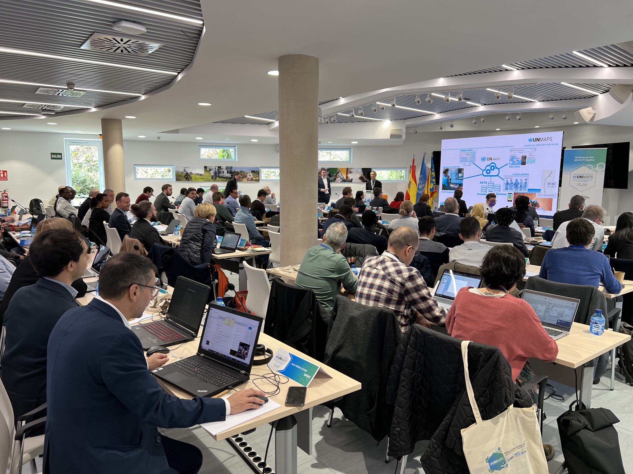
HeiGIT’s contributions to the 2nd UN Maps Conference
The United Nations Maps program, created in 2019, held its 2nd UN Maps Conference, this time in Valencia, Spain. Prof. Alexander Zipf of HeiGIT and the GIScience Research Group at Heidelberg University and Benjamin Herfort of HeiGIT attended the conference to talk about “Open Ecosystems in Practice”, “Partnerships and Cooperation with Academia” and how to “build better…