

GIScience News Blog
-
Unveiling the Sketch Map Tool 2.0: A Comprehensive Overview of New Features and Training Opportunities
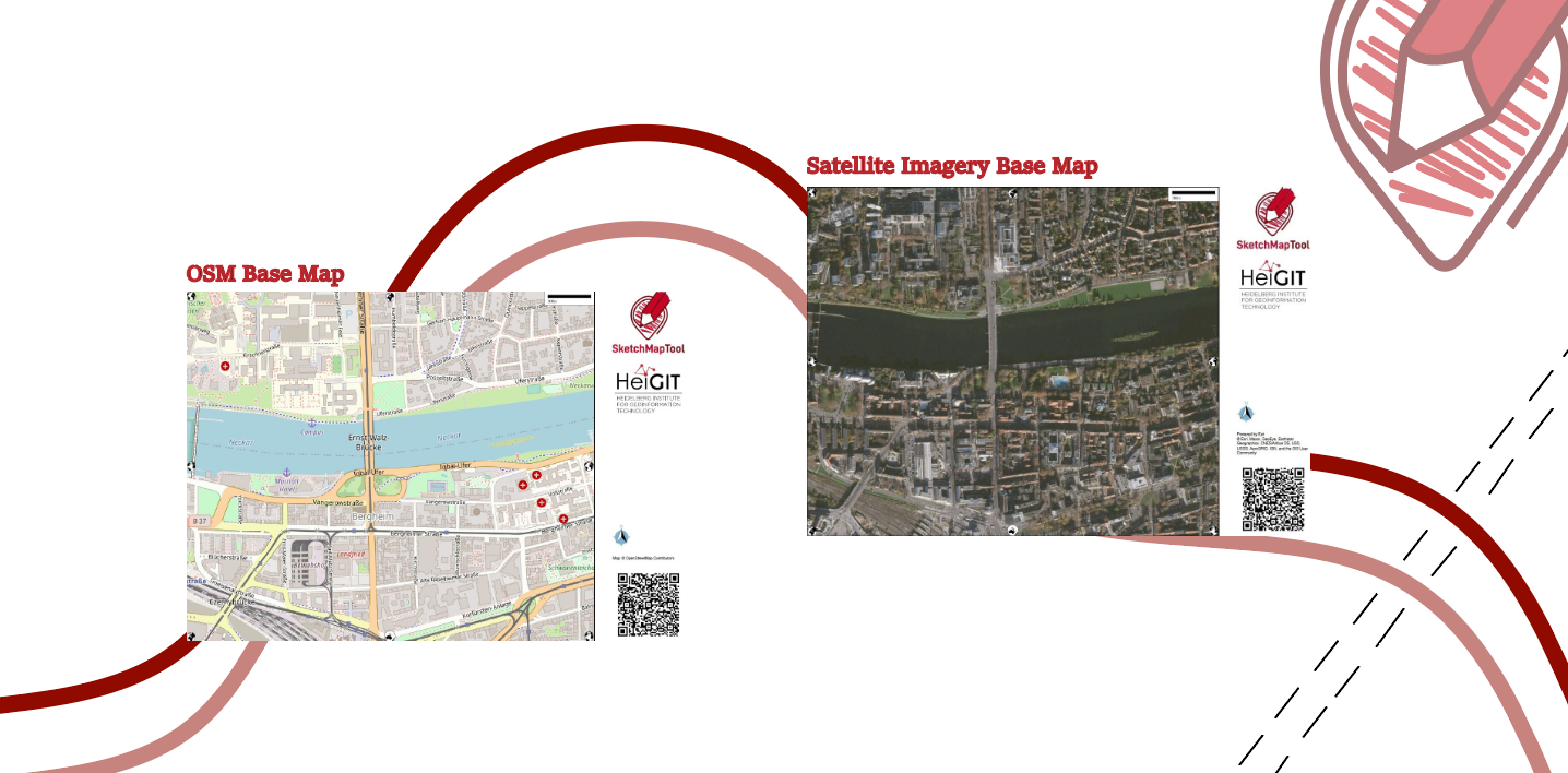
The HeiGIT gGmbH (Heidelberg Institute for Geoinformation Technology) team has just released a version 2.0 of the Sketch Map Tool, a low-tech solution for participatory sketch mapping through offline data collection, digitization and georeferencing of local spatial knowledge. Thanks to continuous support from the German Red Cross and financial support by the German Federal Foreign Office, the HeiGIT tool has undergone significant enhancements. These updates introduce new features aimed…
-
HeiGIT at FOSSGIS 2024
We’re proud to share our recent conference experience with you! Our HeiGIT Product Owners for Big Data and Smart Mobility, Benjamin Herfort and Julian Psotta, had the privilege of attending the FOSSGIS 2024 conference, where they contributed valuable insights and expertise. The results of an exciting six years of joint work and shared projects between HeiGIT and the Federal Agency for Cartography…
-
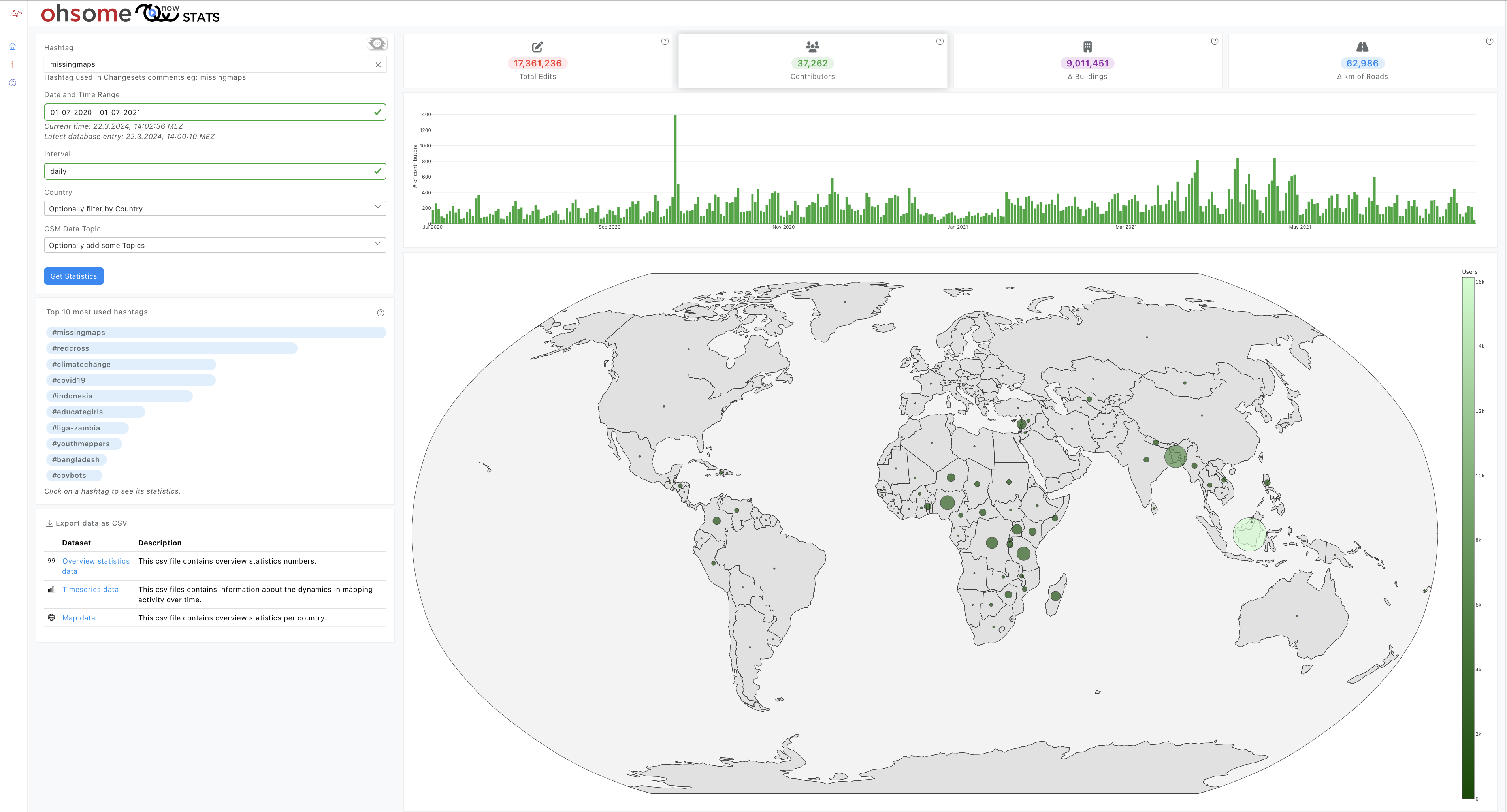
Introducing ohsomeNow stats v1.0
OhsomeNow stats makes it possible to monitor contributions to OpenStreetMap (OSM) in real time. We developed this new dashboard as part of our long-term cooperation with the Humanitarian OpenStreetMap Team (HOT), an international organization dedicated to humanitarian action and community development through open mapping. This dashboard has replaced the Missing Maps Leaderboard with a comprehensive overview…
-
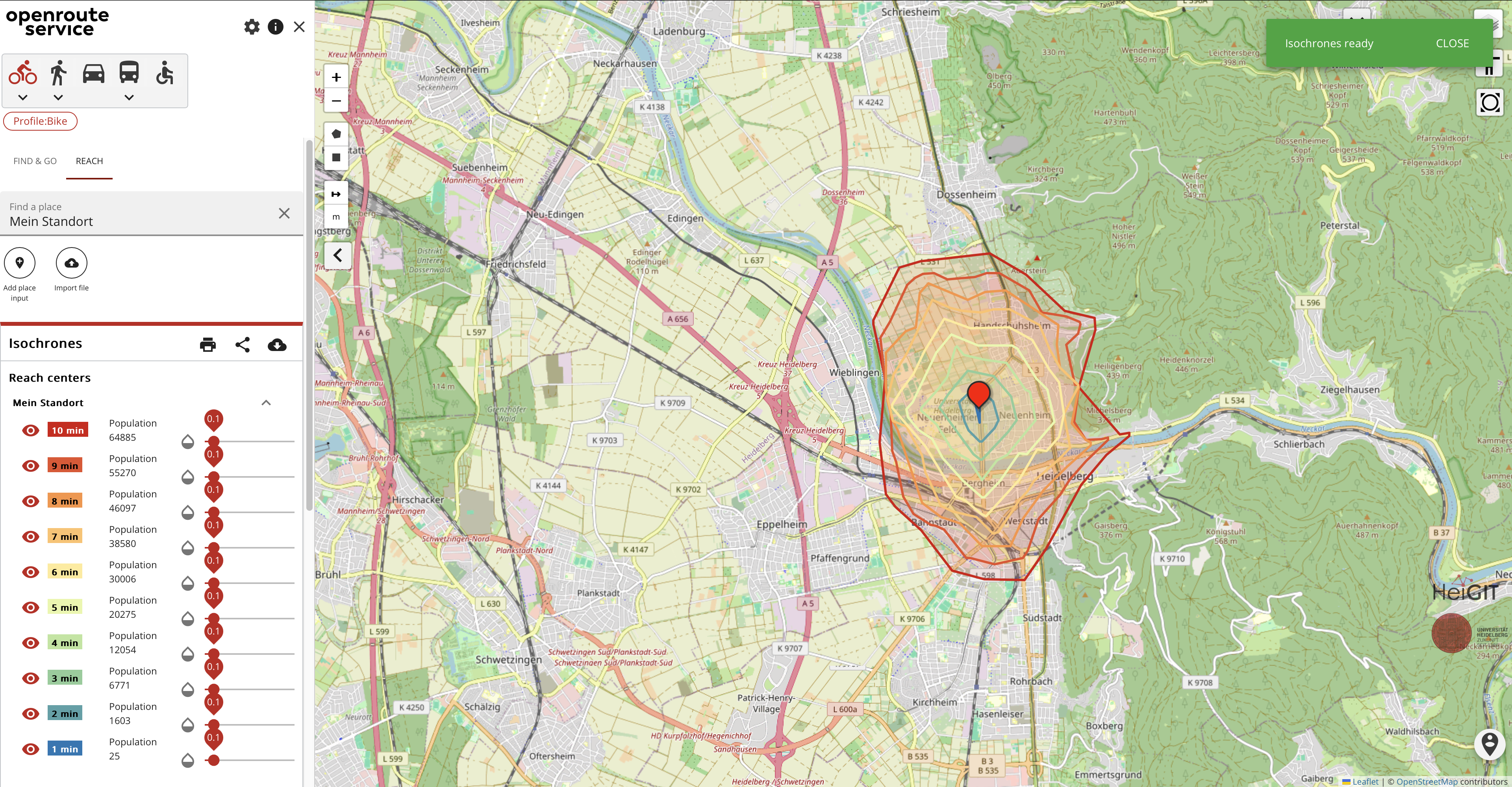
Introducing openrouteservice version 8.0 — A dedication to Wilfried Juling
We’re thrilled to announce the release of openrouteservice (ors) version 8.0, designated “Wilfried”, as a tribute to Prof. Dr. Wilfried Juling, whose steady support and advice fundamentally shaped the growth and success of HeiGIT since its beginning. With countless hours and dedication poured into development and innovation, we’re excited to present a rich set of…
-
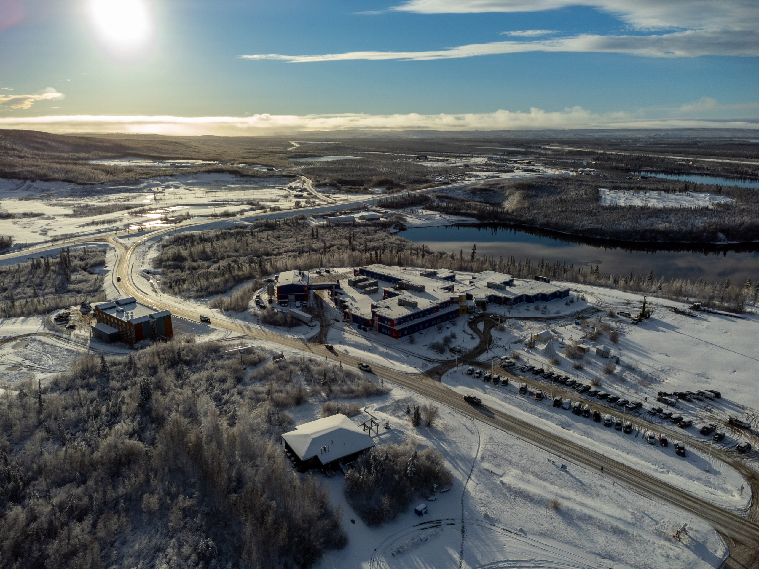
Chasing Permafrost: Insights from the Aklavik Expedition
In 2022, we embarked on an insightful expedition to Aklavik, Canada, in collaboration with our partners, the Alfred Wegener Institute (AWI) Helmholtz Center for Polar and Marine Research and the German Aerospace Center (DLR). This joint effort within the UndercoverEinAgenten project aimed to study the extent and velocity of permafrost thawing, a crucial aspect of…
-

Call for Applications – Robert and Christine Danziger Scholarship 2024
The Robert and Christine Danziger Scholarship application window is open until August 31st, 2024, offering a unique opportunity for doctoral candidates from Africa, particularly Ghana or West and Central Africa. The scholarship designed for those pursuing a doctorate at Heidelberg University in the fields of geography (with a focus on geoinformatics) or political science and…
-
Job Opening: Head of Administration (f/m/d)
Are you interested in applying your experience and knowledge to support science-related, non-profit organizations for the betterment of society and the environment? If so, we have a compelling and fitting position for you! HeiGIT gGmbH is a research-oriented, non-profit company that has set itself the goal of improving the transfer of knowledge and technology from…
-
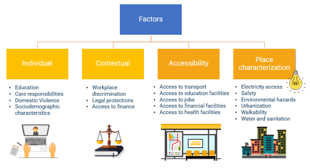
Empowering Change: OpenRouteService in Geospatial Initiatives for Women’s Economic Empowerment and Sustainable Development
The use of open-source geospatial data, exemplified by services like openrouteservice (ORS), proves to be beneficial for both academic research and use case studies. Witnessing our technologies applied in unanticipated ways showcases their potential to meet the evolving needs of various sectors while contributing positively to both society and the environment. One exemplary application is…
-
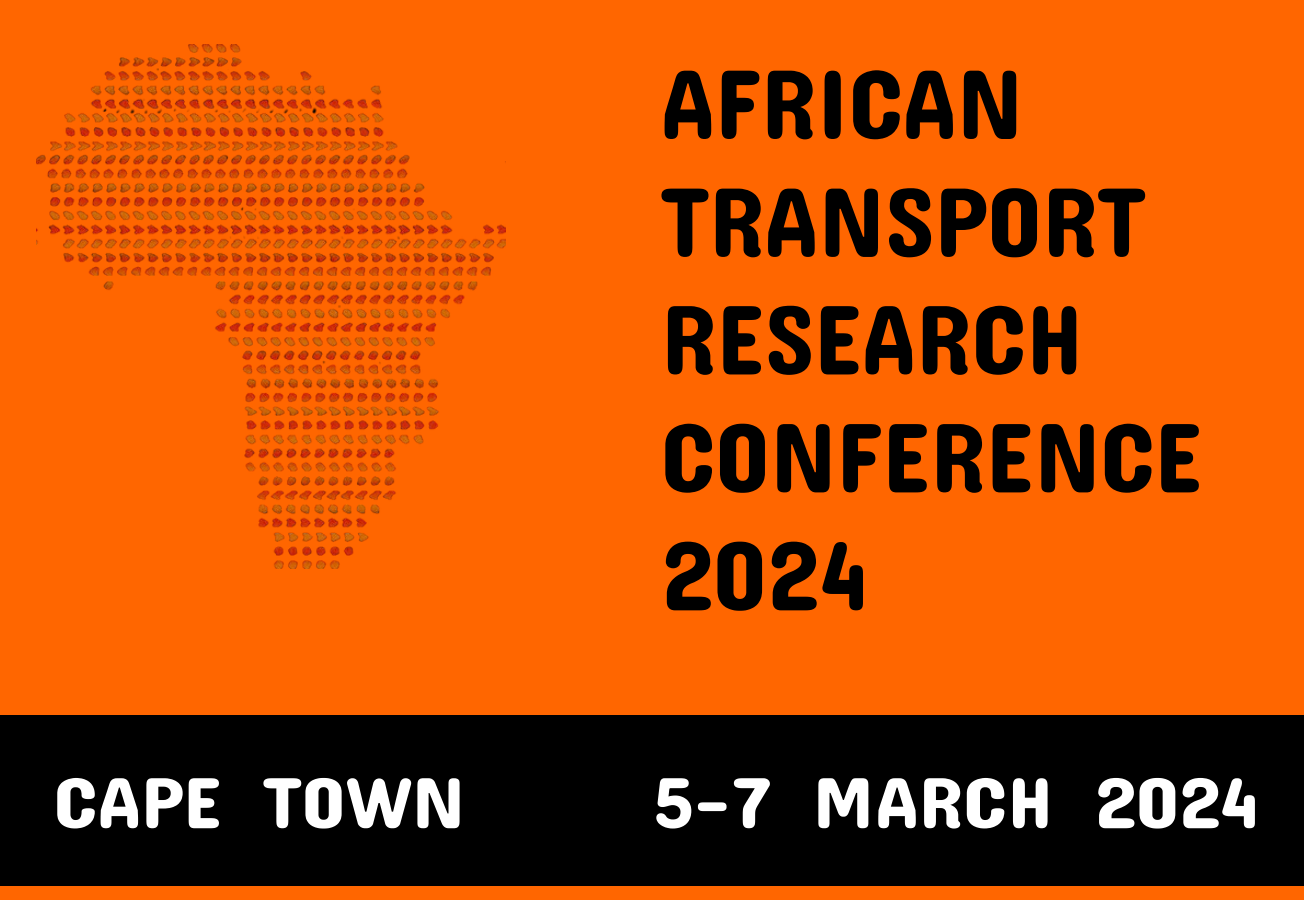
Unveiling the Impact of School Commutes: Charles Hatfield Presents Insights on Traffic Congestion and Urban Planning at ATRC 2024
Charles Hatfield will represent HeiGIT at the first ever African Transport Research Conference (ATRC 2024) which takes place from March 5-7 in Capetown, South Afrika. The conference was established to address rapid urbanisation in Africa and the corresponding challenges for transport and infrastructure. Volvo Research and Educational Foundations (VREF) and the Centre for Transport Studies…
-
IDEAL-VGI: Analyzing and Improving the Quality and Fitness for Purpose of OpenStreetMap as Labels in Remote Sensing Applications
We are happy to announce that the IDEAL-VGI project by GIScience has been successfully completed. IDEAL-VGI was a tandem project in cooperation with Begüm Demir from the TU Berlin and was conducted under the umbrella of the VGIscience Second Phase Projects which ran from 2020 to 2022. VGIscience received funding as a Priority Programme by…
-
HeiGIT International Postdoctoral Fellowships for GIScience Research for Climate Action
Dear Postdoctoral Scholars and Researchers, You are a highly motivated researcher who loves spatial data science and open geodata? You want to use your expertise for the benefit of society and the environment – in particular stimulating Climate Action or enhancing Humanitarian Aid related to Climate Resilience? You want to improve the availability and quality…
-
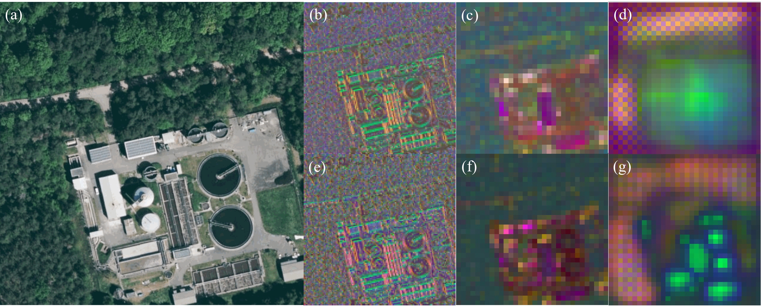
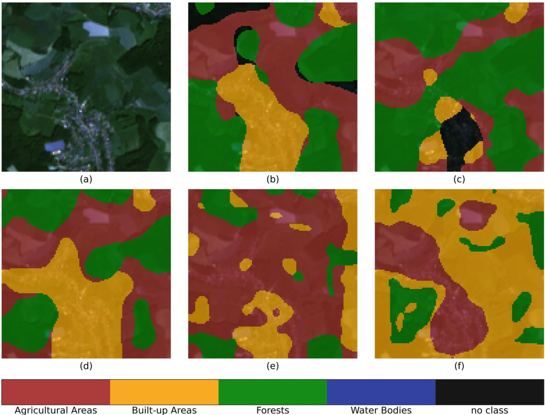
GeoAI4Water 2 Applies Deep Learning to Detect Critical Infrastructure for Disaster Planning
Context During natural disasters and other catastrophic events, quickly identifying and distributing resources is essential. Even a brief delay in evacuating residents or sourcing water can significantly hamper relief efforts and prevent effective disaster management. The HeiGIT and GIScience teams have been actively designing tools to assist in disaster preparation and response, from working with partners to build community resilience to activating our disaster…
3D 3DGEO Big Spatial Data CAP4Access Citizen Science Climate Change Conference crisis mapping Crowdsourcing data quality deep learning disaster DisasterMapping GIScience heigit HELIOS HOT humanitarian humanitarian mapping Humanitarian OpenStreetMap team intrinsic quality analysis landuse laser scanning Lidar machine-learning Mapathon MapSwipe Missing Maps MissingMaps ohsome ohsome example Open data openrouteservice OpenStreetMap OSM OSM History Analytics Quality quality analysis remote sensing routing social media spatial analysis Teaching VGI Workshop