
GIScience News Blog
-
Advancing Climate Action: HeiGIT’s New Climate Action Team
HeiGIT is embarking on an initiative to address one of the most critical challenges of our time — climate change. We are proud to announce the commencement of the Climate Action Readiness Initiatives funded by the Klaus-Tschira Stiftung. These initiatives aim to bridge the gap between knowledge and action by providing decision-makers, citizens, and active…
-
GeoPrompt – Revolutionizing Navigation and Beyond: HeiGIT’s Innovative Web Application Powered by ChatGPT
Introduction In an era where technology continuously reshapes our world, the fusion of artificial intelligence and geospatial data offers exciting possibilities. HeiGIT (Heidelberg Institute for Geoinformation Technology), a pioneering research organization, has unveiled a novel web application that not only simplifies navigation but also empowers users to access a wealth of location-based data. This proof-of-concept…
-
VirtuaLearn3D: New Preprint
We have published a preprint of our recent work in the VirtuaLearn3D project! Deep learning with simulated laser scanning data for 3D point cloud classification Esmorís, A.M., Weiser, H., Winiwarter, L., Cabaleiro, J.C. & Höfle, B. (2024) Laser scanning is an active remote sensing technique to acquire state-of-the-art spatial measurements in the form of 3D…
-
‘Waterproofing Data’ Project wins ESRC Celebrating Impact Prize 2023
The “Waterproofing Data” project has won the ESRC Celebrating Impact Prize 2023 in the category “Outstanding Societal Impact” for helping to protect residents of flood-prone areas in Brazil. In 2018, Joao Porto de Albuquerque from the University of Glasgow initiated the project in which HeiGIT is also involved. The main goal of this project is…
-
OQT for Food Environments
HeiGIT and the Amsterdam University Medical Centers (UMC) partnered up to investigate food environments through the lens of OpenStreetMap (OSM) data. UMC analyses how exposure to different categories of food related retailers affects health matters. The assumption is that the distance to retailers of a certain category, as well as the number of these retailers,…
-
Joint International Tropical Medicine Meeting 2023
GIScience member and PhD candidate Steffen Knoblauch was invited as a speaker at the Joint Internationl Tropical Medicine Meeting (JITMM) 2023. The conference’s focal topic was “Achieving the SDGs: Human and AI-driven Solutions for Tropical Medicine in a Changing world” and it was hosted by the faculaty of Tropical Medicine, Mahidol University and co-organized by…
-
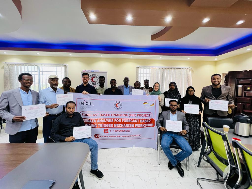
Somaliland GIS Training
Since 2022, HeiGIT is providing technical support to the Somali Red Crescent Society (SRCS) in Somalia. The objective was the development of an Early Action Protocol (EAP) for droughts in Somalia, a plan developed by RCRC National Societies that outlines early actions to be taken when a specific hazard is forecasted to impact communities. In…
-
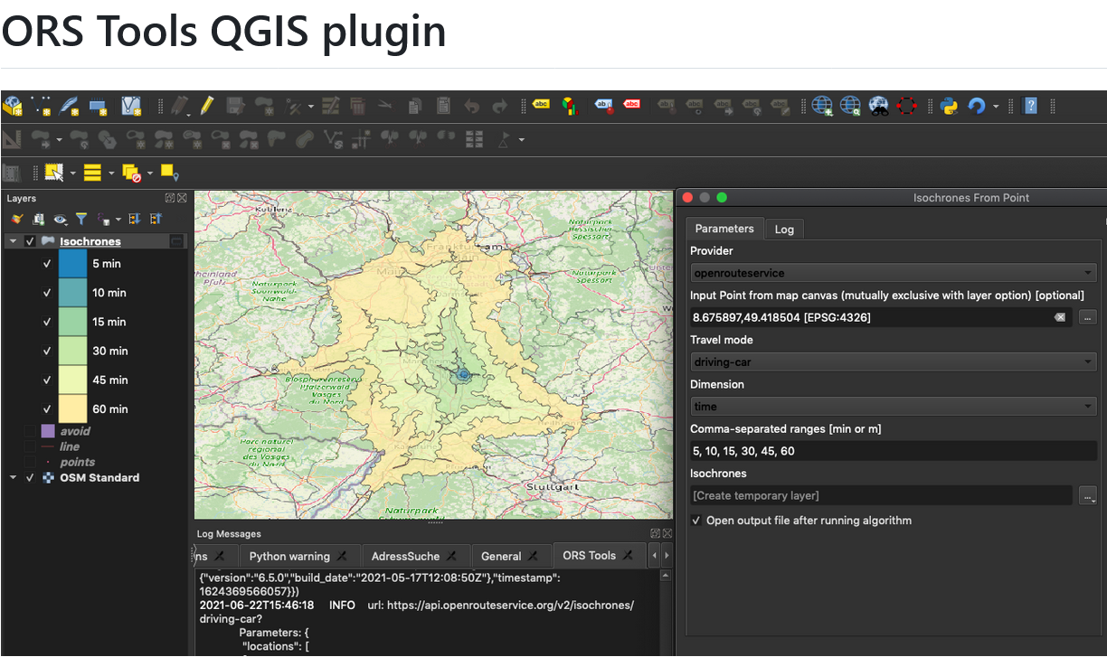
ORS Tools QGIS Plugin Release v1.7.0
Just in time for the new year, the openrouteservice team proudly announces the release of v1.7.0 of the ORS Tools QGIS plugin! Quite a lot has happened. First, the GUI was reworked: Next, there are a few other things that happened: Check out the changelog if you’re interested in all the in-depth details. Feedback and…
-
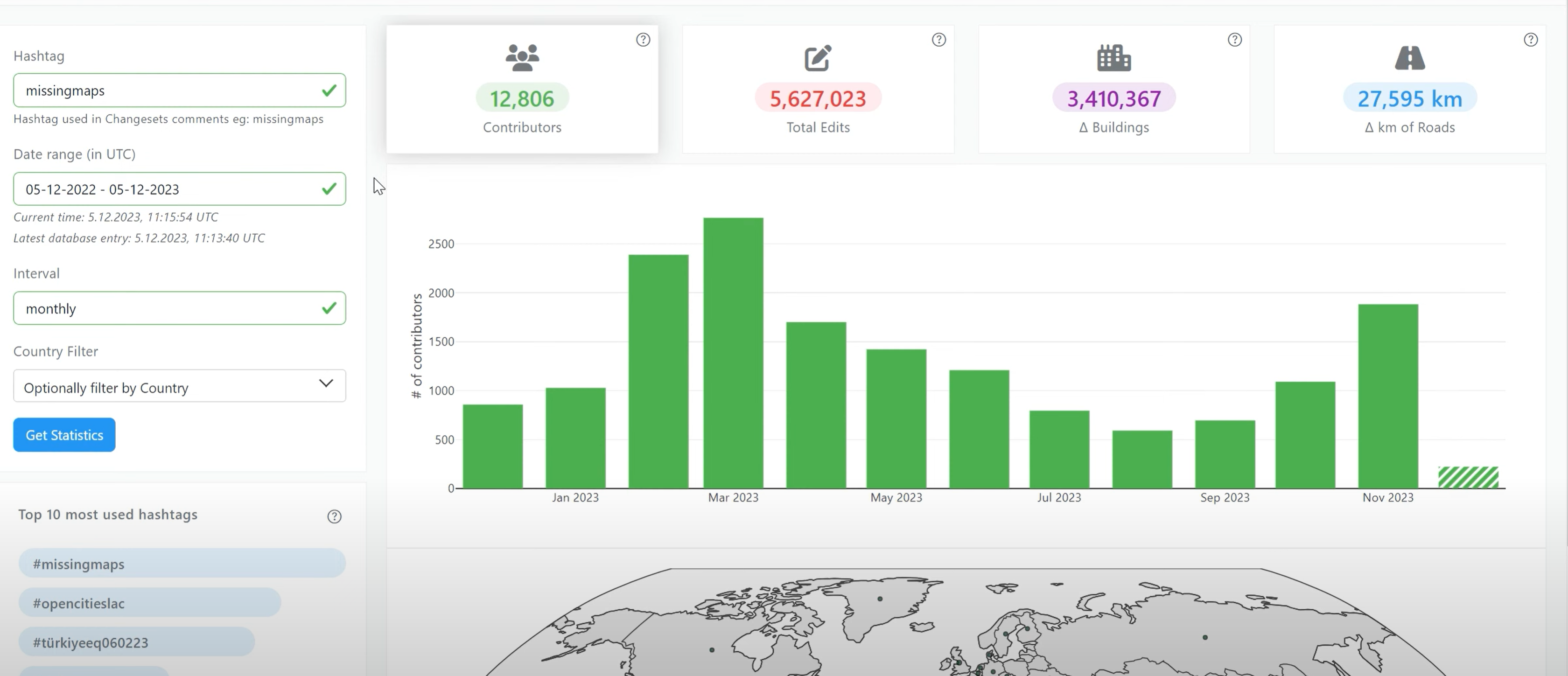
Introducing OhsomeNowStats
OhsomeNowStats allows users to take a look at the mapping activity in OpenStreetMap. This is especially useful for humanitarian organizations and mapathon organizers, because OhsomeNowStats data is updated every 5-10 minutes. Using this tool, user-engagement can be tracked in near real time and used to motivate participants and volunteers alike! By selecting a time range,…
-
IT Systems Engineer (m/f/d, up to 100%)
Are you passionate about automation, monitoring and the development of innovative IT infrastructures? Are you an enthusiast for open source software? And would you like to work with developers and researchers to further develop software in the field of geoinformatics from an operational perspective? We need your expertise to professionalize and fortify our IT services…
-
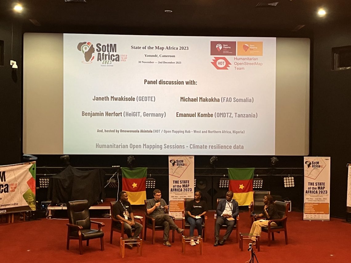
Looking back at SOTM Africa and Missing Maps Gathering
The recently concluded State of the Map Africa 2023, hosted in Yaoundé, Cameroon, marked the fourth edition of this regional OpenStreetMap (OSM) conference. The State of the Map was a great opportunity to get to know the people who are at the center of building open mapping communities in African countries. For the first time…
-
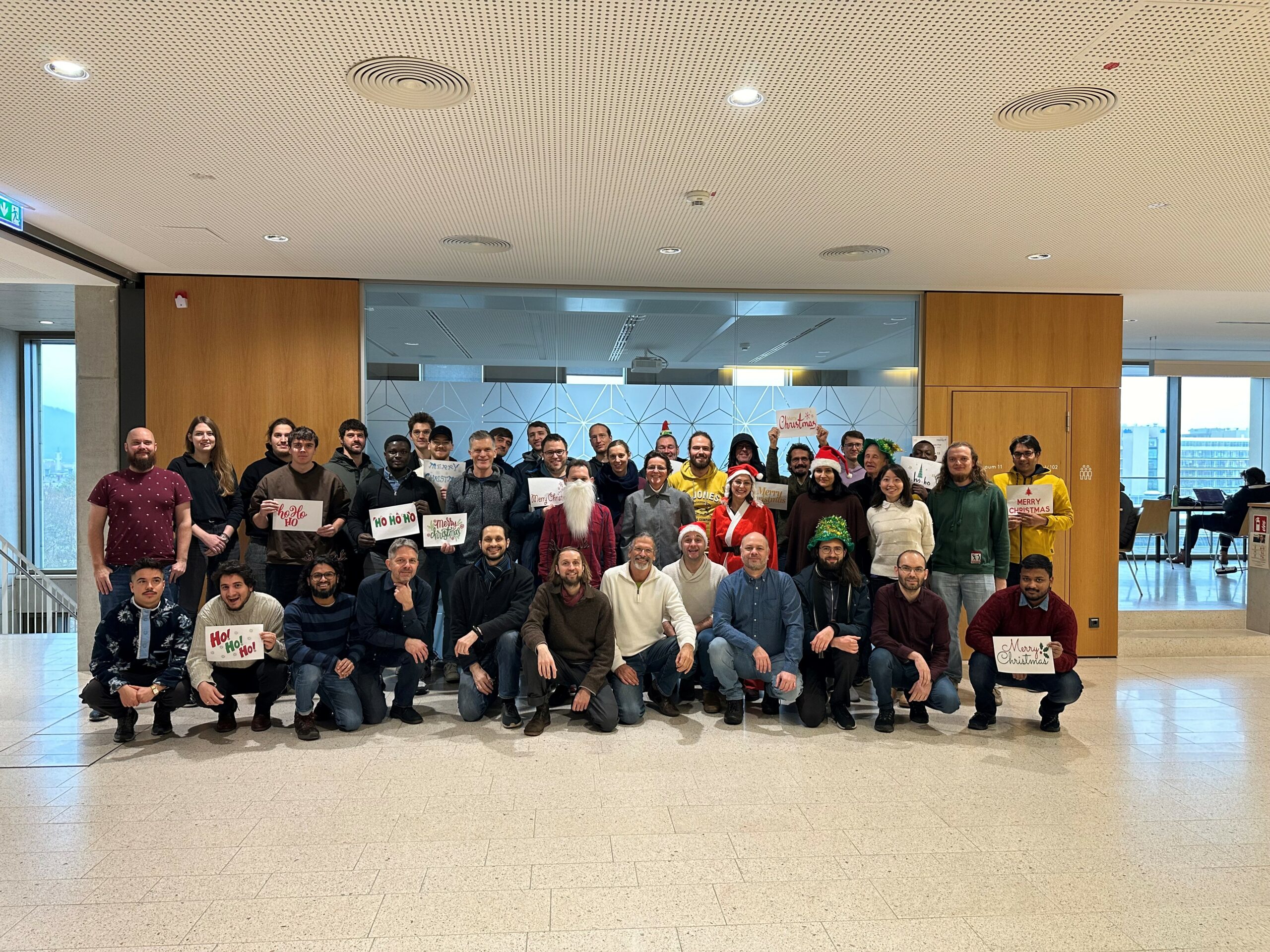
The Year 2023 at HeiGIT
As 2023 is coming to an end, we would like to take the opportunity to look back at this eventful year and appreciate the advance that HeiGIT has made towards its goal of enabling and improving the transfer of knowledge and technology. Thanks to the collective efforts of each team member and the GIScience community,…
3D 3DGEO Big Spatial Data CAP4Access Climate Change Conference crisis mapping Crowdsourcing data quality deep learning disaster DisasterMapping GIScience heigit HELIOS HOT humanitarian humanitarian mapping Humanitarian OpenStreetMap team intrinsic quality analysis landuse laser scanning Lidar machine-learning Mapathon MapSwipe Missing Maps MissingMaps ohsome ohsome example Open data openrouteservice OpenStreetMap OSM OSM History Analytics Public Health Quality quality analysis remote sensing routing social media spatial analysis Teaching VGI Workshop