

GIScience News Blog
-
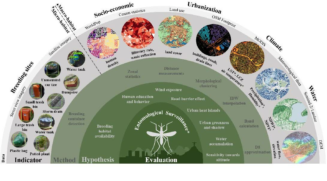
New Paper in Lancet Planetary Health “Urban Aedes aegypti suitability indicators”
To improve vector control strategies, Dr. Steffen Knoblauch (PostDoc at GIScience and HeiGIT) has developed detailed maps showing where Aedes aegyti is most likely to thrive. Using a holistic approach, his work leverages geospatial big data – including openly available satellite and street view imagery as well as climate data – to identify common breeding…
-
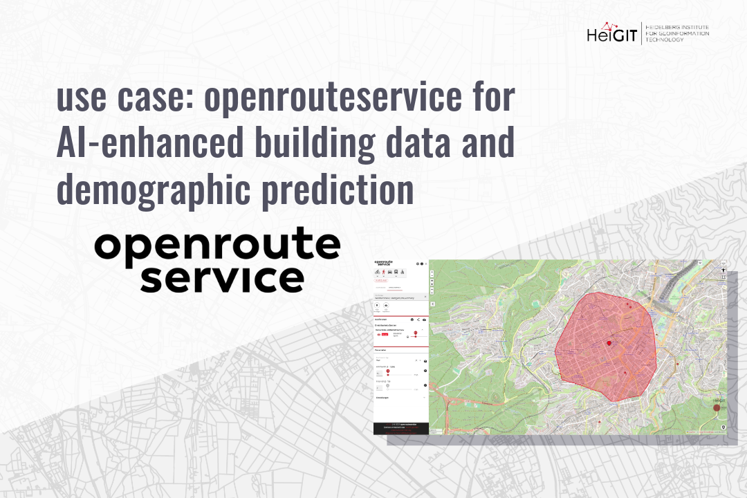
use case: openrouteservice for AI-Enhanced Building Data and Demographic Prediction
This research shows how spatial indicators from openrouteservice (ORS) can support building-level demographic predictions using machine learning. The study combines ORS APIs, building attributes, and POI data to estimate population and age characteristics in German cities, offering insights into the relationship between urban accessibility and demographic patterns. In today’s data-driven world, understanding cities at a…
-
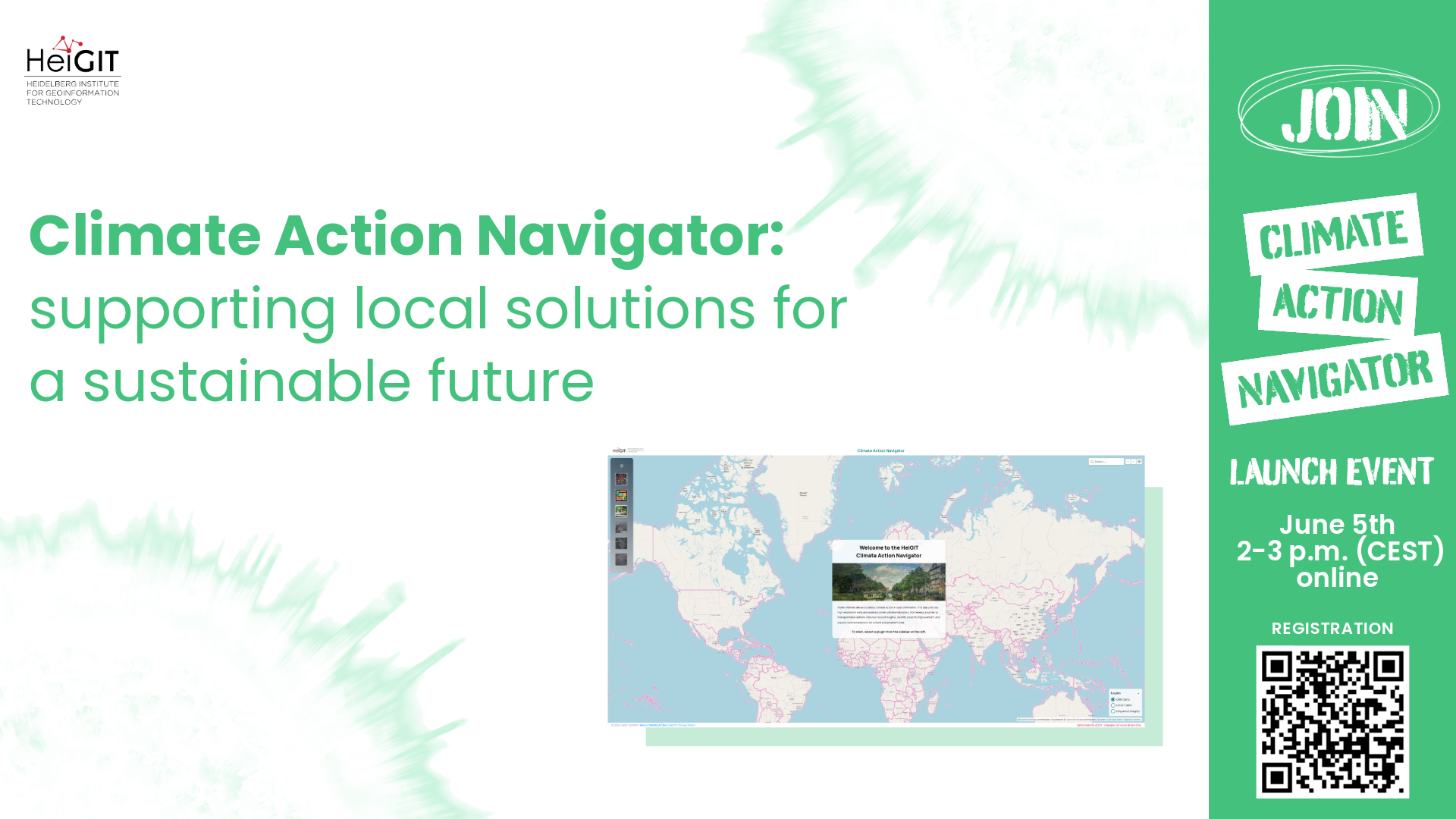
Climate Action Navigator Launch
The Climate Action Navigator is a new dashboard by HeiGIT that displays high-resolution spatial indicators related to climate action. The dashboard can help communities, organizations, and decision-makers identify local strengths and highlight areas for improvement. Join the launch event to learn how it can be used to develop locally tailored solutions for more sustainable cities…
-
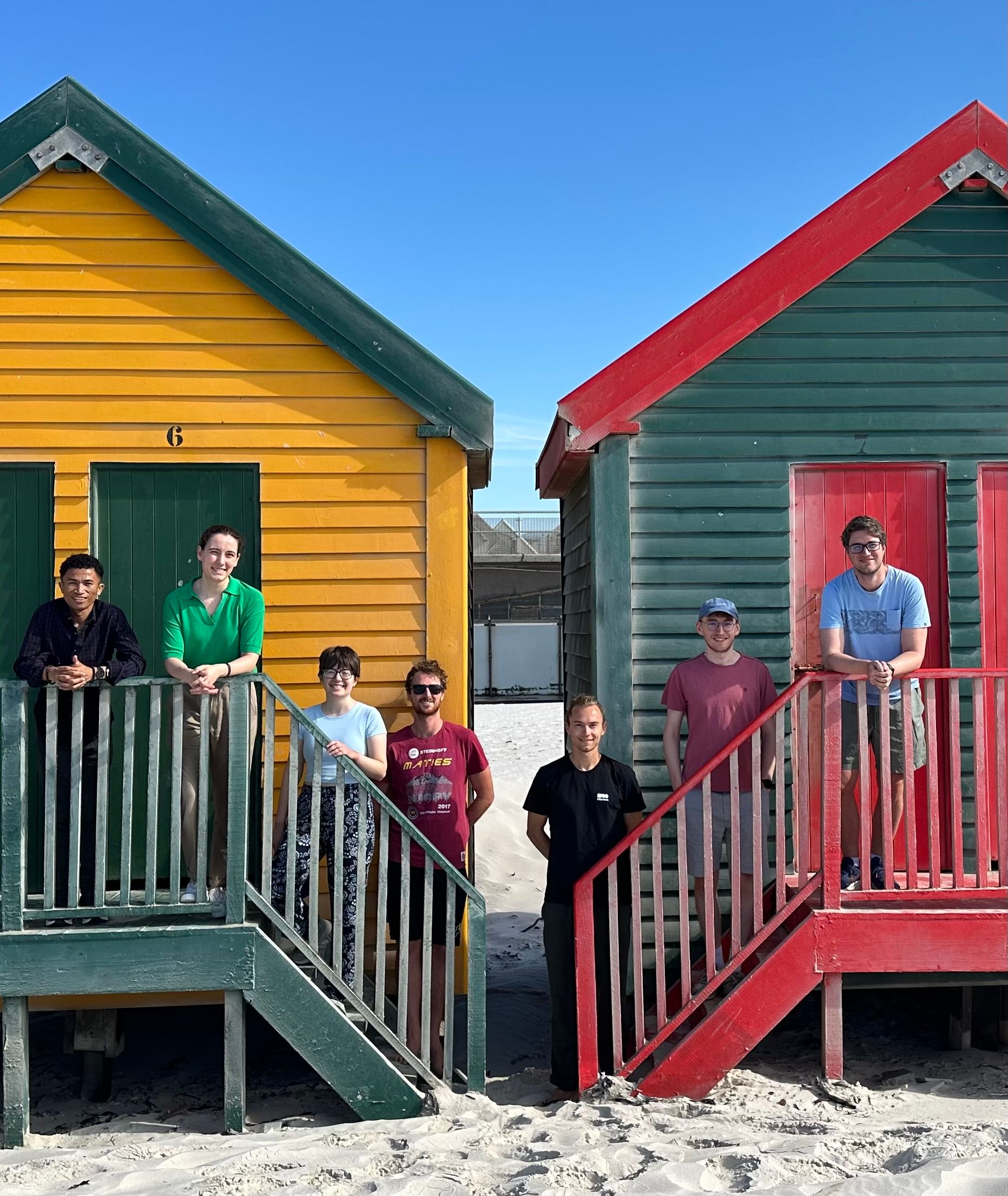
Post-doctoral Research Visit at African Institute of Mathematical Sciences (AIMS) in Cape Town
From January to March 2025, Dr. Steffen Knoblauch undertook a post-doctoral research visit at the African Institute of Mathematical Sciences (AIMS) in Cape Town, South Africa. His research focused on integrating Earth Observation data with bioacoustics, building on his PhD work in spatiotemporal mosquito monitoring for diseases such as Dengue. The primary focus of his…
-
New Paper: “Paved or unpaved? A Deep Learning derived Road Surface Global Dataset from Mapillary Street-View Imagery”
The paper addresses the global shortage of detailed road surface data by leveraging street-view imagery from Mapillary and advanced deep learning techniques. Traditional datasets like OpenStreetMap (OSM) often lack comprehensive road surface attributes—with only about 30–40% coverage—hindering applications such as travel time estimation, disaster response routing, urban planning, and environmental assessments. To fill this gap,…
-
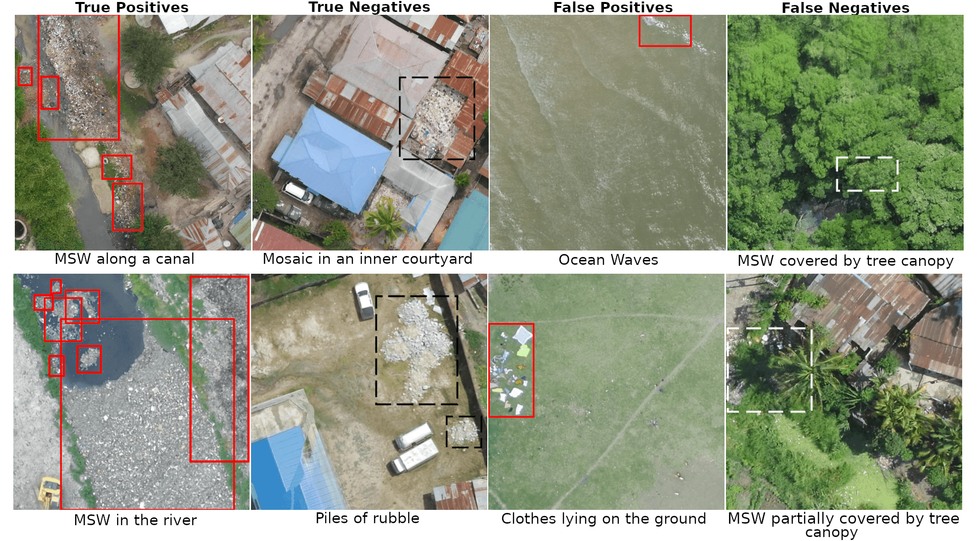
Harnessing UAV Technology to Support Municipal Solid Waste Management
The full article was originally published on geoawesome. The management of Municipal Solid Waste (MSW) represents a significant challenge, particularly in regions lacking adequate waste management infrastructure. In Africa, several regions are identified as critical hotspots for waste mismanagement. In 2012, only 55% of MSW was collected across Africa, with a mere 4% being recycled,…
-
First release of ohsome-planet: OSM history data in GeoParquet format
We’re excited to share the release of the ohsome-planet – a new software library on GitHub, marking a significant step toward the development of ohsome 2.0. This tool is designed to facilitate the transformation of raw OpenStreetMap (OSM) history data into the GeoParquet format, making it more accessible and efficient for spatial data analysis. What…
-
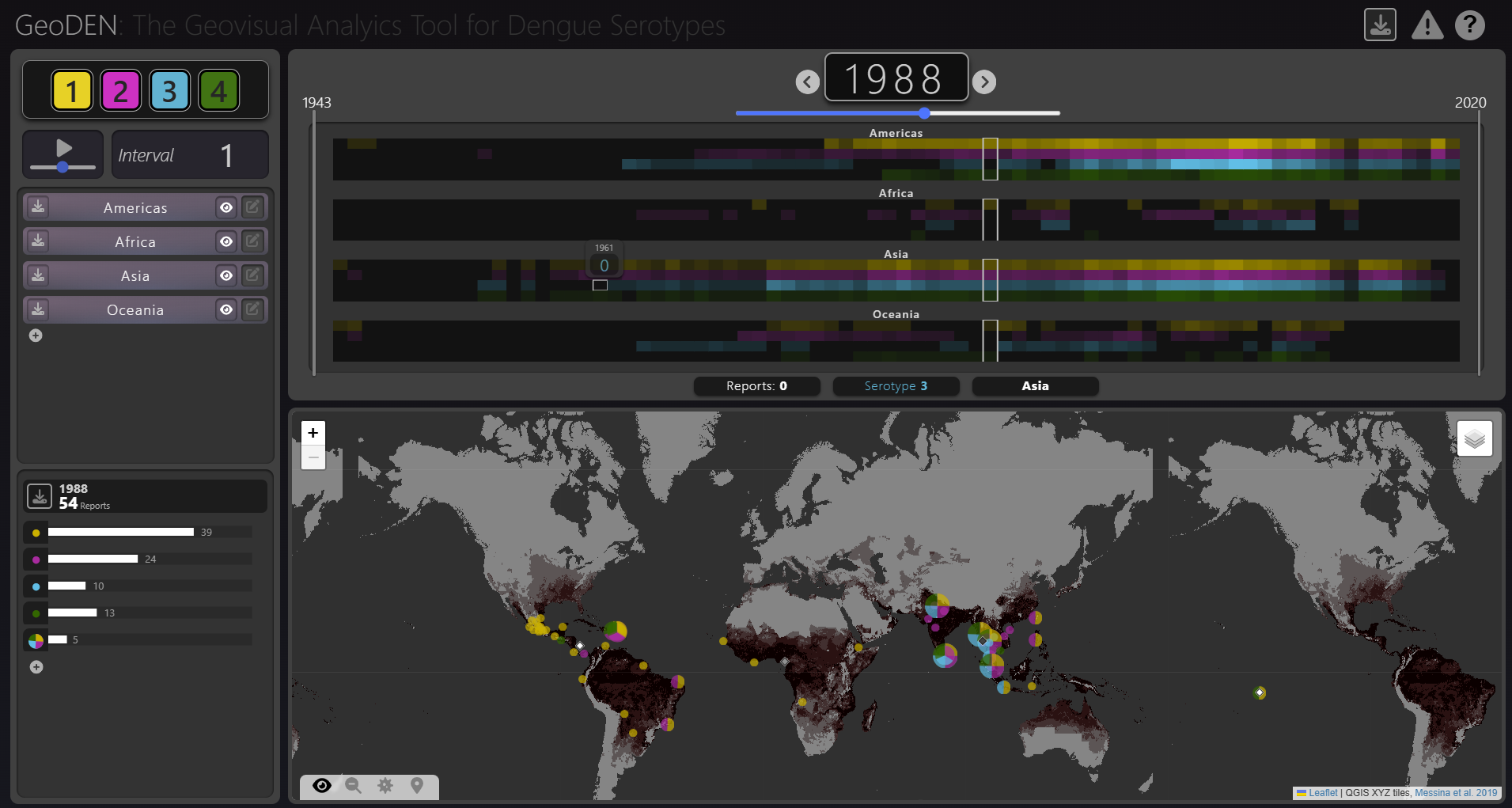
New Paper “GeoDEN: A Visual Exploration Tool for Analyzing the Geographic Spread of Dengue Serotypes”
With the increasing availability of global disease datasets, Visual Analytics (VA) has emerged as a valuable tool in spatial epidemiology, particularly for studying serotype interactions in diseases like dengue. Dengue, caused by four serotypes (DENV1-DENV4), poses a significant global health threat exacerbated by urbanization and climate change. Traditional approaches rely on static mapping or animation…
-
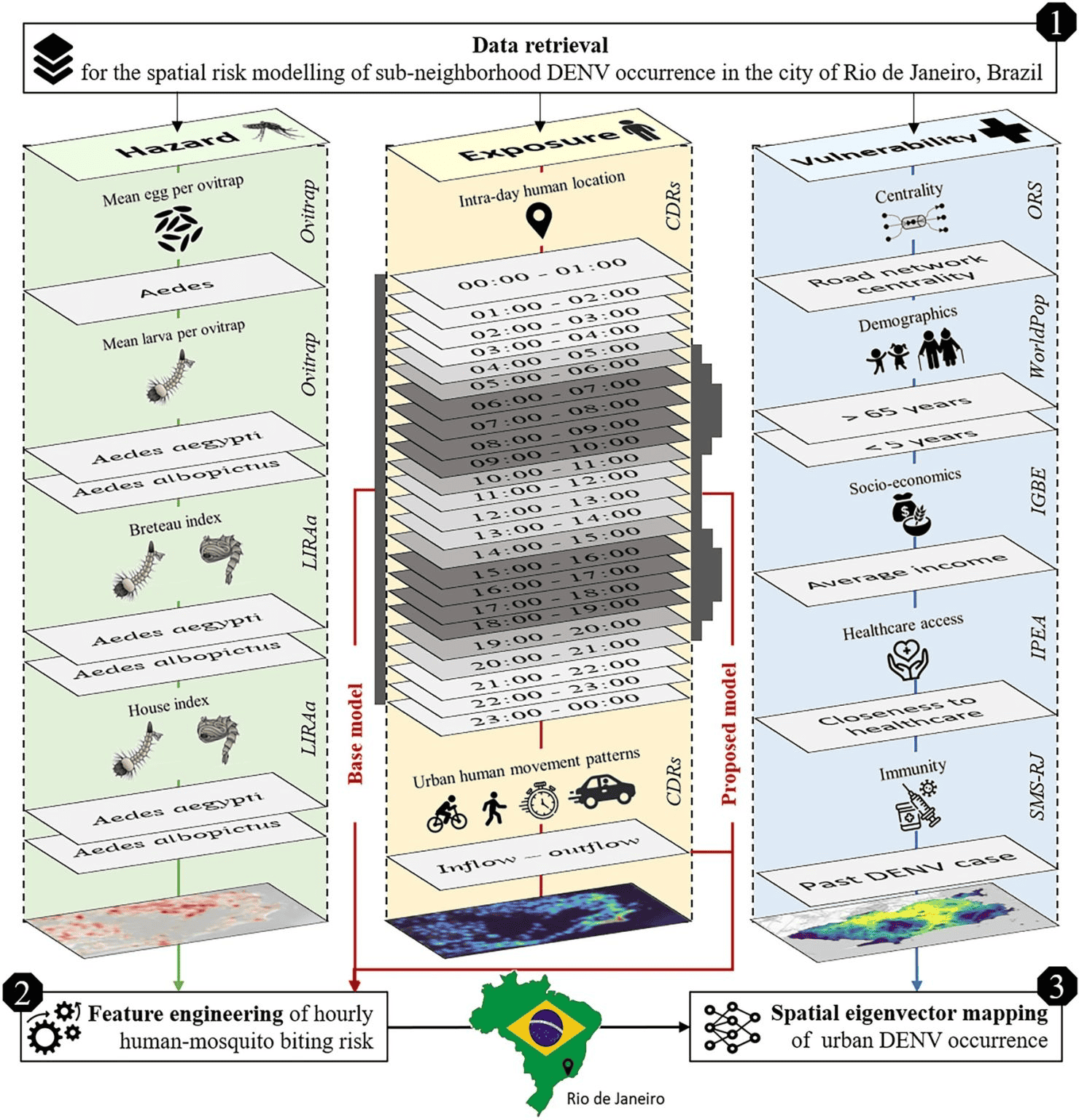
New Paper in Scientific Reports “Modeling Intraday Aedes-human exposure dynamics enhances dengue risk prediction”
Scientific Reports publishes a paper by Steffen Knoblauch et al. that underscores the critical importance of integrating vector ecology and human behavior into advanced disease modeling frameworks. The increasing availability of human movement data presents significant potential for tackling global public health challenges, especially in the context of infectious diseases. This is particularly important for…
-

Call for participation: “Walking the X-min City: Methods and implementations to assess walkability and pedestrian accessibility” Workshop at the AGILE Conference
Join our collaborative workshop at the AGILE Conference in Dresden on June 10, where researchers, practitioners, and policymakers come together to explore methods in walkability and pedestrian accessibility assessment. Workshop scope The assessment of walkability and pedestrian accessibility through GIS methods has gained momentum, offering urban planners and policymakers new ways to assess and implement…
-
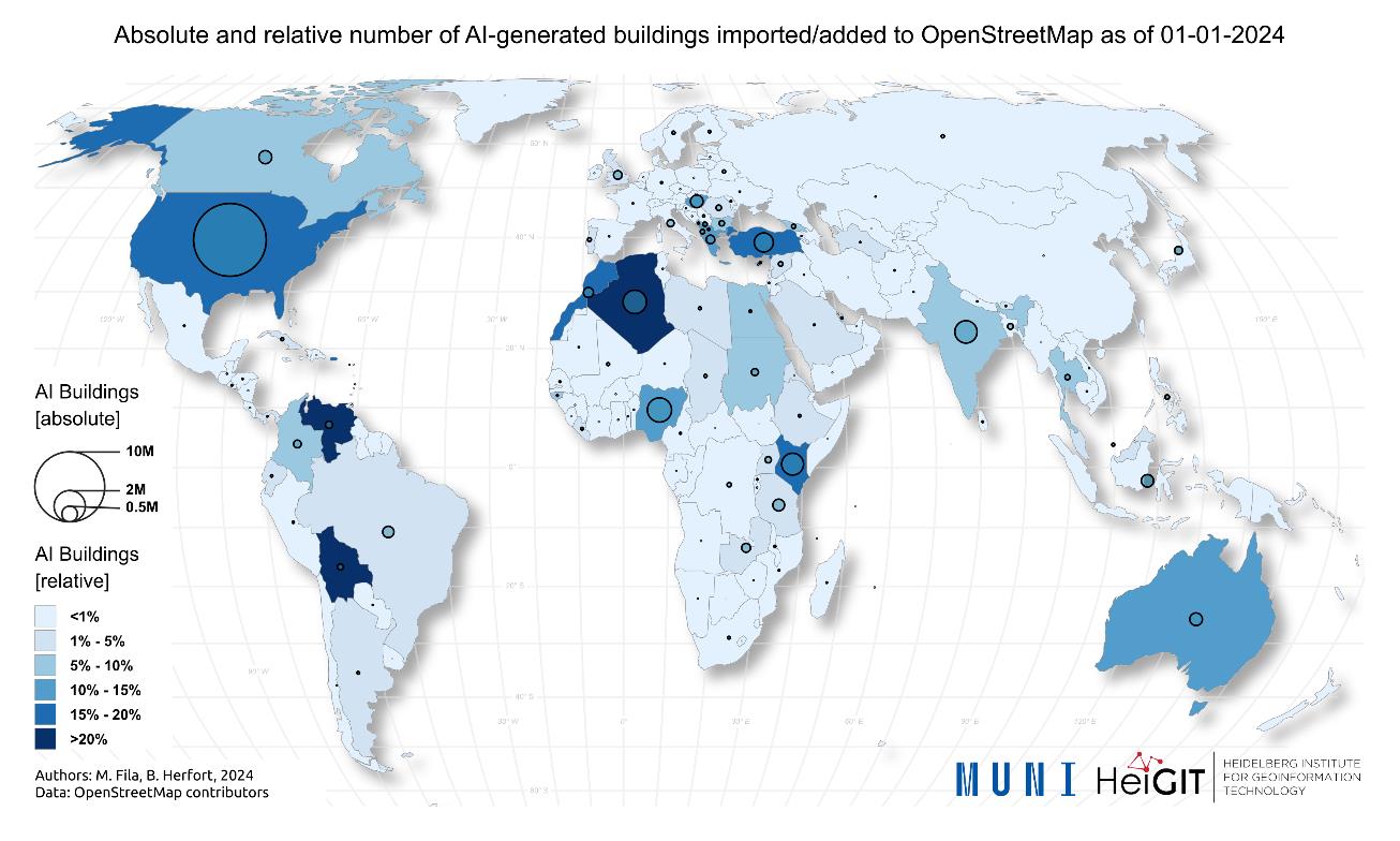
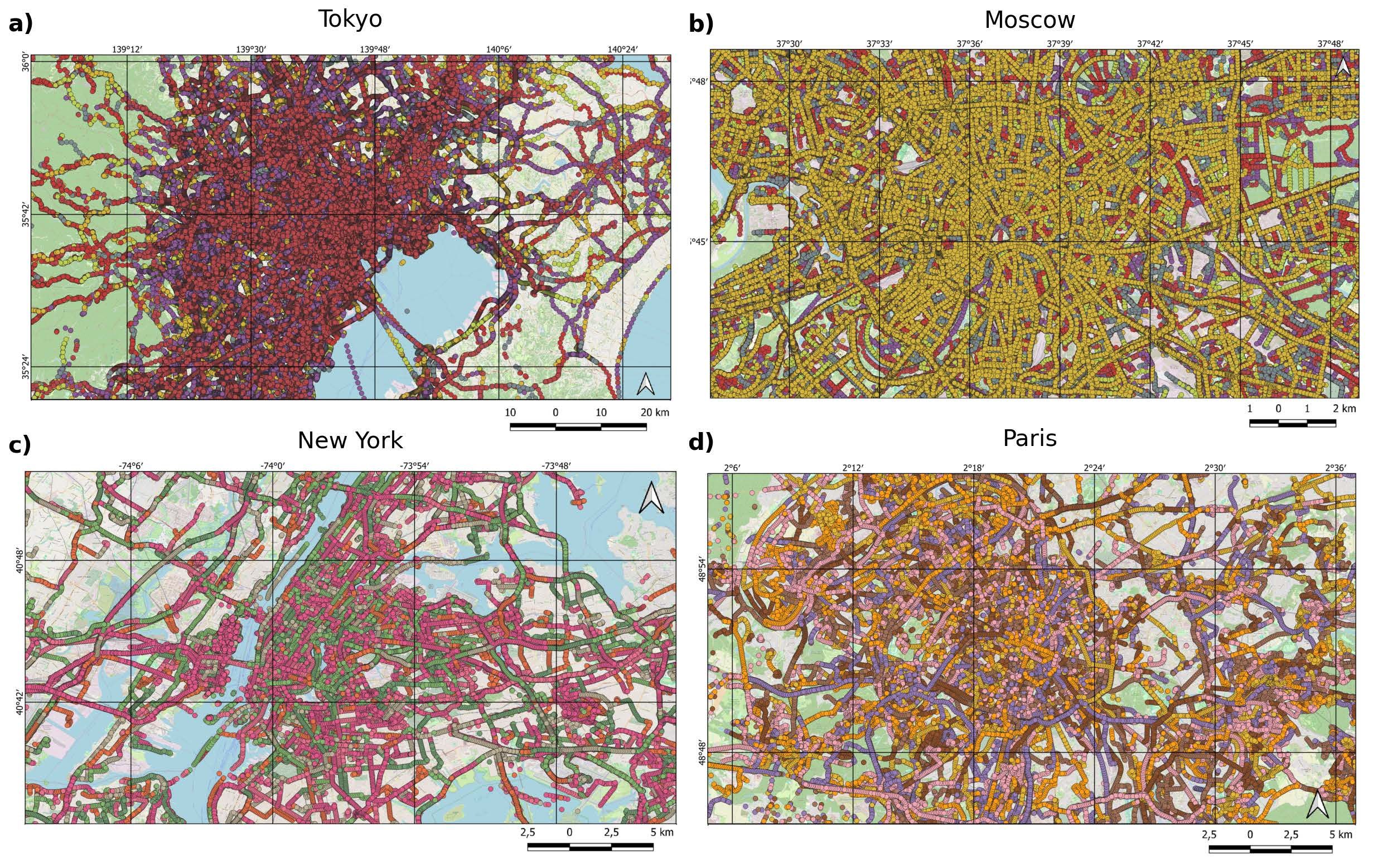
New Paper “AI-Generated Buildings in OpenStreetMap: Frequency of Use and Differences from Non-AI-Generated Buildings”
The concept of a “Digital Earth” has long envisioned a future where technological advancements enable the large-scale collection and visualization of spatial and environmental data. Today, open data sources such as OpenStreetMap (OSM) provide crucial spatial information for diverse applications, including urban planning, disaster management, and public health. However, many regions remain insufficiently mapped, particularly…
-
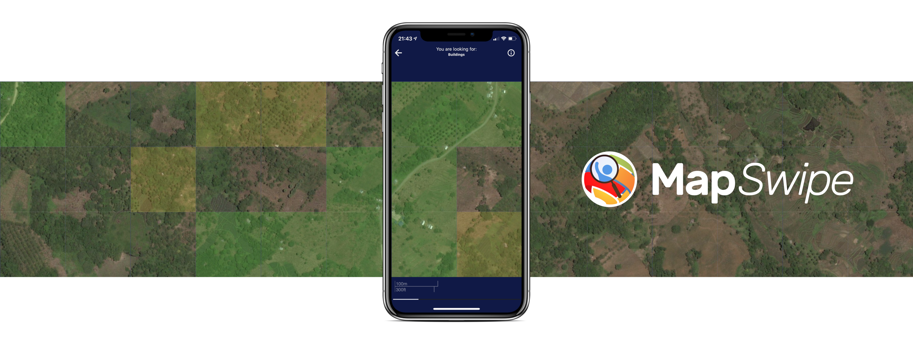
Crowdmapping on Street-Level Imagery with MapSwipe
The crowdmapping app MapSwipe now integrates also street-level imagery. This new feature enables even mapping efforts that require the highest level of detail, such as detecting waste on the street. The MapSwipe App MapSwipe is an open-source app that enables volunteers to map missing geodata, making global mapping efforts more coordinated and efficient. Free, reliable geodata…
3D 3DGEO Big Spatial Data CAP4Access Climate Change Conference crisis mapping Crowdsourcing data quality deep learning disaster DisasterMapping GIScience heigit HELIOS HOT humanitarian humanitarian mapping Humanitarian OpenStreetMap team intrinsic quality analysis landuse laser scanning Lidar machine-learning Mapathon MapSwipe Missing Maps MissingMaps ohsome ohsome example Open data openrouteservice Open Source OpenStreetMap OSM OSM History Analytics Public Health quality analysis remote sensing routing social media spatial analysis Teaching VGI Workshop