

GIScience News Blog
-
HGG lecture: Glaciers – from process understanding to early warning systems to symbols of the climate crisis
The third HGG lecture is about the function of glaciers as early warning systems for climate change and how this has changed over the years.
-
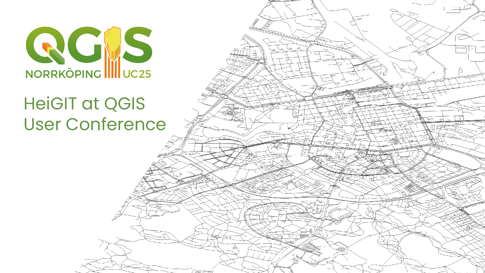
HeiGIT at QGIS User Conference
HeiGIT will present two sessions on openrouteservice. ORSTools – using a global routing engine directly from QGIS Monday, June 2 2025, 16:30–17:00 (Europe/Stockholm), Statisten Getting from A to B fast and efficiently is central to mobility analysis and requires both road network data and a route calculation algorithm capable of using it. This session introduces…
-
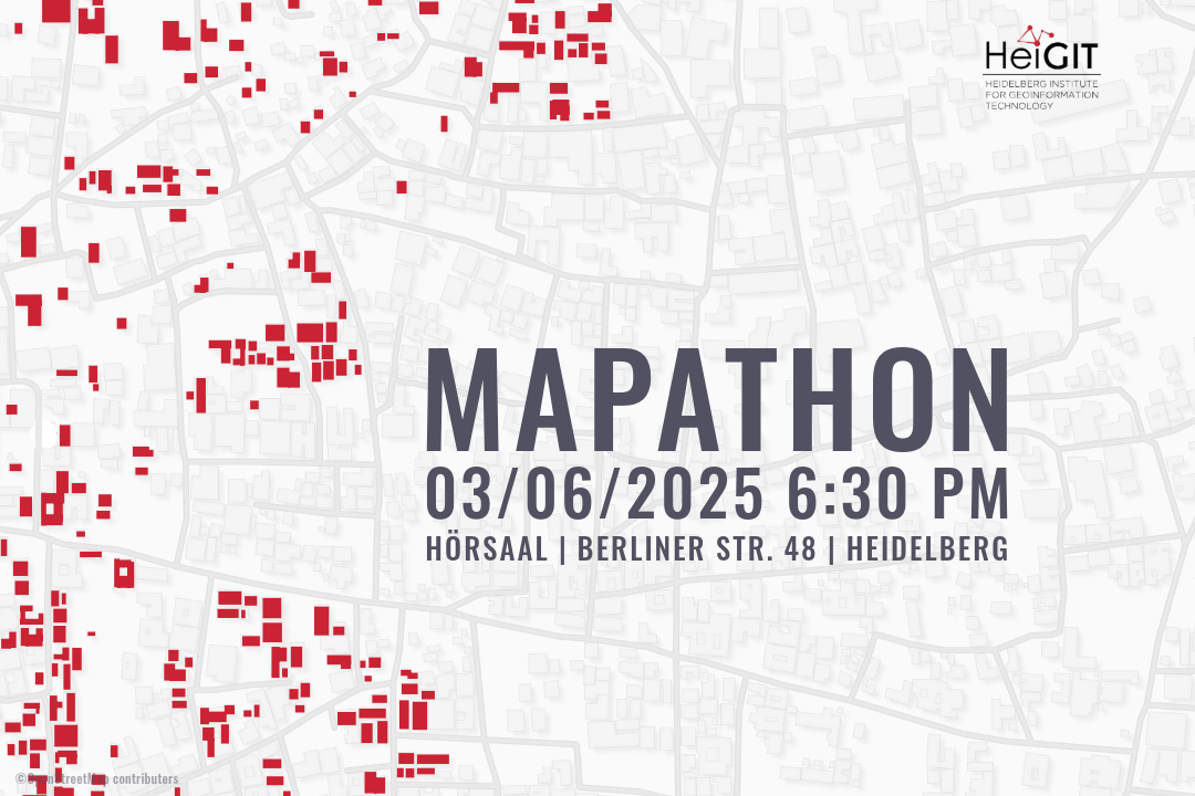
Mapathon – Silver Ways Project
This time, we will map smoothness and surface tags within the Mannheim area. This mapping effort will contribute to delivering the data needed for our ongoing Silverways project. Silver Ways is a project aiming to improve the mobility of senior citizens by developing an empirically informed and validated routing system tailored to their needs. The…
-
New Paper “Lessons in Traffic: Nairobi’s School Term Congestion and Equity Challenges”
This study, published at African Transport Studies, investigates the impact of school sessions on traffic congestion in Nairobi, highlighting how children’s mobility needs are often overlooked in transport planning. The paper explores how poor integration of school-related travel into urban transport planning contributes to traffic congestion in Nairobi. While the conventional response to congestion has…
-
HGG lecture – Why do tree lines exist?
The second HGG lecture of this semester answers the question of why tree borders exist and how climate change influences them.
-
Empowering cities to act: The Climate Action Navigator highlights where climate action is most needed
What does a climate-neutral, livable city look like – and what concrete actions can help us get there? The new Climate Action Navigator (CAN) from HeiGIT (Heidelberg Institute for Geoinformation Technology) offers data-driven answers. This interactive online tool supports cities, NGOs, and community initiatives in identifying and addressing key areas for climate action – scientifically…
-
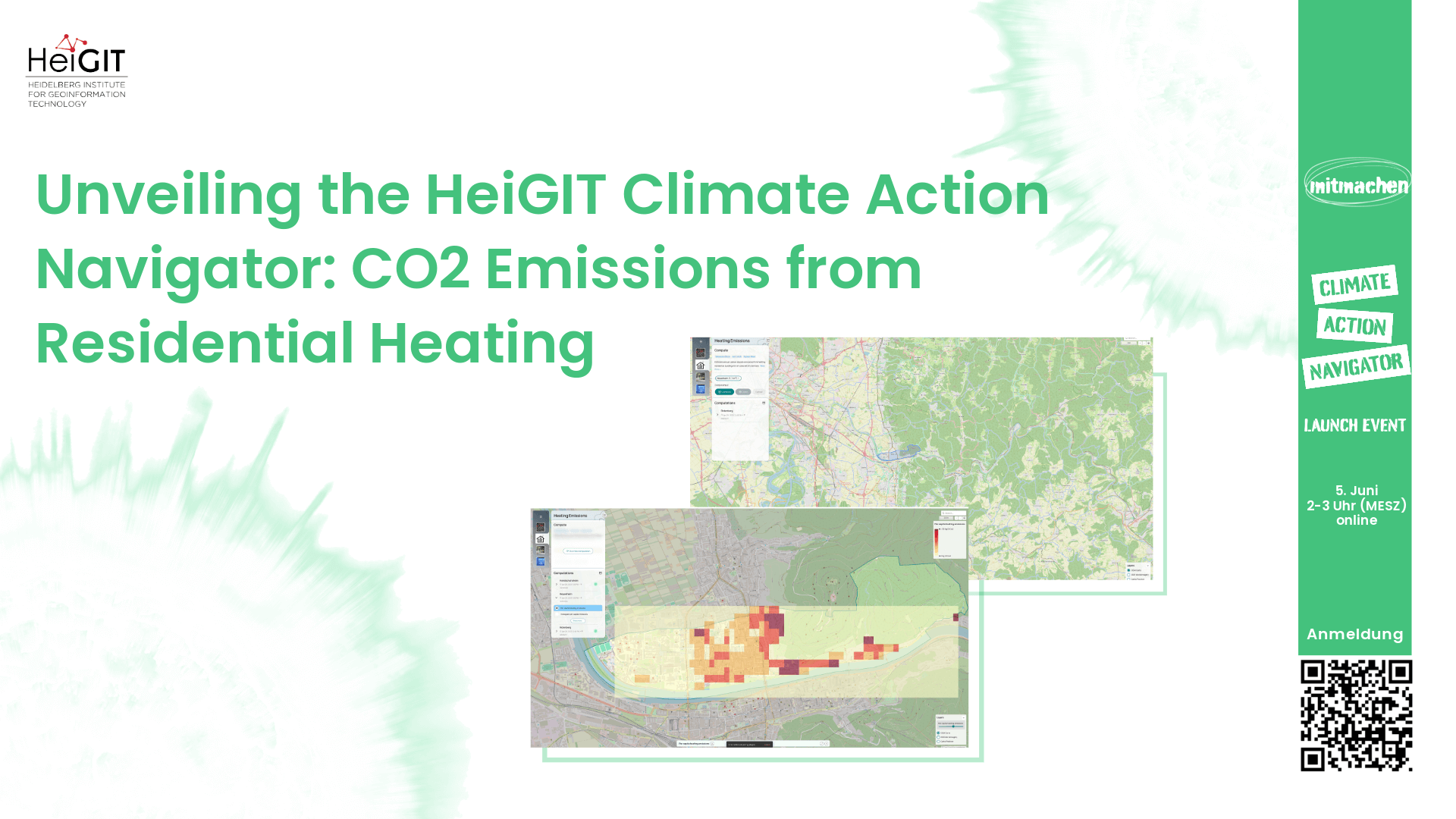
Unveiling the HeiGIT Climate Action Navigator Part 3 – CO2 emissions from residential heating
In just 8 days, on May 15th, we will officially launch the Climate Action Navigator (CAN), HeiGIT’s interactive dashboard offering high-resolution data and analysis on key climate indicators, from the quality and availability of mobility infrastructure to carbon dioxide emissions from heating of residential buildings. In this third part of our blog post series, we…
-

3DGeo April Recap: Conferences
It was an exciting month for the 3DGeo research group in April. Three major conferences took place: Let’s give you some impressions below! JISDM The Joint International Symposium on Deformation Monitoring (JISDM) brings together experts on deformation monitoring from a range of fields such as photogrammetry, remote sensing and of course geodesy. It is a…
-
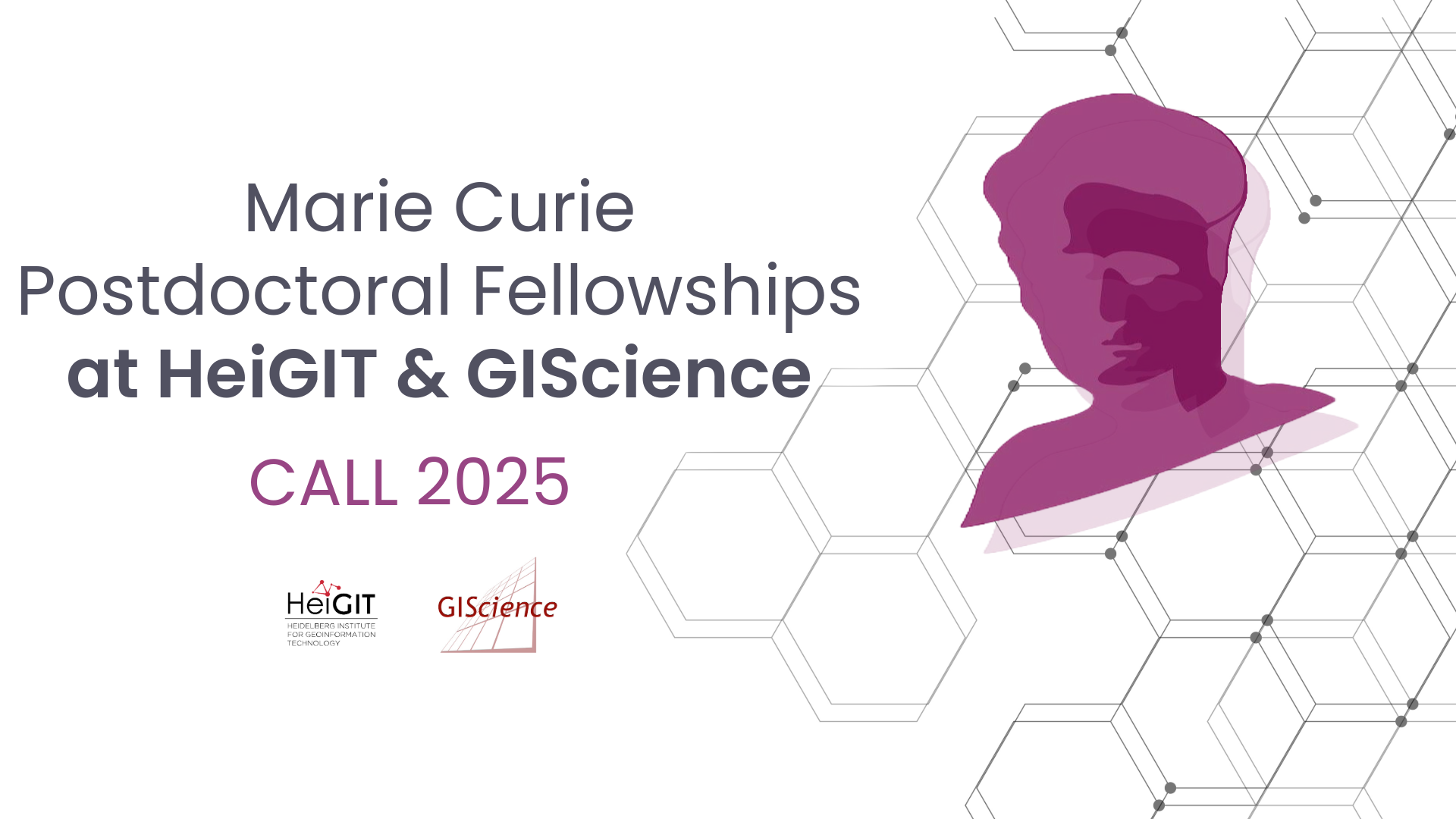
Marie Curie Postdoctoral Fellowships at HeiGIT & GIScience related to Climate Action and Humanitarian Aid
We are pleased to announce that HeiGIT and GIScience research Group at Heidelberg University are open to hosting postdoctoral researchers through the Marie Skłodowska-Curie Postdoctoral Fellowships (MSCA-PF) 2025. MSCA Fellowships offer a unique chance to pursue an independent research project in an international setting while benefiting from advanced training and interdisciplinary exchange. We invite researchers…
-
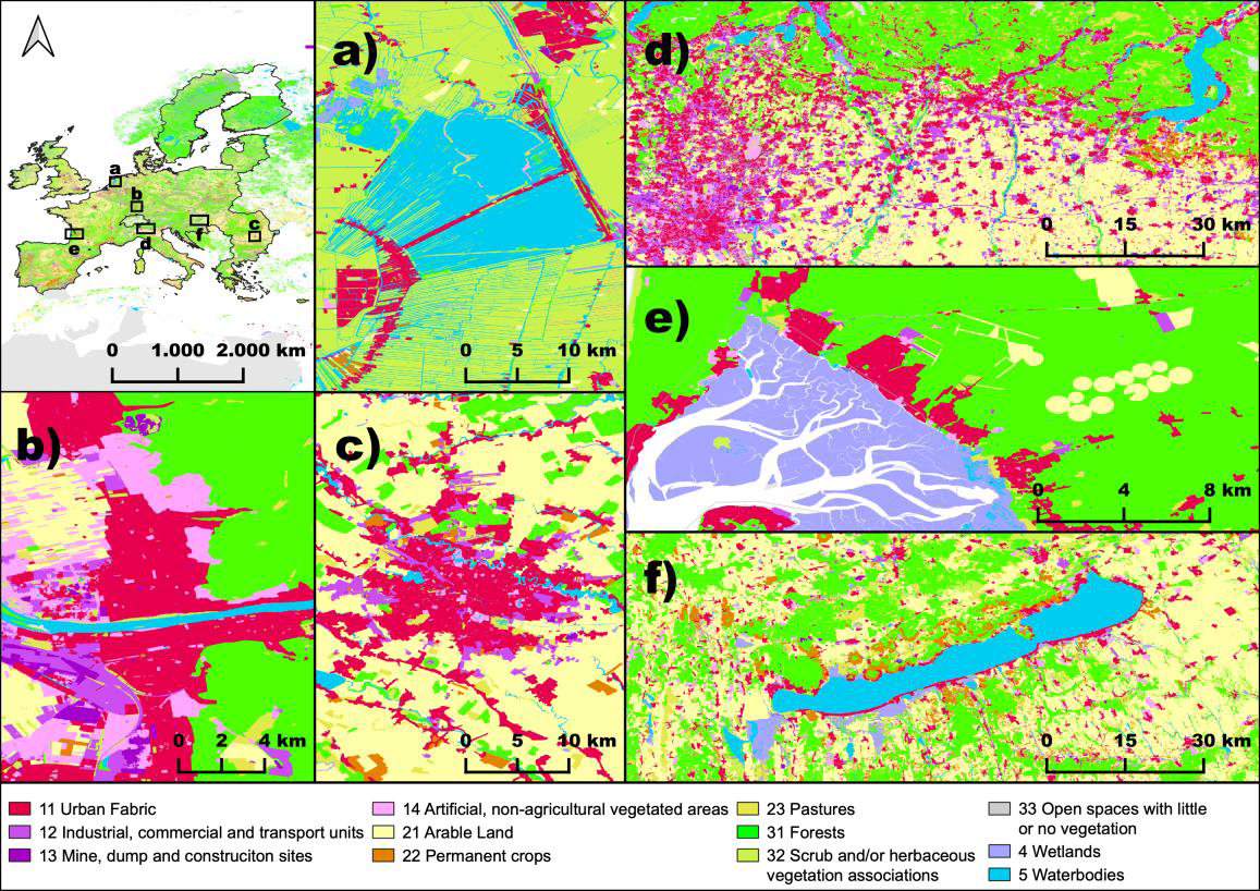
New Paper in Nature “OSMlanduse a dataset of European Union land use at 10 m resolution derived from OpenStreetMap and Sentinel-2”
The paper, published in Nature Scientific Data, presents the first high-resolution (10m or finer) land use map of the European Union derived from a large-scale fusion of OpenStreetMap (OSM) and Copernicus Sentinel-2 data. Leveraging citizen-generated data and remote sensing, the authors demonstrate a scalable and globally applicable methodology to fill thematic and spatial gaps in…
-
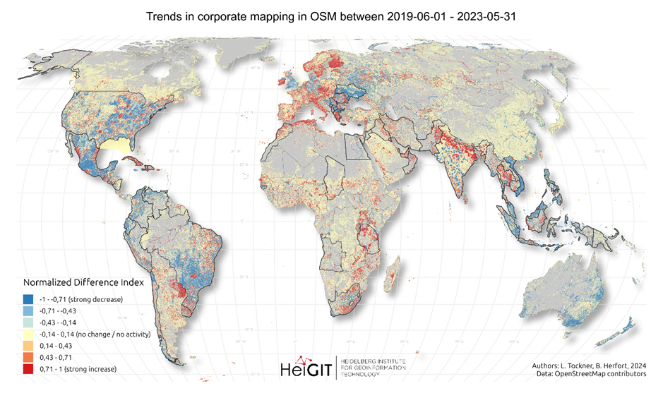
New paper “Corporate Mapping in OpenStreetMap – shifting trends in global evolution and small-scale effects”
Since 2016, corporate involvement in OpenStreetMap (OSM) has grown significantly, with major contributors such as Apple, Microsoft, Meta, and Amazon making substantial edits to the map on a global scale. These efforts have often focused on filling gaps in high- and medium-income countries, contributing to the overall growth of OSM data. However, this increasing corporate…
-
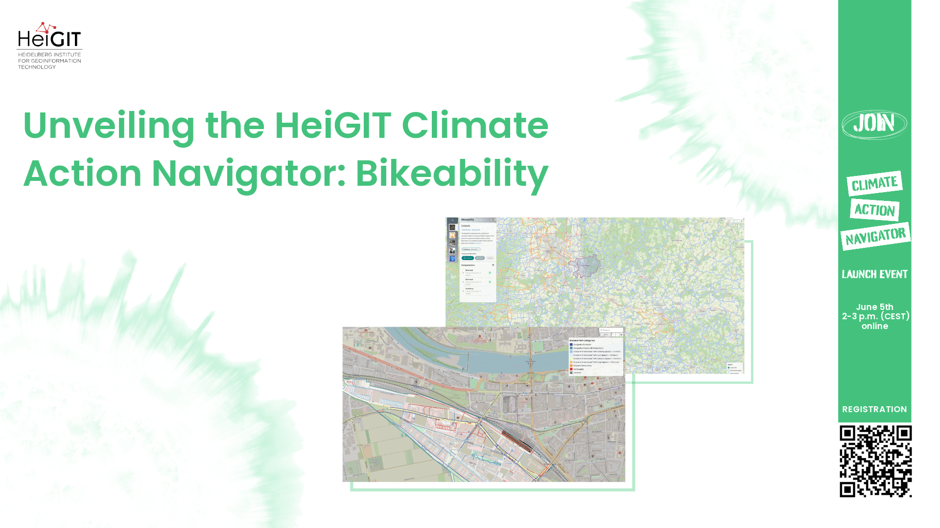
Unveiling the HeiGIT Climate Action Navigator Part 2 – Bikeability (hiBike)
In just 15 days, on May 15th, we will officially launch the Climate Action Navigator (CAN): HeiGIT’s new dashboard offering high-resolution, open data-based insights into key climate action indicators. From assessing CO2 emissions from residential heating to urban active mobility infrastructure, CAN helps identify where targeted action is most urgently needed. In this second post…
3D 3DGEO Big Spatial Data CAP4Access Citizen Science Climate Change Conference crisis mapping Crowdsourcing data quality deep learning disaster DisasterMapping GIScience heigit HELIOS HOT humanitarian humanitarian mapping Humanitarian OpenStreetMap team intrinsic quality analysis landuse laser scanning Lidar machine-learning Mapathon MapSwipe Missing Maps MissingMaps ohsome ohsome example Open data openrouteservice OpenStreetMap OSM OSM History Analytics Quality quality analysis remote sensing routing social media spatial analysis Teaching VGI Workshop