

GIScience News Blog
-
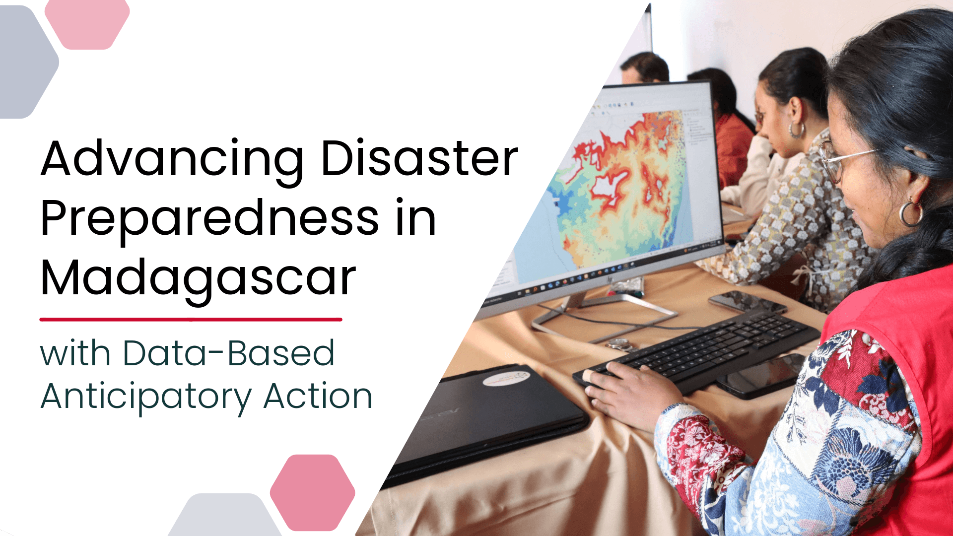
Advancing Disaster Preparedness in Madagascar with Data-Based Anticipatory Action
Anticipatory Action (AA) is becoming an increasingly vital approach in humanitarian and disaster risk management. By leveraging forecasts and risk data, AA enables timely interventions before extreme events occur. Geoinformation technologies play a key role in operationalizing this approach. In Madagascar, where cyclones regularly cause widespread damage, HeiGIT has been working with Croix-Rouge Malagasy (CRM,…
-
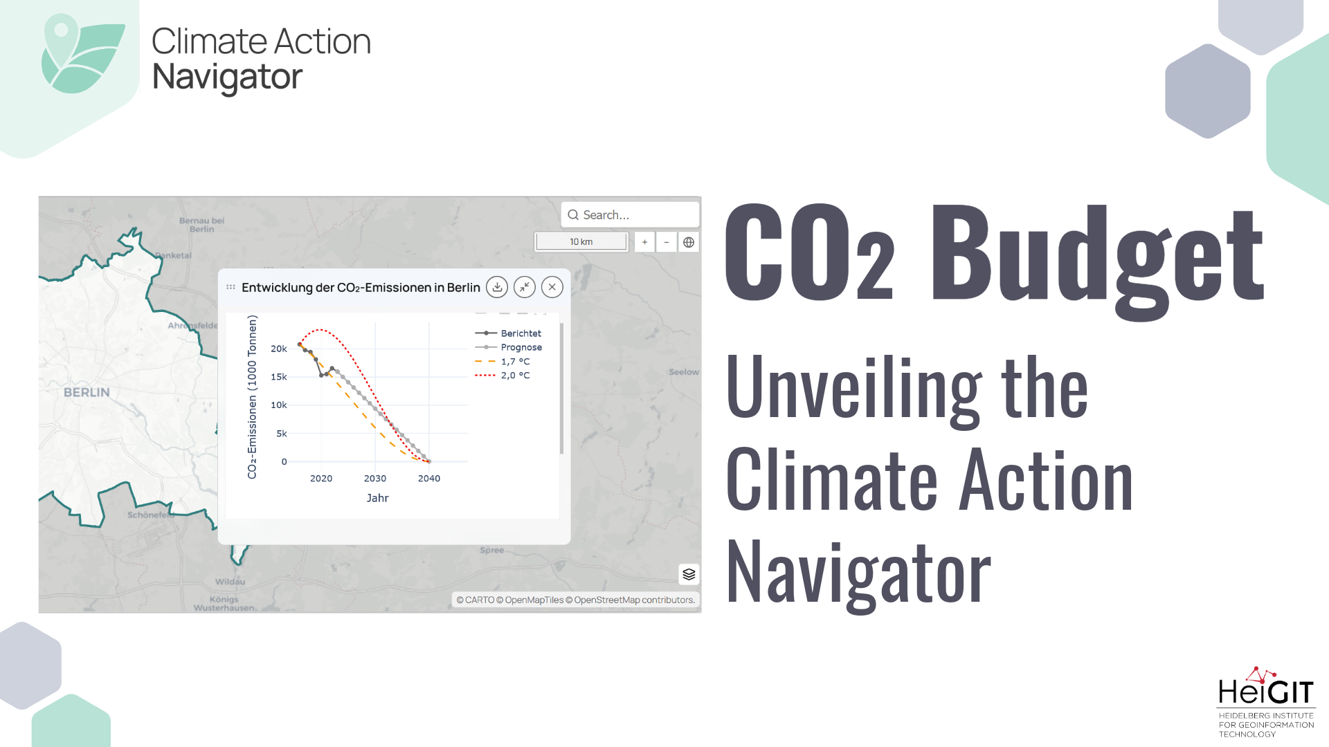
Unveiling the Climate Action Navigator Part 5 – CO₂ Budget
Thanks to the newest addition to the Climate Action Navigator, it is now possible to calculate the remaining CO₂ budget for several German cities (Berlin, Bonn, Hamburg, Heidelberg, and Karlsruhe) to stay within certain global warming limits (e.g. +1,5°C). The CO₂ Budget assessment tool also tracks if the city is on the right track to…
-
HeiGIT at State of the Map World
State of the Map World is the annual event for all mappers and OpenStreetMap users. The program consists of talks, workshops, discussion rounds and more. HeiGIT is taking part with three different contributions. ORS-Tools – Beginner-friendly Mobility Analysis with OpenStreetMap and openrouteservice in QGIS – Julian Psotta, Benjamin Herfort Friday, 11:30 (60 minutes (plus Q&A)); Room:…
-
HeiGIT at Walk21
The 25th International Walk21 Conference on Walking and Livable Communities will take place from 6 – 10 October in Tirana, hosted by the Municipality of Tirana in partnership with GIZ Albania.
-
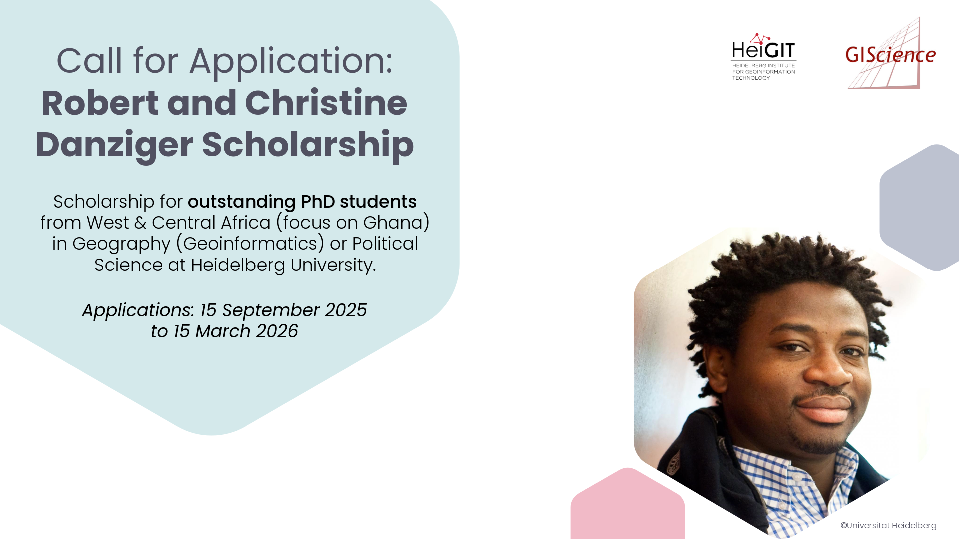
Call for Application: Robert and Christine Danziger Scholarship
The Robert and Christine Danziger Scholarship supports outstanding doctoral students from West and Central Africa (with particular emphasis on applicants from Ghana), who intend to pursue a doctoral degree in Geography (specializing in Geoinformatics) or Political Science at Heidelberg University. Applicants are expected to be in the process of applying for a doctoral position at…
-
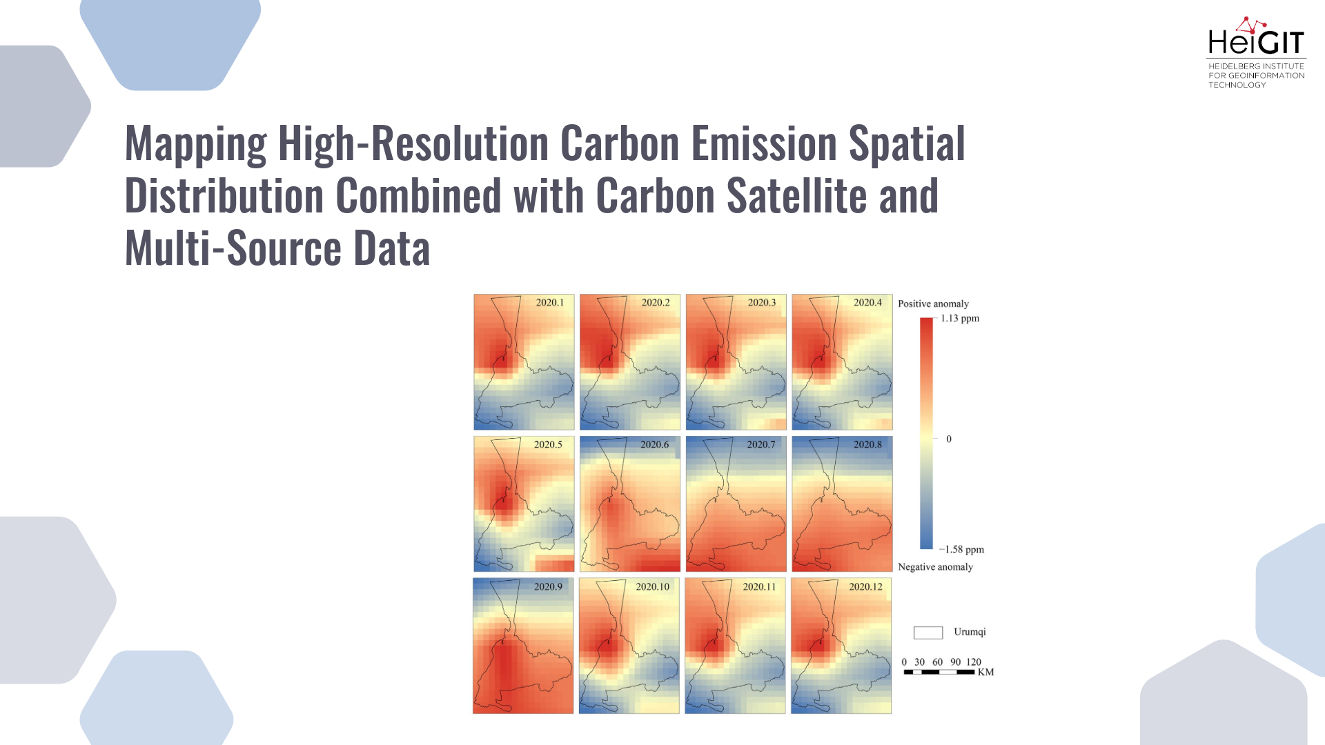
New paper “Mapping High-Resolution Carbon Emission Spatial Distribution Combined with Carbon Satellite and Multi-Source Data”
This study develops a framework integrating satellite observations with spatial proxy data to produce high-resolution urban carbon emission maps. The method is applied to Urumqi, China, demonstrating accurate and timely estimations compared with traditional inventories. Reducing carbon emissions is a global priority, but conventional inventory methods based on administrative statistics fail to capture fine-scale spatial…
-
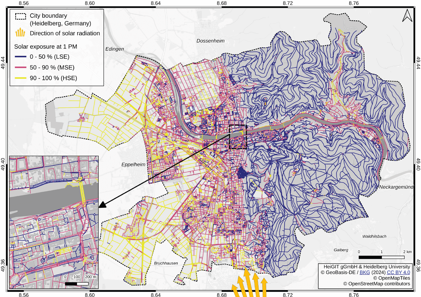
New paper “Mitigating heat stress by reducing solar exposure in pedestrian routing”
Using Heidelberg as a case study, researchers modeled time-dependent solar exposure for the entire pedestrian network by combining high-resolution DEM/DSM building and vegetation data with OpenStreetMap road data. Adapting to heat stress in cities is a major challenge under global warming, as both climate change and the urban heat island effect increase health risks worldwide.…
-
3D Sensor Practical
In June 2025, Ronald Tabernig and Hannah Weiser, researchers in the 3DGeo Research Group (Prof. Bernhard Höfle), held the annual 3D sensor practical, a two-day practical field course which took place in two exciting study sites close to Heidelberg: Our students learnt: Since we surveyed the same study sites last year, students will be able…
-

New paper: Mapping energy poverty indices in urban scale: A case study of Santiago de Chile
This study evaluates the applicability of macro-scale energy poverty indices in an urban context, using Santiago de Chile as a case study. Energy poverty (EP), understood as the inability of a household to meet its basic energy needs, is a global challenge exacerbated by rising energy prices, inflation, and economic instability. Accelerated urbanization and climate…
-
4DGeo Release: v1.0.0
First release of our 4DGeo Dashboard: https://github.com/3dgeo-heidelberg/4dgeo 4DGeo is an open-source, modular, super lightweight, web-based interactive dashboard application for visualizing 3D geodata time series. 🌐 Demo: https://3dgeo-heidelberg.github.io/4DGeo/💻 GitHub: https://github.com/3dgeo-heidelberg/4dgeo📖 Documentation: https://3dgeo-heidelberg.github.io/4DGeo/docs/ Play around with one of our use cases: Bees, a moving tree branch or a rockfall! Or fork the repo, try it out with…
-
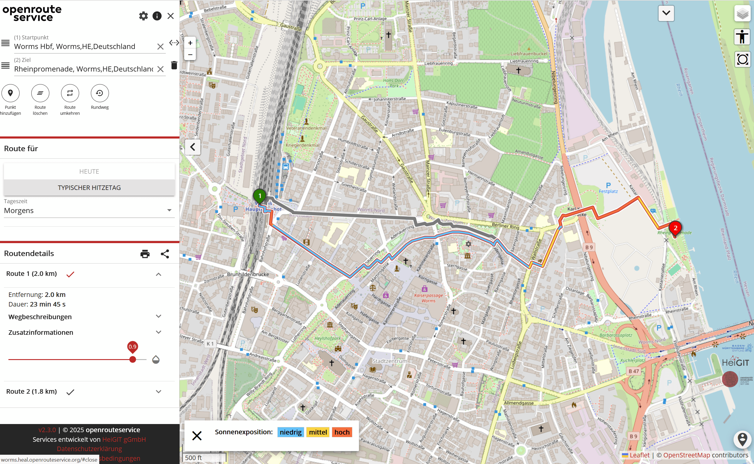
A Routing App to Avoid the Heat: HEAL App now available also for Worms
As summer temperatures soar, being outdoors poses rising health risks, especially in urban areas and for vulnerable groups like the elderly, children, and citizen with pre-existing conditions. The HEAL project launched a routing app to help citizens avoid heat stress, supporting climate adaptation and public health during hot weather periods. Initially developed for Heidelberg, the…
-
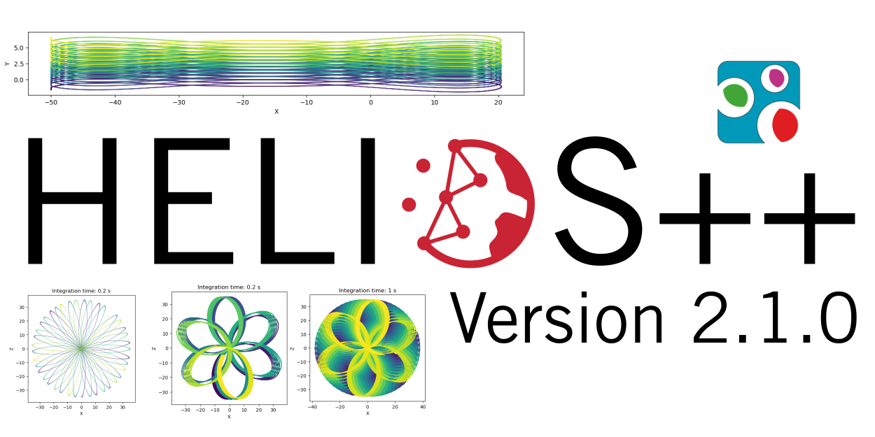
HELIOS++ Release: v2.1.0
We are happy to release a new minor version of HELIOS++: https://github.com/3dgeo-heidelberg/helios/releases What’s new in this release? We present a fully revised implementation of the Risley beam deflector that supports up to three prisms. What does this mean? You can now simulate scanners such as the DJI Zenmuse 2 and the Livox Mid Series in…
3D 3DGEO Big Spatial Data CAP4Access Climate Change Conference crisis mapping Crowdsourcing data quality deep learning disaster DisasterMapping GIScience heigit HELIOS HOT humanitarian humanitarian mapping Humanitarian OpenStreetMap team intrinsic quality analysis landuse laser scanning Lidar machine-learning Mapathon MapSwipe Missing Maps MissingMaps ohsome ohsome example Open data openrouteservice Open Source OpenStreetMap OSM OSM History Analytics Public Health quality analysis remote sensing routing social media spatial analysis Teaching VGI Workshop