

Last week saw the 18th AGILE conference being held in Lisbon, Portugal. Starting on Tuesday with a number of parallel workshops, the conference ran until Friday and included a number of interesting talks, key note sessions and a number of social events. The presence of GIScience at Heidelberg University was felt through two workshops being organised, a presentation being given, and two posters presented (the presentation and posters were all stemming from the CAP4Access project). The poster relating to navigation and landmark extraction was also awarded third place in the best poster competition!
On Tuesday full day workshops were run including (amongst others) a Gamification and Geogames workshop as well as two workshops organised by GIScience at Heidelberg University (“RICH-VGI: enRICHment of volunteered geographic information (VGI): Techniques, practices and current state of knowledge” and “Assessing the fitness of citizens observatories for land cover / land use mapping and validation purposes”). Later that evening saw the official opening of the conference at the “Museu Da Cidade” with a number of drinks and snacks, and a couple of unexpected attendees in the form of Peacocks… The day was rounded off with an ESRI Meetup event comprising of Lightning Talks given by users of ESRI products.
On Wednesday the conference got in full swing with a Keynote by Miguel Castro Neto followed by a full day of interesting talks spanning topics from VGI to Spatial Decision Support Systems. The day was rounded off with a cultural walk around Lisbon in the evening to see some of the many sights offered by Lisbon.
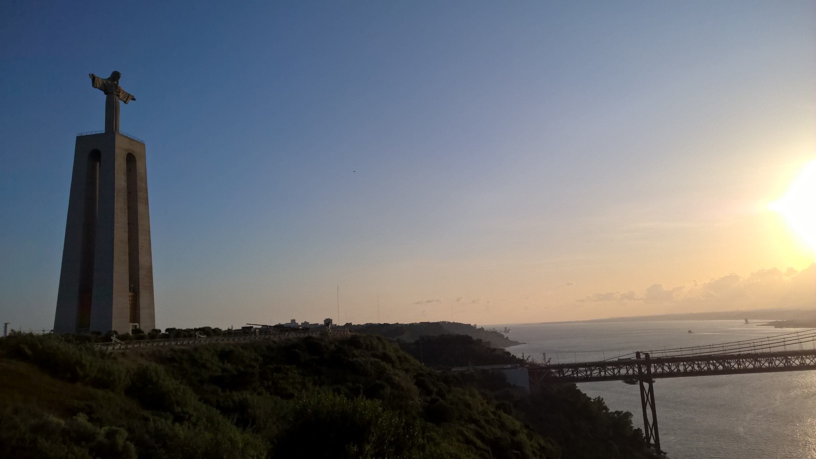
Thursday was opened by another keynote entitled “Big Data Integration to Enable Citizen Participation in Smart Cities” given by Isabel Cruz – a Professor of Computer Science at the University of Illinois at Chicago. the day saw a presentation given by Adam Rousell about “Toward a Collective Tagging Android Application for Gathering Accessibility-related Geospatial Data in European cities” as well as the poster session where two of our posters were presented : “On the completeness of sidewalk information in OpenStreetMap, a case study of Germany” authored by Amin Mobasheri, et al and “Extraction of landmarks from OpenStreetMap for use in navigational instructions”. In the evening was the Gala Dinner held across the river from Lisbon centre with amazing views of the city, “Cristo Rei” statue, and the “Ponte 25 de Abril” bridge.
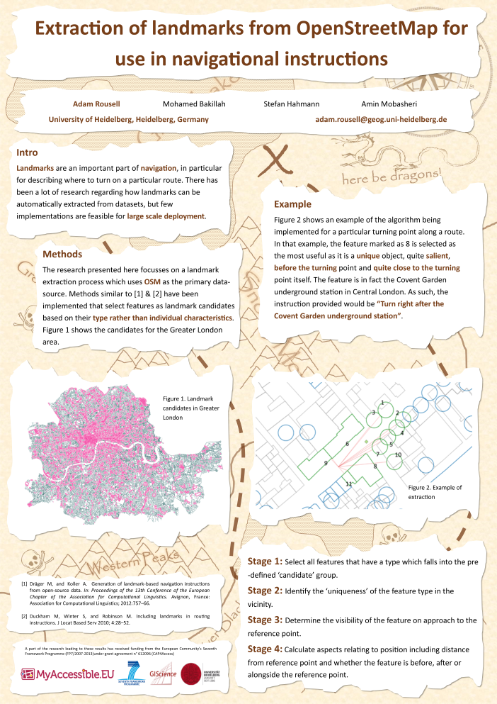
On the final day of the conference the last Keynote was provided by Phil Archer from the W3C and called “GIS and the Web – what’s the problem?”. The following presentations were then the ones selected as best papers from the submissions received and highlighted the high standard of submissions made to the conference. Awards were given out before lunch where the GIScience Heidelberg poster “Extraction of landmarks from OpenStreetMap for use in navigational instructions” presented by Adam Rousell was awarded third place in the best poster competition. An announcement was also made that next years AGILE conference will take place in Helsinki in Finland.
Leave a Reply
You must be logged in to post a comment.