
Search results for: “machine learning”
-
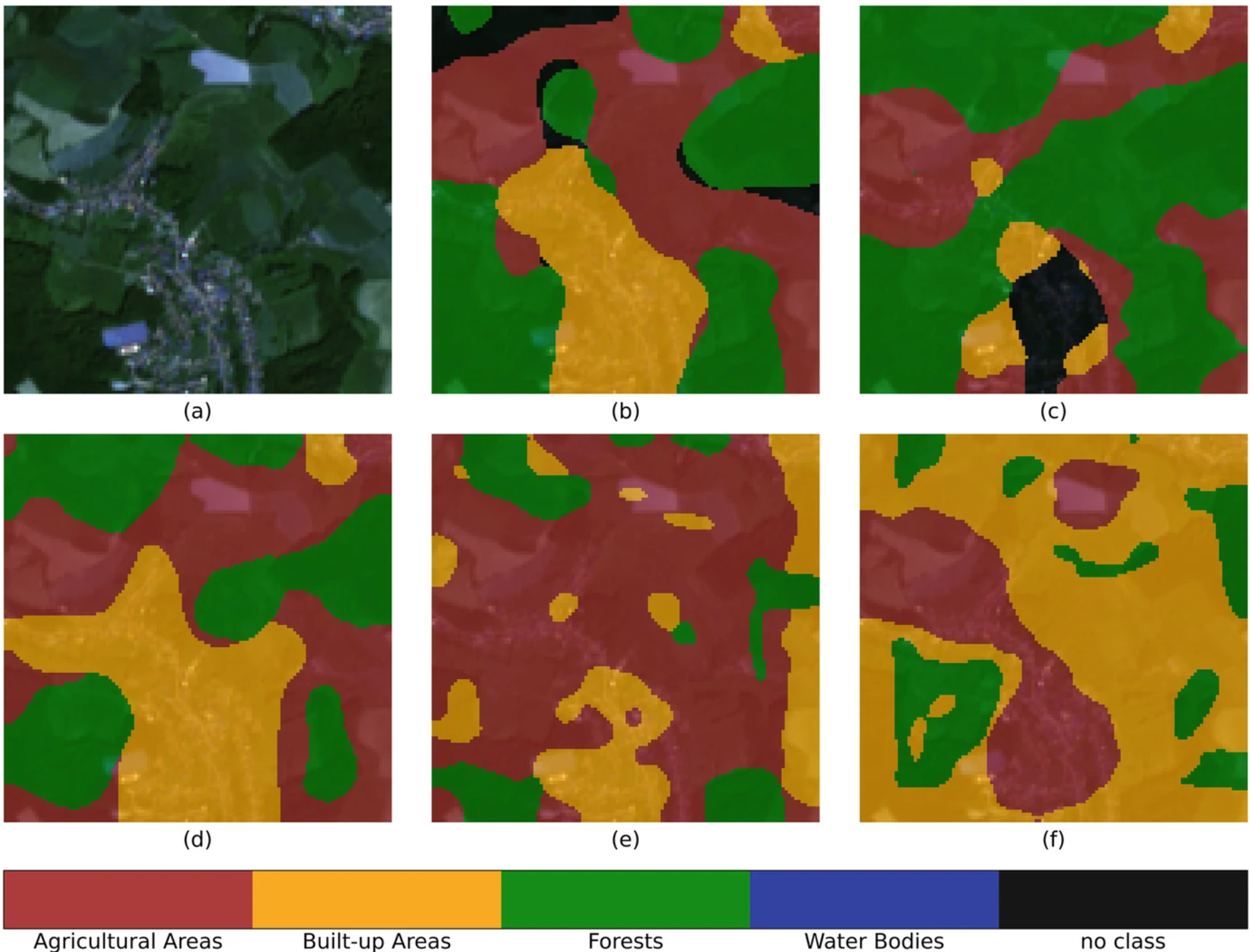
IDEAL-VGI: Analyzing and Improving the Quality and Fitness for Purpose of OpenStreetMap as Labels in Remote Sensing Applications
We are happy to announce that the IDEAL-VGI project by GIScience has been successfully completed. IDEAL-VGI was a tandem project in cooperation with Begüm Demir from the TU Berlin and was conducted under the umbrella of the VGIscience Second Phase Projects which ran from 2020 to 2022. VGIscience received funding as a Priority Programme by…
-
HeiGIT International Postdoctoral Fellowships for GIScience Research for Climate Action
Dear Postdoctoral Scholars and Researchers, You are a highly motivated researcher who loves spatial data science and open geodata? You want to use your expertise for the benefit of society and the environment – in particular stimulating Climate Action or enhancing Humanitarian Aid related to Climate Resilience? You want to improve the availability and quality…
-
Advancing Climate Action: HeiGIT’s New Climate Action Team
HeiGIT is embarking on an initiative to address one of the most critical challenges of our time — climate change. We are proud to announce the commencement of the Climate Action Readiness Initiatives funded by the Klaus-Tschira Stiftung. These initiatives aim to bridge the gap between knowledge and action by providing decision-makers, citizens, and active…
-
Joint International Tropical Medicine Meeting 2023
GIScience member and PhD candidate Steffen Knoblauch was invited as a speaker at the Joint Internationl Tropical Medicine Meeting (JITMM) 2023. The conference’s focal topic was “Achieving the SDGs: Human and AI-driven Solutions for Tropical Medicine in a Changing world” and it was hosted by the faculaty of Tropical Medicine, Mahidol University and co-organized by…
-
DFG Software Grant
Successful proposal: Fostering a community-driven and sustainable HELIOS++ scientific software The 3DGeo Group and the Scientific Software Center (SSC) of Heidelberg University have been successful with their proposal in the DFG call “Research Software – Quality assured and re-usable”, together with two other project proposals at Heidelberg University (see press release). The main objective of…
-
HeiGIT at State of the Map Europe 2023
This year’s State of the Map Europe Conference (SotM EU) took place in Antwerp, Belgium. HeiGIT’s Benjamin Herfort and Jochen Stier visited the conference. SotM is a platform hosting OSM mappers, open-source developers, researchers, GIS professionals, cartographs and many more interested people. The goal is to offer an opportunity for those groups and individuals to…
-
Recap Road Quality Mapathon
Last Monday, on July 31st, we hosted a road quality mapathon, which saw the participation of students and researchers alike. Their collective efforts led to the classification of nearly 50% of all the pre-selected road pictures in 34 African countries. These valuable data points will be instrumental in training machine learning algorithms to identify paved…
-
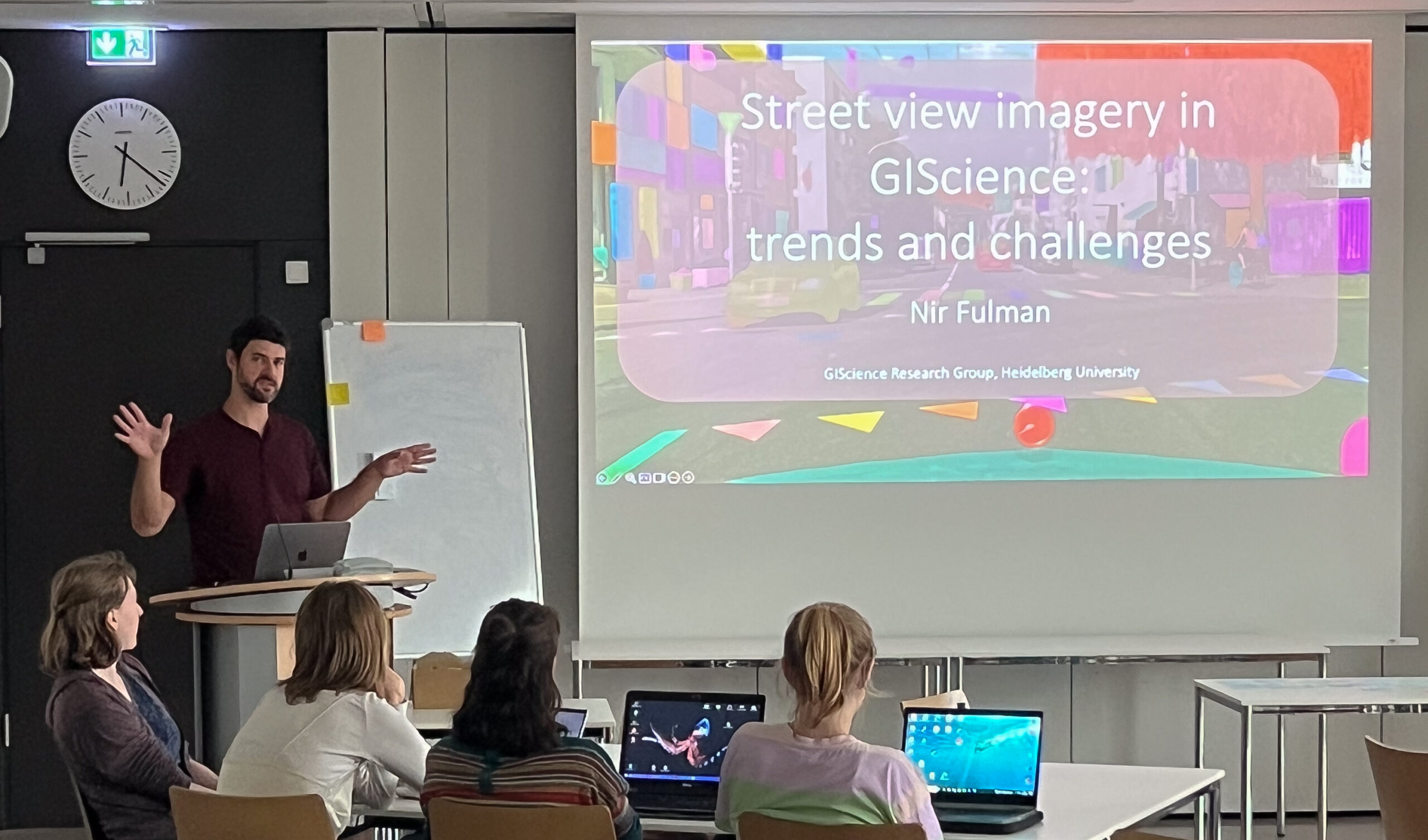
Unleashing the Power of AI-Assisted Mapping in OpenStreetMap? – a webinar with HOT and Masaryk University
The ever-increasing volume and speed of corporate or machine learning-assisted mapping present unique challenges for individual volunteer mappers, particularly in terms of monitoring and validation. While the global impact and evolution of AI-assisted mapping in OpenStreetMap (OSM) remain largely unknown, there is a need to engage with mappers to understand their perspectives on this emerging…
-
Looking back at FOSS4G Conference 2023
Figure 1: FOSS4G 2023, QGIS daily openings This years FOSS4G conference took place from 26 June – 2 July 2023 in beautiful Prizren, Kosovo. Since 2006 FOSS4G, the largest global gathering for geospatial software, is organized by the Open Source Geospatial Foundation (OSGeo). This year workshops, presentations, discussions, cooperation and developing of geospatial tools and softwares…
-
Join The Team: Senior Spatial Data Scientist for Climate Action
(m/f/d, up to 100%) You are a highly motivated person who loves spatial data science? You want to use your expertise for the benefit of society and the environment – in particular stimulating Climate Action? You want to improve the availability and quality of geographic information for Climate Action and develop geoinformatics methods used for…
-
Introducing the VirtuaLearn3D Project
With VirtuaLearn3D (Virtual Laser Scanning for Machine Learning Algorithms in Geographic 3D Point Cloud Analysis), a new project of the 3DGeo group has started. The focus of this project is to enable powerful machine learning algorithms for geographic point cloud analysis by advancing the concept of virtual laser scanning to overcome the lack of training…