

In a previous blog post we performed a conceptual compliance analysis between OSM data and several tagging-guidelines using the OSHDB API. The results were visualized in a line chart, comparing the different compliance ratio over several months. The following analysis focuses on a spatial representation of the conceptual compliance. It is conducted for the “iD-editor” data reference on a yearly basis. We use a shapefile containing a grid of equal area 10×10 km cells over the region of interest. The cells have unique ids. The compliance rate is calculated individually for each cell.
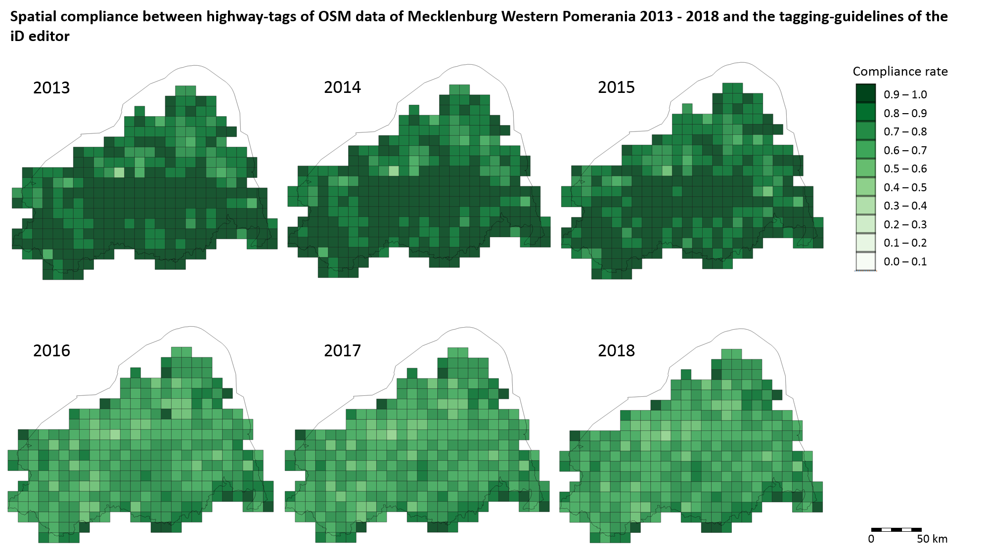
In our former post on computing a compliance rate, between 2015 and 2016 we saw a reduction in the compliance of the OSM data with the iD and JOSM editor. This was caused by a special tag (de:strassenschluessel), which is used almost exclusively in Mecklenburg Western Pomerania and is therefore not directly supported by the presets of OSM’s generic iD editor. In the spatial visualization the effect of this tag is visible as well. Between 2015 and 2016 we see a clear decline of cells with the highest compliance.
More details about the implementation of this analysis can be found in this recent article on heigit.org:
If you have any questions or want to give us feedback, don’t hesitate to contact us via info@heigit.org.