

Tag: oshdb
-
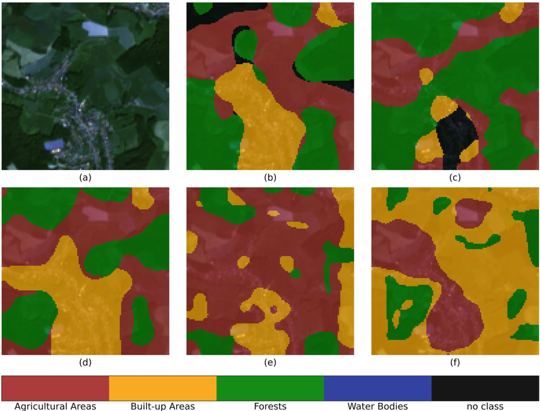
IDEAL-VGI: Analyzing and Improving the Quality and Fitness for Purpose of OpenStreetMap as Labels in Remote Sensing Applications
We are happy to announce that the IDEAL-VGI project by GIScience has been successfully completed. IDEAL-VGI was a tandem project in cooperation with Begüm Demir from the TU Berlin and was conducted under the umbrella of the VGIscience Second Phase Projects which ran from 2020 to 2022. VGIscience received funding as a Priority Programme by…
-
The Year 2023 at HeiGIT
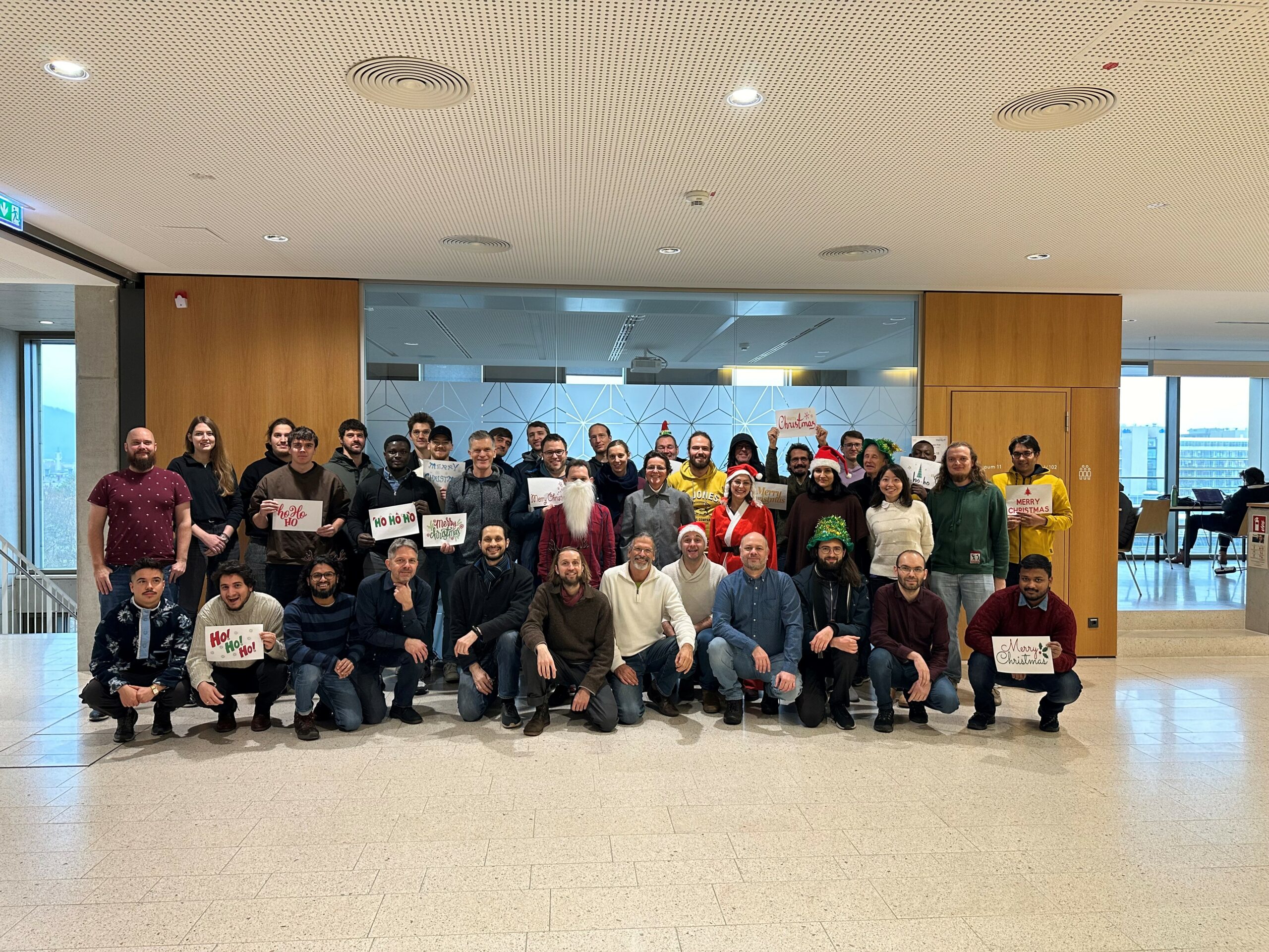
As 2023 is coming to an end, we would like to take the opportunity to look back at this eventful year and appreciate the advance that HeiGIT has made towards its goal of enabling and improving the transfer of knowledge and technology. Thanks to the collective efforts of each team member and the GIScience community,…
-
2022 #30DayMapChallenge Round-Up Part 2: Deleted Maps
Featured photo: The deleted map displays all deleted elements within the analyzed areas (red). Gray rectangles represent deleted buildings. This past November, our teams at HeiGIT and GIScience participated in Topi Tjukanov’s Twitter event #30DayMapChallenge, where mappers display their creativity and ingenuity with a set of 30 daily prompts ranging from colors to specific datasets…
-
OSHDB Version 1.0 Has Arrived
Featured Photo: Ohsome dashboard interface for Heidelberg, Germany. In the words of Confucius, “The man who moves a mountain begins by carrying away small stones.” As we release OSHDB (OpenStreetMap History Database) Version 1.0, we look back at versions 0.5, 0.6, 0.7, and all the other small improvements to our historical OpenStreetMap database as the…
-
Exploring Localness of OSM Data – An analysis using the ohsome API
“Local Knowledge” is constituting the exceptional value of Volunteered Geographical Information and thus also considered as an important indicator of data quality. We are interested in how much local information is captured in OpenStreetMap data. In this blog post we explore the temporal evolution of mapping in OSM and the information stored in its database,…
-
Announcing release 1.0 of ohsome API
Big news from the ohsome team: the release 1.0 of one of our major services, the ohsome API for ohsome OpenStreetMap History Analytics, is on the doorstep. We are bringing three major advancements along with this version. The first one is a completely new documentation of the API giving several examples to different endpoints. The…
-
Mapping Rohingya Refugee Camps in Bangladesh – An Analysis Using the OSHDB API
Humanitarian mapping activations show increasing numbers of contribution. This blog post illustrates the specific potential of the Open Source OSHDB API [1] for detailed analyses of such activations by means of a case study. The examined area is Cox’s Bazar in Southeast Bangladesh, where almost 1 million Rohingya refugees fled to from Myanmar in 2015.…
-
Becoming ohsome is simple: Adding support of simple feature types to the ohsome API
It’s been a while, since we have published the last blog post about the awesome ohsome platform, but don’t worry, there’s always something happening of course in the spatial analytics team of HeiGIT. So here we are, back on track with enlarging your imagination on what is possible when using our OpenStreetMap history analytics tool.…
-
Recap of HeiGIT @ FOSS4G 2019
First of all, thanks to everybody who attended our ohsome lab on OpenStreetMap History Analysis at last weeks FOSS4G in Bucharest. Even though there were eleven (!) tracks running in parallel, and our lab was not in the same location as the program track, we had some interested participants. Their affiliation ranged from public institutions…
-
Successfull PhD Defence by Clemens Jacobs on Plausibility Estimation of Citizen Science Observations for Biodiversity
Last week Dr. Clemens Jacobs successfully defended his PhD about methods for assessing the data quality of citizen science observations of organisms. Congratulations, well done!!! We wish all the very best for the future! The research aimed at using geographic context as an information source for estimating the plausibility of an observation, e.g., of a bird,…
-
How to become ohsome part 5: Measuring numbers of users editing different OSM features
Besides dealing with a snake, making quality assessments, or generating comparable statistics, one needs to know how to handle the whole functionality provided by the ohsome API to really become ohsome. And to achieve exactly that, this blog presents the last missing entry point to the API from the current toolkit, namely the /users resource. With its help you can receive aggregated…
-
OSHDB: a framework for spatio-temporal analysis of OpenStreetMap history data
Earlier we published several blogposts introducing the ohsome platform and its parts (e.g. the ohsome API for example, which was often showcased here in the blog) and its backbone the OSHDB (very recently version 0.5 was published). A recent open access journal article gives even more background to the system, as shown below: Raifer, M,…