Tag: Sketch Map Tool
-

‘Waterproofing Data’ Project wins ESRC Celebrating Impact Prize 2023
The “Waterproofing Data” project has won the ESRC Celebrating Impact Prize 2023 in the category “Outstanding Societal Impact” for helping to protect residents of flood-prone areas in Brazil. In 2018, Joao Porto de Albuquerque from the University of Glasgow initiated the project in which HeiGIT is also involved. The main goal of this project is…
-

The Year 2023 at HeiGIT
As 2023 is coming to an end, we would like to take the opportunity to look back at this eventful year and appreciate the advance that HeiGIT has made towards its goal of enabling and improving the transfer of knowledge and technology. Thanks to the collective efforts of each team member and the GIScience community,…
-
SketchMapTool Enters Next Phase with Funding from German Red Cross and German Federal Foreign Office
The Sketch MapTool (SMT) is entering its next project phase thanks to support from the German Red Cross (GRC) and the German Federal Foreign Office. In this phase, our main goals are enhancing the tool’s stability and marking detection, as well as expanding the current features, adding new languages and satellite imagery as base maps.…
-

Training on digitalization of participatory mapping in Kuala Lumpur
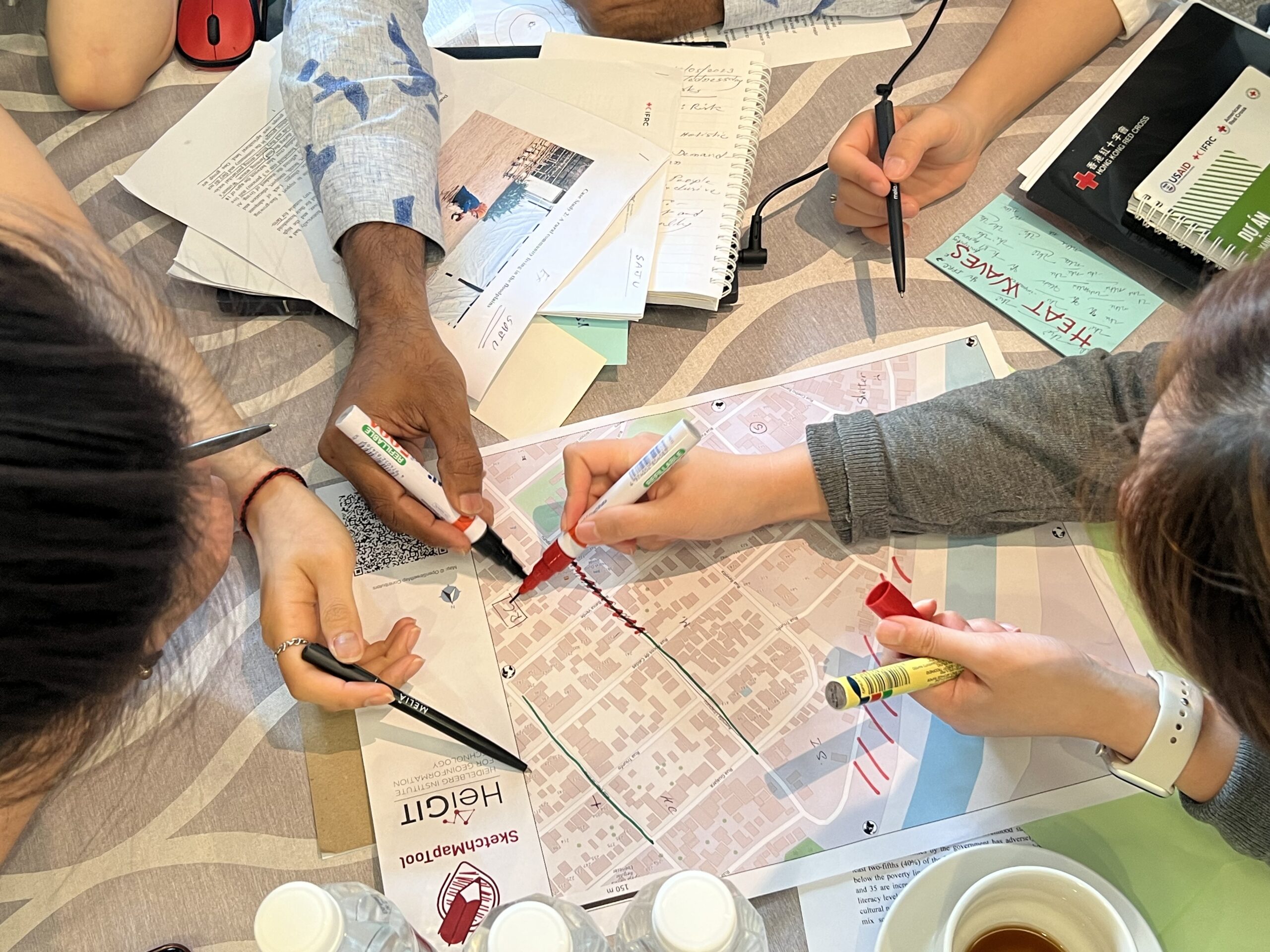
Featured Image: Training participants simulating a participatory mapping on the ground with the SketchMapTool. Last week, HeiGIT team member Anne Schauß held a workshop session in Kuala Lumpur, Malaysia, during a training of the International Federation of Red Cross and Red Crescent Societies (IFRC). The international training focused on community resilience and how to assess…
-
Sketch Map Tool Launch
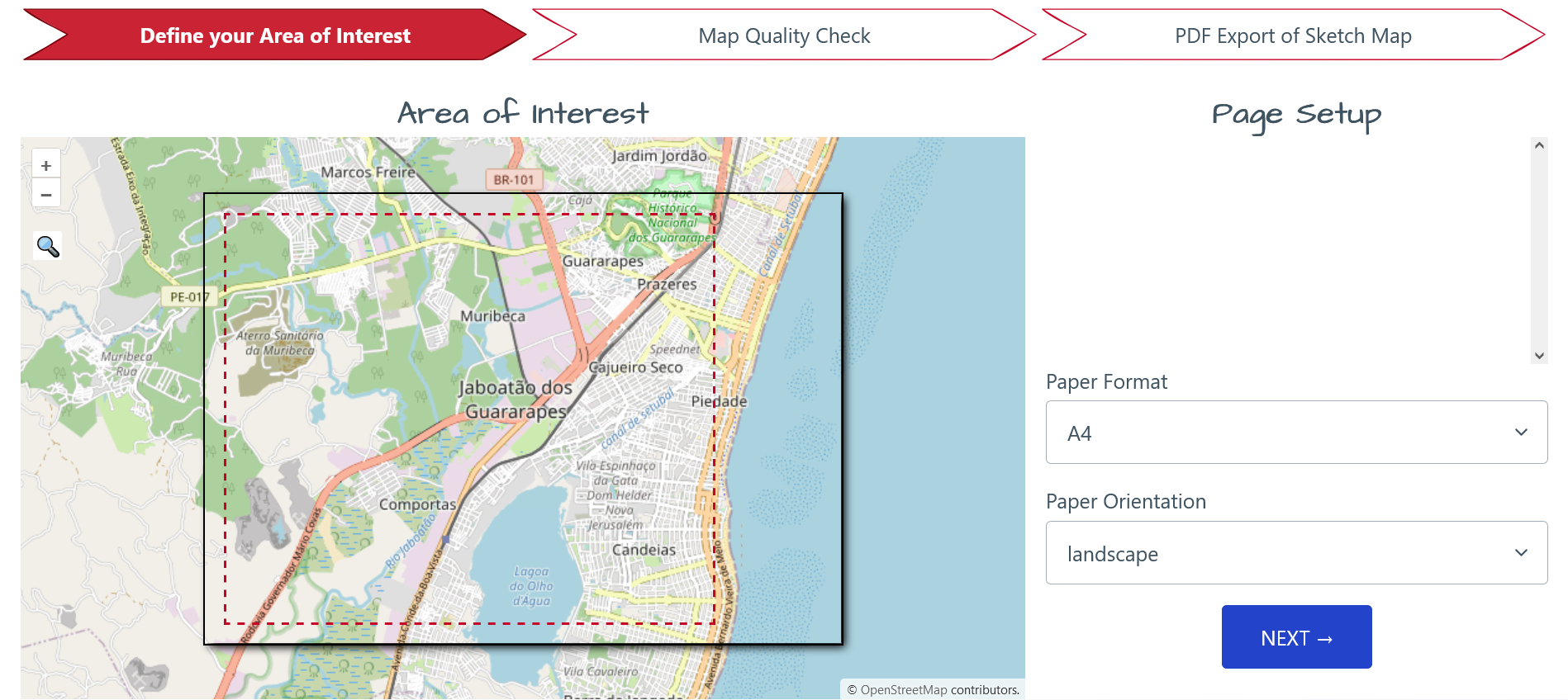
We are excited to invite you to the official launch of the Sketch Map Tool! The Sketch Map Tool is an easy-to-use, open-source and free-of-charge tool which facilitates community mapping. You can use it to collect local spatial knowledge with pen and paper with an OpenStreetMap in the background. With the Sketch Map Tool, you…
-
HeiGIT at MSF Geo Week 2022
This June, MSF (Médecins Sans Frontières) GIS Week 2022 was held in person again in beautiful Prague. Nearly the entire MSF team dealing with geo-data and geospatial analysis congregated at the event, which presented a fantastic opportunity to learn more about the current use of GIS within MSF and to discuss its future strategic importance.…
-
GIScience/HeiGIT und DRK gemeinsam im CHAtroom – Im Podcast werden die Zusammenarbeit und das Sketch Map Tool vorgestellt
Anne Tritschler vom Centre for Humanitarian Action (CHA) spricht im Podcast CHAtroom mit Dr. Carolin Klonner (GIScience) und Dr. Natascha Bing (DRK) über den Einsatz von Geoinformationen in der humanitären Hilfe und welche Rolle dabei Karten, vor allem partizipatives Mapping, spielen. Lokales Wissen ist eine wichtige Informationsquelle, die in der Katastrophenvorsorge immer mehr zum Einsatz…
-
HGG Vortrag: Digitale Geographie im Katastrophenmanagement
Einladung Vortrag Online: Dienstag, 14. Dezember 2021, 19:15 Uhr Melanie Eckle-Elze, Benjamin Herfort, Dr. Carolin Klonner Digitale Geographie im Katastrophenmanagement Klimawandel, Bevölkerungswachstum, Verstädterung und weitere zunehmende Landnutzungsveränderungen führen dazu, dass immer mehr Menschen in Risikogebieten leben. Um die vorhandenen Risiken zu verstehen und angepasste (Vorsorge-) Maßnahmen zu ergreifen, bedarf es der Zusammenführung von Expertenwissen als…
-
Waterproofing Data Project: Sharing experiences and accessing impacts
After three interesting years, the Waterproofing Data Project (WPD) comes to an end. Starting with a workshop in Brazil and several field trips, Corona times started and we had to rethink and reorganize our plans for the second half of the project. Our final workshop day in Heidelberg was also planned to be in person…
-
New paper published about the OSM Sketch Map Tool
The Sketch Map Tool supports participatory mapping approaches and risk communication. An new paper presents the different functionalities of the tool. OSM data quality can be evaluated regarding the fitness for the sketch-map-approach. Based on the great idea of Field Papers, paper maps can be printed out for the use in the field, and afterwards,…


