

The Sketch MapTool (SMT) is entering its next project phase thanks to support from the German Red Cross (GRC) and the German Federal Foreign Office. In this phase, our main goals are enhancing the tool’s stability and marking detection, as well as expanding the current features, adding new languages and satellite imagery as base maps. This new project phase is the next big step towards our overall goal: enabling even more users to collect spatial knowledge and expand towards completely new fields of application.
The official kick-off for this project phase took place on October 4th, 2023, with members from HeiGIT and the German Red Cross attending the event. This collaboration marks an important step forward in the digitalization of participatory mapping.
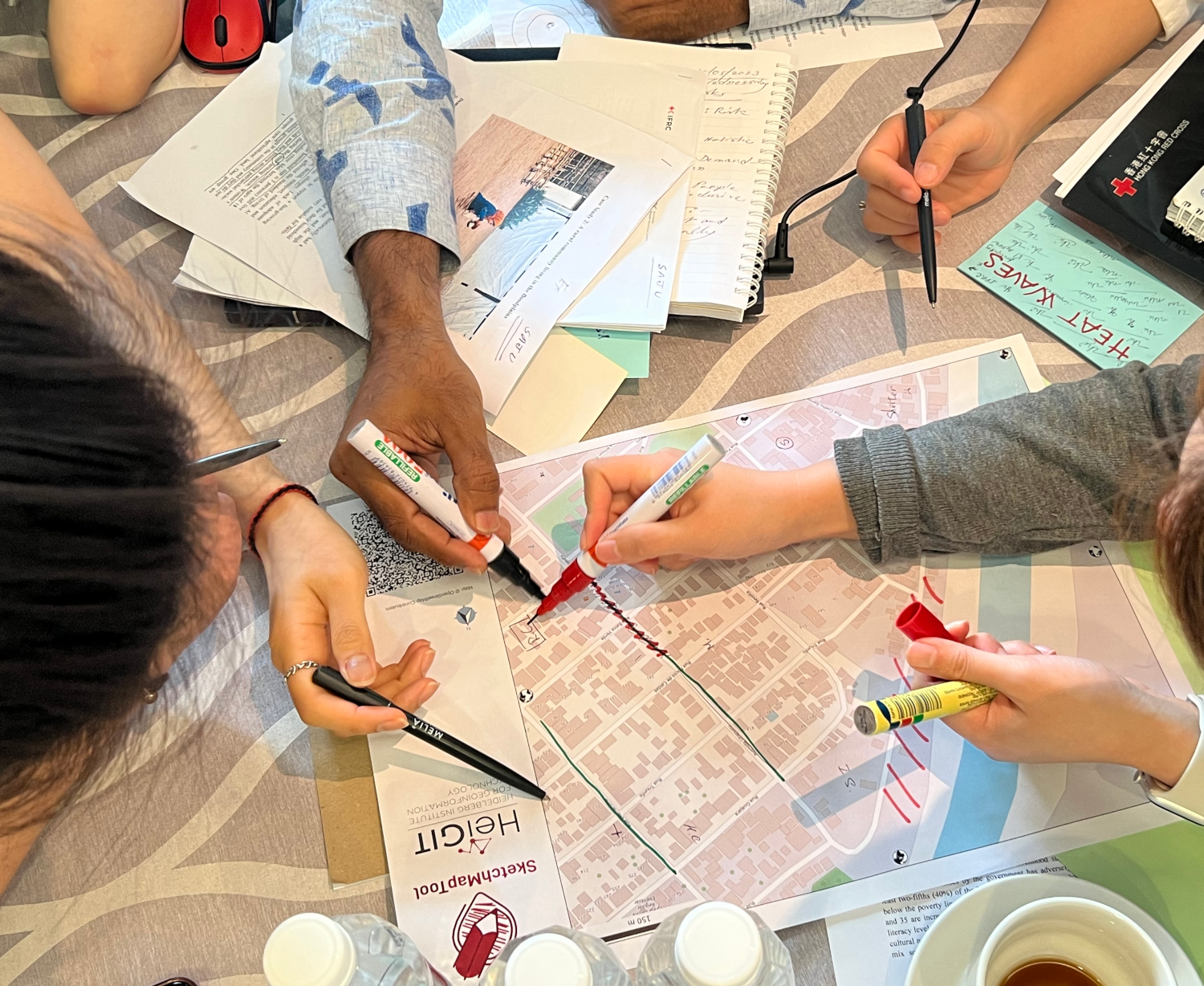
A participatory mapping simulation with the Sketch Map Tool in Kuala Lumpur, 2023.
What is the Sketch Map Tool?
The Sketch Map Tool (SMT) is an easy-to-use and free-of-charge tool that enables community mapping in a paper-based format and provides the mapping results digitally.
The knowledge of local communities is fundamental for humanitarian assistance. Spatial knowledge from local communities is often drawn and collected on paper-based maps, which is more inclusive with regards
to participation of persons with different educational and technical knowledge. However, paper-based maps need to be digitalized for sharing and further analysis. The SketchMapTool is a simple, open-source solution that enables the digitalization process in three simple steps. The SketchMapTool uses OpenStreetMap as a base map, helping participants to orientate themselves, enabling them to map relevant points and areas and providing the possibility for georeferencing. It provides a spatial background and scale to aid discussions and enabling different stakeholders with varying levels of expertise and technical experience to use the tool for a wide range of applications. Currently, the base map depicts OpenStreetMap data, giving communities the opportunity to improve their base maps.
At the beginning of this year, a user-ready version of the tool was officially launched. Since then, a lot has happened: SketchMapTool has been introduced in various application contexts, e. g. the Enhanced Vulnerability and Capacity Assessment (EVCA) of the International Red Cross Red Crescent Movement. The presentation and practical workshops at a regional training of the International Federation of Red Cross and Red Crescent Societies in Kuala Lumpur, Malaysia represented a crucial step towards integrating the tool into the standard processes of the International Red Cross and Red Crescent societies worldwide.
Looking Ahead
With the crucial support of the German Red Cross and the German Federal Foreign Office, the SketchMapTool now goes into the next development phase.
The tool will be released in several new languages, significantly expanding its accessibility. Moreover, it will be possible to use satellite imagery as base map. The development team will also be working with state-of-the-art methodologies to keep improving the marking detection on the paper Sketch Maps, furthermore tackling software stability issues in order to guarantee a smooth and fail-safe usage of the tool.
This is a a significant step forward in opening the tool to new application fields and more users worldwide, contributing to positive, transformative change in many vulnerable communities.
Related work
Klonner, C., Hartmann, M., Djami, L., Zipf, A. (2019). “Ohsome” OpenStreetMap Data Evaluation: Fitness of Field Papers for Participatory Mapping In: Minghini, M., Grinberger, A.Y., Juhász, L., Yeboah, G., Mooney, P. (Eds.). Proceedings of the Academic Track at the State of the Map 2019, 35-36. Heidelberg.
Klonner, C., Usón, T.J., Aeschbach, N., Höfle, B. (2021): Participatory Mapping and Visualization of Local Knowledge: An Example from Eberbach, Germany. Int J Disaster Risk Sci 12, 56–71. https://doi.org/10.1007/s13753-020-00312-8 .
Lautenbach, S., Sendlinger, L., Schultz, M. Ludwig, C., Klonner, C., Neumann, D., Zipf, A. (2021): OpenStreetMap als Datenquelle für Umweltinformationssysteme – Grundlagen und Anwendungsbeispiele. In: Fischer-Stabel, P.: Umweltinformationssysteme. Grundlagen einer angewandten Geoinformatik/Geo-IT. 3., völlig neu bearbeitete und erweiterte Auflage, pp. 188-197.
Marchezini, V., Porto de Albuquerque, J., Pitidis, V., Rudorff, C.d.M., Lima-Silva, F., Klonner, C. and Martins, M.H.d.M. (2022): Flood risk governance in Brazil and the UK: facilitating knowledge exchange through research gaps and the potential of citizen-generated data. Disaster Prevention and Management, Vol. 31 No. 6, pp. 30-44.
Lightning talk: OpenStreetMap Sketch Map Tool – The Future of OpenStreetMap Field Papers