

Tag: openrouteservice
-

Announcing openrouteservice version 9.0.0: codename “Europa”
We are proud to announce the release of openrouteservice version 9.0.0, codename “Europa”. In this release, there are a number of new features that make running your own instance a whole lot easier, and some changes that improve the general routing results. For our API users, this release will not mean much, as just a…
-
Openrouteservice Feature Updates: Export and Snap Endpoints
The openrouteservice (ORS) continuously evolves, bringing a suite of new features: the export and snap endpoints. These new features will change the way users interact with and process routing data, making it easier to handle complex use cases or pre-process points for routing queries. Export Feature While openrouteservice does not directly provide tools for network…
-
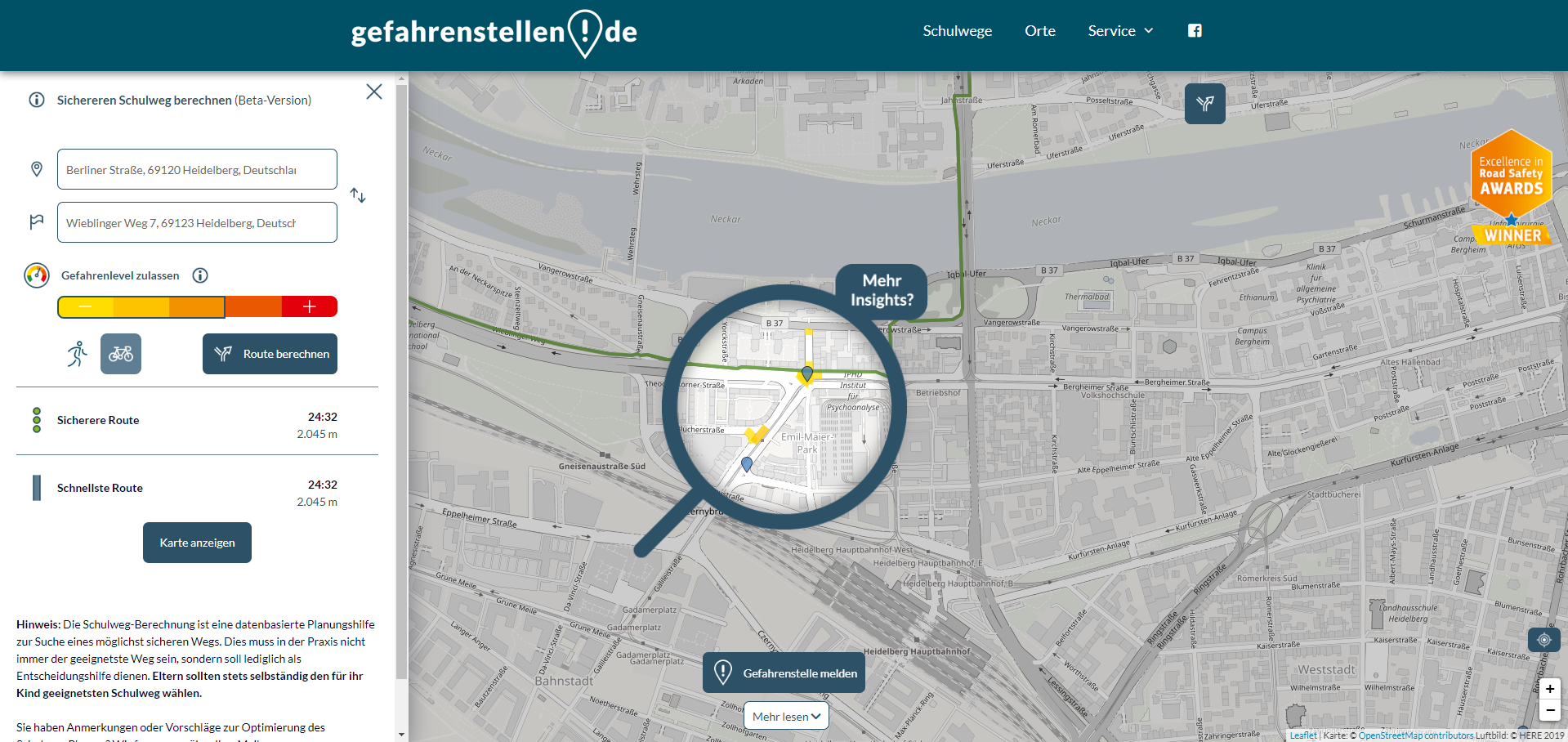
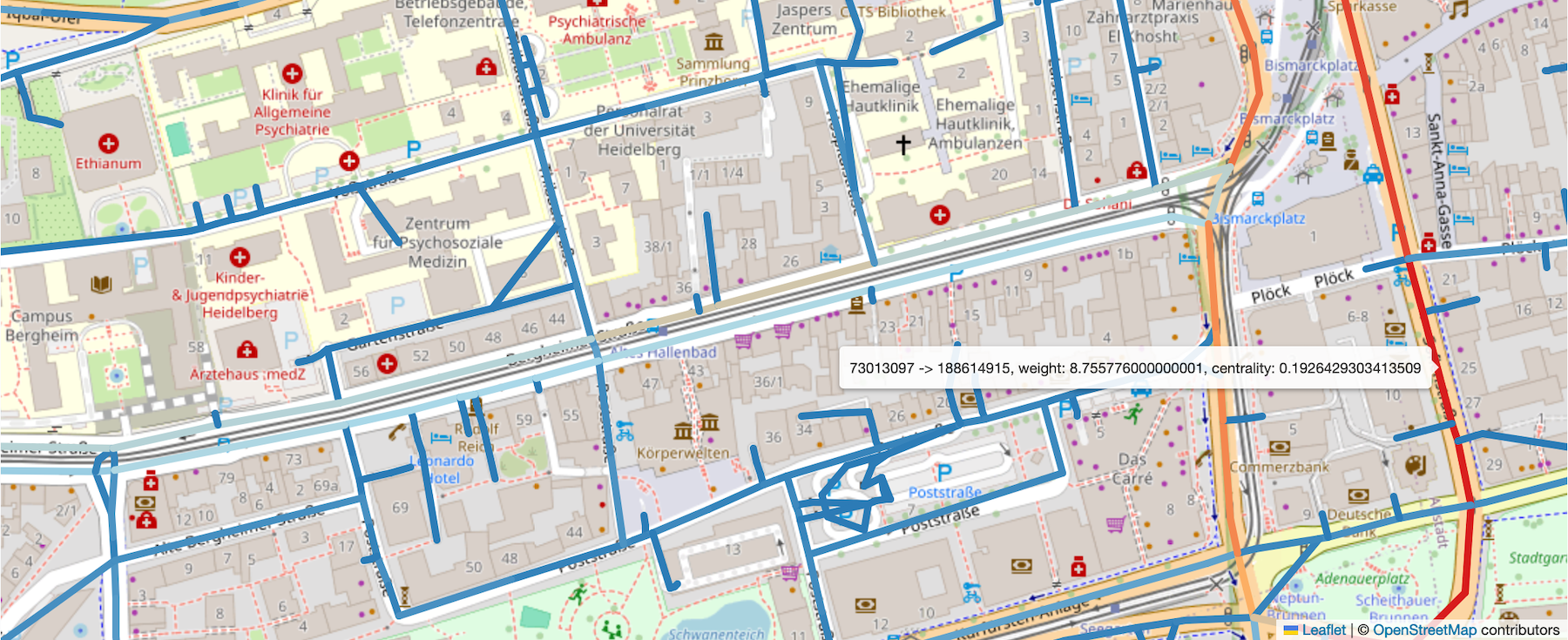
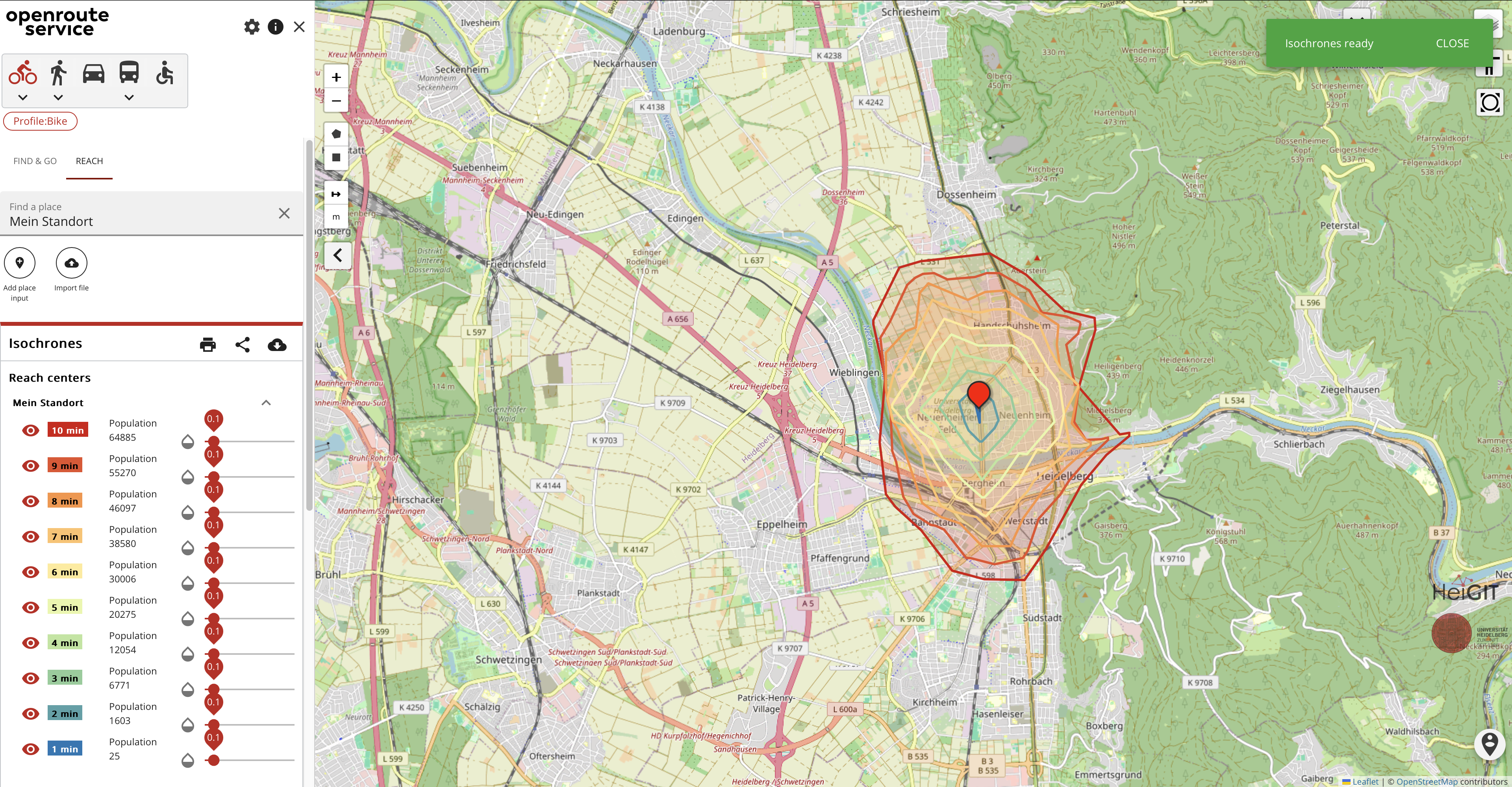
Enhancing school safety with openrouteservice: the digital school route planner
The OpenStreetMap (OSM) and openrouteservice (ORS) provide free geospatial data that serve a multitude of research and practical applications. OSM thrives on its community-driven approach, ensuring its data is always up-to-date and versatile. ORS takes this a step further by providing sophisticated routing services for various modes of transport, including walking, cycling, driving, and wheelchair…
-
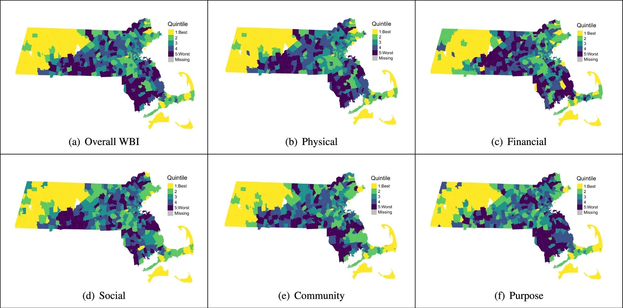
Use Case: ORS for Modeling Health and Well-Being
Open-source tools that incorporate open geospatial data, such as openrouteservice (ORS), prove to be beneficial for both academic research and practical applications. These tools enable researchers to pursue innovative approaches aimed at addressing complex societal challenges and beyond. A great illustration of this is presented in the journal paper titled “Modeling health and well-being measures…
-
Enhancements in the QGIS Plugin for openrouteservice
The openrouteservice (ORS) QGIS plugin continues to evolve, bringing a suite of new features, improvements, and fixes that enhance its functionality and user experience. This update incorporates significant changes that will benefit users working on diverse geospatial projects. In this post, we highlight the key updates in the latest version of the ORS QGIS plugin.…
-

HeiGIT at FOSSGIS 2024
We’re proud to share our recent conference experience with you! Our HeiGIT Product Owners for Big Data and Smart Mobility, Benjamin Herfort and Julian Psotta, had the privilege of attending the FOSSGIS 2024 conference, where they contributed valuable insights and expertise. The results of an exciting six years of joint work and shared projects between HeiGIT and the Federal Agency for Cartography…
-
Introducing openrouteservice version 8.0 — A dedication to Wilfried Juling
We’re thrilled to announce the release of openrouteservice (ors) version 8.0, designated “Wilfried”, as a tribute to Prof. Dr. Wilfried Juling, whose steady support and advice fundamentally shaped the growth and success of HeiGIT since its beginning. With countless hours and dedication poured into development and innovation, we’re excited to present a rich set of…
-

Spotlight on HeiGIT’s FOSSGIS 2024 Presentations
We’re thrilled to share some exciting news – our colleagues Julian Psotta and Benjamin Herfort are set to deliver talks at FOSSGIS 2024 in Hamburg, Germany! Julian Psotta will be presenting the openrouteservice project together with the Federal Agency for Cartography and Geodesy (BKG). Their joint talk “From openrouteservice to RoutingPlus – Insights into a…
-
GeoPrompt – Revolutionizing Navigation and Beyond: HeiGIT’s Innovative Web Application Powered by ChatGPT
Introduction In an era where technology continuously reshapes our world, the fusion of artificial intelligence and geospatial data offers exciting possibilities. HeiGIT (Heidelberg Institute for Geoinformation Technology), a pioneering research organization, has unveiled a novel web application that not only simplifies navigation but also empowers users to access a wealth of location-based data. This proof-of-concept…
-
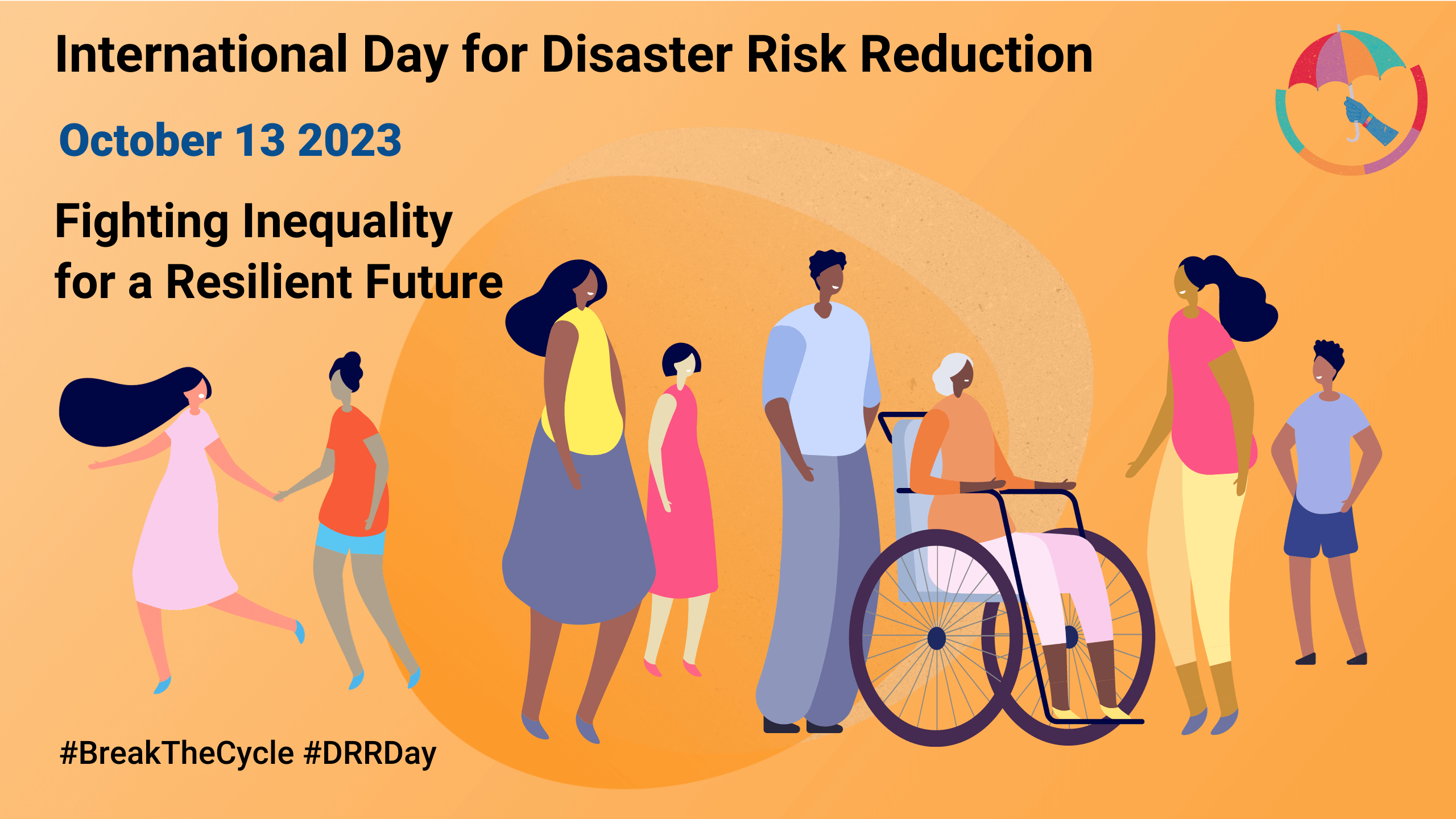
Today is the International Day for Disaster Risk Reduction!
Did you know that October 13th is the International Day for Disaster Risk Reduction (IDDRR)? Since 1989, the United Nations Office for Disaster Risk Reduction promotes a global culture of risk-awareness and disaster reduction on this day and encourages the community to share their events, promotions and ideas regarding disaster risk reduction. Under this year’s…
-
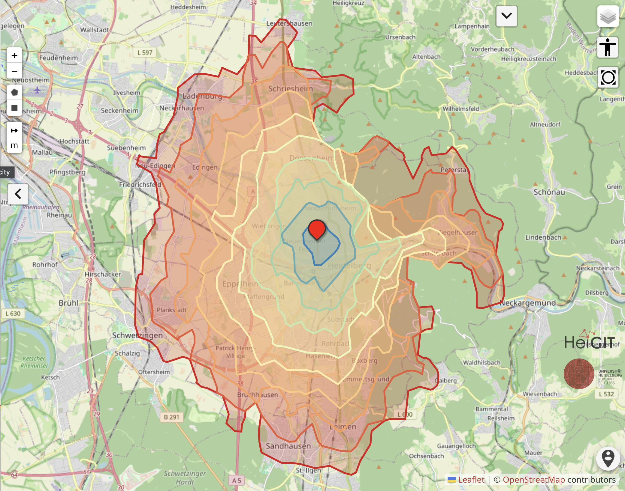
Expanding Disaster Management Capabilities with openrouteservice
In the context of disaster management, time is of the essence. Quick and accurate response can make all the difference in saving lives and mitigating damage. That’s why the openrouteservice (ORS) for Disaster Management is taking a step forward by expanding its coverage to larger areas. This upgrade is set to improve the possibilities of…
-
Disaster openrouteservice to support the current response efforts to the Türkiye/Syria earthquake
On February 6, a 7.7 magnitude earthquake struck southern Türkiye at 4:17 a.m. This is Türkiye’s most powerful earthquake recorded since 1939. The Government of Türkiye has since issued a Level 4 alarm, calling for international assistance. The quake also heavily impacted north-west Syria, a region where 4.1 million people depend on humanitarian assistance already…