

On February 6, a 7.7 magnitude earthquake struck southern Türkiye at 4:17 a.m. This is Türkiye’s most powerful earthquake recorded since 1939. The Government of Türkiye has since issued a Level 4 alarm, calling for international assistance. The quake also heavily impacted north-west Syria, a region where 4.1 million people depend on humanitarian assistance already (UN OCHA, Earthquake: Türkiye and north-west Syria Flash Update No. 1 As of 6 February 2023 – Türkiye).
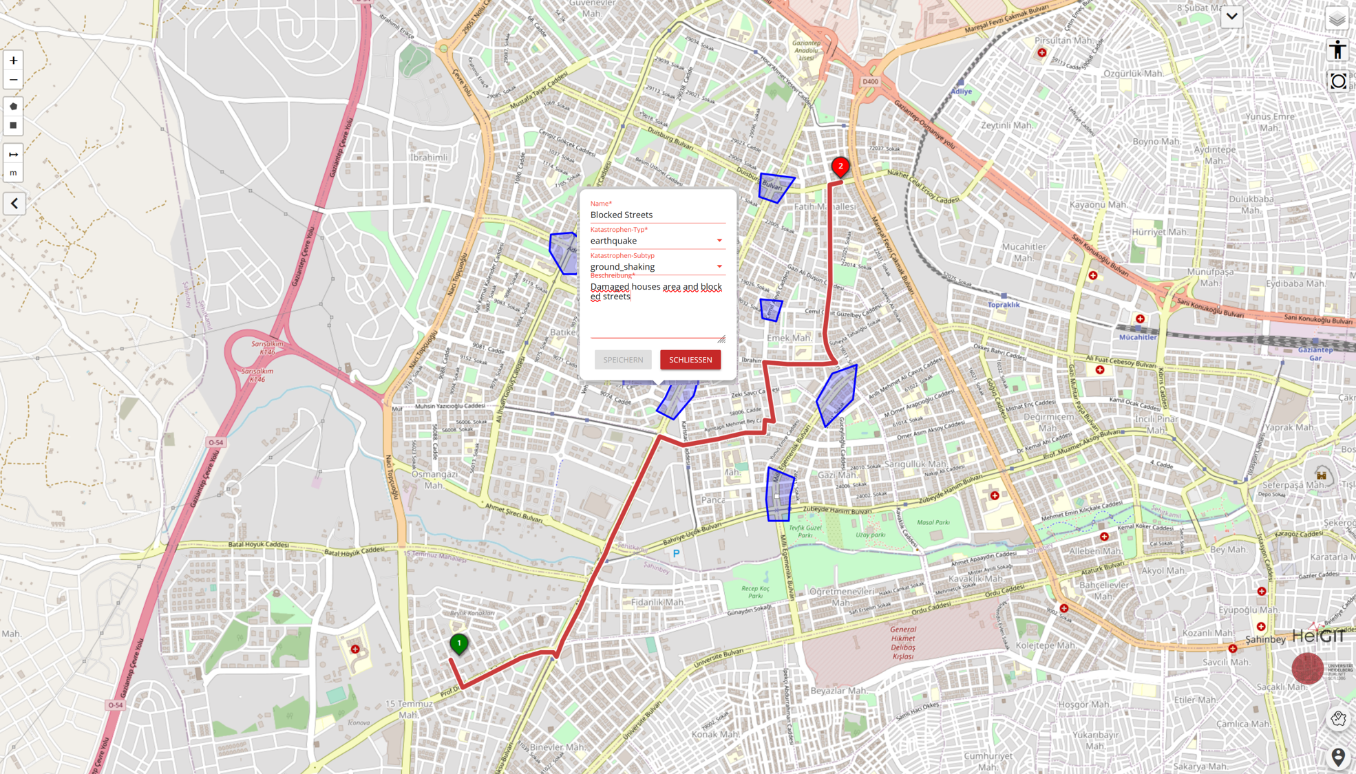
In response to the earthquake, the Smart Mobility team of HeiGIT set up an instance of the disaster openrouteservice for the impacted region. The disaster openrouteservice provides near real time updates of OSM data and is able to calculate the best routes in the affected region. Currently, the underlying OSM data is being updated every 10 minutes to allow access to the newest data for routing and accessibility analyses. This can be crucial for disaster management, especially taking into account roads that have recently been added or marked as damaged by participants of a mapping activation. The service will be further developed and extended based on requests from our humanitarian partners. A detailed user guide as well as follow-up posts are currently being worked on.
Alongside other humanitarian aid providers the Humanitarian OpenStreetMap Team ( Humanitarian OpenStreetMap Team | Home) also started a mapping activation to support map data collection in OpenStreetMap (OSM). The created OSM data is utilized to support disaster management and coordination efforts (see HOT Tasking Manager). To participate you only need to create an OSM profile and log into the HOT Tasking Manager. From then on there are various tasks to choose from, where you can immediately start mapping. There are tutorials available.