
Search results for: “red cross”
-
CAP4Access e-Newsletter No. 2 – 2015 (Part 1, Geoinfo for Mobility Impaired
CAP4Access e-Newsletter No. 2, 2015 (Part 1) First tools released + + + “Mapping parties” raise awareness for disability issues Dear Readers, The CAP4Access project has kick-started its second year by publishing first versions of a range of tools. They are intended to raise awareness about accessibility of the built environment and for providing concrete…
-
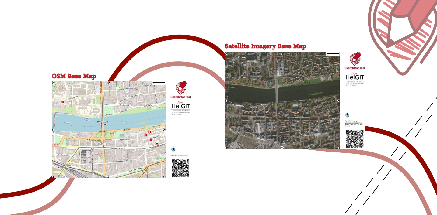
Unveiling the Sketch Map Tool 2.0: A Comprehensive Overview of New Features and Training Opportunities
The HeiGIT gGmbH (Heidelberg Institute for Geoinformation Technology) team has just released a version 2.0 of the Sketch Map Tool, a low-tech solution for participatory sketch mapping through offline data collection, digitization and georeferencing of local spatial knowledge. Thanks to continuous support from the German Red Cross and financial support by the German Federal Foreign Office, the HeiGIT tool has undergone significant enhancements. These updates introduce new features aimed…
-

Mapathon on February 7th
The first Mapathon this year will be on February 7th. When: Wednesday, 07.02.2024, at 7 p.m. Where: Berliner Straße 48, Hörsaal After a short introduction into the region and subject of this mapping task, you will also get instructions how to map. The Mapathon will be a collaboration with the German Red Cross (GRC) and…
-
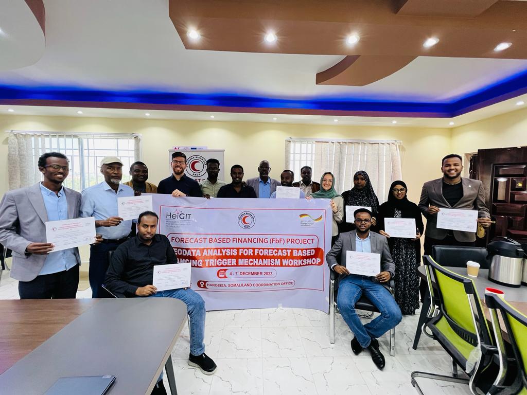
Somaliland GIS Training
Since 2022, HeiGIT is providing technical support to the Somali Red Crescent Society (SRCS) in Somalia. The objective was the development of an Early Action Protocol (EAP) for droughts in Somalia, a plan developed by RCRC National Societies that outlines early actions to be taken when a specific hazard is forecasted to impact communities. In…
-
Looking back at SOTM Africa and Missing Maps Gathering
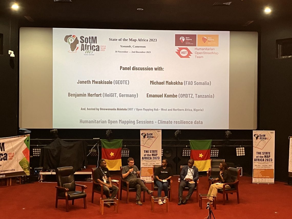
The recently concluded State of the Map Africa 2023, hosted in Yaoundé, Cameroon, marked the fourth edition of this regional OpenStreetMap (OSM) conference. The State of the Map was a great opportunity to get to know the people who are at the center of building open mapping communities in African countries. For the first time…
-
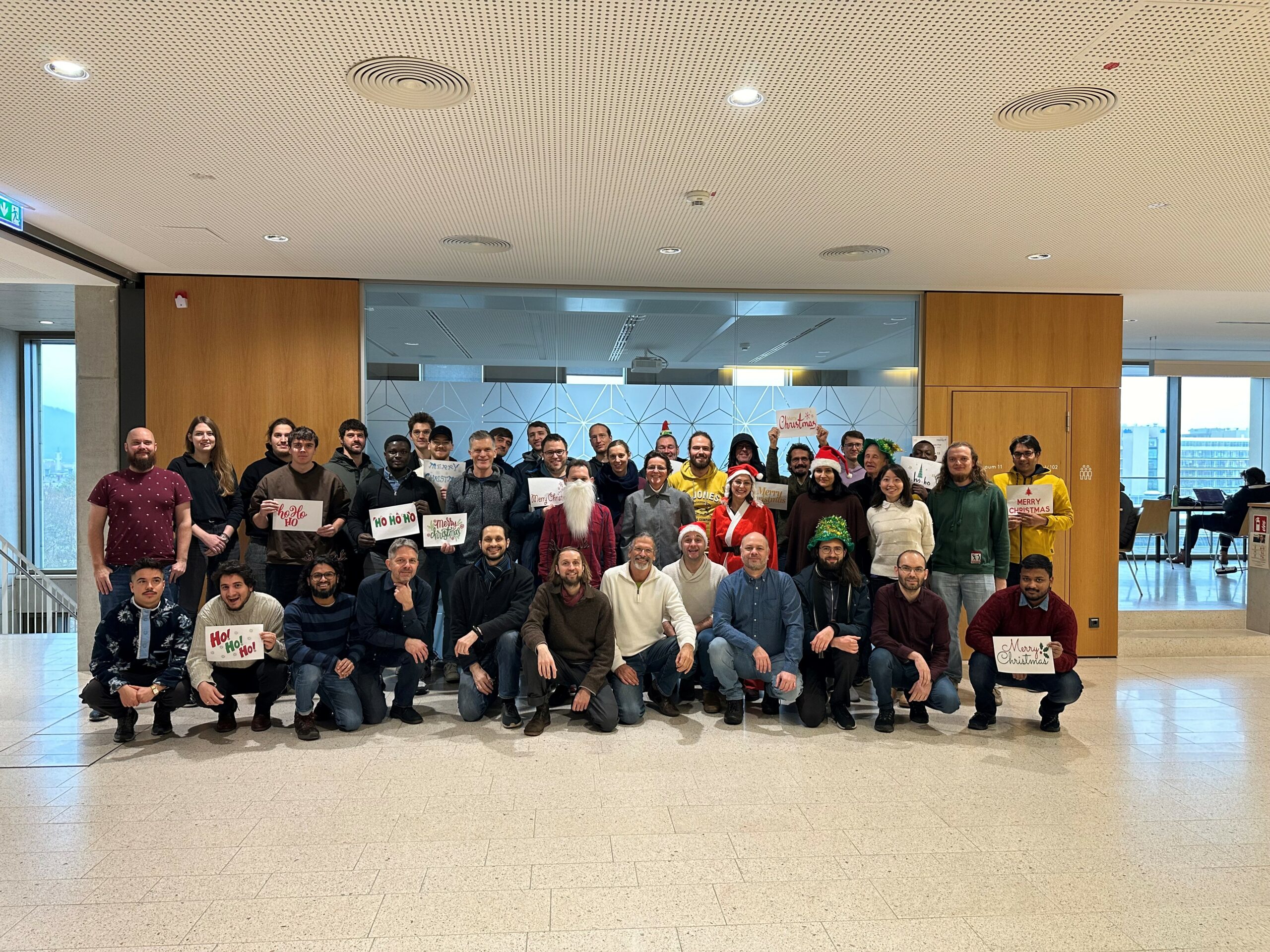
The Year 2023 at HeiGIT
As 2023 is coming to an end, we would like to take the opportunity to look back at this eventful year and appreciate the advance that HeiGIT has made towards its goal of enabling and improving the transfer of knowledge and technology. Thanks to the collective efforts of each team member and the GIScience community,…
-
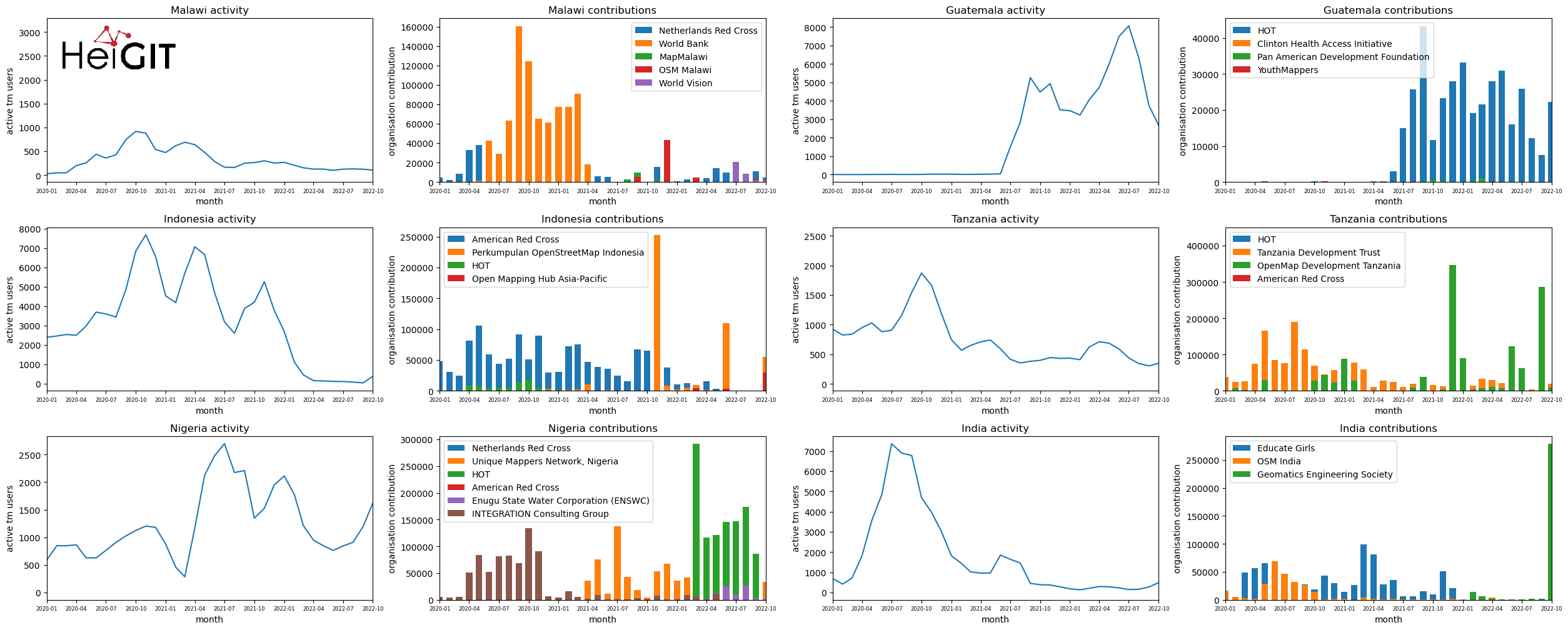
Analysis of Humanitarian OSM Stats: User activity through HOT-TM and contributing organizations
Introduction In this blogpost we are taking a look at humanitarian mapping through the Tasking Manager (HOT-TM) that is operated by the Humanitarian OpenStreetMap Team (HOT). At HeiGIT we work together with HOT to provide analyses and statistics to further understand mapping activity. Explore the user and mapping stats of all Tasking Manager activites here. Check our blog posts about topics…
-
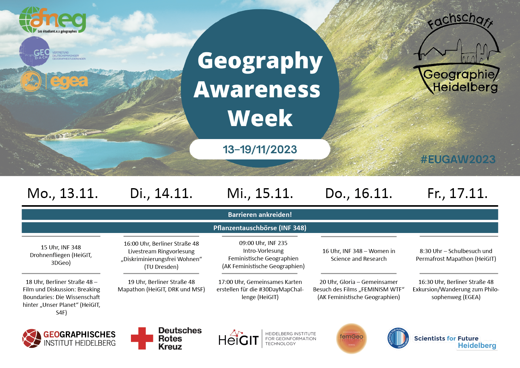
HeiGIT participates at this year’s Geography Awareness Week
In the upcoming week, 13th – 17th November, the annual Geography Awareness Week will take place. The theme week, organized by the National Geographic Society, aims to show the importance of geography in many areas of everyday life and the opportunities this discipline offers to tackle key challenges such as climate change. HeiGIT organizes and participates in…
-
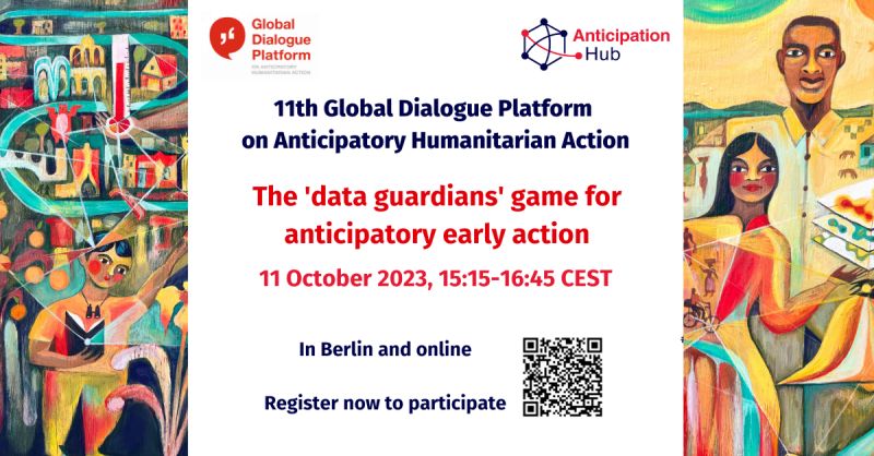
HeiGIT at the 11th Global Dialogue Platform on Anticipatory Humanitarian Action
In October 2023, the 11th Global Dialogue Platform on Anticipatory Humanitarian Action will take place as a hybrid event in Berlin, allowing for people to attend either in person or online (register here). Under this year’s main theme “People at the centre: scaling up anticipatory action”, the platform offers a plethora of workshops and discussion…
-
HeiGIT contributes to German Congress for Geography and Young Congress for Geography 2023
From 19th until 23th September 2023 the 62nd German Congress for Geography (DKG) and Young Congress for Geography (JGK) will take place at the Goethe-Universität Frankfurt. The congress under the motto “Planetary Futures” aims to become a lively and vibrant place for scientific exchange on current issues, important research questions and societal problems. HeiGIT will contribute with…
-

Introducing ohsomeNow stats: Real-Time Monitoring for OpenStreetMap Contributions
You can now monitor contributions to OpenStreetMap (OSM) in real time with ohsomeNow stats! We developed this new dashboard as part of our long-term cooperation with the Humanitarian OpenStreetMap Team (HOT), an international organization dedicated to humanitarian action and community development through open mapping. This dashboard replaces the Missing Maps Leaderboard with a comprehensive overview of…
-
Join The Team: Student Assistant (m/f/d) for QGIS Training Platform for Humanitarian Aid and Disaster Response
Dear Students, we at HeiGIT are currently looking for a student assistant for our QGIS Training Platform for Humanitarian Aid and Disaster Response. Your Tasks will mostly be to create and manage training materials for QGIS Trainings for Red Cross and Red Crescent Societies based on existing materials, video editing of short clips for the…