
Search results for: “climate change”
-
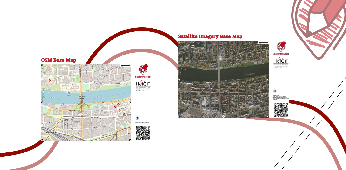
Unveiling the Sketch Map Tool 2.0: A Comprehensive Overview of New Features and Training Opportunities
The HeiGIT gGmbH (Heidelberg Institute for Geoinformation Technology) team has just released a version 2.0 of the Sketch Map Tool, a low-tech solution for participatory sketch mapping through offline data collection, digitization and georeferencing of local spatial knowledge. Thanks to continuous support from the German Red Cross and financial support by the German Federal Foreign Office, the HeiGIT tool has undergone significant enhancements. These updates introduce new features aimed…
-
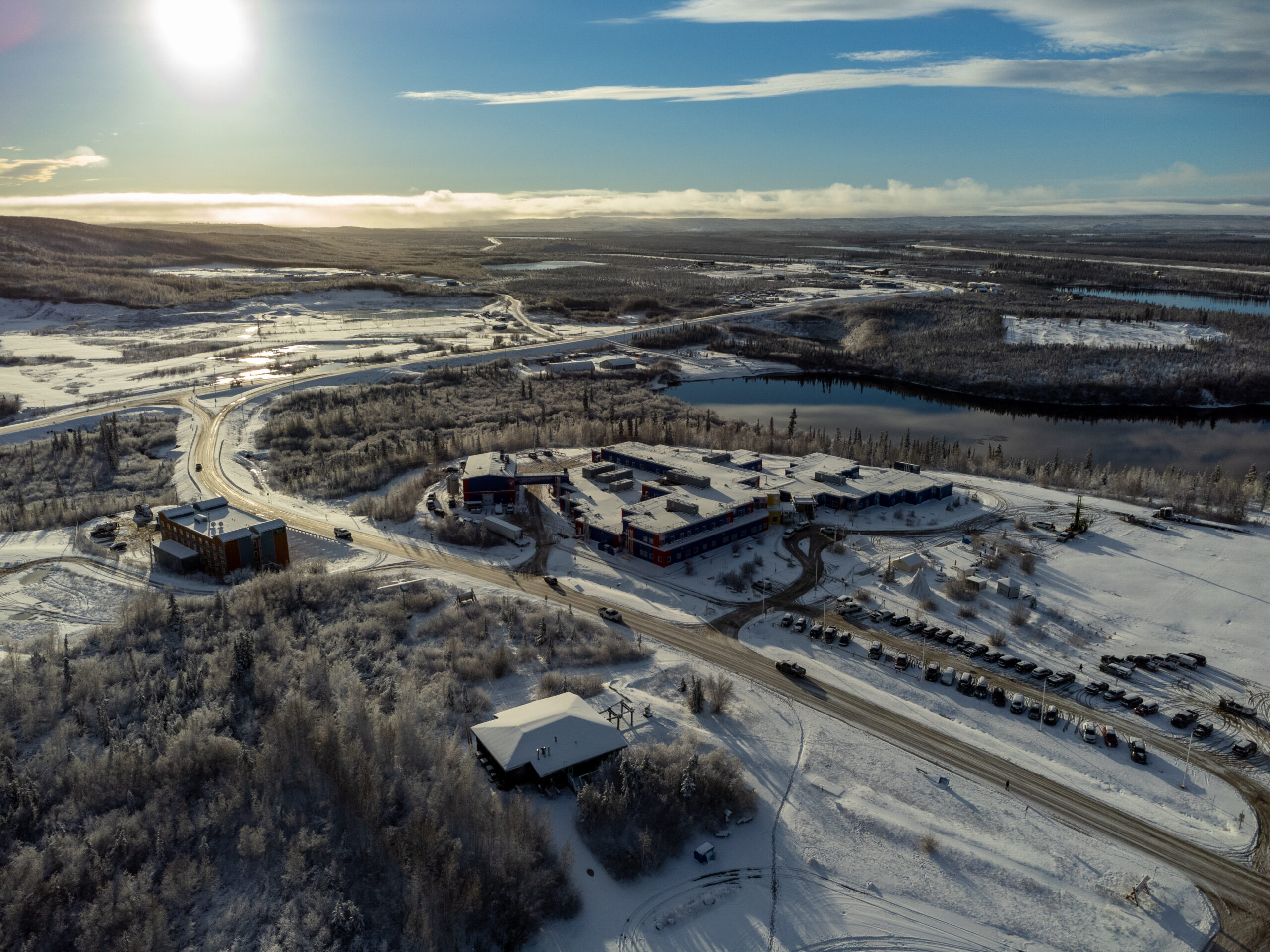
Chasing Permafrost: Insights from the Aklavik Expedition
In 2022, we embarked on an insightful expedition to Aklavik, Canada, in collaboration with our partners, the Alfred Wegener Institute (AWI) Helmholtz Center for Polar and Marine Research and the German Aerospace Center (DLR). This joint effort within the UndercoverEinAgenten project aimed to study the extent and velocity of permafrost thawing, a crucial aspect of…
-
Job Opening: Head of Administration (f/m/d)
Are you interested in applying your experience and knowledge to support science-related, non-profit organizations for the betterment of society and the environment? If so, we have a compelling and fitting position for you! HeiGIT gGmbH is a research-oriented, non-profit company that has set itself the goal of improving the transfer of knowledge and technology from…
-
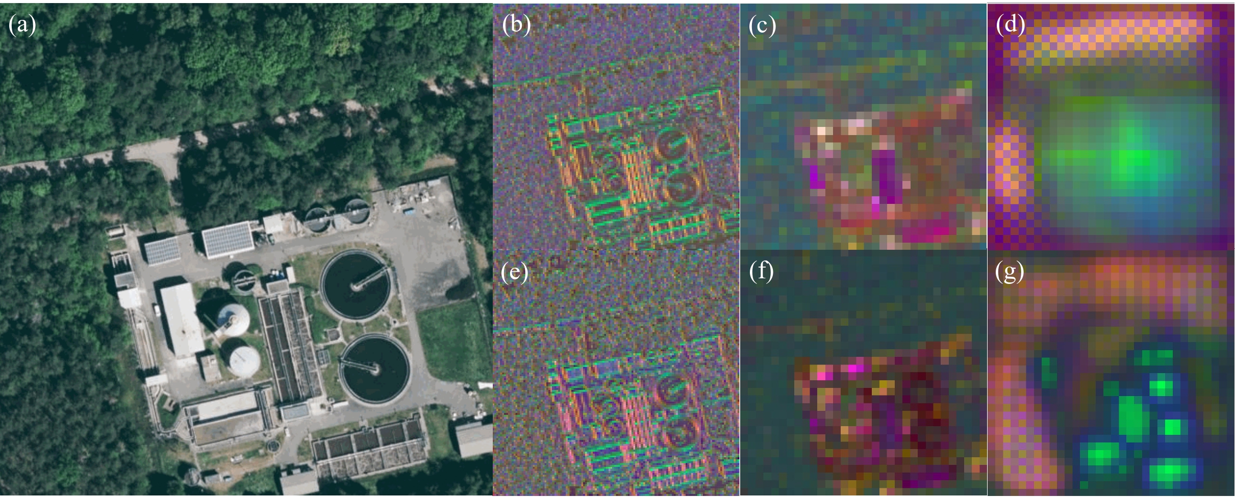
GeoAI4Water 2 Applies Deep Learning to Detect Critical Infrastructure for Disaster Planning
Context During natural disasters and other catastrophic events, quickly identifying and distributing resources is essential. Even a brief delay in evacuating residents or sourcing water can significantly hamper relief efforts and prevent effective disaster management. The HeiGIT and GIScience teams have been actively designing tools to assist in disaster preparation and response, from working with partners to build community resilience to activating our disaster…
-
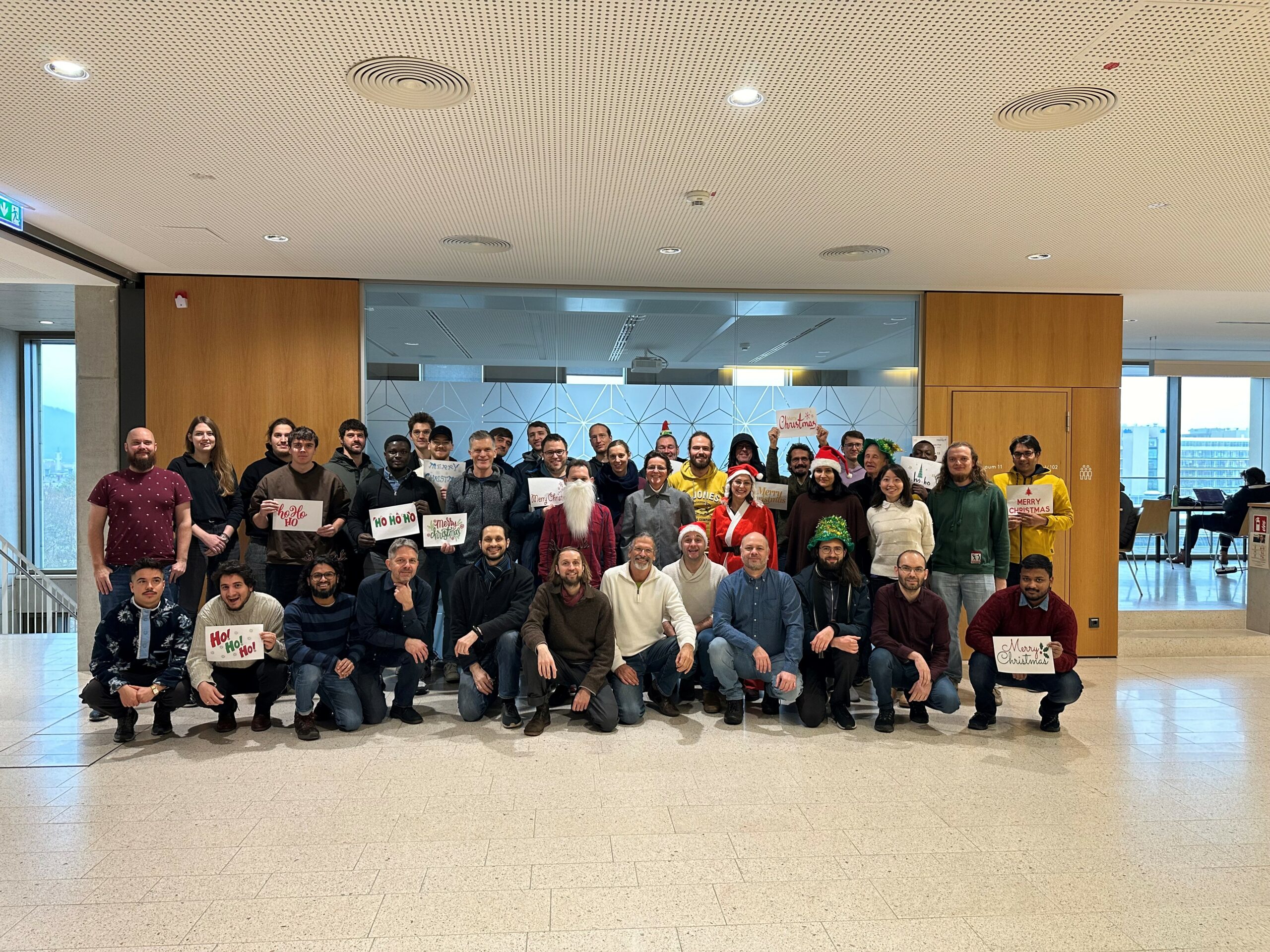
The Year 2023 at HeiGIT
As 2023 is coming to an end, we would like to take the opportunity to look back at this eventful year and appreciate the advance that HeiGIT has made towards its goal of enabling and improving the transfer of knowledge and technology. Thanks to the collective efforts of each team member and the GIScience community,…
-
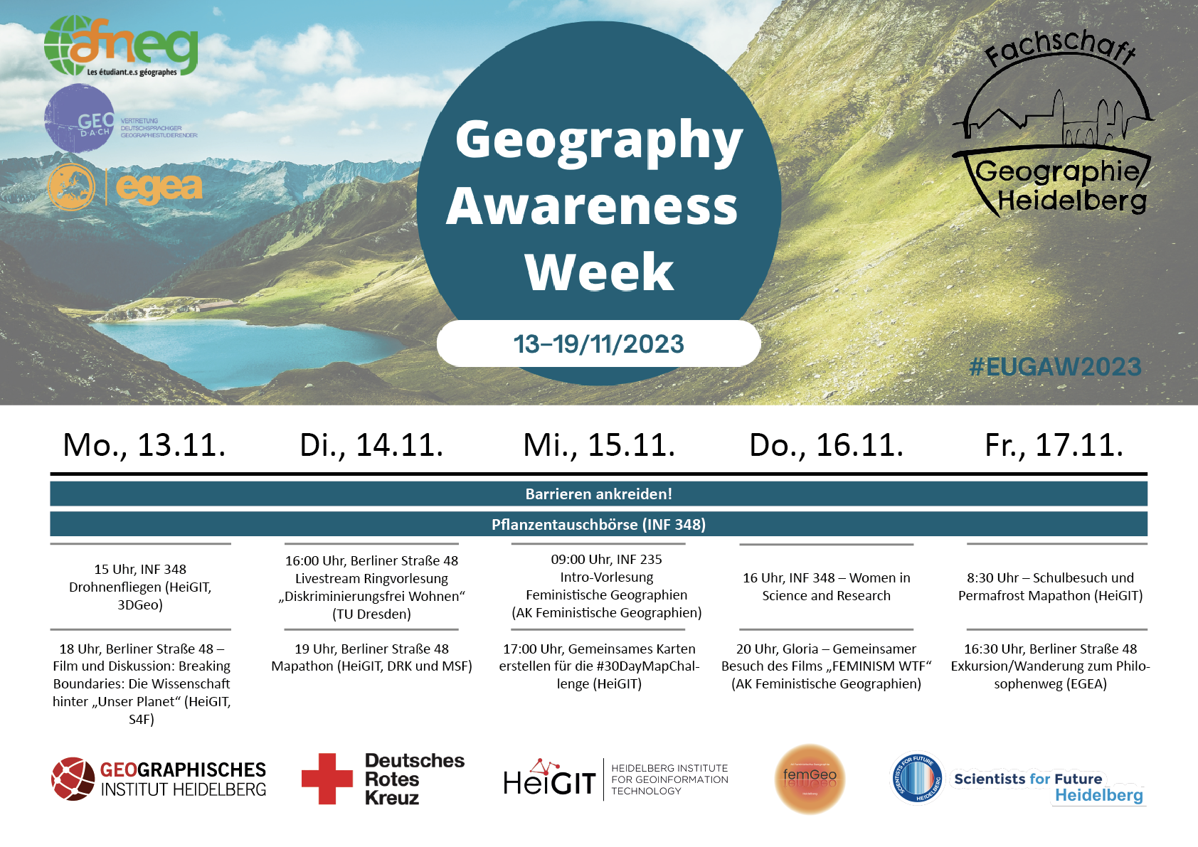
HeiGIT participates at this year’s Geography Awareness Week
In the upcoming week, 13th – 17th November, the annual Geography Awareness Week will take place. The theme week, organized by the National Geographic Society, aims to show the importance of geography in many areas of everyday life and the opportunities this discipline offers to tackle key challenges such as climate change. HeiGIT organizes and participates in…
-
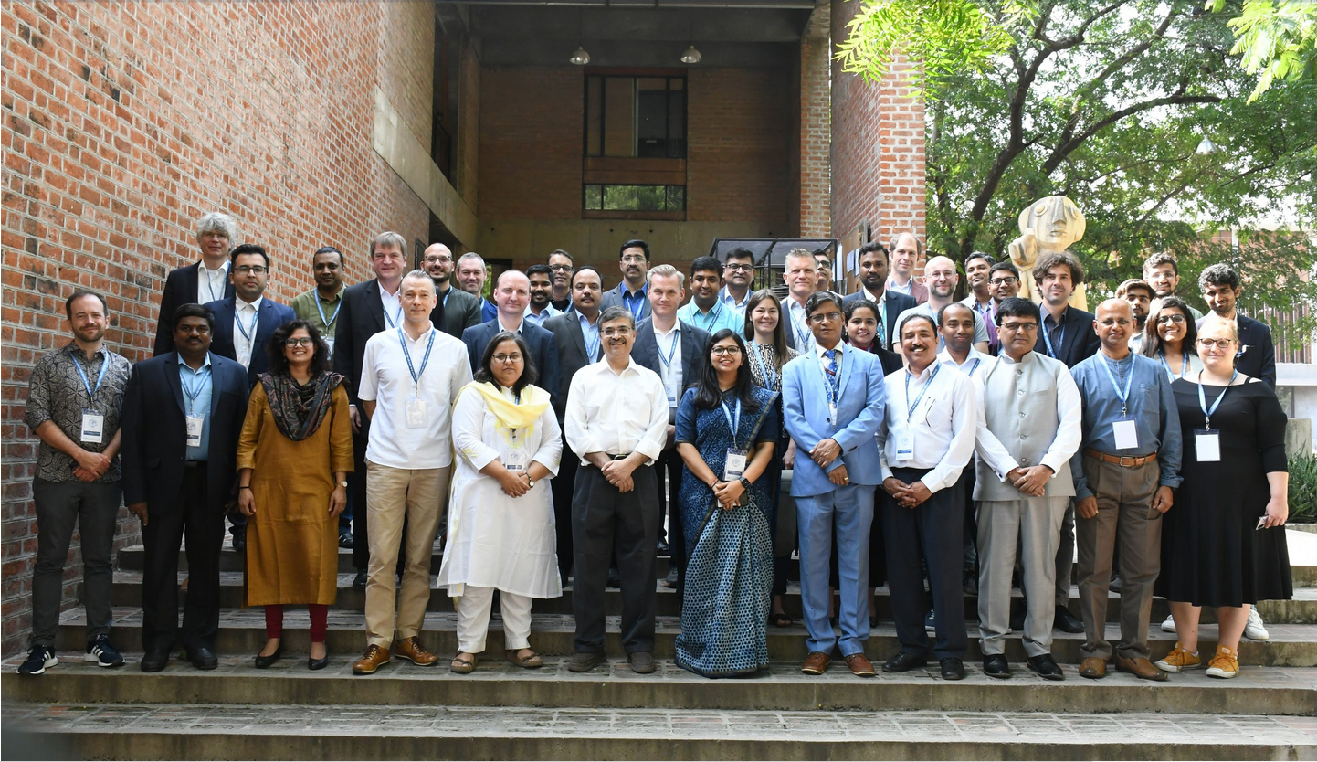
HeiGIT at the International Land Use Symposium in India
HeiGIT Scientific and Managing Director Prof. Dr. Alexander Zipf and HeiGIT Chief Scientist Adj. Prof Dr. Seven Lautenbach attended the 4th International Land Use Symposium at CEPT University in Ahmedabad, India. The symposium was held from 4th – 6th October 2023 under the main theme “Urban Analytics for Transforming Cities and Regions: Tools, Methods and…
-
More food, more water, less carbon? Costs andbenefits of global land-use optimality
Re-arranging food production: How we could use the vegetation zones on our planet more efficiently Imagine we could almost double the amount of crops we grow on our planet, while at the same time increasing the freshwater supplies and carbon storage! Tell you what: We actually could, if we re-arranged the location of food production…
-
Kick-off: AImon5.0 – Real-time monitoring of gravitational mass movements for critical infrastructure risk management with AI-assisted 3D metrology
In September 2023, our new research project AImon5.0 has been kicked-off. In this project the open-source frameworks HELIOS++ and py4dgeo of the 3DGeo research group will be combined to enhance current approaches for operational risk monitoring. AImon5.0 is an interdisciplinary collaboration project of the 3DGeo research group with DMT GmbH & Co. KG (project leader),…
-
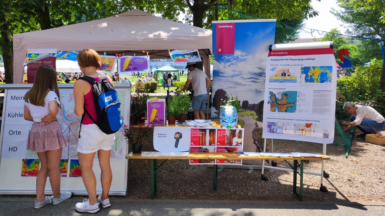
Safely through the heat with HEAL: Transdisciplinary project helps at-risk groups in everyday life
The transdisciplinary project HEAL involves citizens in the research process on heat stress in the city: The aim is to make everyday life easier for at-risk groups during heat waves. The Heidelberg Institute for Geoinformation Technology (HeiGIT), supported by the Klaus Tschira Foundation, the TdLab Geography and the GIScience Research Group of Heidelberg University are…
-
New paper “Urban Heat Island Intensity Prediction in the Context of Heat Waves: An Evaluation of Model Performance”
Aner Martinez-Soto, Johannes Fürle and Alexander Zipf published the paper „Urban Heat Island Intensity Prediction in the Context of Heat Waves: An Evaluation of Model Performance“. It was presented at the 9th International Conference on Time Series and Forecasting in Gran Canaria, Spain, on 12th – 14th July 2023. Due to Climate Change urban heat…
-
Call for Papers: Workshop on Geocomputational Analysis of Socio-Economic Data
Published: 30. June 2023 Figure from ACM SIGSPATIAL You have published an original research contribution on Geocomputational Analysis of Socio-Economic Data, or have a work-in-progress paper that would fit the topic?We invite you to contribute to the workshop on Geocomputational Analysis of Socio-Economic Data at the International Conference on Advances in Geographic Information Systems in…