In September 2023, our new research project AImon5.0 has been kicked-off. In this project the open-source frameworks HELIOS++ and py4dgeo of the 3DGeo research group will be combined to enhance current approaches for operational risk monitoring.
AImon5.0 is an interdisciplinary collaboration project of the 3DGeo research group with DMT GmbH & Co. KG (project leader), TU Munich and their associated partners Deutsche Bahn Netz AG and Landesamt für Geologie und Bergbau Rheinland Pfalz. The expertise of all partners will be combined to close the gap between research and application of operational risk monitoring.
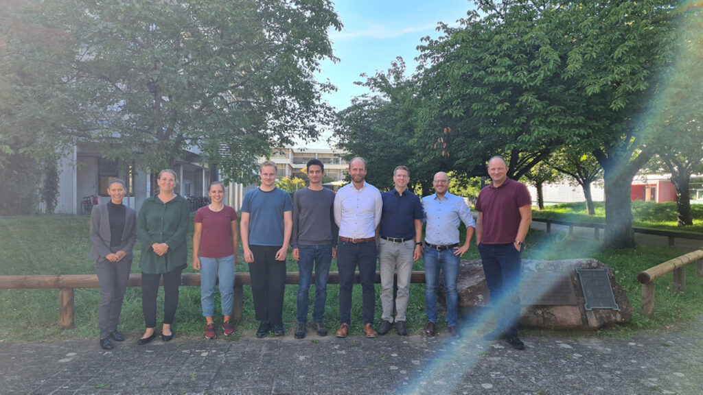
The kick-off meeting on September 14 & 15 allowed the exchange of methods and expected results of the three project partners and the detailed discussion of their contribution to the overall project. Moreover, specific test sites for the development and application of the new system were jointly discussed with our assiciated partners.
We are also grateful for the participation of Ines Klugius and Alexandra Decker (Projektträger Karlsruhe) who will supervise AImon5.0 administratively.
Background and Motivation
The Earth’s surface is constantly changing. Climate change is altering environmental conditions – for example, more intense and prolonged precipitation is causing more frequent landslides or rockfalls. Such events do not only affect the local population but also central and critical infrastructure. A key tool in integrated risk management is the availability of 4D geo-information. The information is collected through continuous monitoring in near real time. The current state of the art is fixed and autonomous permanent laser scanner (PLS) systems. PLS systems provide huge amounts of data (billions of measurements per day). In order to make PLS systems and 4D analysis methods available for operational use and to limit the big 4D data to the relevant information for decision makers, a new interface between the information needs of the application and the 4D acquisition and analysis is required. This will make it possible for the first time to use state-of-the-art PLS systems in operational risk monitoring and, with the help of artificial intelligence methods, to find and evaluate specific relevant events (e.g. activation of a slope area) in the huge amounts of data, to follow them in continuous monitoring and to automatically identify new events.
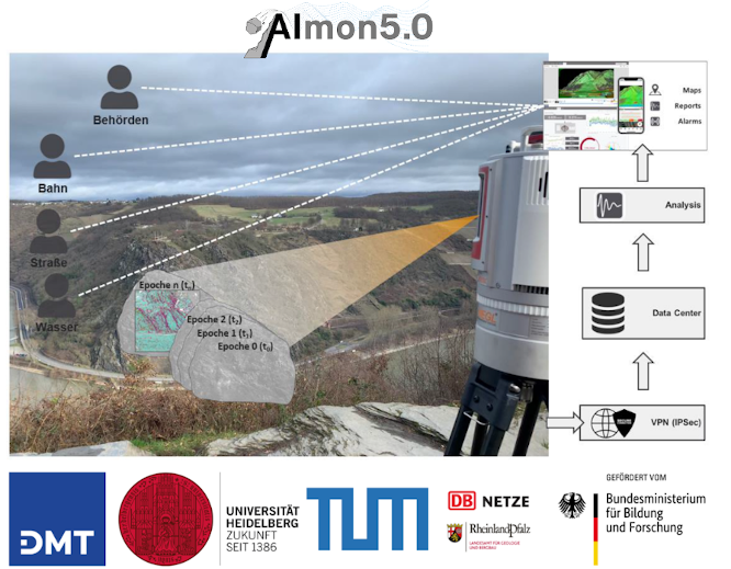
In this project of the 3DGeo research group Heidelberg the following central research objectives will be addressed:
- Identify which computer-based methods for automatic information extraction from 4D PLS data and their visualisation are particularly suitable for operational use and how these may have to be adapted and extended in order to deliver reliable and timely results.
- Investigate and combine two complementary approaches (rule-based 4D change analysis and data-driven approaches using AI and virtual laser scanning) for the automatic extraction of change information.
- Find out which levels of abstraction and forms of visualization are best suited for certain tasks and also given reaction times.
AImon5.0 will thereby close the gap between existing 4D analysis methods and an operational implementation in a real-time assistance system.
Project Updates
Find all details on the project website and follow project updates on Twitter and LinkedIn (#AImon #BMBF).
Funding
AImon5.0 is funded from 2023-2025 by BMBF (Federal Ministry for Education and Research) in frame of the funding priority “Digital GreenTech – Umwelttechnik trifft Digitalisierung” (funding code: 02WDG1696).