

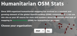
Since 2010 organized humanitarian mapping has evolved as a constant and growing element of the global OpenStreetMap (OSM) community. With more than 7,000 projects in 150 countries humanitarian mapping has become a global community effort. Due to this large amount of projects, it can be difficult to get an overview on mapping activity. This is why we worked on the “Humanitarian OSM Stats” website to make it easier to find the information you are looking for. It combines data from the open-source Tasking Manager hosted by the Humanitarian OpenStreetMap Team (HOT) and information from OpenStreetMap (OSM) that has been processed using the ohsome OSM History Data Analytics Platform developed by HeiGIT.
Let us take for example Médecins Sans Frontières (MSF), which is among the biggest institutional users of the Tasking Manager. Since 2016, MSF has created mapping campaigns both in response to emergency situations, such as the epidemic outbreaks in the Democratic Republic of Congo and cyclones in Mozambique, but also for pre-emptive mapping ahead of a possible programme development.
Goals
In this blog post we will pursue three relatively easy goals:
- Find out where mapping projects are located.
- Find out about specific regions on which mapping has been concentrated.
- Download all the data needed for the things above.
How to get the information from the website
- Visit the humstats.org website and select your organization and click on “go”. This will direct you to a new site with the statistics for the selected organization.
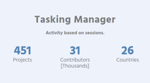
- A very quick overview on the locations of projects can be obtained from the “Tasking Manager” section. For MSF, we learn that, in total, more than 450 projects have been organized through the Tasking Manager. We further see that mapping has been organized in 26 countries.
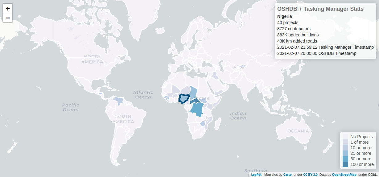
- More details about the mapping in each country is provided in the map below. The color represents the number of projects in a specific country (darker → more projects). You can hover with the mouse over the map and get more insights. For instance, MSF has organized 40 projects in Nigeria through which more than 850,000 buildings have been added to OSM. More than 8,500 volunteers contributed to this effort. Wow! MSF’s mapping projects have also contributed many roads and buildings in the Democratic Republic of Congo, Central African Republic and Chad to the map. In each of these countries, volunteers have added more than 300,000 buildings to OSM.
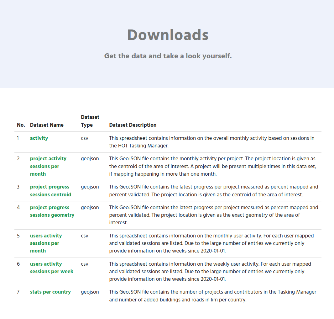
Download the data as a geojson file
If you are interested to get the data behind these numbers and plots continue reading. On the website we offer a list of files to download. The stats_per_country.geojson is the ones that you need for the purpose described in this blog post. For instance, for MSF, this file will be located here: https://humstats.heigit.org/api/export/msf/stats_per_country.geojson.
To be continued
This is the third blog post of a series of posts we are currently working on. If you are interested please reach out to us (benjamin.herfort@heigit.org) and we can try to cover your questions in a future post.
In the next blog post of this series we will take an even closer look at the MSF’s mapping activity in the Democratic Republic of Congo (DRC), Central African Republic (CAR) and Venezuela.