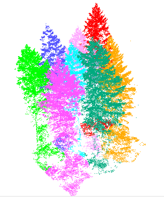
On Tuesday, 25.02.2020, the 3DGeo group and the SYSSIFOSS project partner from KIT organised a collaborative data processing event. 24 participants spent 6 hours (10:00-16:00) extracting individual trees from airborne LiDAR forest point clouds.

In the SYSSIFOSS project, the segmented 3D tree models are required to simulate 3D forest stands when combined with a forest growth simulator (find further information about the project below). Tree extraction from airborne LiDAR data is a very time-expensive task, which is also a lot more fun when many people are working on it together.
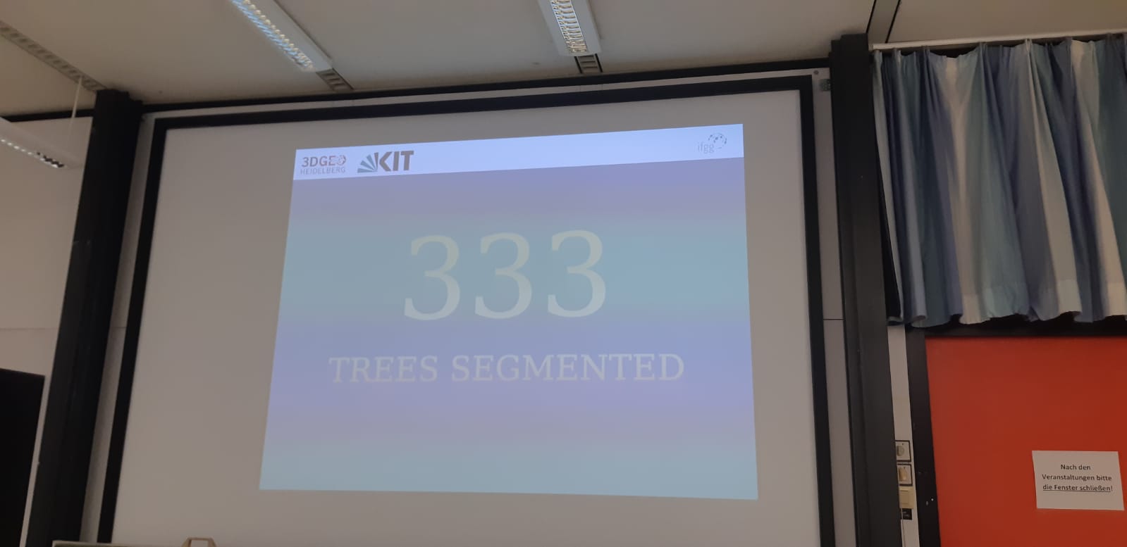
During the mapathon the number of extracted trees was projected to the screen in the front and kept everyone motivated. Tasty food and drinks were provided by the organisers and after reaching the 200-tree mark, the music started playing, which contributed to a great atmosphere. Since it was the last day of carnival, 3DGeo members also dressed in costumes. Even though extracting trees was tricky at times as we were struggling to see the wood for the trees, we had a lot of fun…
…and in the end we were happy to end the day with exactly 333 trees segmented.
Thanks again to all participants!
About SYSSIFOSS
In SYSSIFOSS we are using 3D LiDAR forest data to create a database of diverse model trees (different species and characteristics). Using tree positions and parameters provided by a forest growth simulator, 3D forest scenes will be assembled from these model trees. They serve as input for the Heidelberg LiDAR Operations Simulator (HELIOS). Based on the resulting simulations, we will conduct a sensitivity analysis to identify the most important factors (field inventory design, field plot size, statistical model, LiDAR acquisition settings, etc.) influencing LiDAR based forest inventories. Furthermore, we will investigate the potential of synthetic data to minimize the amount of field data collection.
Schäfer, J., Faßnacht, F., Höfle, B. & Weiser, H.(2019): Das SYSSIFOSS-Projekt: Synthetische 3D-Fernerkundungsdaten für verbesserte Waldinventurmodelle. In: 2. Symposium zur angewandten Satellitenerdbeoachtung, Cologne, Germany, pp.1-1.
Find further details about the SYSSIFOSS project on the project website, in recent blogposts, or on Twitter (#SYSSIFOSS).
SYSSIFOSS is funded by the Deutsche Forschungsgemeinschaft (DFG, German Research Foundation) – project number: 411263134.