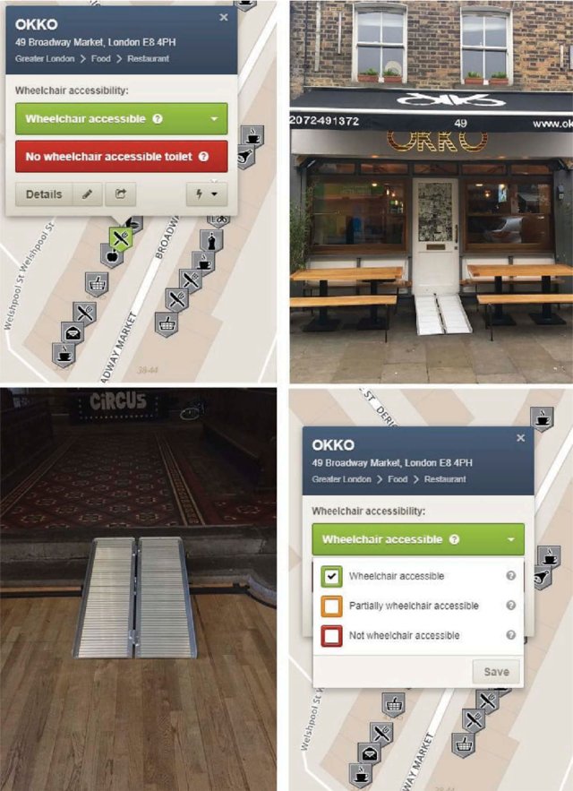
Nowadays, several research projects show interest in employing volunteered geographic information (VGI) to improve their systems through using up-to-date and detailed data. The European project CAP4Access was one of the successful examples of such international-wide research projects that aimed to improve the accessibility of people with restricted mobility using crowdsourced data. In this project, OpenStreetMap (OSM) was used to extend OpenRouteService. However, a basic challenge that this project tackled was the incompleteness of OSM data with regards to certain information that is required for wheelchair accessibility (e.g. sidewalk information, kerb data, etc.). In the following article, we present our approach in awareness raising and using tools for tagging accessibility data into OSM database for enriching the sidewalk data completeness. Several experiments have been carried out in different European cities, and discussion on the results of the experiments as well as the lessons learned are provided. The lessons learned provide recommendations that help in organizing better mapping party events in the future. We conclude by reporting on how and to what extent the OSM sidewalk data completeness in these study areas have benefited from the mapping parties by the end of the project.

Further reading:
Mobasheri, A., Zipf, A., Francis. L. (2018). OpenStreetMap Data Quality Enrichment through Awareness Raising and Collective Action Tools – Experiences from a European project. Journal of Geo-spatial Information Science, 21:3, 234-246, DOI: 10.1080/10095020.2018.1493817
The article is part of a special issue on Crowdsourcing for Urban Geoinformatics of the Journal of Geo-spatial Information Science. Amongst interesting other papers this issue includes some more articles from our group:
- Ming L., R. Westerholt & A. Zipf (2018): Do people communicate about their whereabouts? Investigating the relation between user-generated text messages and Foursquare check-in places, Geo-spatial Information Science, 21:3, 159-172, DOI: 10.1080/10095020.2018.1498669
- Hahmann, S., J. Miksch, B. Resch, J. Lauer & A. Zipf (2018) Routing through open spaces – A performance comparison of algorithms, Geo-spatial Information Science, 21:3, 247-256, DOI: 10.1080/10095020.2017.1399675
Further selected publications on the topic of OSM/VGI for accessibility:
- Zipf, A., Mobasheri, A., Rousell, A., Hahmann, S. (2016). Crowdsourcing for individual needs – the case of routing and navigation for mobility-impaired persons, a book chapter in C. Capineri et al., eds. European Handbook of Crowdsourced Geographic Information, Ubiquity Press.
- Mobasheri, A., Huang. H., Castro Degrossi, L., Zipf, A. (2018). Enrichment of OpenStreetMap data completeness with sidewalk geometries using data mining techniques. Sensors, 18(2), 509.
- Rousell A. and Zipf A. (2017): Towards a landmark based pedestrian navigation service using OSM data. International Journal of Geo-Information, ISPRS IJGI, 6(3): 64.
- Mobasheri, A., Deister, J., Dieterich, H. (2017). Wheelmap: The Wheelchair Accessibility Crowdsourcing Platform . Journal of Open Geospatial Data, Software and Standards, 2: 27, doi: https://doi.org/10.1186/s40965-017-0040-5
- Mobasheri, A., Sun, Y., Loos, L., and Ali, A. L. (2017). Are Crowdsourced Datasets Suitable for Specialized Routing Services? Case Study of OpenStreetMap for Routing of People with Limited Mobility. Sustainability, 9(6), 997.
- Hahmann, S., Zipf, A., Rousell, A. Mobasheri, A., Rylov, M., Steiger, E., Loos, L., Lauer, J. (2016). GIS-Werkzeuge zur Verbesserung der barrierefreien Routenplanung aus dem Projekt CAP4Access. AGIT – Journal für Angewandte Geoinformatik. Vol. 2, pp. 328-333. DOI: 10.14627/537622047
- John, S., Hahmann, S., Rousell, A., Loewner, M., Zipf, A. (2016). Deriving incline values for street networks from voluntarily collected GPS traces. Cartography and Geographic Information Science (CaGIS). Taylor & Francis. DOI:10.1080/15230406.2016.1190300
- Voss, H., Hahmann, S., Mobasheri, A., Rousell, A., Spindler, R. (2015).Utilizing Viennese Geographic Open Government Data For Better Inclusion Of Mobility-Impaired Persons. European Data Forum (EDF) 2015, Luxembourg.


