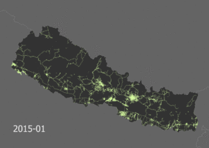
Disaster mapping activations that are supported by many volunteers with various levels of experience raise questions related to the quality of the provided Volunteered Geographic Information. Learning about the data quality that can be expected in a disaster activation helps to evaluate the quality and fitness for purpose of the OSM data.
At the ISCRAM 2018 we presented how the recently introduced ohsome OpenStreetMap history analytics platform, developed at HeiGIT, facilitates an exploratory analysis of the evolution of the OSM street network in the aftermath of the Nepal earthquake 2015.
Find out more about the ohsome platform and its ability to assess the topological correctness of the OSM street network in:
Auer, M.; Eckle, M.; Fendrich, S.; Griesbaum, L.; Kowatsch, F.; Marx, S.; Raifer, M.; Schott, M.; Troilo, R.; Zipf, A. (2018): Towards Using the Potential of OpenStreetMap History for Disaster Activation Monitoring. ISCRAM 2018. Rochester. NY. US.


