

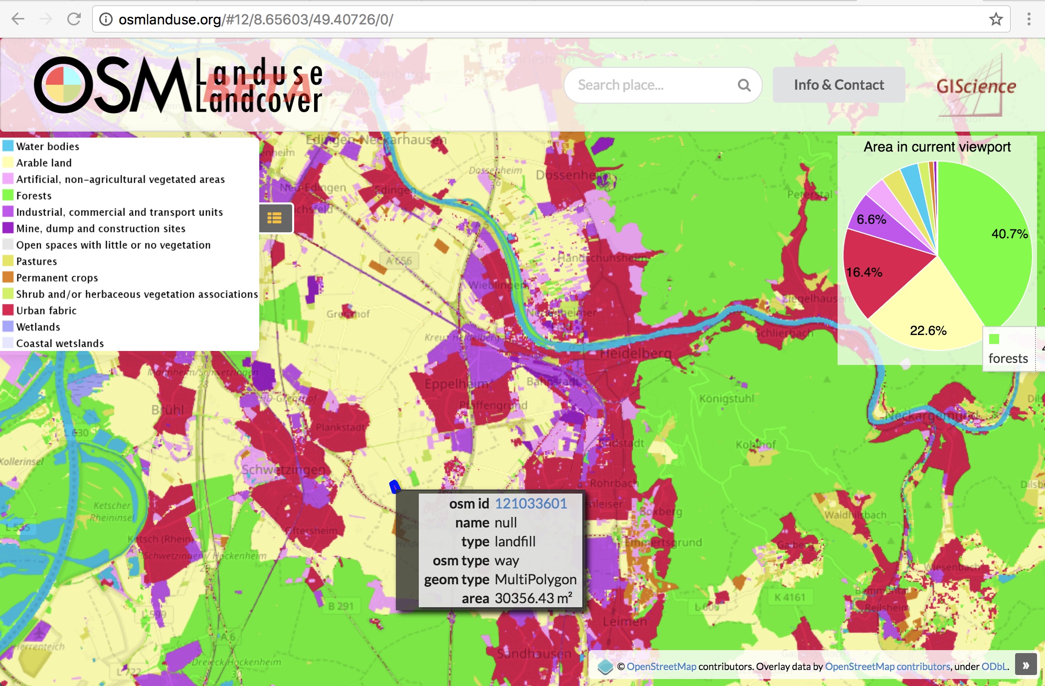
Land use data created by humans (OSM) was fused with satellite remote sensing data, resulting in a conterminous land use data set without gaps. The first version is now available for all Germany at OSMlanduse.org.
When human input (OSM data) was absent a machine generated missing land use information learning from human inputs and using remote sensing time series as feature space was added. The method outlined in Schultz et al. 2017 http://www.sciencedirect.com/science/article/pii/S0303243417301605 was now used to create the new data set for all of Germany.
Data gaps in the global OSMlanduse.org map were filled for Germany using free remote sensing data, which resulted in a land cover (LC) prototype with complete coverage in this area. Sixty tags in the OSM were used to allocate a Corine Land Cover (CLC) level 2 land use classification, and the remaining gaps were filled with remote sensing data
Have a look at the result on osmlanduse.org (the new version is at the moment for Germany only, the other parts of the world currently use only OpenStreetMap without remote sensing data added).
Stay tuned for further versions and improvements!
Schultz, M., Voss, J., Auer, M., Carter, S., and Zipf, A. (2017): Open land cover from OpenStreetMap and remote sensing. International Journal of Applied Earth Observation and Geoinformation, 63, pp. 206-213. DOI: 10.1016/j.jag.2017.07.014.
http://www.geog.uni-heidelberg.de/gis/land_sense.html
Related earlier work:
Jokar Arsanjani, J., Mooney, P., Zipf, A., Schauss, A., (2015): Quality assessment of the contributed land use information from OpenStreetMap versus authoritative datasets. In: Jokar Arsanjani, J., Zipf, A., Mooney, P., Helbich, M., OpenStreetMap in GIScience: experiences, research, applications. ISBN:978-3-319-14279-1, PP. 37-58, Springer Press.
Dorn, H., Törnros, T. & Zipf, A. (2015): Quality Evaluation of VGI using Authoritative Data – A Comparison with Land Use Data in Southern Germany. ISPRS International Journal of Geo-Information. Vol 4(3), pp. 1657-1671, doi: 10.3390/ijgi4031657
Jokar Arsanjani, J., Helbich, M., Bakillah, M., Hagenauer, J., & Zipf, A. (2013). Toward mapping land-use patterns from volunteered geographic information. International Journal of Geographical Information Science, 2264-2278. DOI:10.1080/13658816.2013.800871.