

Tag: OSMlanduse
-
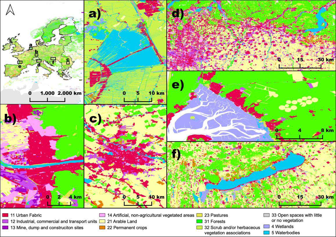
New Paper in Nature “OSMlanduse a dataset of European Union land use at 10 m resolution derived from OpenStreetMap and Sentinel-2”
The paper, published in Nature Scientific Data, presents the first high-resolution (10m or finer) land use map of the European Union derived from a large-scale fusion of OpenStreetMap (OSM) and Copernicus Sentinel-2 data. Leveraging citizen-generated data and remote sensing, the authors demonstrate a scalable and globally applicable methodology to fill thematic and spatial gaps in…
-
OSM Landuse Data is available in HeiData
We are excited to announce that the data displayed on OSM – Landuse is now freely accessible. These data sets offer valuable insights and can be utilized for various applications. Urban planners will find the data useful for development projects and zoning regulations, while environmental researchers can study land use changes and their impact on…
-
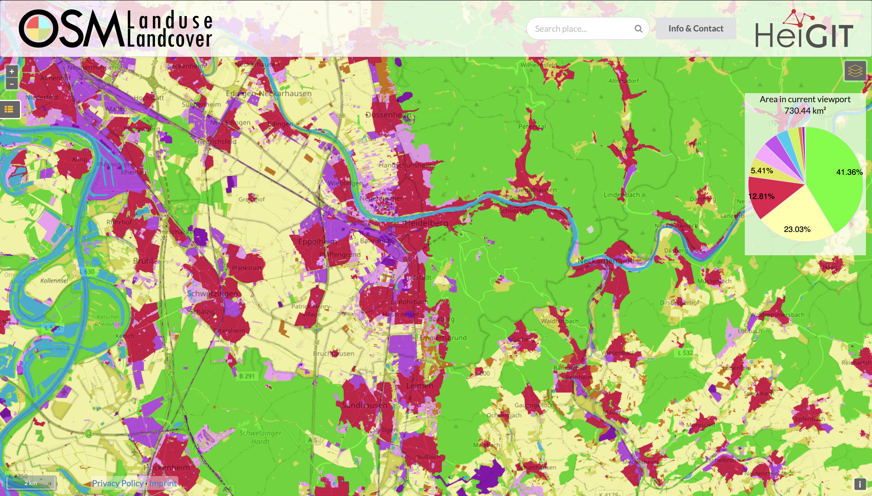
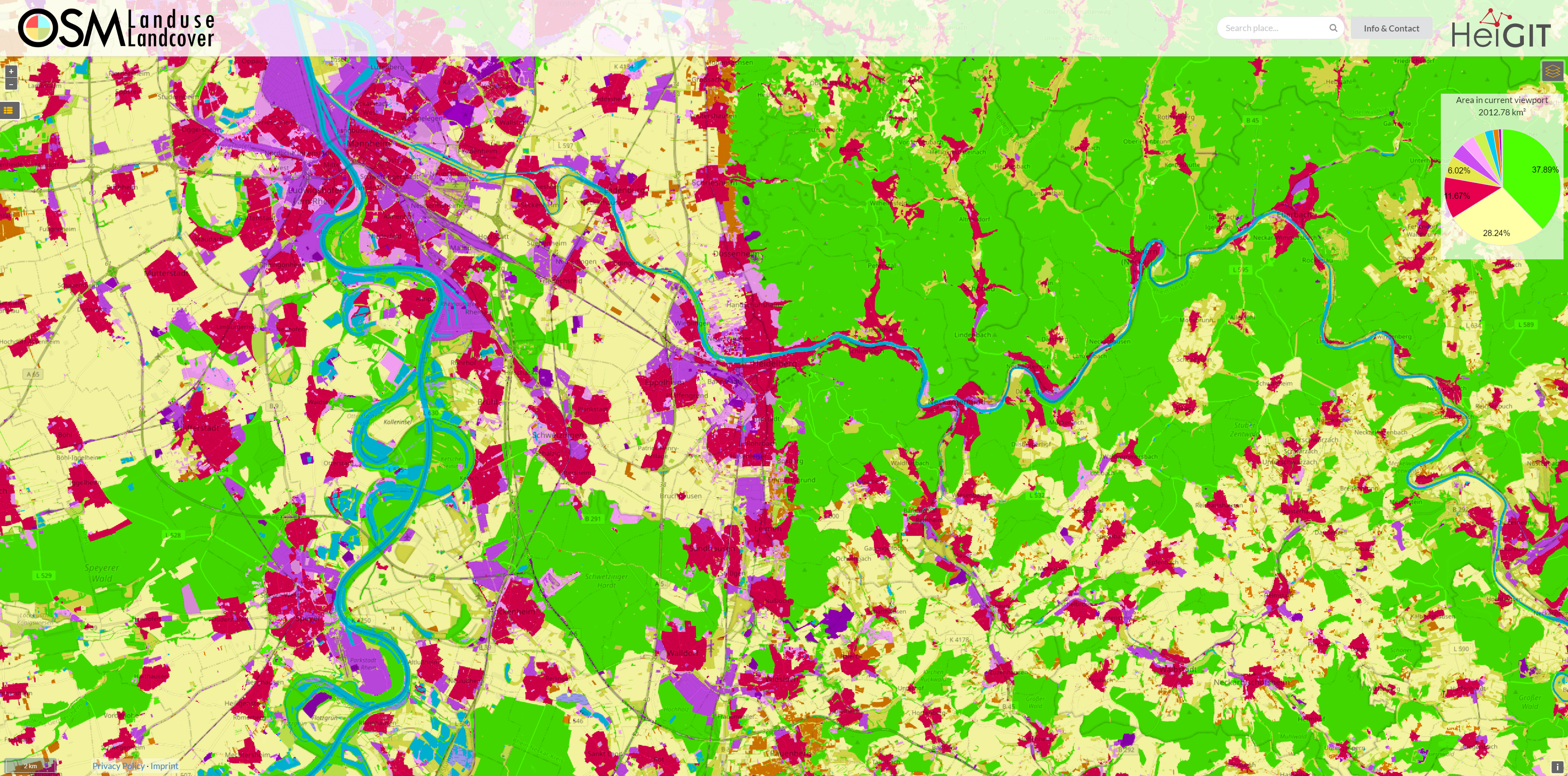
Functionality Update for OSM Landuse Landcover
We are pleased to announce that https://osmlanduse.org has received a functionality update. Thanks to the cooperation of GIScience and HeiGIT under the IDEAL-VGI project, our researchers were able to add a number of new features to the interactive map. The map displays OSM land-use and land-cover information. The two different data layers that made up…
-
Automatic mapping of national surface water with OpenStreetMap and Sentinel-2 MSI data using deep learning
Large-scale mapping activities can benefit from the vastly increasing availability of earth observation (EO) data, especially when combined with volunteered geographical information (VGI) using machine learning (ML). High-resolution maps of inland surface water bodies are important for water supply and natural disaster mitigation as well as for monitoring, managing, and preserving landscapes and ecosystems. In…
-
HeiGIT Services User Feedback Survey – only one more week!
HeiGIT wants to serve you even better. Therefore we are conducting user feedback surveys regarding our various services. If you have ever used one of our OpenStreetMap based Online Services (or will do so now) for whatever purpose, we’d be very happy if you took the time and filled out the respective survey. THANK YOU!…
-
LandSense Horizon 2020 A Citizen Observatory and Innovation Marketplace for Land Use and Land Cover Monitoring, project successful finished
The Horizon 2020 LandSense project was concluded successful. Please find a selection of the produced publications and deliverables here. The project has enabled our group to pursue quality aspects of voluntarily collected geo information data and to ramp up efforts related to OSMlanduse. Together with the University of Nottingham (Giles Foody) and Institut national de l’information…
-
OSMlanduse European Union validation effort EuroSDR conference 11/24/2020
During the EuroSDR workshop we will present our OSMlanduse product (earlier post) to the land use (LU) and land cover community (LC) and highlight class accuracies and a benchmark comparison towards existing national authoritative products. Accuracy estimated to be presented are based on more than 7k reference points collected in the past month through a…
-
OSMlanduse wird auf Geonet.MRN Meetup zu Flächennutzung und Flächenmanagement vorgestellt: Donnerstag 29.10.2020, 16:30
Am am 29.10.20, 16:30 Uhr veranstaltet das Netzwerk Geoinformation der Metropolregion Rhein-Neckar GeoNet.MRN zum Thema: Flächennutzung und Flächenmanagement: Ein Geoinformation Meetup Teilnahme: Kostenlos und ohne Anmeldung mit Teams unter diesem Link. Themen des Meetups sind die Online-Beteiligung von Kommunen, Bürgern sowie Firmen und Institutionen im Bereich Flächenmanagement mit Fokus auf die Siedlungs- und Verkehrsentwicklung und die…
-
OSMlanduse European Union validation effort
We launched a validation campaign of our new 10meter resolution OSMlanduse product for the member states of the European Union. Please contribute to the validation here. A technique where contributions are checked against each other is implemented to promote quality of information. The mapathon comes in four themes: nature, urban, agriculture or expert. While the expert…
-
Contiguous high resolution OSMlanduse map of the European Union by combining Copernicus data and OpenStreetMap
Find here a new update of the OSMlanduse.org map. By injecting known tags provided by OpenStreetMap (OSM) into a remote sensing feature space using deep learning, tags were predicted when absent thus creating a contiguous map – initially for the member states of the EU. By design our method can be applied when- and wherever…
-
New DFG project: IdealVGI – Deep Learning with OSM
Recently a new DFG project proposal was accepted to the GIScience Research Group Heidelberg within the DFG priority programme VisVGI (Volunteered Geographic Information: Interpretation, Visualisation and Social Computing” [SPP 1894]). It is joint collaboration project together with Prof. Begüm Demir from TU Berlin. IDEAL-VGI: Information Discovery from Big Earth Observation Data Archives by Learning from…
-
OpenStreetMap (OSM) Workshop at the University of Jena
Last week, GIScience Heidelberg successfully held two collaborative workshops about OpenStreetMap (OSM) at the Department of Earth Observation in Jena. Dr. Chistian Thiel and his team from the University of Jena kindly organized the event. Three members of the GIScience Research Group and the Heidelberg Institute for Geoinformation Technology (HeiGIT), Dr. Michael Schultz, Benjamin Herfort…