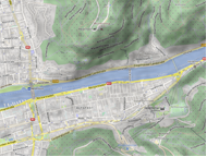
OpenStreetMap has become a huge source for any kind of geographic information. In OpenStreetMap you now find not only street information, but also information related to buildings, shops, sights and in Heidelberg even to individual trees.
Furthermore, OpenStreetMap data is open data – everyone is free to edit and to download the data to create own maps and analysis. In our workshop we want to explore this potential together with you.
When: Thursday, 18.05.2017, 6 pm
Where: PC-labs + Seminarraum, Berliner Straße 48, Heidelberg University, Institute of Geography
Depending on you pre-knowledge, we plan to have different groups. Please sign up using this link until wednesday (17.05.):
dudle.inf.tu-dresden.de/dmappers-osm/
Beginner:
- no/ little knowledge about OpenStreetMap and GIS
- download and visualize OSM data in ArcGIS or QGIS
- easy queries and styling
Intermediate:
- some knowledge and experience with OSM data
- select and export only specific OSM objects
- queries related to different timestamps, users and other parameters
Professional:
- already good experience with OSM data and keen to analyse “big data”
- store OSM data in a database
- advanced queries for large regions containing many objects
See you soon,
your disastermappers heidelberg
PS: We booked the PC-labs, however it may be worth to bring the own laptop.


