Geographic information crowdsourcing is an increasingly popular approach to derive geographic data about human settlements from remotely sensed imagery. However, crowdsourcing approaches are frequently associated with uncertainty about the quality of the information produced. Although previous studies have found acceptable quality of crowdsourced information in some application domains, there is still lack of research about the quality of information produced with mobile crowdsourcing tools.
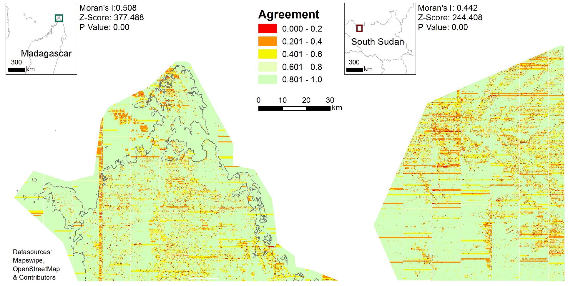
A current study accepted for the AGILE 2017 conference contributes towards filling this gap by presenting an initial analysis of the contributions of two crowdsourcing projects based on the MapSwipe mobile app, in Madagascar and South Sudan. Our results show, that there is substantial agreement amongst volunteers thus suggesting that mobile crowdsourcing is a viable approach to support the mapping of human settlements.
Nevertheless, this study also identifies several factors that may cause disagreement between volunteers (e.g. bad imagery, dependence on individual users) and thus reduce the reliability of the information they produce. However, such disagreement cases appear not to be random. Their spatially clustered distribution suggests that they are systematically caused by underlying factors. The insights of this initial study may be used to indicate which types of classification tasks are not well understood by volunteers. Thus, the results may be useful to improve the instructions and the design of the mobile crowdsourcing applications, such as Mapswipe. This is especially important for ambiguous cases like tasks in which a large part of the imagery contains clouds, but some single buildings are also identifiable. Further enhancement of the application or more comprehensive instructions for volunteers could minimize the impact of these factors of disturbance and thus improve the quality of the resulting geographic information.
The paper has been accepted for AGILE 2017 International Conference on Geographic Information Science in Wageningen NL. Stay tuned for the details presented there!
Herfort, B., Reinmuth, Porto de Albuquerque M.J. and Zipf, A. (2017): Towards evaluating the mobile crowdsourcing of geographic information about human settlements. AGILE 2017 International Conference on Geographic Information Science. Wageningen. NL. (accepted).