For all people who are interested in historic features of the OpenStreetMap dataset a complete new worldwide map service has been published. It is extending the original old HistOSM (*) from 2009 considerably.
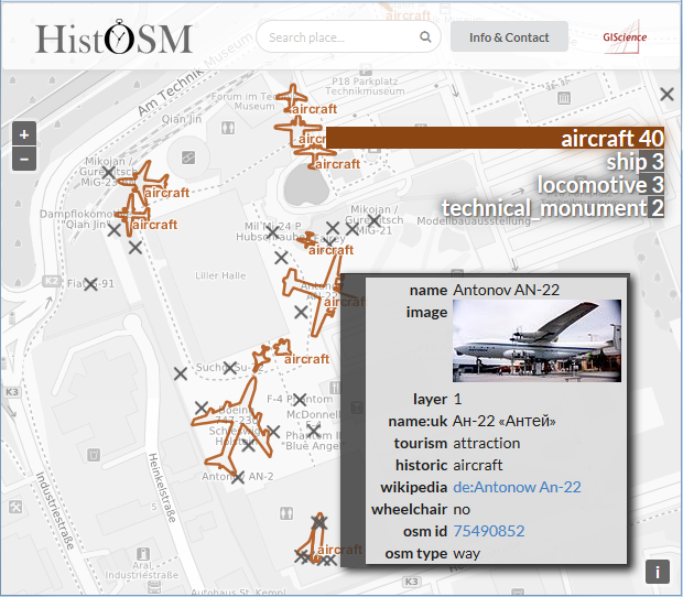
As of October 2016 you can find 638.284 objects that were tagged ‘historic’ all over the world. The range of object types is almost inexhaustible. It varies from buildings, castles, memorials, archaeological sites or ship wrecks to more exotic or unexpected features like meteor craters, Celtic earthworks, charcoal piles, aircrafts or boundary stones. While browsing the map there is an additional dynamic chart that informs about the frequency of the different objects in the current map view. Further information from the individual objects, inclusive an image preview (where available), can be obtained by clicking on the features.
It’s implemented using OpenLayers 3, D3.js and Semantic UI. The place search is powered by Nominatim and the background OSM layer is from OpenMapSurfer. This is dynamically gray-scaled by a HTML5 canvas composite operation inside the OpenLayers rendering pipeline in the client.
Cartographically interesting, a scale based switch from linear to point representation for individual objects is applied for better readability.
Check it out and have fun.
Ref. old HistOSM realized 2009:
Auer, M., Fees, M. & Zipf, A. (2010): HistOSM.org – ein Webportal zu historischen und archäologischen Stätten und Sehenswürdigkeiten auf Basis der nutzergenierten Daten von OpenStreetMap (OSM). AGIT 2010. Symposium für Angewandte Geoinformatik. Salzburg. Austria.