

Category: Digital Humanities
-
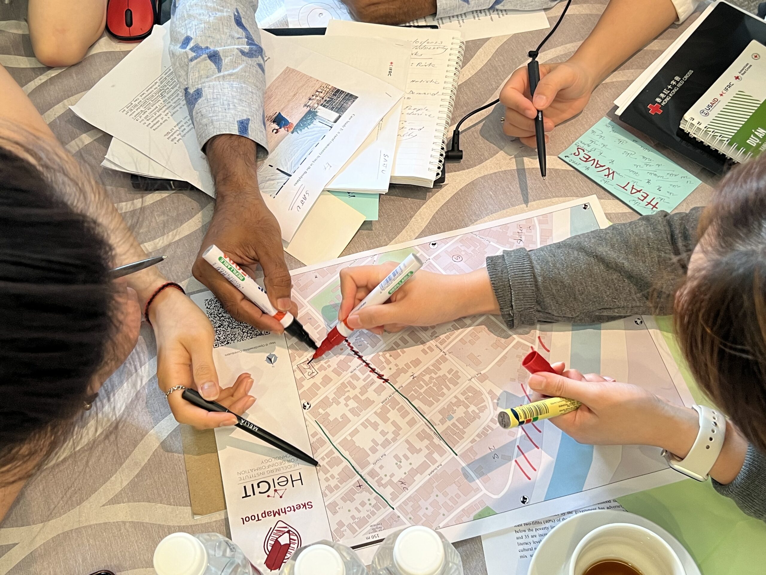
Training on digitalization of participatory mapping in Kuala Lumpur
Featured Image: Training participants simulating a participatory mapping on the ground with the SketchMapTool. Last week, HeiGIT team member Anne Schauß held a workshop session in Kuala Lumpur, Malaysia, during a training of the International Federation of Red Cross and Red Crescent Societies (IFRC). The international training focused on community resilience and how to assess…
-
HeiGIT und Deutsches Rotes Kreuz Mapathon zur Unterstützung des Mozambique Red Cross
For english version see below HeiGIT und das Deutsche Rote Kreuz unterstützen das Mozambique Red Cross in einem Projekt zur Sensibilisierung für das Hochwasserrisiko und zum Aufbau von Kapazitäten zur Verringerung des Katastrophenrisikos in Maputo. Zur Verbesserung der Datenlage ist nun, relativ kurzfristig, ein Mapathon für kommenden Montag 23.05. ab 18 Uhr geplant. Zu Beginn…
-
Where to map in OpenStreetMap next? Experiences from Mozambique, India, and Tonga
OpenStreetMap (OSM) has been intensively used to support humanitarian aid activities, especially in the Global South. Its data availability in the Global South has been greatly improved via recent humanitarian mapping campaigns and due to the efforts of local communities. However, large rural areas are still incompletely mapped. The timely provision of map data is…
-
Humanitarian OpenStreetMap Team has been selected by the Audacious Project
The Humanitarian OpenStreetMap Team (HOT) has announced major financial support from the Audacious Project, which will be provided over the next five years. HOT aims to use this funding to grow OpenStreetMap (OSM) communities in 94 countries. By engaging one million volunteers the goal is to map an area home to one billion people living…
-
Healthsites and HeiGIT establish partnership
The Global Healthsites Mapping Project (Healthsites) and the Heidelberg Institute for Geoinformation Technology/ GIScience Research Group are happy to announce the now also formal cooperation. Last week, HeiGIT/ GISciences signed the Healthsites Memorandum of Understanding (MoU) to strengthen their strategic partnership with the main aim to support the analyses, sharing and use of baseline OpenStreetMap…
-
Successfull PhD defence by Michael Auer on 3D WebGIS
Last month Dr. Michael Auer successfully defended his PhD on Advancing 3D WebGIS – browser-based Methods for Visualization and Analysis and their Integration in Virtual Research Environments in the Context of Cultural Heritage . We congratulate cordially! We are happy to have Michael with us as in the Big Spatial Data Analytics team of HeiGIT…
-
ISCRAM 2019 in Valencia- Towards closer exchange in crisis management between practitioners, stakeholders and researchers
The 16th ISCRAM conference took place in the city of Valencia (Spain). It succeeded again to gather an international audience of researchers that shared their work all around crisis management. As ISCRAM is mainly interested in the support and intersection of practical application in crisis management and research, the focus was however again on another…
-
HeiGIT/GIScience at Global Platform for Disaster Risk Reduction and Multi Hazard Early Warning Conference
Middle of May, Geneva becomes the gathering place for citizens, political leaders, government institutions, private sector, civil society, and scientific and technical institutions, that all jointly work towards a big objective – to manage disaster risk. In line with the Sendai Framework, the conference is focusing on and strengthening the shift from the management of…
-
Empower Humanitarian Mapping with Deep Neural Networks to Detect Human Settlements
Recently, earth observation by satellites has shown great capability in supporting a range of challenges such as disaster assessment, agriculture monitoring, and humanitarian mapping. MapSwipe, as a humanitarian mapping app, provides a crowdsourcing platform to collect volunteered geographical information (VGI), in order to generate the demanding base map of human settlements for better planning of…
-
HeiGIT and German Red Cross representation at DLR Humanitarian Technology Days 2019
Last week, Michael Schultz (GIScience Research Group) attended the Humanitarian Technology Days 2019 that was organized by the German Aerospace Center (Deutsches Zentrum für Luft- und Raumfahrt, DLR) as a representative of the GIScience Research Group/ HeiGIT and of our collaboration with German Red Cross. For two days, around 80 scientists, humanitarian actors and funding…
-
GIScience Group Successful at the AGILE
The GIScience group attended the AGILE 2018 conference to present about a diversity of topics. More participants than ever have attended the conference in Lund, Sweden (12–15 June 2018). They discussed scientific topics related to the general theme of the conference, Geospatial Technologies for All. The following short papers have been presented and been published…
-
HeiGIT/GIScience @ISCRAM 2018 Rochester- Exchange of latest crisis management practice and innovative ideas near a natural wonder of the world
Rochester NY, a small city located at Lake Ontario, became a gathering place for the international ISCRAM community last week. Researchers and practitioners from over 20 countries presented their latest work, ideas and needs related to crisis management at the 15th ISCRAM conference. Crisis and humanitarian management being one of the main focuses of the…