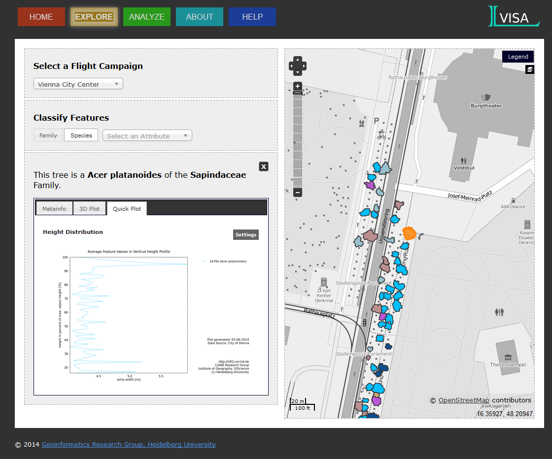
The LIDAR Research Group (LRG) present a new release of LVISA: plotting out of the map.
Besides the 3D presentation of a selected tree, plots with respect to feature statistic as well as the comparison to corresponding tree species, family and class are now also available.
Who has not heard of LVISA:
LVISA is a novel system for analyzing point clouds of vegetation. This system examplifies a web-based laser scanning database for the management and analysis of tree reference signatures. It combines techniques and methods of LiDAR and 3D GIScience.
Explore the new release and let us know what you think.