

Tag: QGIS
-
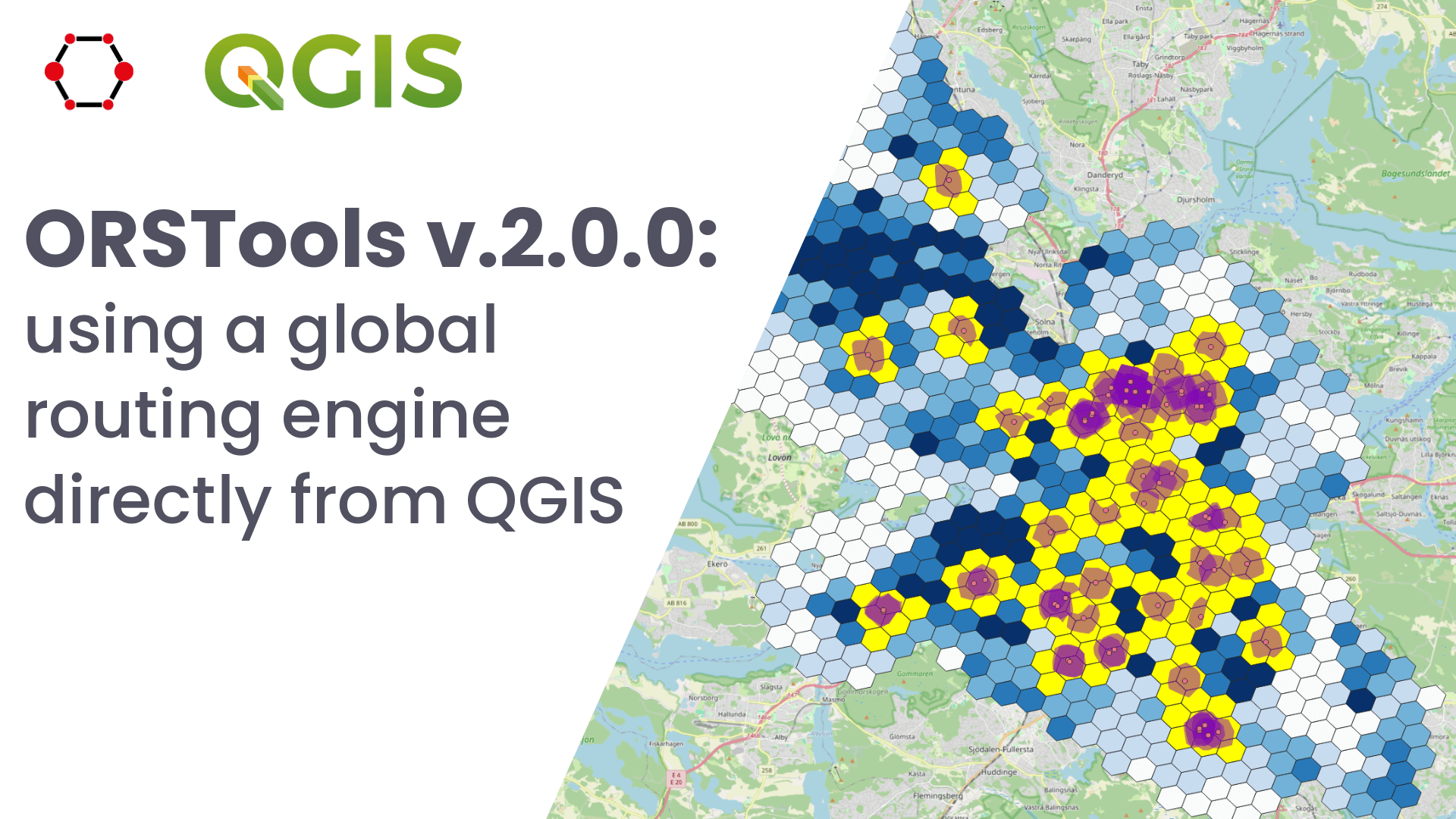
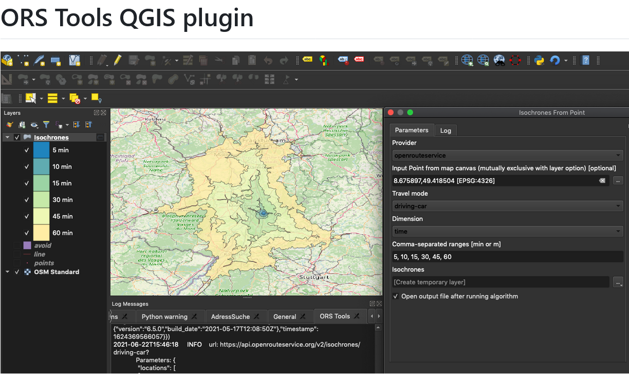
Release of QGIS plugin ORSTools v.2.0.0 & QGIS User Conference
What is ORSTools? With ORSTools, most of the functionalities of openrouteservice are directly accessible in QGIS. The plugin offers a toolset, including routing, isochrone generation and matrix calculations. These functions can be used interactively in the map canvas or applied to point files within the processing framework. Output files come with rich attribute data such…
-

First release of ohsome-planet: OSM history data in GeoParquet format
We’re excited to share the release of the ohsome-planet – a new software library on GitHub, marking a significant step toward the development of ohsome 2.0. This tool is designed to facilitate the transformation of raw OpenStreetMap (OSM) history data into the GeoParquet format, making it more accessible and efficient for spatial data analysis. What…
-
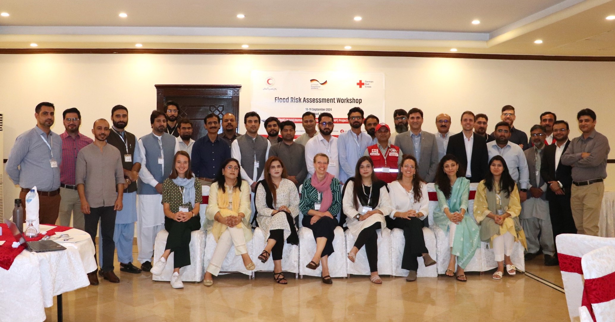
Acting Before the Disaster Happens: QGIS Training and Risk Assessment for Riverine Floods in Pakistan
In the field of humanitarian aid, Anticipatory Action (AA) is emerging as an important strategy to mitigate the impacts of natural disasters. At HeiGIT, we have been actively working with this approach to support local communities in building resilience. Unlike traditional reactive responses, AA aims to initiate predefined actions based on weather forecasts and risk…
-
Enhancements in the QGIS Plugin for openrouteservice
The openrouteservice (ORS) QGIS plugin continues to evolve, bringing a suite of new features, improvements, and fixes that enhance its functionality and user experience. This update incorporates significant changes that will benefit users working on diverse geospatial projects. In this post, we highlight the key updates in the latest version of the ORS QGIS plugin.…
-
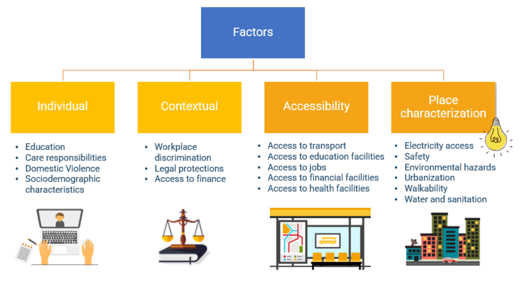
Empowering Change: OpenRouteService in Geospatial Initiatives for Women’s Economic Empowerment and Sustainable Development
The use of open-source geospatial data, exemplified by services like openrouteservice (ORS), proves to be beneficial for both academic research and use case studies. Witnessing our technologies applied in unanticipated ways showcases their potential to meet the evolving needs of various sectors while contributing positively to both society and the environment. One exemplary application is…
-
ORS Tools QGIS Plugin Release v1.7.0
Just in time for the new year, the openrouteservice team proudly announces the release of v1.7.0 of the ORS Tools QGIS plugin! Quite a lot has happened. First, the GUI was reworked: Next, there are a few other things that happened: Check out the changelog if you’re interested in all the in-depth details. Feedback and…
-
Visualizing OQT API Results in QGIS
Using the ohsome dashboard, it is possible to explore quality estimation for OpenStreetMap (OSM) data from the ohsome quality analyst (OQT) for arbitrary regions. Also, OQT does provide an API to programmatically fetch quality estimation for a lot of different regions in one request. Chances are that one wants to visualize the results on a…
-
GIScience and HeiGIT at SotM 2022
We are happy to announce that, this year, GIScience and HeiGIT has had four contributions to the FOSS-Community “conferencathon” in Florence. As QGIS-Meeting, State of the Map, HOT unSummit and FOSS4G all took place consecutively, the schedule was shaping up to be extremely packed. We’d like to highlight some specific events and topics that you…
-
Openrouteservice for complex route optimization in new QGIS extension by Regionalverband Ruhr
(Deutsche Version unten) The Regionalverband Ruhr (Team 9-2 Geodata Technology) has used the potential of HeiGIT’s openrouteservice (ORS) in a new QGIS extension and thereby created another possible application for the ORS: The tool “Location and Route Optimization of Addresses” allows to search and locate addresses and to find the optimal routes between them. This…
-
New version of ORS Tools QGIS Plugin
We’re happy to announce a new version of our QGIS Plugin ORS Tools. Additionally to the core services of giving easy access to our directions, isochrone and matrix API’s, the plugin now allows users to optimize their trips via a Traveling Salesman service. The openrouteservice API’s included a Vehicle Routing Optimization Machine since quite a…
-
New OpenRouteService QGIS Plugin
Finally there is a new version of the QGIS plugin for OpenRouteService: ORS Tools. It gives easy access to our directions, isochrone and matrix API’s from within QGIS. The old plugin OSM Tools plugin has been deprecated due to its name being too generic. However, the name is not the only thing that changed: Create…
-
Erreichbarkeitsanalyse von Haltestellen des öffentlichen Personennahverkehrs in Stuttgart per Openrouteservice
In einer aktuellen Publikation der Stadt Stuttgart wird die Erreichbarkeit von Haltestellen des öffentlichen Personennahverkehrs in Stuttgart untersucht. Für die Berechnung der Isochronen wurde das kostenfrei nutzbare QGIS-Plugin OSM Tools verwendet. Dieses nutzt den seit 2008 verfügbaren Openrouteservice des Heidelberg Institute for Geoinformation Technology (HeiGIT). Das Toolset umfasst Routing, Geocoding, Isochronen und Matrixberechnungen, entweder interaktiv im…