

Tag: Participatory mapping
-
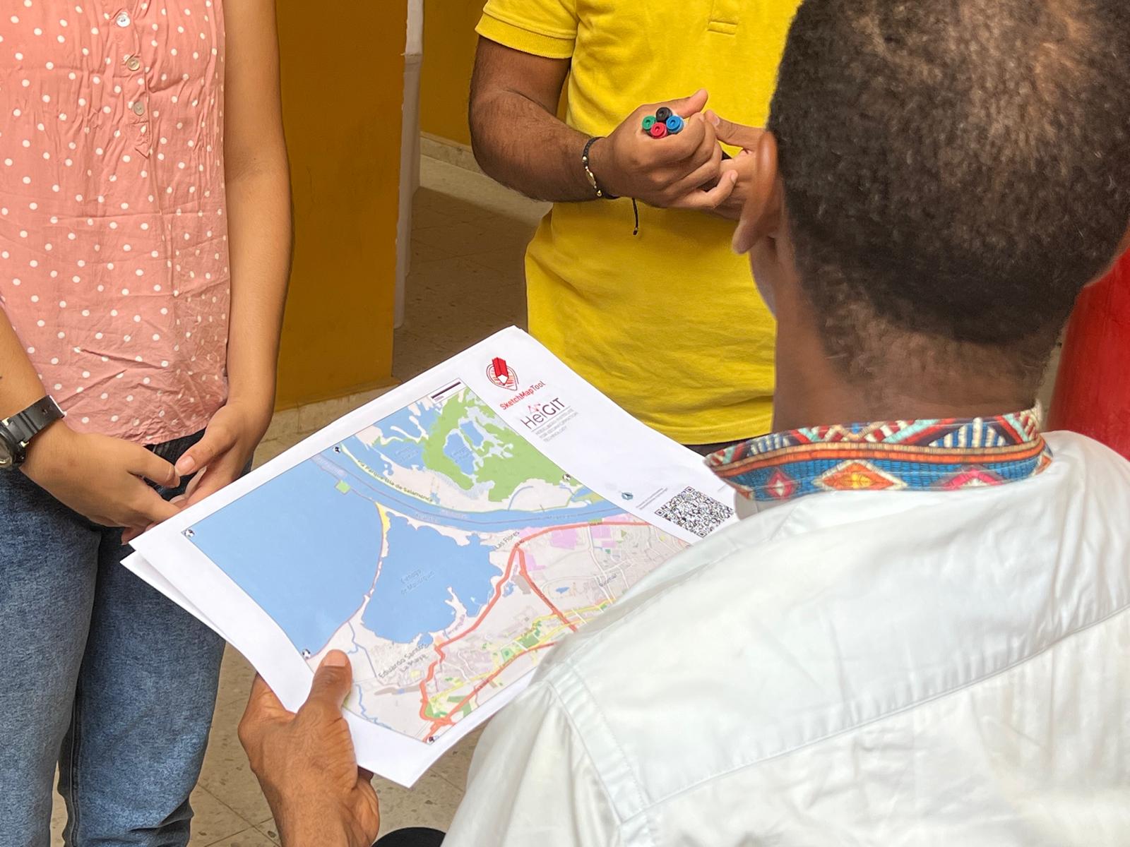
Including Local Communities in Colombia´s Risk Governance with Participatory Mapping
In June 2024, researchers from the Urban Big Data Centre (UBDC) and HeiGIT (Heidelberg Institute for Geoinformation Technology) carried out a joint field trip to Colombia to strengthen participatory mapping collaborations. The visit included workshops, partner meetings, and field activities with communities, universities, and government institutions, with a focus on the use and development of…
-
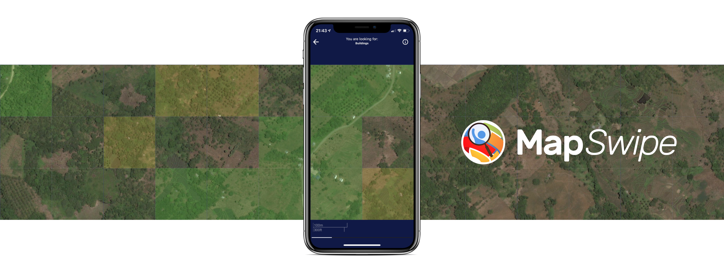
Crowdmapping on Street-Level Imagery with MapSwipe
The crowdmapping app MapSwipe now integrates also street-level imagery. This new feature enables even mapping efforts that require the highest level of detail, such as detecting waste on the street. The MapSwipe App MapSwipe is an open-source app that enables volunteers to map missing geodata, making global mapping efforts more coordinated and efficient. Free, reliable geodata…
-
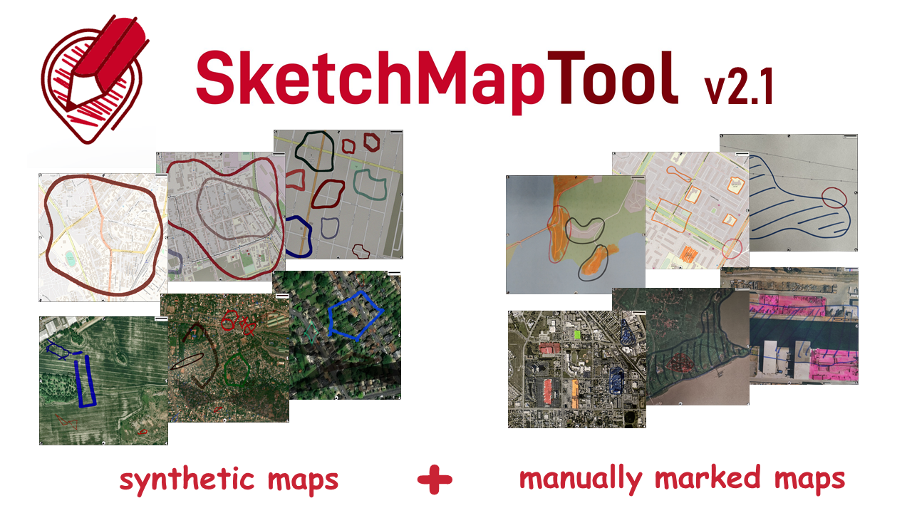
Digitizing Maps with SketchMapTool v2.1: Enhanced Sketch Detection and Global Impact
The newly released Sketch Map Tool v2.1 features a higher accuracy in digitizing hand-sketched markings on Sketch Maps, thanks to a larger training dataset and an updated machine learning model for sketch detection. New user metrics show that thousands of Sketch Maps are created every month all over the world. The Sketch Map Tool The…
-
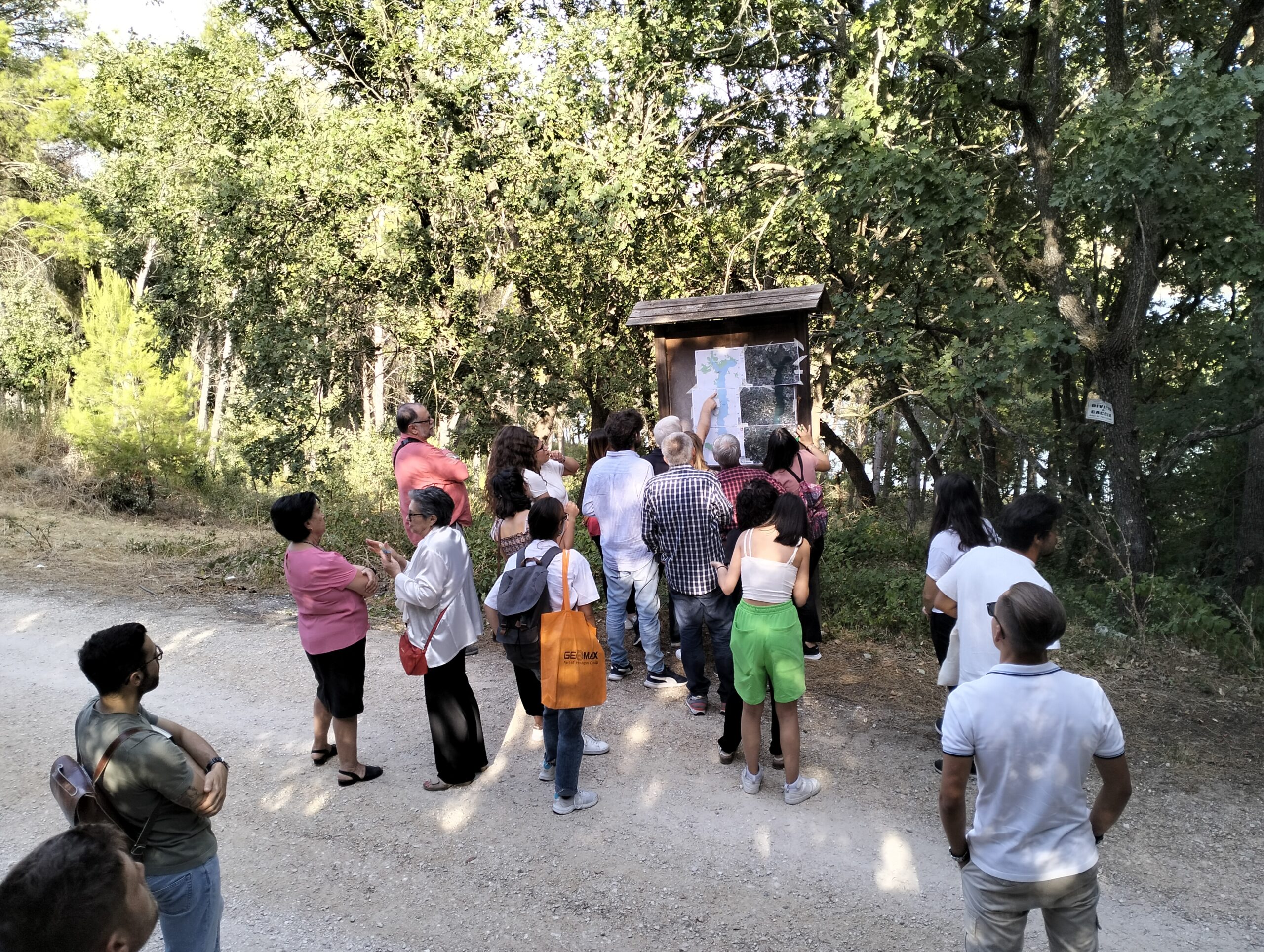
Participatory Mapping for Cultural Landmarks
Claudio Sossio De Simone is a PhD candidate at the University of Rome Tor Vergata in the field of Cultural Heritage, Education and Territory. His research interests include GIS science and geoinformation applied to cultural heritage, as well as the geo-historical study of rural landscapes. The Sketch Map Tool was used as part of his…
-
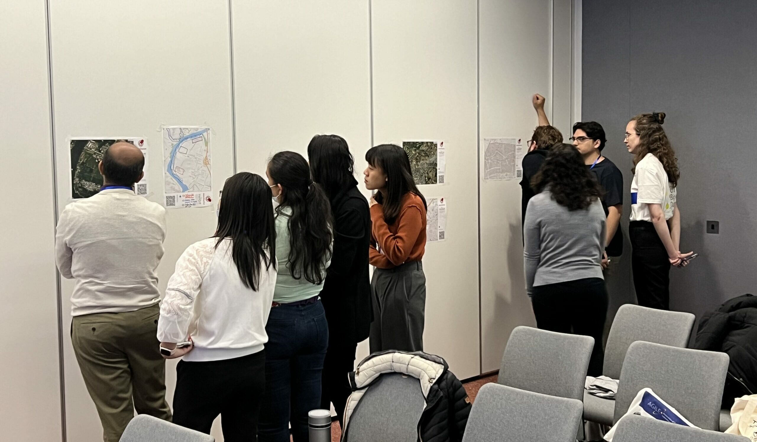
Mapping With Communities workshop at AGILE 2024
HeiGIT and Urban Big Data Centre (UBDC) hosted a successful international workshop entitled ‘Mapping with Communities’ at the AGILE 2024 conference in Glasgow, Scotland, UK. Responding to the conference theme of ‘Geographic Information Science for a Sustainable Future’ two teams facilitated activities with researchers from various European GI Science research centers. The Glasgow workshop followed the first event…
-

HeiGIT at the AGILE 2024 Conference: Mapping, Routing, Sustainability
“Geographic Information Science for a Sustainable Future” – The theme of this year’s conference held by the Association of Geographic Information Laboratories in Europe (AGILE) in Glasgow, UK, on 4-7 June 2024. Attendees of the AGILE 2024 conference will explore the crucial role of geographic information science (GIS) in the relationships between the environment, society,…
-
SketchMapTool Enters Next Phase with Funding from German Red Cross and German Federal Foreign Office
The Sketch MapTool (SMT) is entering its next project phase thanks to support from the German Red Cross (GRC) and the German Federal Foreign Office. In this phase, our main goals are enhancing the tool’s stability and marking detection, as well as expanding the current features, adding new languages and satellite imagery as base maps.…
-
The role of data in transformations to sustainability: a critical research agenda
A recently published article in ‘Current Opinion in Environmental Sustainability‘ investigates the role of digital technologies and data innovations, such as big data and citizen-generated data, to enable transformations to sustainability. We reviewed recent literature in this area and identified that the most prevailing assumption of work is related to the capacity of data to…
-
OSM data quality analysis for different stages of the mapping process
Slums are an important operational area for humanitarian organisations: Because of provisional housing, poor sanitation and difficult socio-political circumstances offers of help from such organisations are important and often necessary. For such deployments, humanitarian actors rely heavily on Volunteered Geographic Information (VGI), as official maps and data are often incomplete. This makes it all the…
-
New paper published about the OSM Sketch Map Tool
The Sketch Map Tool supports participatory mapping approaches and risk communication. An new paper presents the different functionalities of the tool. OSM data quality can be evaluated regarding the fitness for the sketch-map-approach. Based on the great idea of Field Papers, paper maps can be printed out for the use in the field, and afterwards,…
-
GIScience at GeOnG 2020
These days so much is different- also conferences. Carolin Klonner and Marcel Reinmuth attended the GeOnG 2020 virtually. Thanks to the organizers! It worked well and there was great exchange between the participants. The workshop on experiences in defining health catchment areas brought together diverse stakeholders and approaches. Marcel Reinmuth contributed from the scientific open…
-
Starkregen in Heidelberg: Zusammenarbeit mit Bürgern der Stadt
Starkregen stellt eine besondere Gefährdung in Heidelberg dar. Studierende haben bereits im Rahmen eines Seminars der GIScience und in Zusammenarbeit mit dem Amt für Umweltschutz, Gewerbeaufsicht und Energie der Stadt Heidelberg Informationen zu Starkregen in Handschuhsheim mit partizipativen Methoden gesammelt und analysiert (Blogbeitrag). Nun bietet die Stadt Heidelberg über die Infoseite www.heidelberg.de/starkregen ein Portal zur…