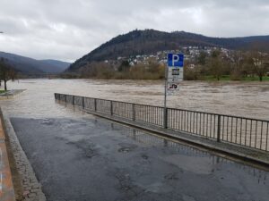
Worldwide, more and more people are affected by flooding. Local knowledge provides a valuable source of information for disaster risk reduction. We present an approach for visualizing and formalizing this local knowledge.
More information can be found in the paper:
Related work:
https://www.geog.uni-heidelberg.de/gis/neohaz.html
https://www.geog.uni-heidelberg.de/gis/waterproofing.html
Klonner, C., Hartmann, M., Djami, L., Zipf, A. (2019). “Ohsome” OpenStreetMap Data Evaluation: Fitness of Field Papers for Participatory Mapping. In: Proceedings of the Academic Track at the State of the Map 2019. Heidelberg, Germany, pp. 35-36.


