

Tag: OpenStreetMap
-
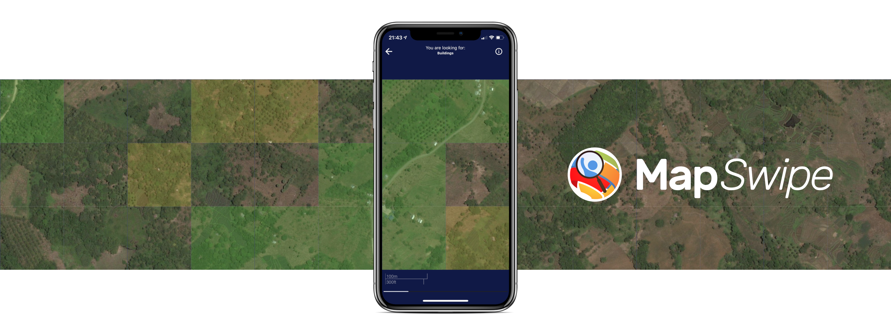
Crowdmapping on Street-Level Imagery with MapSwipe
The crowdmapping app MapSwipe now integrates also street-level imagery. This new feature enables even mapping efforts that require the highest level of detail, such as detecting waste on the street. The MapSwipe App MapSwipe is an open-source app that enables volunteers to map missing geodata, making global mapping efforts more coordinated and efficient. Free, reliable geodata…
-
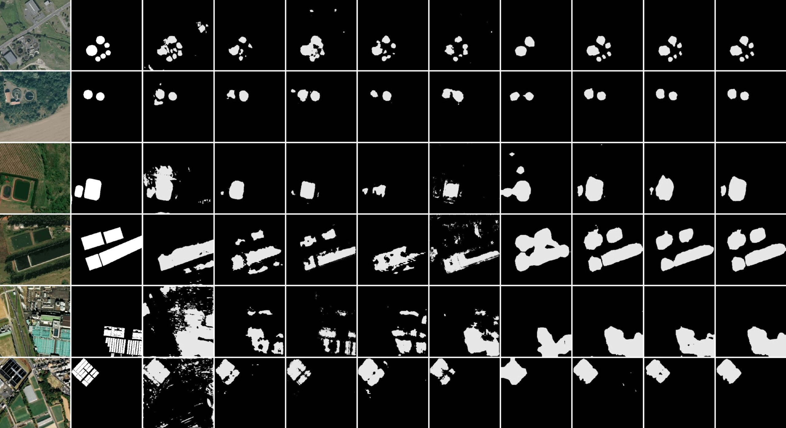
New paper “STVAE: Skip connection driven two-stream property Fusion Variational AutoEncoder for cross-region wastewater treatment plant semantic segmentation”
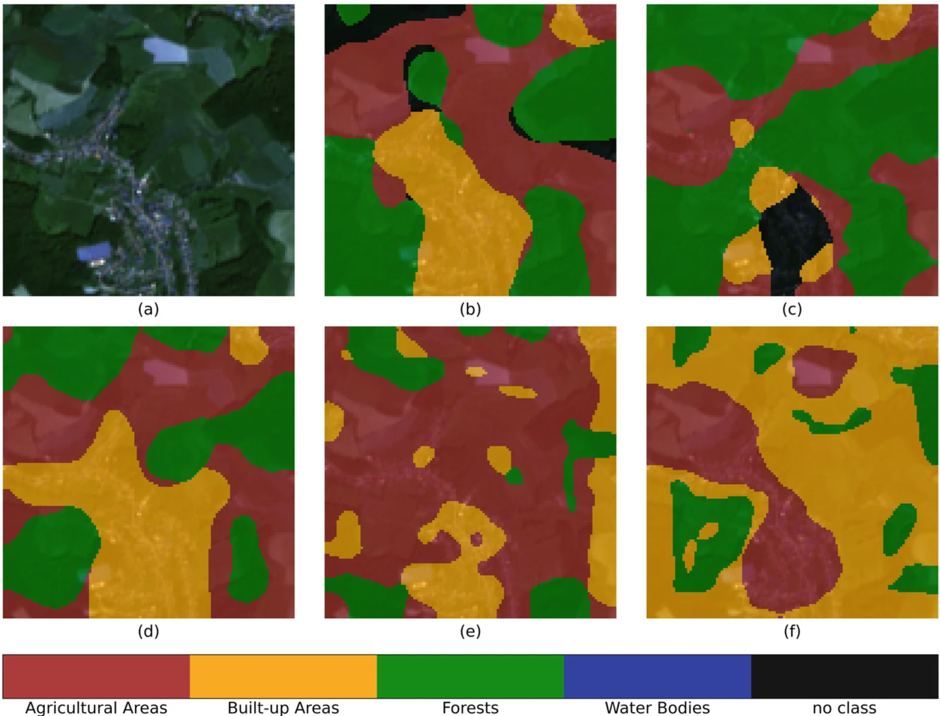
Wastewater treatment plants (WWTPs) play a crucial role in maintaining ecological balance and public health and are essential for advancing social sustainable development goals. However, the diverse architectural styles, scales, and environmental contexts of WWTPs—shaped by climate, topography, and regional economic conditions—pose significant challenges for generalizing segmentation algorithms. To address this, integrating knowledge from different…
-
OSM Completeness with Overture maps data
Free and open-source map data has become a keystone for research across diverse fields. The extensive coverage of OpenStreetMap (OSM) data allows scientists to conduct independent studies without relying on corporate collaborations or investing heavily in proprietary datasets. However, OSM data coverage completeness varies significantly by location. Moreover, the latest data updates cannot always be…
-
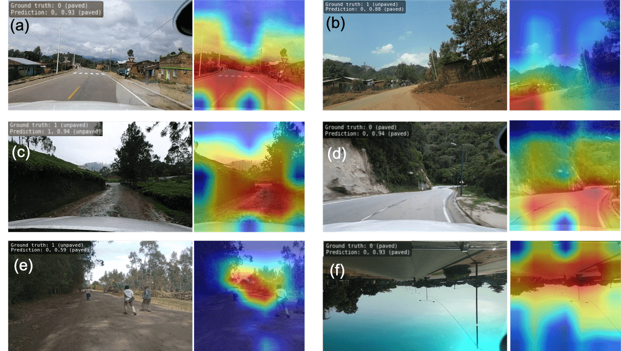
Accurate road surface data for transportation, safety, and economic development
Researchers at HeiGIT (Heidelberg Institute for Geoinformation Technology) have publicly released a first of its kind planet-scale dataset on road surface type (paved or unpaved) using state-of-the-art GeoAI methods based on street-view imagery from Mapillary, in order to support humanitarian response, urban planning and progress towards the Sustainable Development Goals. Road surface information plays an essential…
-
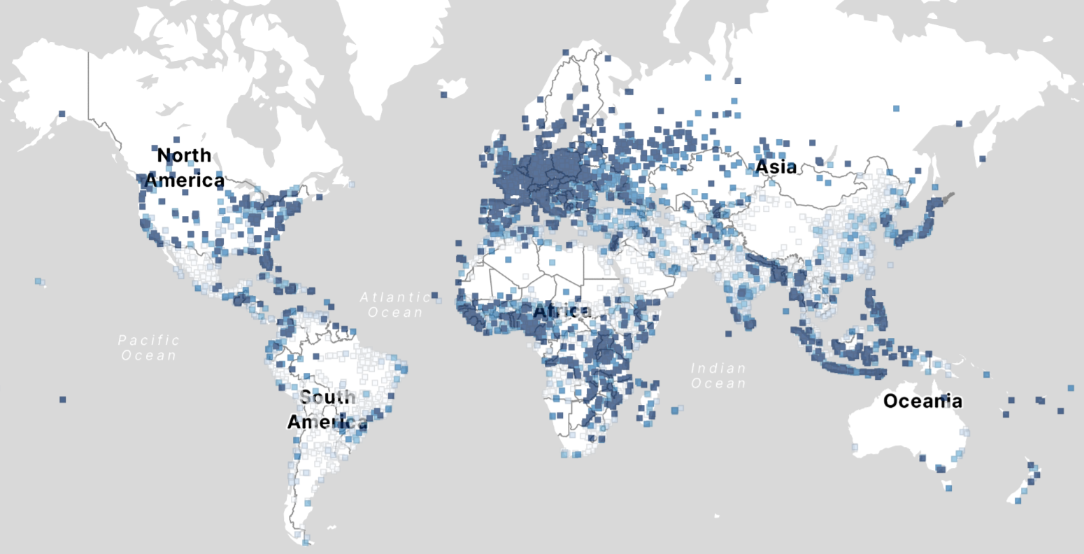
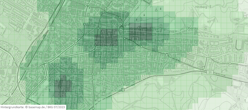
Analysis of OSM building data completeness using new data
With thousands of people mapping in OSM every day, missing building data in urban centers is steadily decreasing. Since OSM is a widely used source for projects researching urban phenomena around the world, a good data quality and an even distribution are important factors. If a spatial bias is present but not accounted for, researchers…
-
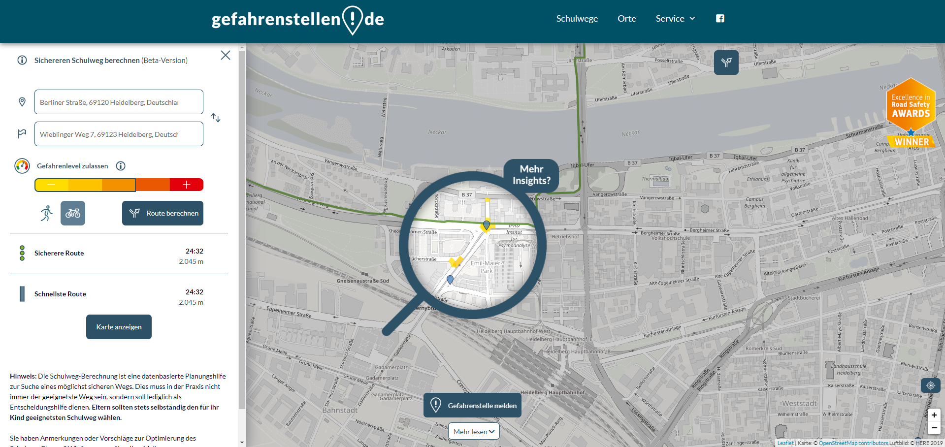
Enhancing school safety with openrouteservice: the digital school route planner
The OpenStreetMap (OSM) and openrouteservice (ORS) provide free geospatial data that serve a multitude of research and practical applications. OSM thrives on its community-driven approach, ensuring its data is always up-to-date and versatile. ORS takes this a step further by providing sophisticated routing services for various modes of transport, including walking, cycling, driving, and wheelchair…
-
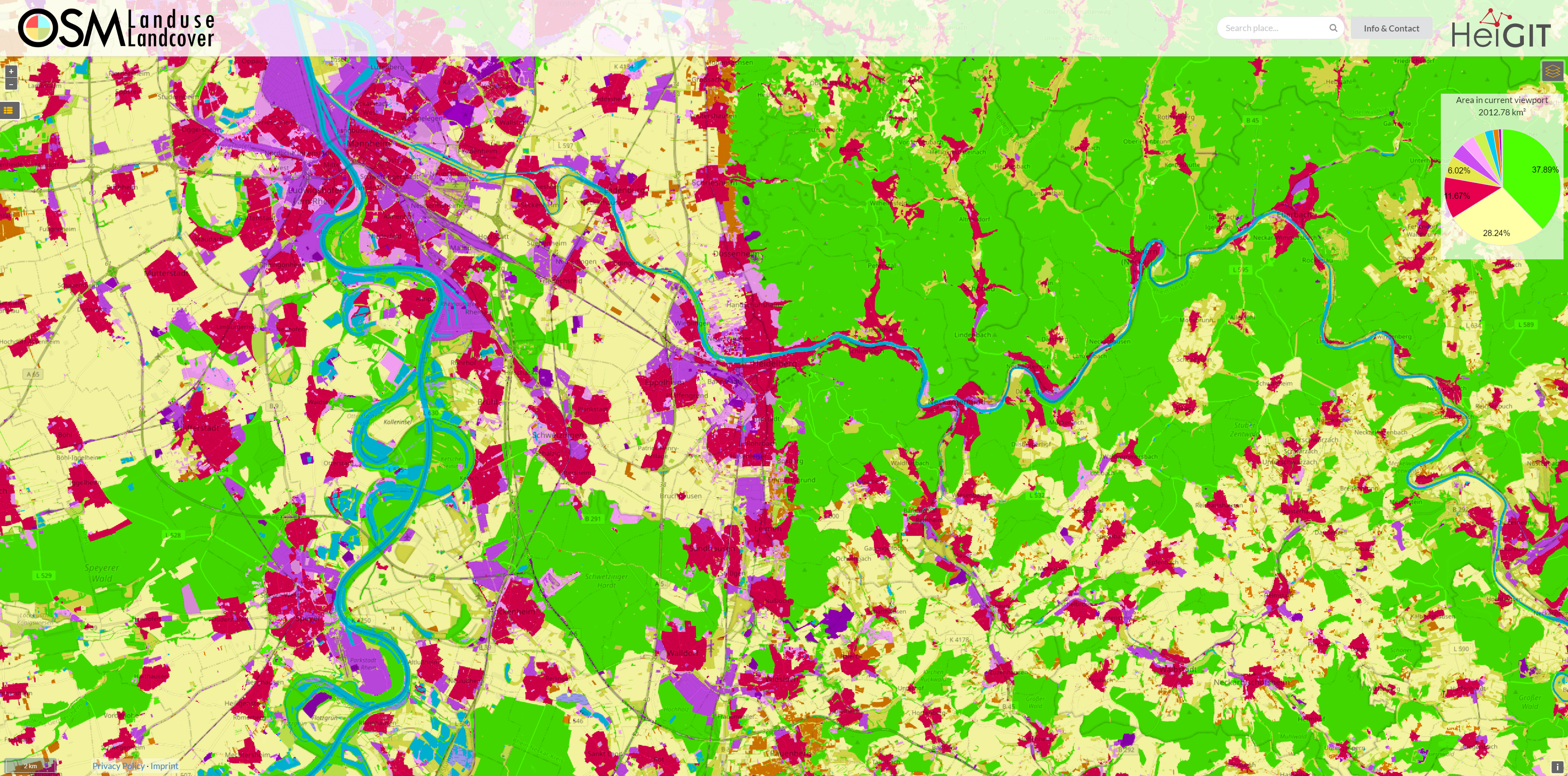
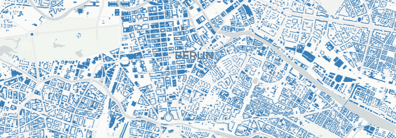
OSM Landuse Data is available in HeiData
We are excited to announce that the data displayed on OSM – Landuse is now freely accessible. These data sets offer valuable insights and can be utilized for various applications. Urban planners will find the data useful for development projects and zoning regulations, while environmental researchers can study land use changes and their impact on…
-
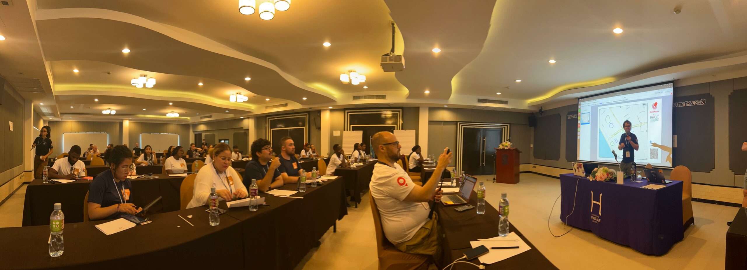
Reflections on the 2024 YouthMappers Leadership Fellows Workshop
The YouthMappers network recently held its 2024 Leadership Fellows Workshop, an inspiring event that brought together a top cohort of university students from around the globe. This year’s workshop, held in Bangkok, Thailand, was a dynamic seven-day program dedicated to exploring three critical Sustainable Development Goals (SDGs): Zero Hunger (SDG 2), Sustainable Cities and Communities…
-
The EU-Project “Gitterzellendatenbank”: Determining Reachability Made Easy With Openrouteservice (ORS)
Free open geodata are of increasing importance. They are used in research or case studies and can lead to important insights on social, economic or environmental topics. A problem that often occurs while working with various kinds of geodata is that they cannot be used together because of differing spatial reference units. The Federal Agency…
-

HeiGIT at the AGILE 2024 Conference: Mapping, Routing, Sustainability
“Geographic Information Science for a Sustainable Future” – The theme of this year’s conference held by the Association of Geographic Information Laboratories in Europe (AGILE) in Glasgow, UK, on 4-7 June 2024. Attendees of the AGILE 2024 conference will explore the crucial role of geographic information science (GIS) in the relationships between the environment, society,…
-
GeoNight Mapathon on April 12th
Our next Mapathon is just around the corner, and this time, we’re joining forces with OpenStreetMap Ghana to improve coverage and to help disaster risk assessment.Join us and be a part of the GeoNight 2024 to celebrate geography together in all its forms and facets! Everyone is welcome and no previous knowledge is needed!Do bring your laptop and preferably…
-
IDEAL-VGI: Analyzing and Improving the Quality and Fitness for Purpose of OpenStreetMap as Labels in Remote Sensing Applications
We are happy to announce that the IDEAL-VGI project by GIScience has been successfully completed. IDEAL-VGI was a tandem project in cooperation with Begüm Demir from the TU Berlin and was conducted under the umbrella of the VGIscience Second Phase Projects which ran from 2020 to 2022. VGIscience received funding as a Priority Programme by…