Tag: Ohsome Dashboard
-

New Features for the ohsome Quality API and Dashboard
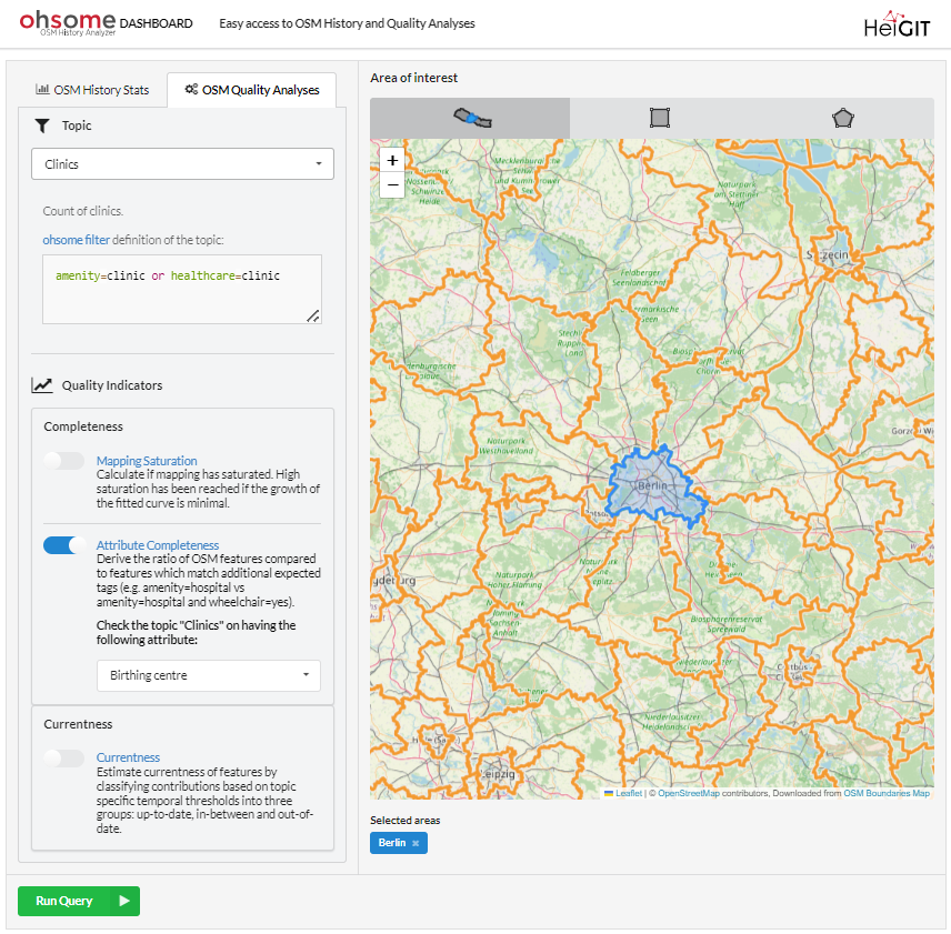
*Title image: Fig. 1: New UI of the ohsome dashboard In the last few weeks, a lot of work has been put into expanding the functionalities of the ohsome Quality API. Most notably, the ohsome dashboard now has a new Quality indicator ready for use: the Attribute Completeness indicator. The ohsome quality API and the…
-
Version 1.0 of the ohsome quality API and ohsome dashboard
At HeiGIT and in particular within the ohsome team, we strive to provide valuable insights into OpenStreetMap (OSM) data. The ohsome API offers aggregated statistics on the evolution of OSM elements since 2020. These are made easily accessible by the ohsome dashboard. With the ohsome quality API, previously called ohsome quality analyst (OQT), we continue…
-
Taginfo goes ohsome
Did you know that the OpenStreetMap (OSM) taginfo site now lets you access the ohsome dashboard? This allows you to gain refined insights into the usage stats of specific keys and tags. Taginfo is the main source for statistics about keys, tags and current tag usage. In most cases, you have to acces a localized…
-
Integration of OQT into the ohsome dashboard: Computing data quality metrics for OpenStreetMap
The ohsome dashboard has been and continues to be an easy access point to generate accurate statistics about the historical development of OpenStreetMap data for arbitrary regions. Now, the ohsome dashboard got extended to be able to compute data quality metrics for OpenStreetMap through the ohsome quality analyst (OQT) which is also developed by HeiGIT. The source code is now…
-

How to become ohsome part 15- Analysing Changes in OSM after the Earthquake in Syria and Türkiye in February 2023
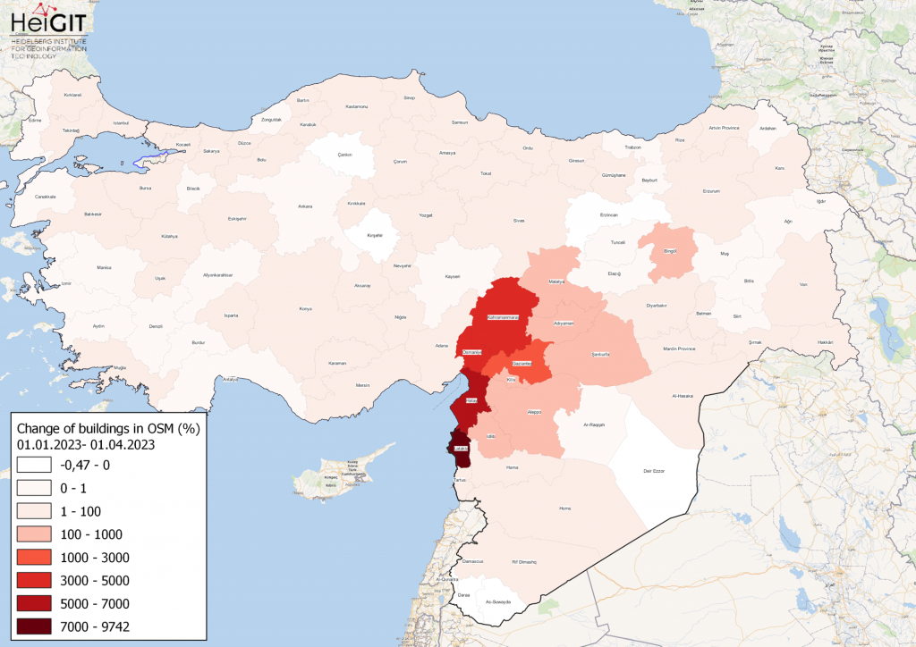
Featured Map: Percent change in each province of Türkiye and Syria of buildings in OSM. Data from OpenStreetMap, visualized using QGIS and the ohsome API plugin. Welcome back to the how to become ohsome series! If you’re new to the series, you can check out the previous issues (like this one) or the ohsome Region of…
-
Neu: Globale OSM History Analysen mit ohsomeHeX v1.0
Erhalten Sie mit ohsomeHeX wertvolle Einblicke in die Qualität und den Entwicklungsprozess von OpenStreetMap-Daten! (see for english version here) Das HeiGIT Big Data Team freut sich zur Exploration der Veränderungen der globalen Daten in OpenStreetMap nun eine Version 1.0 von ohsomeHeX , dem OSM History eXplorer zu veröffentlichen, die eine komplett überarbeitete Benutzeroberfläche bietet. Diese macht es einfacher…
-
Explore the ohsome OSM History of whole Germany
Our new ohsome dashboard is another preview on what is and will be possible with our ohsome OpenStreetMap history analytics platform. Behind the scenes, we added support for the Apache Ignite big data framework and deployed an instance using the full OSM history data of whole Germany on Heidelberg University’s cloud computing infrastructure heiCLOUD. Apache Ignite is an open-source…
-
Meet us at State of the Map 2018 Milan: Ohsome talks and workshop ahead!
In a few days – THIS Saturday July, 29. – the State of the Map 2018 Conference in Milan will opening its doors with many interesting talks and workshops related to OpenStreetMap. HeiGIT and the GIScience Research Group at Heidelberg University will be there with several persons and give the following presentations and even a…
-
HeiGIT/GIScience @ISCRAM 2018 Rochester- Exchange of latest crisis management practice and innovative ideas near a natural wonder of the world
Rochester NY, a small city located at Lake Ontario, became a gathering place for the international ISCRAM community last week. Researchers and practitioners from over 20 countries presented their latest work, ideas and needs related to crisis management at the 15th ISCRAM conference. Crisis and humanitarian management being one of the main focuses of the…
-
Ohsome Nepal Dashboard supports admin boundary selection
The Ohsome Nepal Dashboard has new features to enhance its usability and functionality. The user can now easily select administrative areas of interest through a new map interface. Different administrative levels can be selected by zooming in and out and afterwards just clicking or tapping on that specific region. This convenience feature makes it much faster…


