Author: Dominik Neumann
-

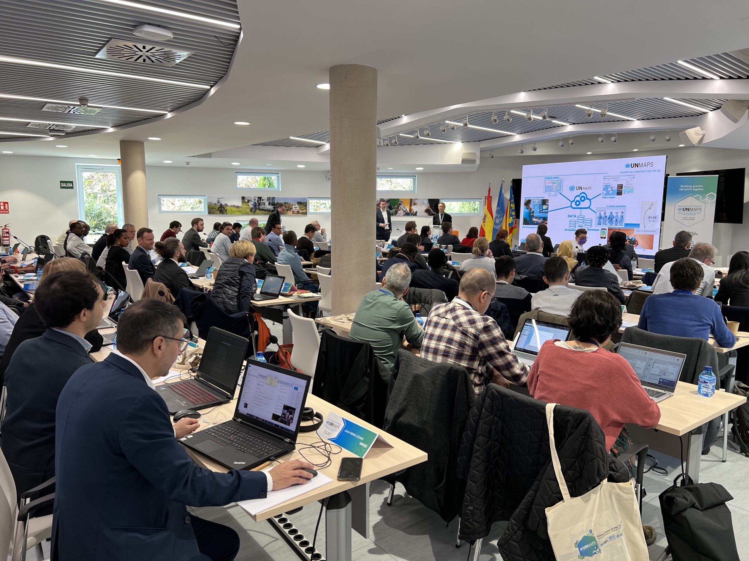
HeiGIT’s contributions to the 2nd UN Maps Conference
The United Nations Maps program, created in 2019, held its 2nd UN Maps Conference, this time in Valencia, Spain. Prof. Alexander Zipf of HeiGIT and the GIScience Research Group at Heidelberg University and Benjamin Herfort of HeiGIT attended the conference to talk about “Open Ecosystems in Practice”, “Partnerships and Cooperation with Academia” and how to “build better…
-

HeiGIT to hold hands-on workshop about OSM data quality at FOSSGIS Berlin 15.-18.03.2023
HeiGIT will present its software “ohsome quality analyst” (OQT) at the FOSSGIS Conference in Berlin this week. In the demo session, Benjamin Herfort will show the numerous possibilities of the tool and how everyone can use OQT to evaluate completeness, level of detail, currentness and more in just a few steps. Join him on Thursday…
-
Cooperation between HeiGIT, the German Red Cross and the German Aerospace Center
Welche Gebäude sind nach einem Erdbeben am schwersten beschädigt? Welche Gegenden haben keinen Zugang zu Gesundheitseinrichtungen? Wie verändert sich die Routenplanung und somit die Notfallversorgung, wenn bestimmte Straßen und Brücken nicht nutzbar sind? Das Heidelberg Institute for Geoinformation Technology gGmbH (HeiGIT) arbeitet seit einigen Jahren mit dem Deutschen Roten Kreuz (DRK) und mit dem Deutschen Zentrum für…
-
Disaster openrouteservice to support the current response efforts to the Türkiye/Syria earthquake
On February 6, a 7.7 magnitude earthquake struck southern Türkiye at 4:17 a.m. This is Türkiye’s most powerful earthquake recorded since 1939. The Government of Türkiye has since issued a Level 4 alarm, calling for international assistance. The quake also heavily impacted north-west Syria, a region where 4.1 million people depend on humanitarian assistance already…
-
Job Offer: Deep Learning Engineer (m/f/d, up to 100%)
Are you a highly motivated individual who loves designing and developing machine learning and deep learning systems? Do you want to use your machine learning expertise for the benefit of society and the environment? Do you want to improve the availability and quality of geospatial data and further develop geoinformatics methods used for open, non-profit…
-
GIScience Postdoc/Senior Researcher Opportunity for OpenStreetMap Road Quality Analysis
If you’re on the job market or know someone who is, check out this exciting new opening from our partners at GIScience. The offer is included as text below. You are interested in enhancing methods for analyzing & improving OpenStreetMap data? You are an experienced Spatial Data Scientist innovating geoinformatics methods & workflows? You have…
-
Assessing road criticality and loss of healthcare accessibility during floods: the case of Cyclone Idai, Mozambique 2019
Featured Image: Road network analysis for the driving profiles. A Normal conditions before the flood event. B Evolution of scores after the floods induced by Cyclone Idai. The lower row shows a close-up of the area surrounding the city of Dondo The ability of disaster response, preparedness, and mitigation efforts to assess the loss of physical access to health…
-
OSHDB Version 1.0 Has Arrived
Featured Photo: Ohsome dashboard interface for Heidelberg, Germany. In the words of Confucius, “The man who moves a mountain begins by carrying away small stones.” As we release OSHDB (OpenStreetMap History Database) Version 1.0, we look back at versions 0.5, 0.6, 0.7, and all the other small improvements to our historical OpenStreetMap database as the…
-
Job Opening for Postdoc / Senior Researcher on OpenStreetMap Road Quality Analysis
If you’re on the job market or know someone who is, check out this exciting new opening at GIScience. The offer is included as text below! You are interested in enhancing methods for analyzing & improving OpenStreetMap data? You are an experienced Spatial Data Scientist innovating geoinformatics methods & workflows? You have profound hands-on experience…
-
Geography Awareness Week 14.-19.11.2022
Der Klimawandel, Grenz- und Wasserkonflikte stellen enorme Herausforderungen für die aktuelle und kommenden Generationen dar. In all diesen Bereichen und darüber hinaus bietet die Geographie einmalige Chancen, zielgerichtet Lösungen zu erarbeiten. Das Geographische Institut der Universität Heidelberg möchte gemeinsam mit der Fachschaft Geographie, dem HeiGIT(Heidelberg Institute for Geoinformation Technology), GeoDACH e.V. und anderen internationalen Partnerorganisationen Aufmerksamkeit auf das Fach Geographie und…
-
Aktivierung des Disaster openrouteservice für Überschwemmungen in Pakistan
In den vergangenen Wochen hat die Monsunflut in Pakistan über 1.000 Tote gefordert und Millionen Menschen ohne Dach über dem Kopf hinterlassen. Da Berichte und Fotos von rapide steigenden Lebensmittelpreisen, Bewohnern, die durch schultertiefes Wasser waten und Satellitenbilder von überfluteten Flüssen das Ausmaß dieser Katastrophe unterstreichen, hat das HeiGIT den Disaster openrouteservice für diese Region…
-
Disaster openrouteservice response to Pakistan flooding
Over the past weeks, monsoon flooding in Pakistan has left over 1,000 dead and millions without homes. As reports and photos of skyrocketing food prices, residents wading through shoulder-deep water, and satellite images of flooded rivers highlight the magnitude of this catastrophe, HeiGIT has created an activation of the Disaster openrouteservice for that region. Currently, data is…


