

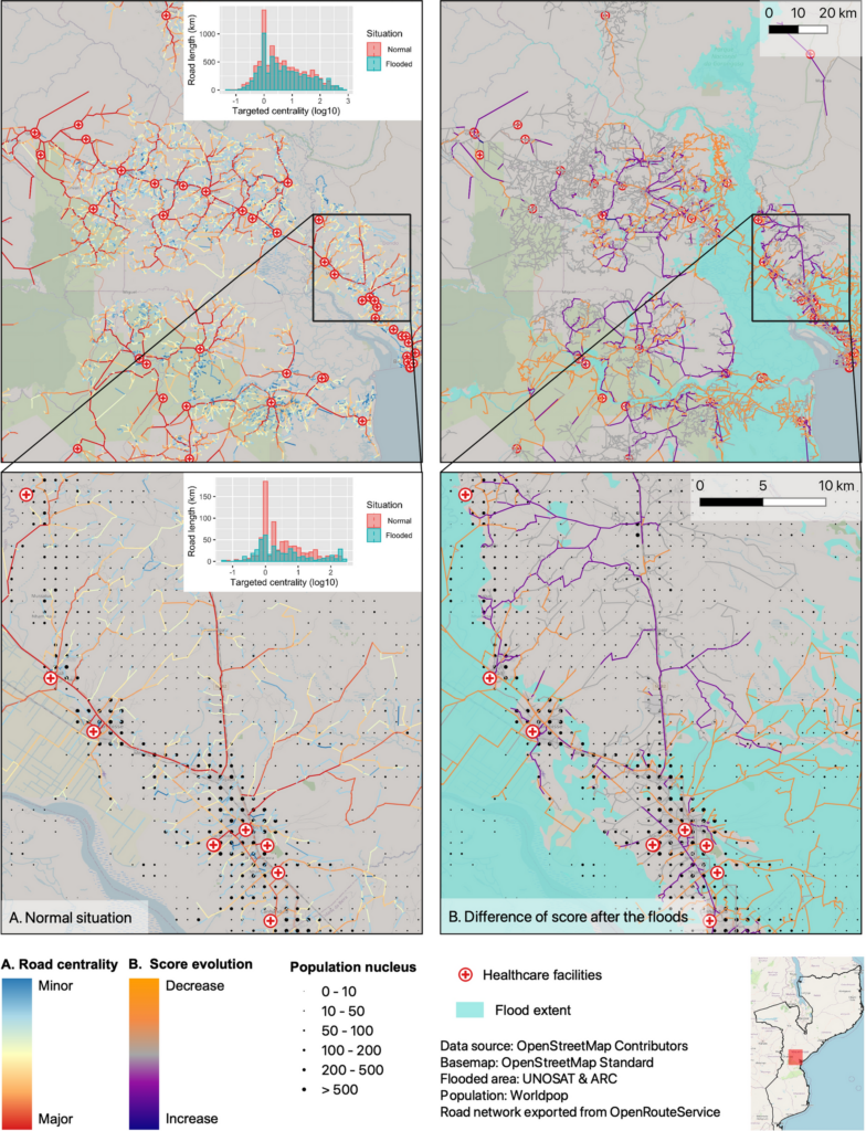
Featured Image: Road network analysis for the driving profiles. A Normal conditions before the flood event. B Evolution of scores after the floods induced by Cyclone Idai. The lower row shows a close-up of the area surrounding the city of Dondo
The ability of disaster response, preparedness, and mitigation efforts to assess the loss of physical access to health facilities and to identify impacted populations is key to reducing the humanitarian consequences of disasters. Recent studies use either network- or raster-based approaches to measure accessibility in respect to travel time. Our analysis compares a raster- and a network- based approach that both build on open data with respect to their ability to assess the loss of accessibility due to a severe flood event. As our analysis uses open access data, the approach should be transferable to other flood-prone sites to support decision-makers in the preparation of disaster mitigation and preparedness plans. This research was led by our intern Sami Petricola, with support and supervision from HeiGIT and the GIScience research group. The results are now openly available in the International Journal of Health Geographics.
Petricola, S., Reinmuth, M., Lautenbach, S. et al. Assessing road criticality and loss of healthcare accessibility during floods: the case of Cyclone Idai, Mozambique 2019. Int J Health Geogr 21, 14 (2022). https://doi.org/10.1186/s12942-022-00315-2
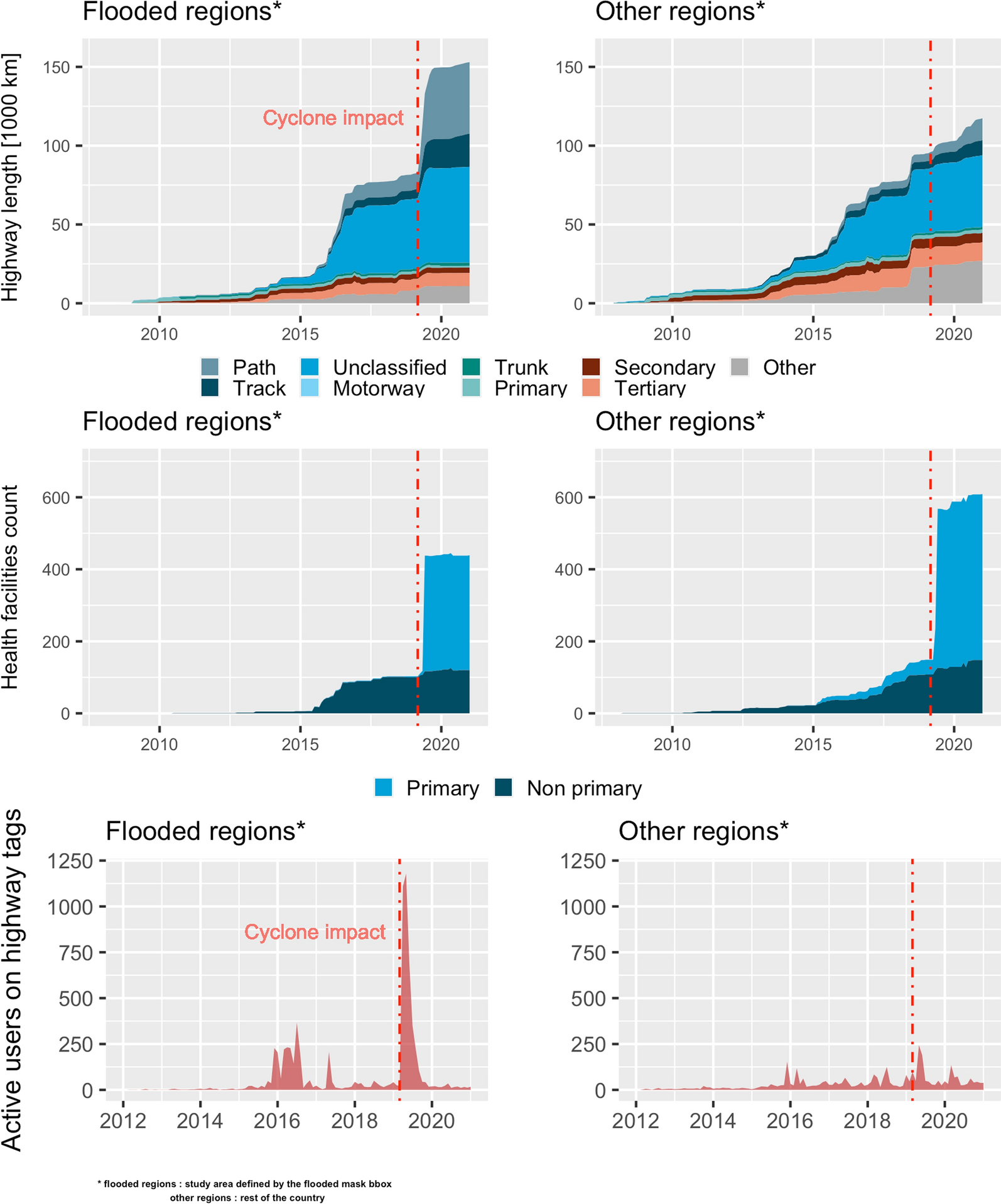
Image: History analysis of OSM contribution: number of objects and active users over time. Flooded regions represent the study area, other regions represent the rest of the country. The dashed line marks the impact date of the cyclone in March 2019
The different results obtained between the raster- and network-based methods indicate the importance of data quality assessments in addition to accessibility assessments as well as the significance of fostering mapping campaigns in large parts of the Global South. Data quality is therefore a key parameter when deciding which method is best suited to local conditions. Another noteworthy aspect is the required spatial resolution of the results. Identification of critical segments of the road network provides essential information to prepare for potential disasters.
Previous related work:
- Geldsetzer, P.; Reinmuth, M.; Ouma, P. O., Lautenbach, S.; Okiro E. A.; Bärnighausen, T.; Zipf, A. (2020) Mapping physical access to health care for older adults in sub-Saharan Africa and implications for the COVID-19 response: a cross-sectional analysis. The Lancet Healthy Longevity. 1(1):E32-E42.
- Klipper, I. G., Zipf, A., and Lautenbach, S. (2021) Flood Impact Assessment on Road Network and Healthcare Access at the example of Jakarta, Indonesia, AGILE GIScience Ser., 2(4), https://doi.org/10.5194/agile-giss-2-4-2021.
- Accessibility of covid-19 vaccination centers in Germany
- Open Healthcare Access Map globally available and on HDX