

Search results for: “public health”
-
Public lecture on “Habitat-Scale Environmental Suitability Mapping for Aedes aegypti”
On December 18, 2024, GIScience PhD candidate Steffen Knoblauch will present his research on “Habitat-Scale Environmental Suitability Mapping for Aedes aegypti.” The public lecture will take place at 9:00 AM in the Conference Room, 5th Floor, Mathematikon, Im Neuenheimer Feld 205, 69120 Heidelberg, and will be followed by a non-public PhD defense examination. Geoinformatics Research…
-
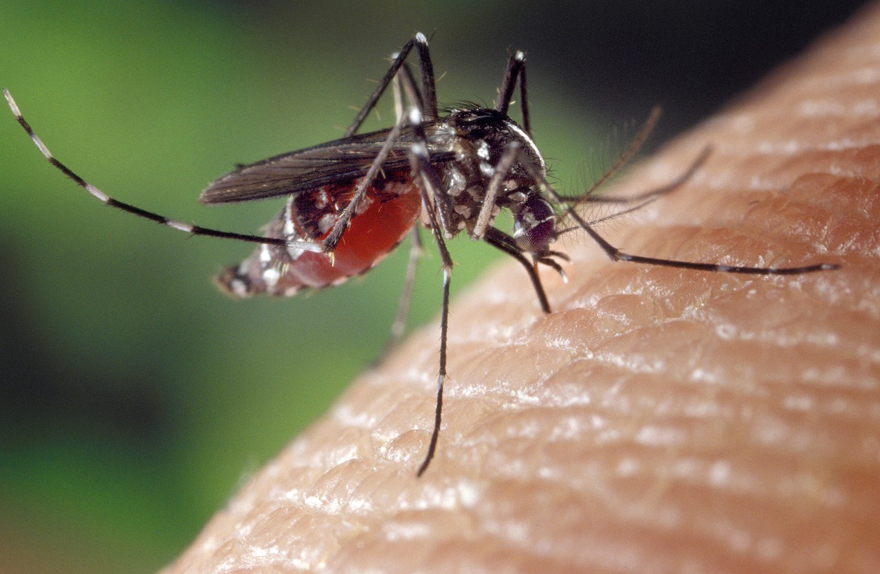
Use Case: ORS for Modeling Health and Well-Being
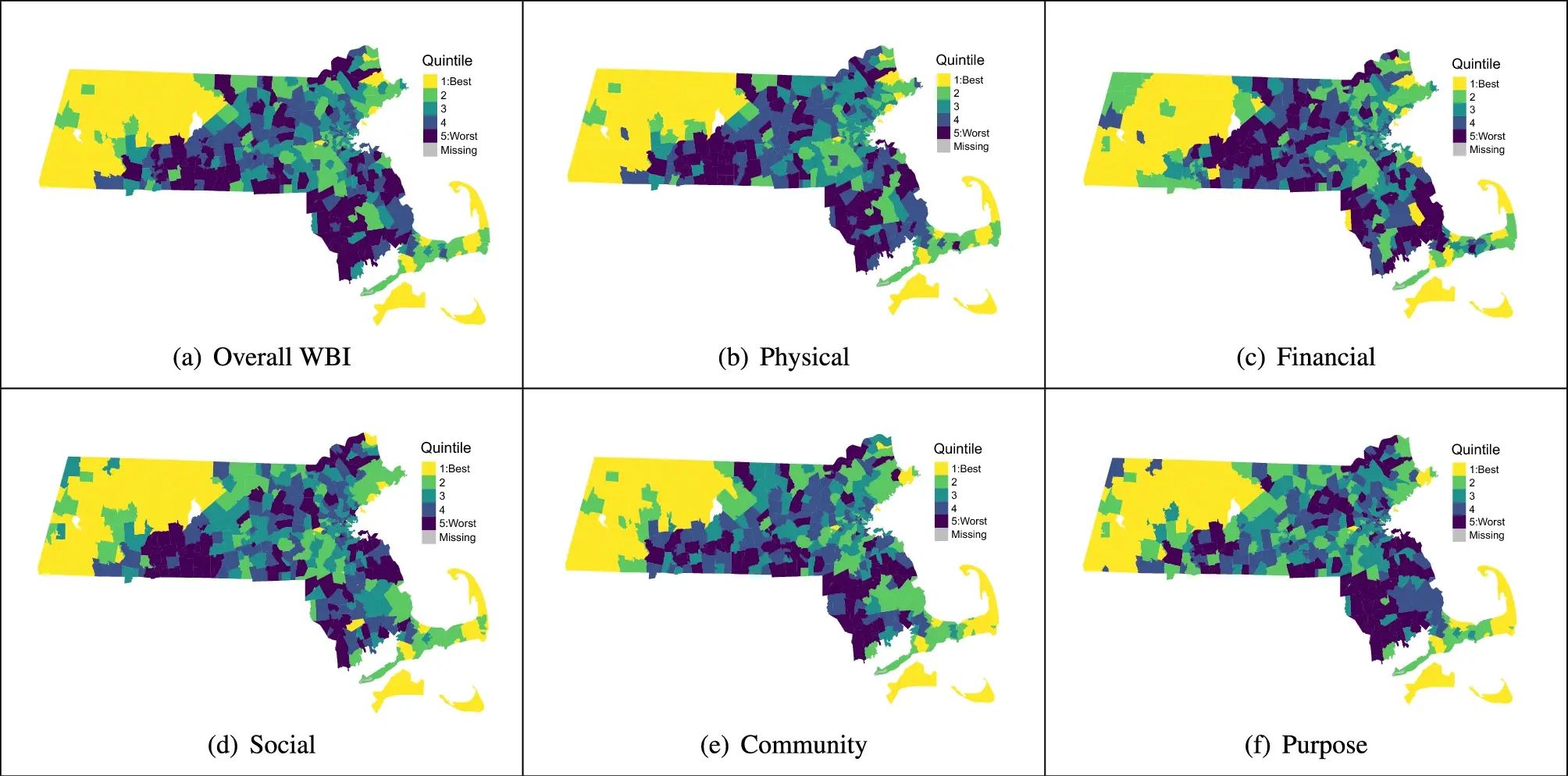
Open-source tools that incorporate open geospatial data, such as openrouteservice (ORS), prove to be beneficial for both academic research and practical applications. These tools enable researchers to pursue innovative approaches aimed at addressing complex societal challenges and beyond. A great illustration of this is presented in the journal paper titled “Modeling health and well-being measures…
-
Join the team: Public Relations Manager (m,f,d) up to 100%
Do you want to use your know-how and experience in science communications, digital marketing, and international outreach for the benefit of society and the environment? Help us at HeiGIT as we innovate towards that goal! We need your expertise to strengthen our outreach and partner network so that organizations and people in need can learn about our geospatial…
-
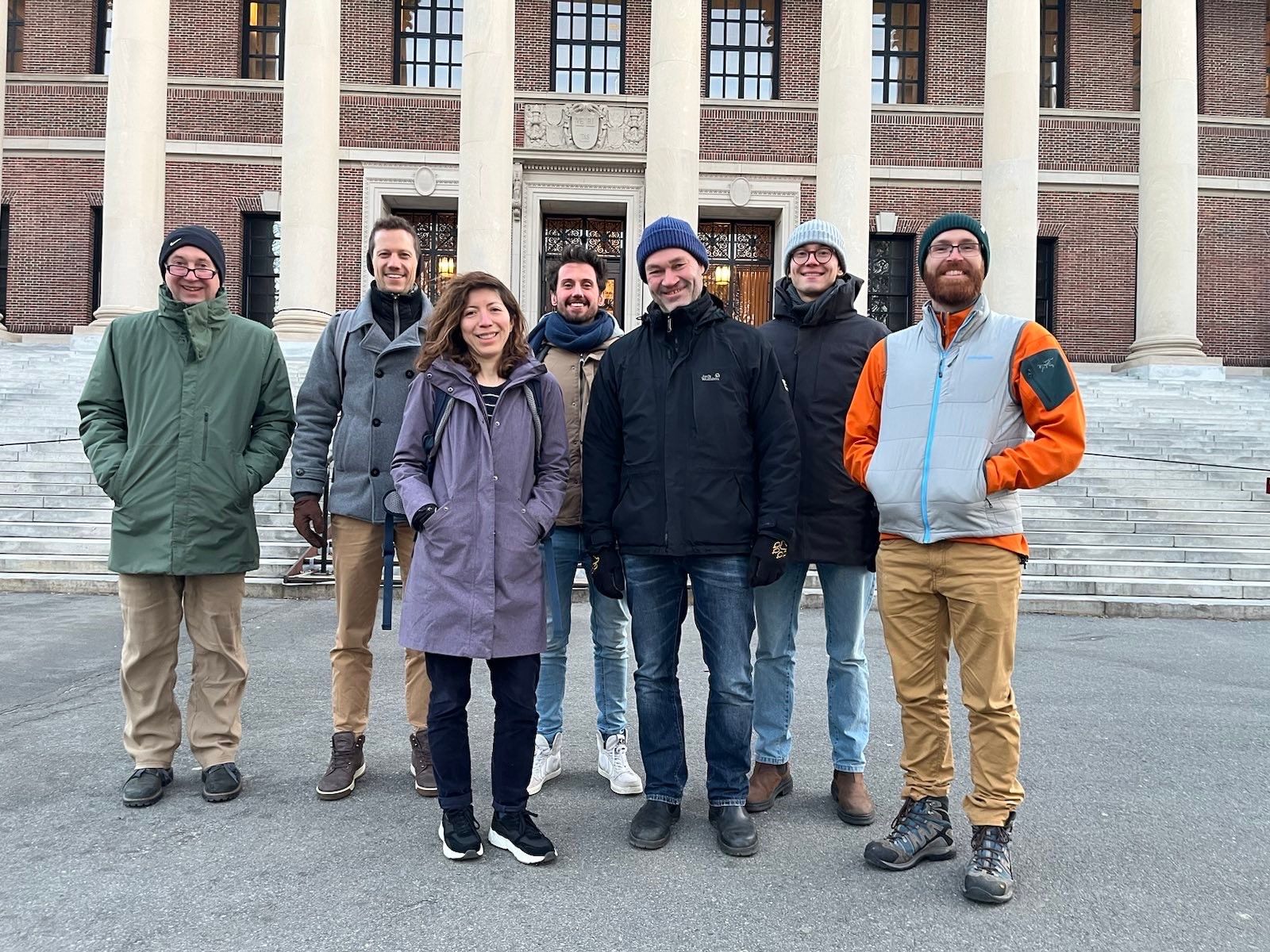
GeoEpi at CGA 2023: From Geospatial Research to Health Solutions
Featured photo: The geoEpi team attending CGA 2023. Back row from left: PD Dr. med. Thomas Jaenisch, Assoz. Prof. Dr. Bernd Resch, Dorian Arifi and Steffen Knoblauch. Front row from left: Dr. rer. nat. Ivonne Morales Benavides, Apl. Prof. Dr. Sven Lautenbach, and Dr. Yannik Roell. Ever since Dr. John Snow’s 1854 tracing of a…
-
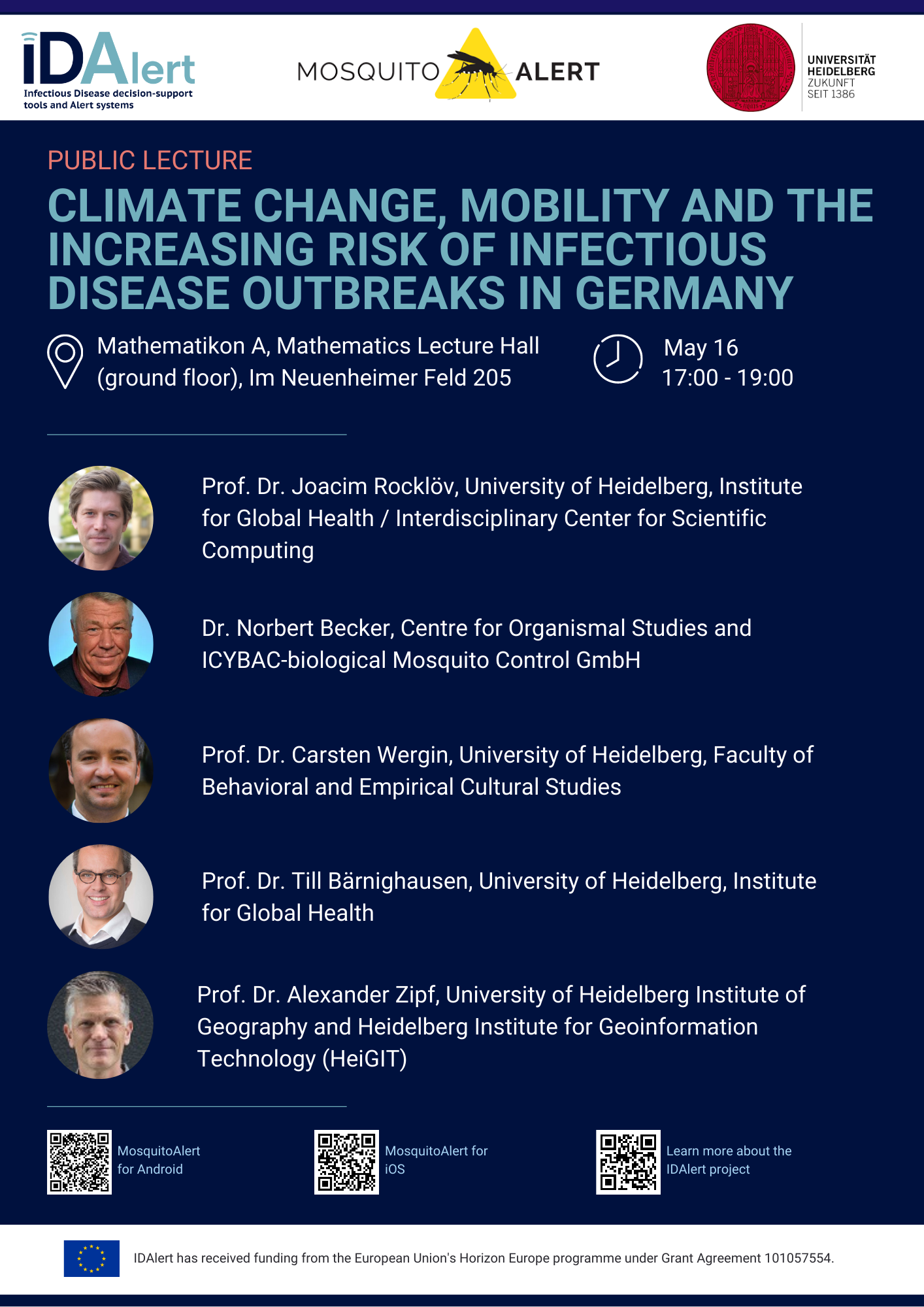
Upcoming Public Lecture May 16: Climate Change, Mobility, and the Increasing Risk of Infectious Disease Outbreaks in Germany
On Tuesday, May 16, visitors to the public lecture “Climate Change, Mobility, and the Increasing Risk of Infectious Disease Outbreaks in Germany” will be treated to insights from five experts currently pioneering research into one of the greatest threats to Germany’s public health. The event will occur in both German and English on the ground…
-
Open GIScience PostDoc positions on understanding the relationships between “Urban nature experience, biodiversity and mental health”
We call for applications to postdoctoral positions within the Heidelberg Mannheim Health and Life Science Alliance “Innovation Campus” for Inter-institutional project. The Central Institute of Mental Health (ZI), Prof. A. Meyer-Lindenberg, the GIScience Research Group at Heidelberg University (Prof. A. Zipf), the 3DGeo Group (Prof. B. Höfle); and the Department of Biodiversity and Plant Systematics…
-
Global Health Academy 2021: workshop material online
Last week, the Global Health Academy 2021 took place in an online format with a focus on the COVID-19 pandemics. The conference was conveyed by the Heidelberg Institute of Global Health (HIGH) and aimed at practitioners, researchers and PhD students in the public health domain. Dr. Sven Lautenbach with support by Steffen Knoblauch and Marcel…
-
Alexander Zipf selected as Marsilius Fellow 2021/2022 – Project with HIGH on Climate Change and Health
Many pressing problems of our time – climate change, aging societies, questions of modern medicine – cannot be solved by one discipline alone. It is becoming ever more urgent for scholars to collaborate across disciplines – natural sciences, life sciences, and social sciences, law, and humanities. The Marsilius Kolleg at Heidelberg University is an institutional…
-
New training program “Research Training on Harnessing Data Science for Global Health Priorities in Africa”
A new training program, “Research Training on Harnessing Data Science for Global Health Priorities in Africa” has been granted by the US National Institute of Health (NIH) and will build upon existing data science research capacity at the partnering institutions to enhance innovative new data science research capacity related to health priorities in Africa. Harvard…
-
Becoming ohsome in R – analysis of the completeness of the road network and health sites in Jakarta
Data quality is an important issue then performing analysis based on OpenStreetMap data. We have recently demonstrated how the effects of the 2013 flood in Jakarta on the accessibility of hospitals and clinics could be analyzed based on network analysis indicators and the isochrones functionality of the openrouteservice. As part of that analysis we analyzed…
-
Mapping Public Urban Green Spaces Based on OpenStreetMap and Sentinel-2 Imagery Using Belief Functions
Public urban green spaces are important for the urban quality of life. Still, comprehensive open data sets on urban green spaces are not available for most cities. As open and globally available data sets, the potential of Sentinel-2 satellite imagery and OpenStreetMap (OSM) data for urban green space mapping is high but limited due to…
-
Insights into OpenStreetMap healthcare attributes in India over time
Last November, we covered the recent increase of healthcare related objects in OpenStreetMap (OSM) in India. In less than a year, the amount of facilities has increased from 6.956 to 48.101. This is mainly due to an import run by RMSI – an Indian GIS consulting company. In this blog we will take a closer look at…