The ohsome quality analyst (short: OQT) has been introduced at the beginning of this year and today we are proud to announce two updates.
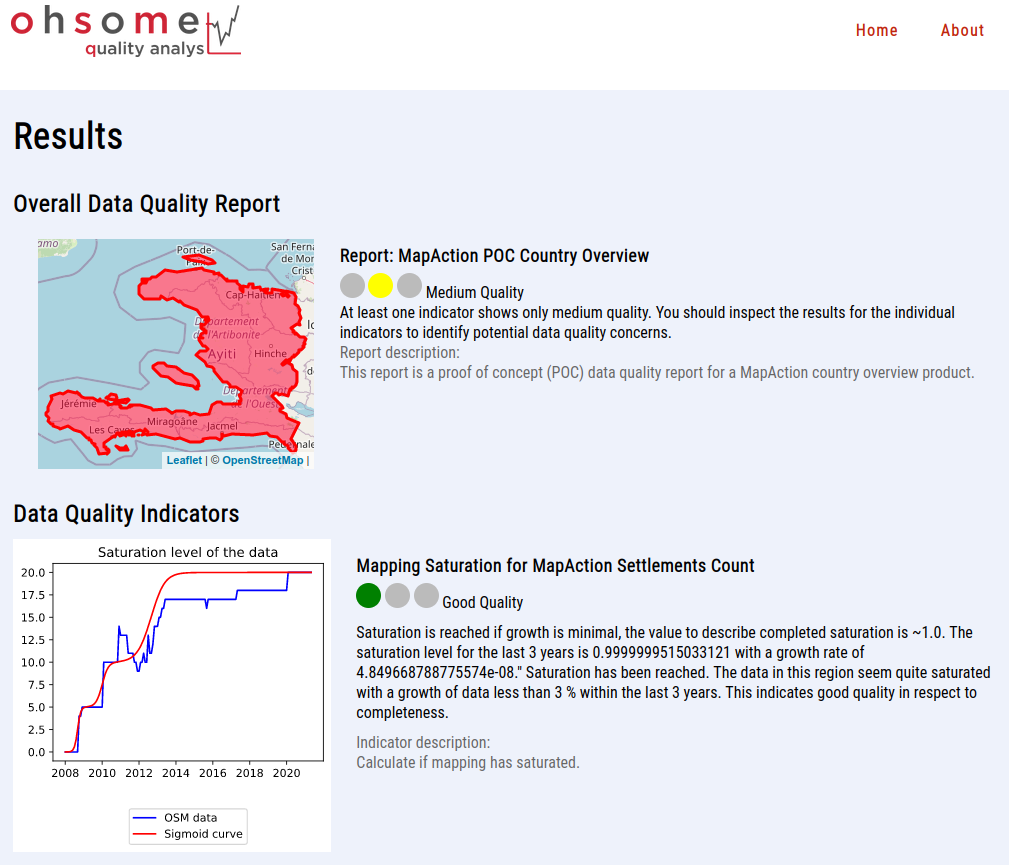
First, we released the new version 0.3.0 which includes new OSM layers and a brand new data quality report. Working on this release has been the first collaboration with MapAction under the umbrella of the memorandum of understanding between HeiGIT and MapAction. Here we started to outline data quality needs for the MapAction map products. Based on this a first report – MapAction Country Overview Report – has been implemented and is now available through the website. Discussing how data quality indicators relate to the specific usage of OSM data has been a central part of the work in the past weeks. With our work on OQT we try to bring these two domains closer to each other.
With this release it is now also much easier to use OQT from your command line to calculate the data quality for the regions you are interested in. For this you just need to install it locally and prepare a geojson file with the geometries of your area of interest. This can be especially useful when you are interested in regions that are not yet covered on our website. Feel free to get in contact with us (ohsome@heigit.org) and let us know about your challenges.
Second, we are happy to work on OQT from now on publicly on Github. This is another important step for us to make sure that we can work closely together with other researchers, practitioners and OSM communities. Today OQT joins our other open source software tools such as the OSDHB, ohsome API and openrouteservice. We welcome your suggestions and contributions.
Figure: MapAction Country Overview Report for Haiti
Related work:
OQT relies on information from the OpenStreetMap (OSM) that has been processed using the ohsome OSM History Data Analytics Platform developed by HeiGIT. The aim of the ohsome framework is to make OpenStreetMap’s full-history data more easily accessible for various kinds of OSM data analytics tasks, such as data quality analysis, on a regional, country-wide, or global scale. Here you find a list of related blog posts and publications:
Blogposts
- Introducing the ohsome quality analyst (OQT)
- Behind the scenes of the ohsome quality analyst (OQT)
- ohsome general idea
- ohsome general architecture
- how to become ohsome blog series
Publications
- Raifer, Martin; Troilo, Rafael; Kowatsch, Fabian; Auer, Michael; Loos, Lukas; Marx, Sabrina; Przybill, Katharina; Fendrich, Sascha; Mocnik, Franz-Benjamin; Zipf, Alexander (2019): OSHDB: a framework for spatio-temporal analysis of OpenStreetMap history data. Open Geospatial Data, Software and Standards.
- Herfort, B., Lautenbach, S., Porto de Albuquerque, J., Anderson, J., Zipf, A.The evolution of humanitarian mapping within the OpenStreetMap community. Scientific Reports 11, 3037 (2021). DOI: 10.1038/s41598-021-82404-z https://www.nature.com/articles/s41598-021-82404-z
- Schott, M.; Grinberger, A. Y.; Lautenbach, S. & Zipf, A. (2021) The Impact of Community Happenings in OpenStreetMap – Establishing a Framework for Online Community Member Activity Analyses In: ISPRS Int. J. Geo-Inf. 10, no. 3: 164. https://doi.org/10.3390/ijgi10030164
- Grinberger, AY, Schott, M, Raifer, M, Zipf, A. (2021): An analysis of the spatial and temporal distribution of large‐scale data production events in OpenStreetMap. Transactions in GIS. 2021; 00: 1– 20. https://doi.org/10.1111/tgis.12746


