

#OpenStreetMap is turning 16! Happy Birthday from the HeiGIT team.
16 years of OSM activity has created the most feature rich and global free multi purpose map that the world has ever seen.
The ohsome team at HeiGIT has created several tools and technologies to have a closer look into that history of OSM edits (OSHDB, Ohsome API, Ohsome Dashboard, OhsomeHeX, etc).
As a birthday gift, we present a new open-source utility – ohsome2X – which you can use to create the data for time-series maps of the OSM historic development.
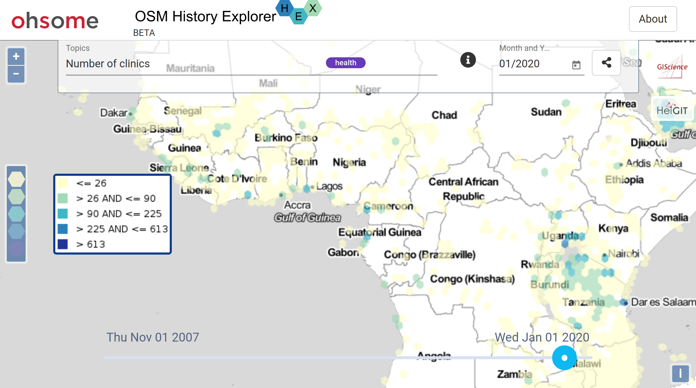
Internally we use the tool to create the time-series data for the ohsome OSM History Explorer OhsomeHeX:
Now, with ohsome2X, YOU will be able to create your own OSM History Stats Maps, for your areas of interests.
The tool uses the Ohsome API in the background to query the relevant statistics and marries the results with any input of polygons (admin areas, regular grids etc). For small tasks you can throw in a geojson, for larger tasks you can link it to a PostGIS DB and process your data iteratively in digestible chunks.
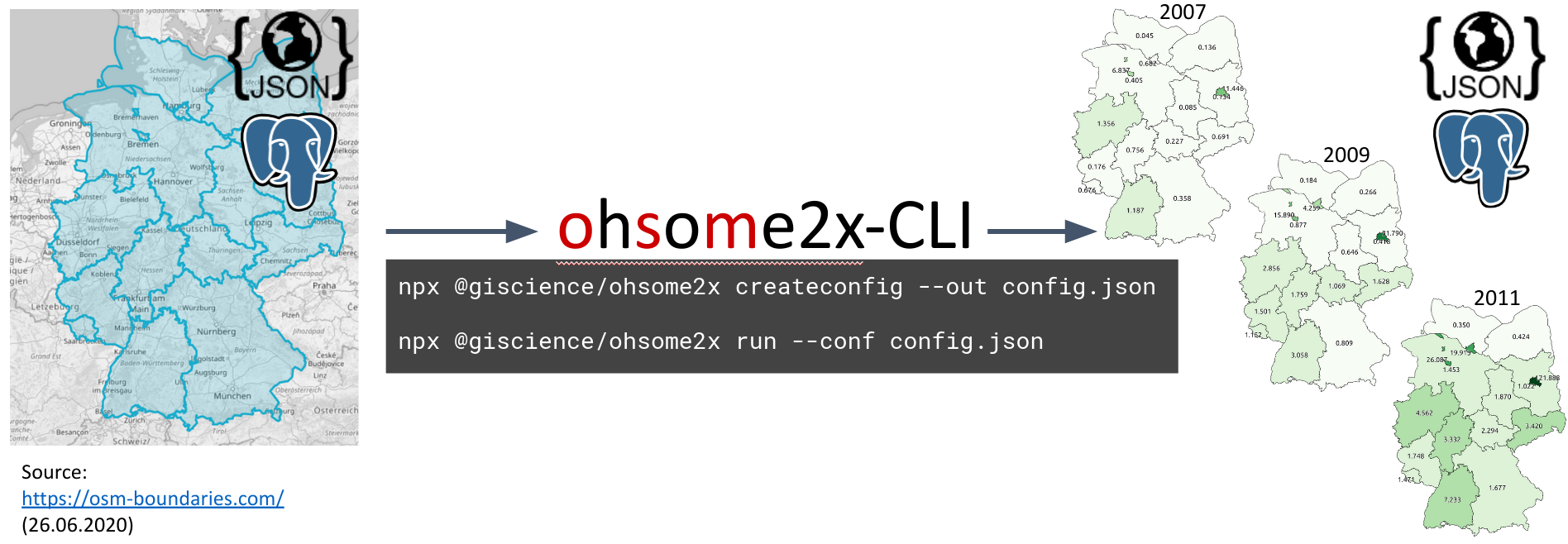
As a result you get a geodataset with values per timestamp and polygon, such that it is directly compatible with the QGIS Time Manager Plugin. This is useful to explore the data temporally or to create animated maps (Fig.2).

Ohsome2X is based on NodeJS and it is publicly available on npm and our gitlab-repository. For our other open source tools see github.com/GIScicence.
HAPPY BIRTHDAY OSM, stay ohsome and have fun!
Wanna read other ohsome blogposts or related literature?:
Raifer, M; Troilo, R; Kowatsch, F; Auer, M; Loos, L; Marx, S; Przybill, K; Fendrich, S; Mocnik, F-B; Zipf, A (2019): OSHDB: a framework for spatio-temporal analysis of OpenStreetMap history data. Open Geospatial Data, Software and Standards.
Auer, M.; Eckle, M.; Fendrich, S.; Griesbaum, L.; Kowatsch, F.; Marx, S.; Raifer, M.; Schott, M.; Troilo, R.; Zipf, A. (2018): Towards Using the Potential of OpenStreetMap History for Disaster Activation Monitoring. ISCRAM 2018. Rochester. NY. US.
Wu, Zhaoyan, Li, Hao, & Zipf, Alexander. (2020). From Historical OpenStreetMap data to customized training samples for geospatial machine learning. In proceedings of the Academic Track at the State of the Map 2020 Online Conference, July 4-5 2020. DOI: http://doi.org/10.5281/zenodo.3923040“