

Today the time has come: The “meinGrün” web app for Dresden and Heidelberg is officially launched.
With the mobile application you can (re-)discover known and unknown green spaces and find a pleasant route to those. Users can learn about the functions of the app via virtual scavenger hunt. The app is the result of the meinGrün project. This is funded by the German Federal Ministry of Transport and Digital Infrastructure as part of the Research Initiative Modernity Fund (mFUND).
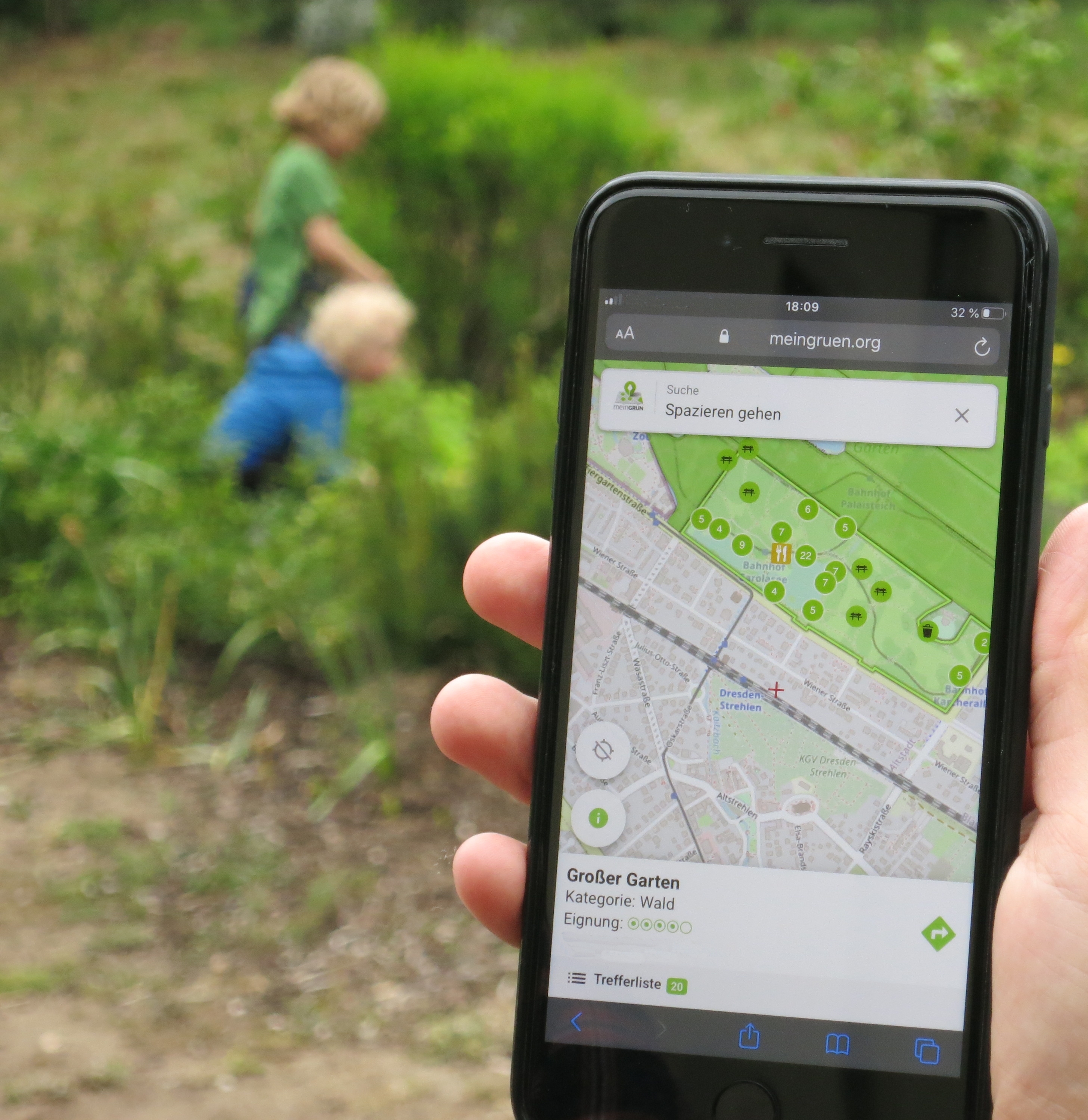
Whether a family picnic, soccer with friends, a walk around the dog or a quiet observation of nature – every outdoor activity needs a suitable green space. With the meinGrün app, you can now quickly and easily find the green that best suits your own needs. The mobile application not only provides information about the location of public green spaces, but also provides information about the equipment on site. Where is there a playground, where is a lawn? Which park also offers a barbecue area and where can you browse through your favorite book on a quiet bench? With a variety of search functions, everyone can find the personal optimal green space.
And that’s not all. The meinGrün app also provides information on how to get into the green. New routing options allow you to find not only the shortest route, but also the quietest, greenest, or the route that offers the most shade. This function is based on the openrouteservice, which is developed by the Heidelberg Institute for Geoinformation Technology (HeiGIT) and the GIScience Research Group at Heidelberg University. With the app, we would like to encourage people to make their way into the green as environmentally friendly as possible, ideally on foot or by bike.
From June 19, the meinGrün app will be available to all interested parties in the pilot cities of Heidelberg and Dresden. In order to make it easier to use, the project team has developed several virtual scavenger hunts. A four-kilometer version starts in Dresden on the playground in Park Bürgerweise, a second 13-kilometer route on Dresden’s Albertplatz. The starting point in Heidelberg is the Neckarwiese. The paper chases guide the participants from one green area to the next with the help of the meinGrün app and exciting tasks. All the functions that the app offers can be learned in a playful way. Those who take part in the scavenger hunt also have the opportunity win a prize in a contest!
The meinGrün app https://meingruen.org/
Further info https://www.geog.uni-heidelberg.de/gis/meingruen_en.html http://meingruen.ioer.info/
Novack, T.; Wang, Z.; Zipf, A. (2018): A System for Generating Customized Pleasant Pedestrian Routes Based on OpenStreetMap Data. Sensors 2018, 18, 3794.
Ludwig, Christina ; Zipf, Alexander (2019): Exploring regional differences in the representation of urban green spaces in OpenStreetMap. Proceedings of the GeoCultGIS – Geographic and Cultural Aspects of Geo-Information: Issues and Solutions, Limassol (Cyprus)
Wang Z., T. Novack, Y. Yan, A. Zipf (2020, accepted): Quiet Route Planning for Pedestrians in Traffic Noise Polluted Environments. IEEE Transactions on Intelligent Transportation Systems.(accepted)
Background:
The meinGrün project is funded by the Federal Ministry of Transport and Digital Infrastructure (BMVI) as part of the mFUND research initiative (FKZ: 19F2073A). The project consortium includes the Leibniz Institute for Ecological Spatial Development (project management), the German Remote Sensing Data Center of the German Aerospace Center (DLR), the Institute of Cartography at the Technical University of Dresden, the Heidelberg Institute for Geoinformation Technology HeiGIT) and GIScience Research Group at Heidelberg University, the Institute for software development and IT consulting in Karlsruhe as well as urbanista in Hamburg and Terra Concordia in Berlin. In developing the meinGrün WebApp, the project team also worked closely with the administrations of the two pilot cities of Dresden and Heidelberg. They not only provided advice, but also provided municipal (green space) data for the project.
In 18 months of scientific work, technical implementation and practical tests, the project partners developed the meinGrün app. The application combines various data, including open geodata and the latest remote sensing data from the European space program Copernicus, as well as user-generated data from OpenStreetMap. The meinGrün WebApp was initially developed for the pilot cities of Dresden and Heidelberg. But it can also be transferred to other cities.