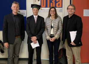
Last week Dr. Clemens Jacobs successfully defended his PhD about methods for assessing the data quality of citizen science observations of organisms.
Congratulations, well done!!! We wish all the very best for the future!

The research aimed at using geographic context as an information source for estimating the plausibility of an observation, e.g., of a bird, which was reported to a citizen science portal such as iNaturlist or Artenfinder collecting such data from volunteers. To this end, approaches were developed which tap into different kinds of sources of Volunteered Geographic Information (VGI) to capture geographic context. One of these sources is OpenStreetMap (OSM). HeiGIT’s OpenStreetMap History Database (OSHDB) as part of the ohsome OpenStreetMap History Analytics platform was used to derive typical contexts of species in the form of OSM tags which are frequently found close to observations of certain species. This information can then be used to examine the tag context of a new observation of such a species. If the context of an observation fits the typical OSM context well, this indicates a high plausibility of that observation as explained in this post.
Some further results can also be found e.g. in this publication:
Jacobs C. and A. Zipf (2017): Completeness of Citizen Science Biodiversity Data from a Volunteered Geographic Information Perspective. Geo-Spatial information Science, GSIS, 2017. Taylor & Francis. DOI: 10.1080/10095020.2017.1288424.


