

Volunteered Geographic Information (VGI) such as data derived from the OpenStreetMap (OSM) project is a popular data source for freely available geographic data. There is frequently a cause of concern regarding the quality and usability of such data. In addition to our former studies (further here) or complementing our OSM in GIScience Book in a new study, the quality of OSM land use and land cover (LULC) data is investigated for an area in southern Germany in comparison to an authorative data set.
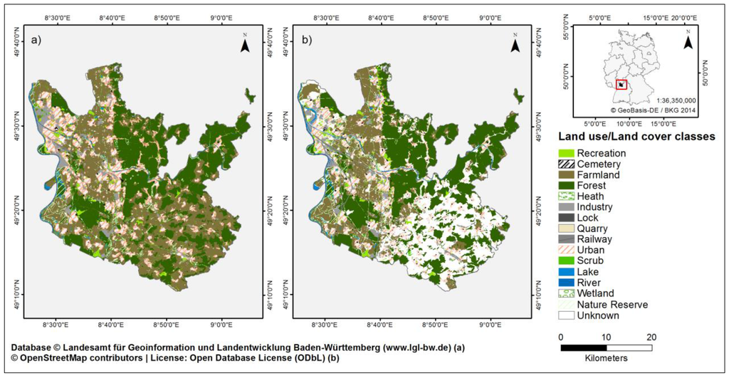
Two spatial data quality elements, thematic accuracy and completeness are addressed by comparing the OSM data with an authoritative German reference dataset. The results show that the kappa value indicates a substantial agreement between the OSM and the authoritative dataset. Nonetheless, for our study region, there are clear variations between the LULC classes. Forest covers a large area and shows both a high OSM completeness (97.6%) and correctness (95.1%). In contrast, farmland also covers a large area, but for this class OSM shows a low completeness value (45.9%) due to unmapped areas. Additionally, the results indicate that a high population density, as present in urbanized areas, seems to denote a higher strength of agreement between OSM and the DLM (Digital Landscape Model). However, a low population density does not necessarily imply a low strength of agreement.
Dorn H., Törnros T., Zipf A. (2015): Quality Evaluation of VGI Using Authoritative Data—A Comparison with Land Use Data in Southern Germany. ISPRS International Journal of Geo-Information. 2015; 4(3):1657-1671.