Increasing traffic, especially in urban areas, leads to more and more infrastructural bottlenecks and congestion inside transportation networks. The aim is therefore to use existing transport networks as efficiently as possible. Current traffic and incident reports from the Traffic Message Channel (TMC) are an important source of information to provide further services in the context of a dynamic routing.
The state of North Rhine-Westphalia develops a new integrated transport information portal (Traffic NRW) for North Rhine-Westphalia. In the portal address lookup, a route planner and maps are provided. In order to also integrate current traffic information in the portal, a road graph with TMC LCL information based on OpenStreetMap (OSM) is needed. To enable this service the German federal road agency (BAST) agreed to publish the Location Code List (LCL) for Germany to be used by the OSM project. The goal of our project “Development of an OSM road graph with TMC LCL information” was therefore to develop a matching method to associate TMC / LCL information automatically with OSM.
Automated matching between LCL and OSM
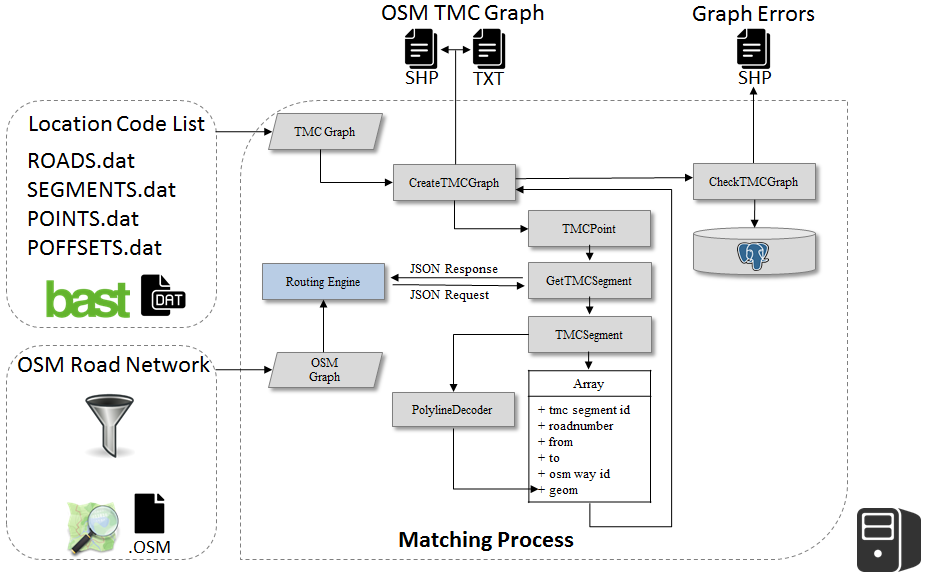
For matching the LCL information with the OSM road network, a multi-stage process comprising the following steps has been implemented:
- Creating a graph LCL (topologies and attributes) from the Location Code List
- Transfer of the selected LCL Points and Coordinates using routing algorithms
- Calculation of the route between two points LCL (depending on the segment and the direction
- Semantic validation between LCL segment and the calculated route (OSM Ways)
- Matching of segement-based LCL attribute information to the extracted OSM Ways

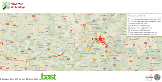
The figure above shows the implemented system architecture of the presented matching method. As part of the implementation of the matching process, a prototype web-client has been developed which is used to visualize the results.

Services
Although LCL information is partially already available in the OSM dataset, there are currently no further services / applications that illustrate the benefits of localization of traffic information in OSM to motivate the community. The Web client therefore also includes two further layers which uses the currently generated TMC OSM graph to visualize real-time TMC messages on top of our OSM-based OpenMapSurfer map service. This first initial service provides real-time traffic information for Germany.
Further project information is available here. We thank our project partner BAST and StraßenNRW as well as MDM Germany for sponsoring this research project.
Research results will be presented at this years AGIT. Please have a look at the corresponding publication:
Steiger, E. Zipf, A. (2015): Erstellung eines OSM Straßengraphen mit TMC LCL Informationen . (accepted) In: Strobl, J., Blaschke, T., Griesebner, G. (Hrsg.): Angewandte Geoinformatik 2015. Berlin


