Tag: point clouds
-

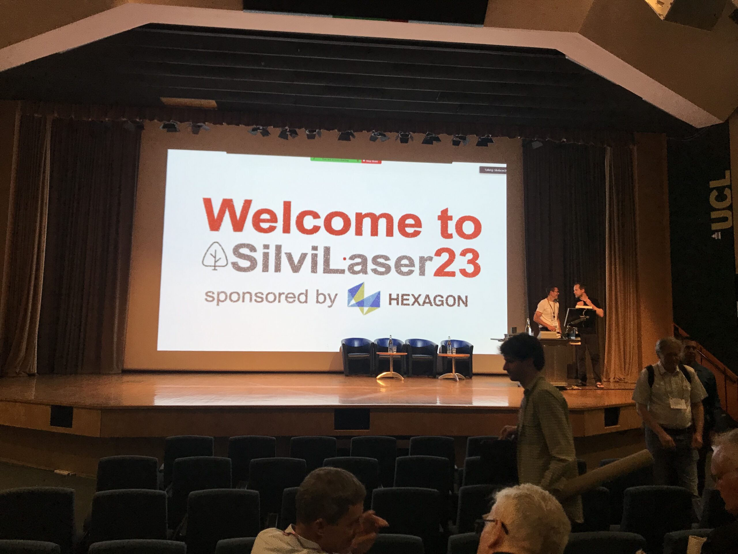
Impressions from Silvilaser 2023
Last week, our PhD student, Hannah Weiser, joined Silvilaser 2023 at University College London (UCL). The conference covers cutting-edge science and technology from the laser scanning and forest communities, which is a perfect match for Hannah’s PhD topic and 3DGeo research in general. The week started off with interesting workshops on Tuesday using some of…
-
CharAct4D – Unravelling Landscape Dynamics via Automatic Characterization of Surface Activity using Geographic 4D Monitoring
With her new project CharAct4D Dr. Katharina Anders has become part of the Eliteprogramme for Postdocs of the Baden-Württemberg Stiftung, which supports early career researchers to qualify for a professorship -check the related press release by Heidelberg University. Many congratulations, Katharina! Katharina’s research interests in the 3DGeo research group are method development for 3D/4D change analysis…
-
Open Data: Multi-platform point clouds and orthophotos of the inland dune in Sandhausen
The commune Sandhausen (Baden-Württemberg) got its name from the inland dune, which is located in the area of the village. In 2021 and 2022, the 3DGeo group of Heidelberg University conducted UAV-based and ground-based surveys of three areas of the inland dune of Sandhausen to acquire 3D point clouds and orthophotos. The dataset is freely and…
-
Human-in-the-loop development of spatially adaptive ground point filtering pipelines — An archaeological case study
LiDAR data have become indispensable for research in archaeology and a variety of other topographic applications. To derive products (e.g. digital terrain or feature models, individual trees, buildings), the 3D LiDAR points representing the desired objects of interest within the acquired and georeferenced point cloud need to be identified. This process is known as classification,…
-
4D change analysis for improving our understanding of dynamic landscapes
Time series of topographic point clouds offer great possibilities to advance our understanding of dynamic landscapes. To exploit the full information these 4D datasets contain on spatial and temporal properties of natural surface changes, the 3DGeo research group is developing methods for 4D change analysis. These methods are required to answer fundamental questions on the…
-
SYSSIFOSS project video on the potential of synthetic LiDAR data in forestry applications
Do you want to find out about the potential of simulating LiDAR data over synthetic forest stands and the steps to get there? Get to know the SYSSIFOSS research project in the video below! Link to video In SYSSIFOSS we are using 3D LiDAR forest data to create a database of diverse model trees (different…
-
Video on research of 3DGeo on change analysis methods at an active rock glacier
Always been curious about how we develop our methods for 3D/4D change analysis? Then check out our new video on high-resolution and high-frequency monitoring of a rock glacier in Austria! Link to video LiDAR datasets of the rock glacier provide the basis for the development of 3D and 4D methods for geomorphic change quantification within…
-
SYSSIFOSS project @ 2nd symposium on satellite-based earth observation in Cologne
On November 12-13, Jannika Schäfer from KIT presented the SYSSIFOSS project at the 2nd symposium on satellite-based earth obersvation (2. Symposium zur angewandten Satellitenerdbeoachtung) in Cologne. SYSSIFOSS is a joint project between the Institute of Geography and Geoecology (IFGG) of the Karlsruhe Institute of Technology (KIT) and the 3DGeo Research Group of Heidelberg University. In…
-
The Importance of Monitoring Interval for Rockfall Magnitude‐Frequency Estimation
Rockfalls commonly exhibit power law volume-frequency distributions, where fewer large events are observed relative to more numerous small events. Within most inventories, the smallest rockfalls are the most difficult to detect and so may not be adequately represented. A primary challenge occurs when neighboring events within a single monitoring interval are recorded as one, producing…
-
High-frequency and high-resolution monitoring of rock glacier dynamics
How do the dynamics of surface change on a rock glacier look like over an entire summer season? And how is rockfall activity and storage and talus supply from the headwall of a rock glacier related to patterns of its movement? These and other questions are currently investigated within the AHK-4D and Geomorph4D projects of…
-
PhD Colloquium “Deep Learning in Photogrammetry, Remote Sensing and Geospatial Information Processing”
On 14th and 15th May, our 3DGeo group members Bernhard Höfle and Lukas Winiwarter were co-organizing and participating in the 4th colloquium for PhD students working on the topic of Deep Learning and its applications in Photogrammetry, Remote Sensing and Geoinformation Processing of the Deutsche Geodätische Kommission (DGK) and the Deutsche Gesellschaft für Photogrammetrie und…
-
Live from the Ötztal Alps (#3): Exploring high mountain 3D geoinformation
On the last day of fieldwork in the rotmoos valley two groups (terrestrial laser scanning (TLS) and photogrammetry) set off to the rotmoos glacier again. A second TLS dataset was aqcuired which enables the students to perform a change detection or deformation analysis. The electrical resistivity tomography (ERT) group futher explored the pre-Quaternary relief in…


