

Search results for: “public health”
-
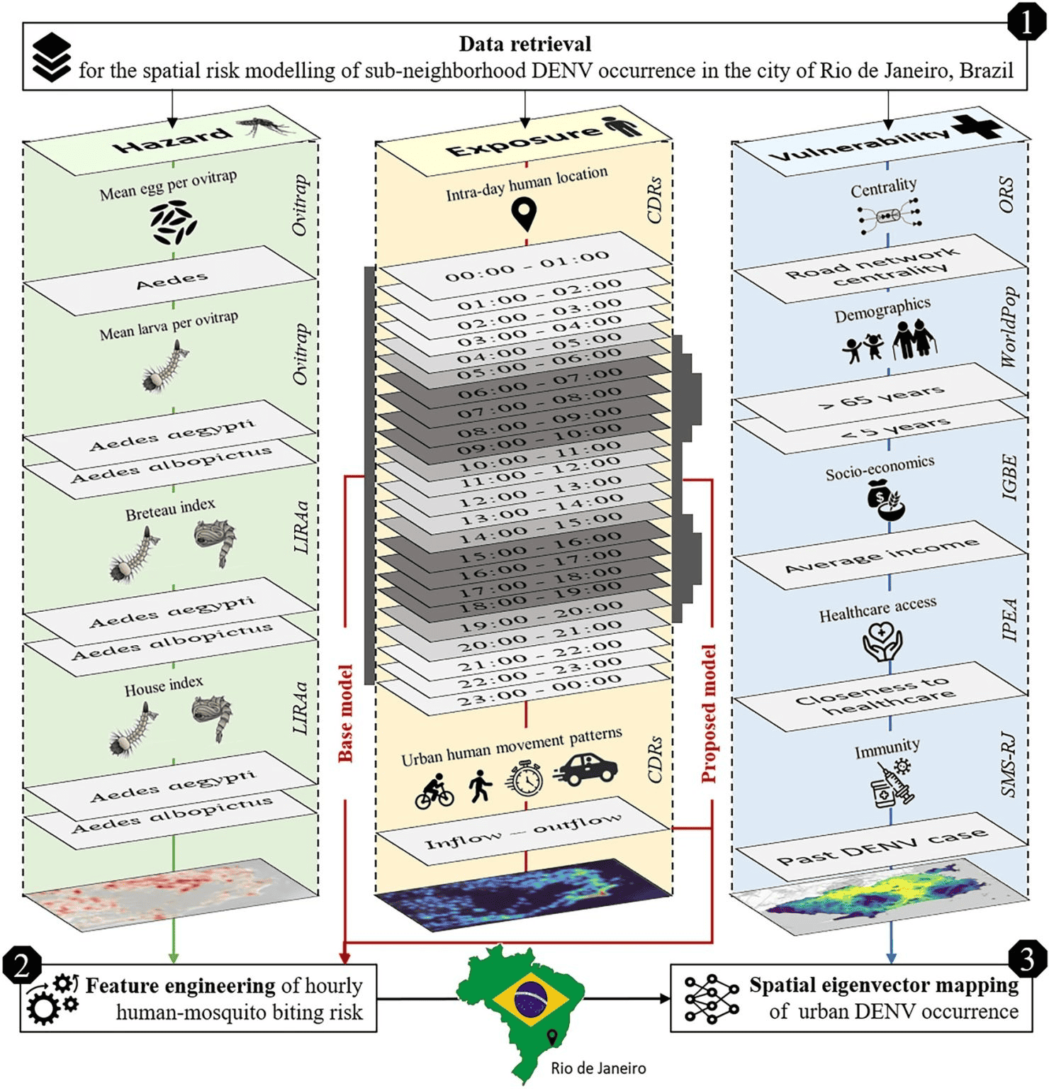
New Paper in Scientific Reports “Modeling Intraday Aedes-human exposure dynamics enhances dengue risk prediction”
Scientific Reports publishes a paper by Steffen Knoblauch et al. that underscores the critical importance of integrating vector ecology and human behavior into advanced disease modeling frameworks. The increasing availability of human movement data presents significant potential for tackling global public health challenges, especially in the context of infectious diseases. This is particularly important for…
-
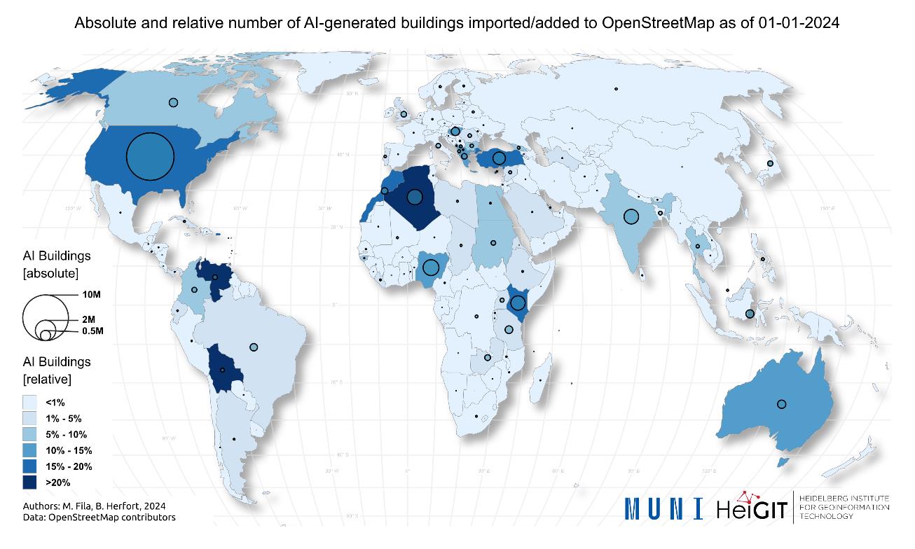
New Paper “AI-Generated Buildings in OpenStreetMap: Frequency of Use and Differences from Non-AI-Generated Buildings”
The concept of a “Digital Earth” has long envisioned a future where technological advancements enable the large-scale collection and visualization of spatial and environmental data. Today, open data sources such as OpenStreetMap (OSM) provide crucial spatial information for diverse applications, including urban planning, disaster management, and public health. However, many regions remain insufficiently mapped, particularly…
-

New Paper “An explainable GeoAI approach for the multimodal analysis of urban human dynamics: a case study for the COVID-19 pandemic in Rio de Janeiro”
The COVID-19 pandemic highlighted the importance of understanding human behavior in cities to develop effective public health interventions. Crowd-sourced geospatial data available online can therefore serve as a valuable resource for analyzing such dynamics with Geospatial Artificial Intelligence (GeoAI). However, previous research often struggles with the complexity and heterogeneity of such data, and faces challenges…
-
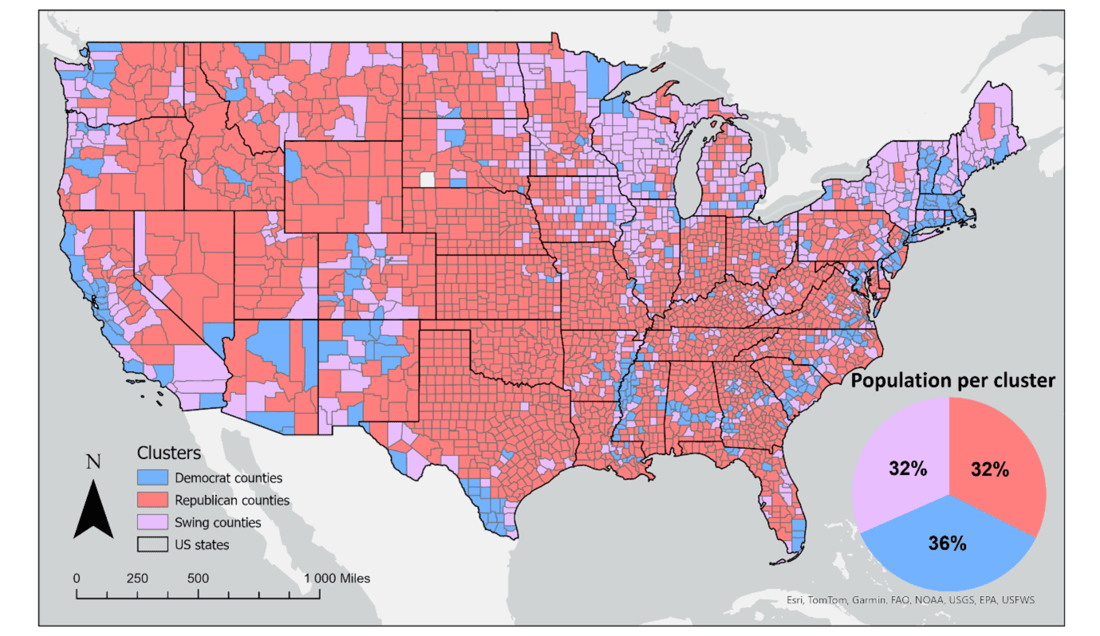
New Paper “Geosocial Media’s Early Warning Capabilities Across US County-Level Political Clusters: Observational Study”
The novel coronavirus disease (COVID-19) generated significant health concerns worldwide, leading policymakers and health care experts to implement nonpharmaceutical public health interventions to mitigate the spread of the virus. While these interventions played a crucial role in controlling transmission, they also resulted in substantial economic and societal costs, necessitating strategic deployment, particularly during periods of…
-
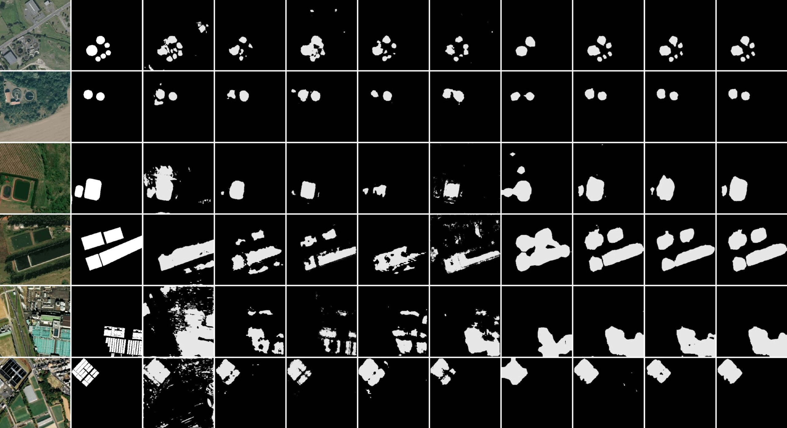
New paper “STVAE: Skip connection driven two-stream property Fusion Variational AutoEncoder for cross-region wastewater treatment plant semantic segmentation”
Wastewater treatment plants (WWTPs) play a crucial role in maintaining ecological balance and public health and are essential for advancing social sustainable development goals. However, the diverse architectural styles, scales, and environmental contexts of WWTPs—shaped by climate, topography, and regional economic conditions—pose significant challenges for generalizing segmentation algorithms. To address this, integrating knowledge from different…
-
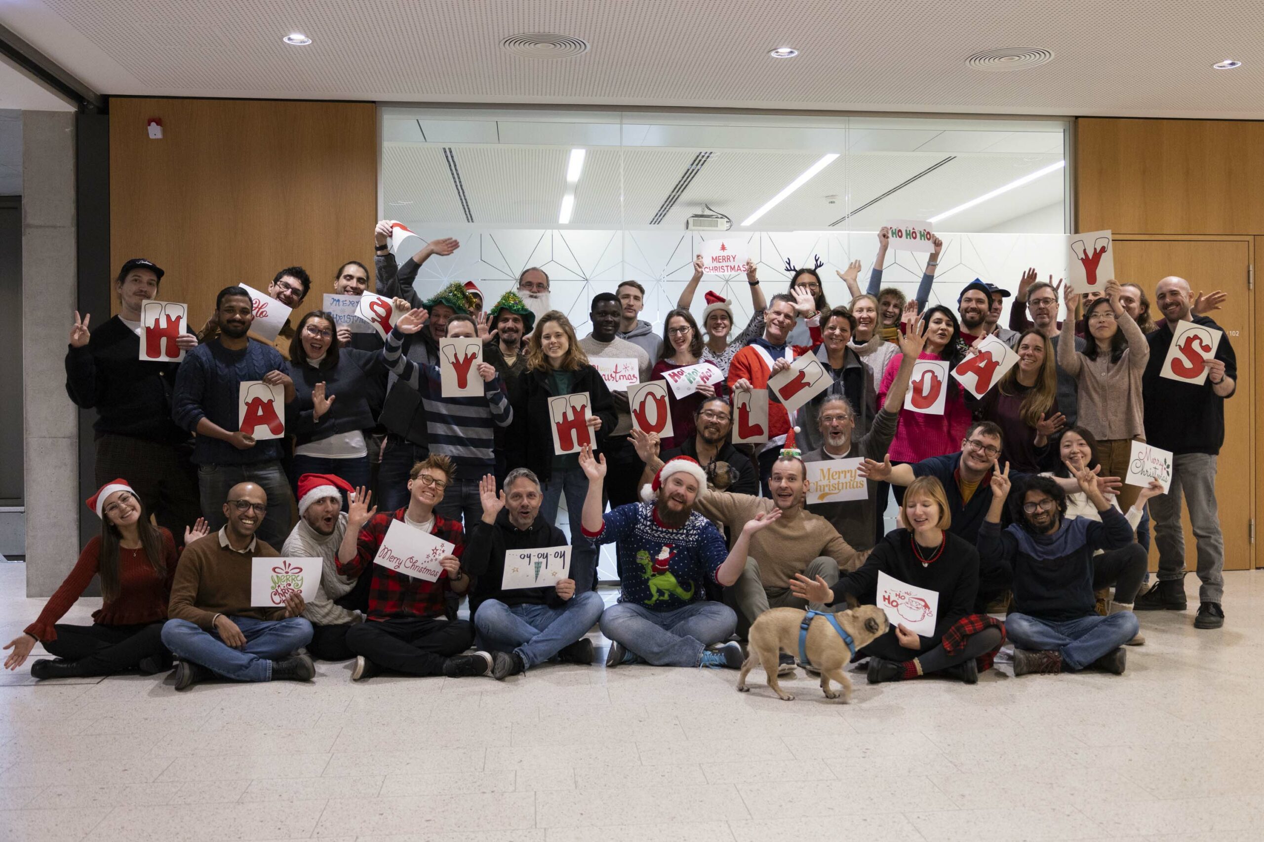
The Year 2024 at HeiGIT
With 2024 drawing to a close, we reflect on a year filled with events, accomplishments and opportunities to make a positive impact. Halfway through the year, we celebrated HeiGIT’s fifth anniversary—a moment to appreciate how far we’ve come and everything we’ve accomplished together. From our early days to the milestones of 2024, our growth sets…
-
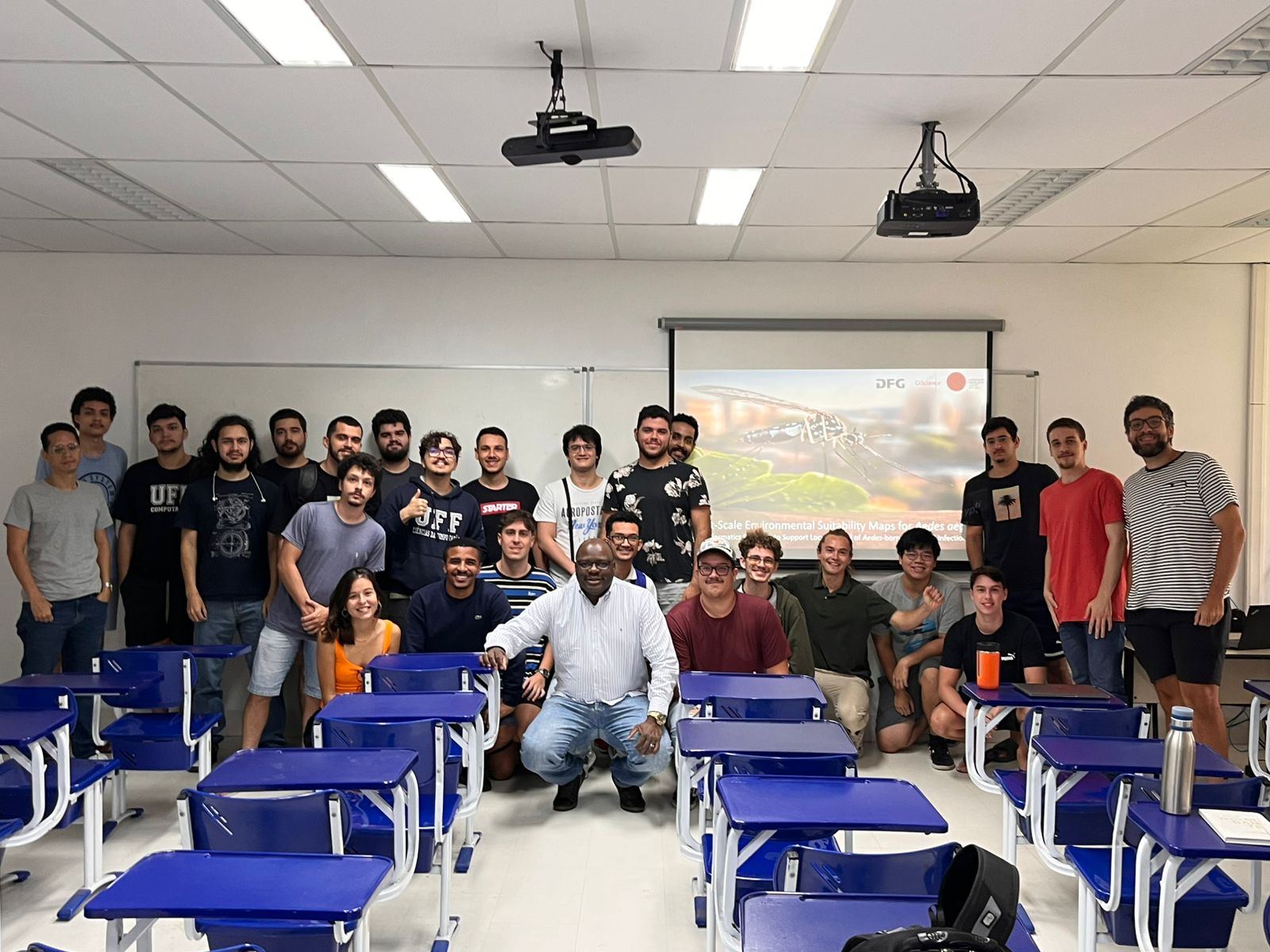
Research Visit to Rio de Janeiro
Building on ongoing efforts to enhance urban health management and mosquito-borne disease monitoring in the municipality of Rio de Janeiro, PhD candidate Steffen Knoblauch returned to the city for a second visit deepen collaborations and explore further applications of his research findings. He delivered lectures at several research institutions such as Universidade Federal do Rio…
-

Balancing Walkability and Climate Mitigation in Urban Design
Recently, our colleague Kirsten von Elverfeldt attended the Walk21 Conference in Lisbon, an inspiring event dedicated to reimagining cities by transforming car-centered spaces into active, livable, and vibrant environments for people. The conference was filled with innovative ideas and strategies from around the world, showcasing how urban mobility can improve quality of life. One standout…
-
The Heads behind the Climate Action Team
At HeiGIT, the recently established Climate Action team is a group of dedicated professionals of diverse backgrounds and areas of expertise working together to drive impactful environmental solutions. The climate crisis is one of the most urgent challenges for society, and its impacts are becoming increasingly severe. However, there is a large gap between awareness…
-

Heigit and PLANUM Join Forces: A Guide to Co-developing Climate Action Indicators
HeiGIT and PLANUM, are happy to announce their cooperation in the field of climate action. PLANUM is committed to driving positive change through innovative engineering solutions. The company specializes in sustainable planning, making them a crucial partner in our pursuit of creating impactful and practical solutions to combat climate change. At HeiGIT, the newly established…
-
Call for Papers: Special Issue on Urban AI in Environment and Planning B
Together with collaborators from Urban Analytics Lab Singapore and CICI Lab, we are organising a special issue in Environment and Planning B: Urban Analytics and City Science, on the topic of Urban AI for a Sustainable Built Environment. Here is the summary of the call for papers: “Recently, Urban AI has become an emerging field…
-
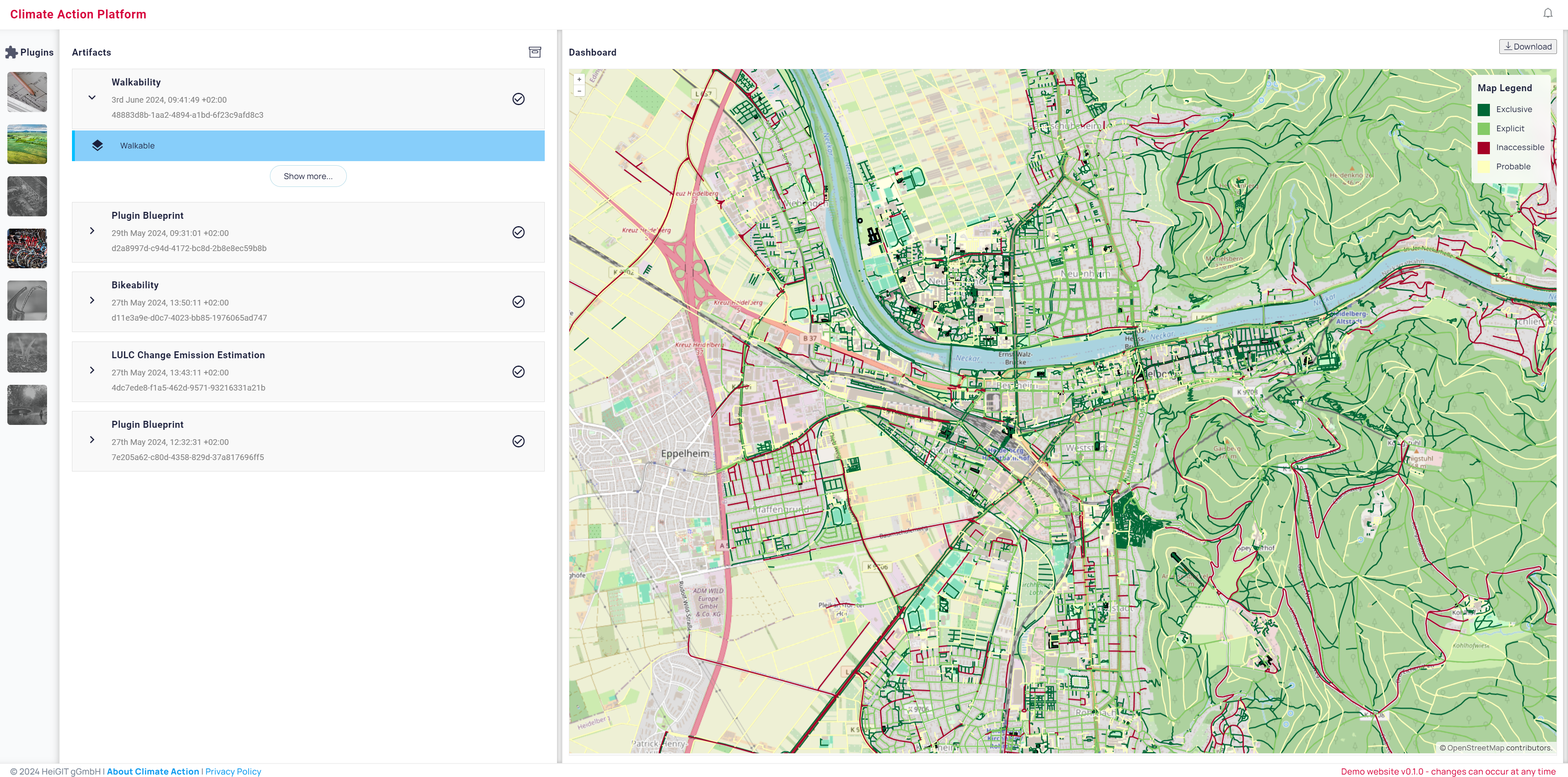
Walkability: A Key Index for Climate Action
At HeiGIT, we are committed to raising awareness about the climate crisis and taking action to support stakeholders with knowledge and actionable know-how to drive the transformation of our society and built environment. In this spirit, we joined forces with PLANUM, an Austrian traffic planning office with extensive expertise in active mobility, particularly walkability. As…