

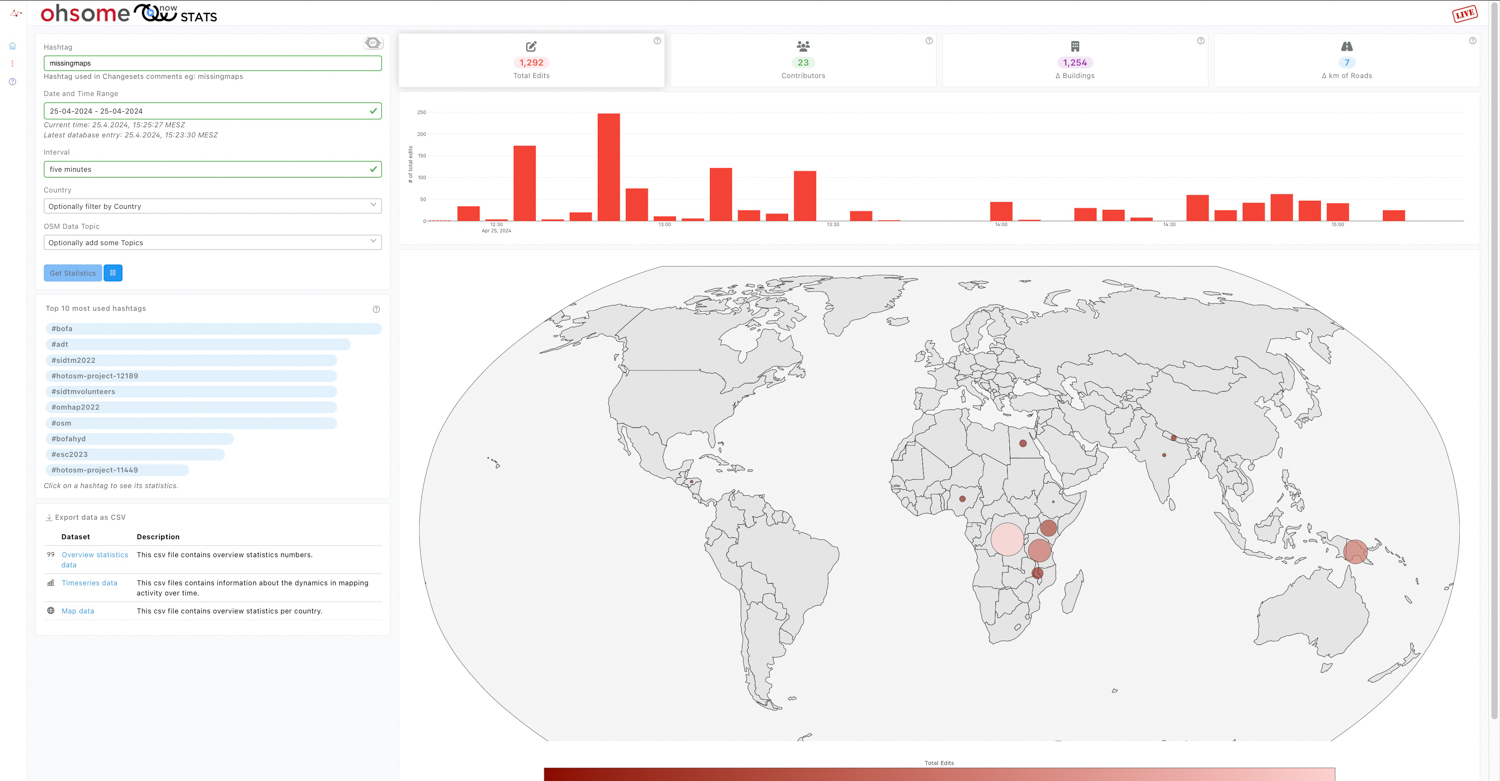
Search results for: “mapathon”
-
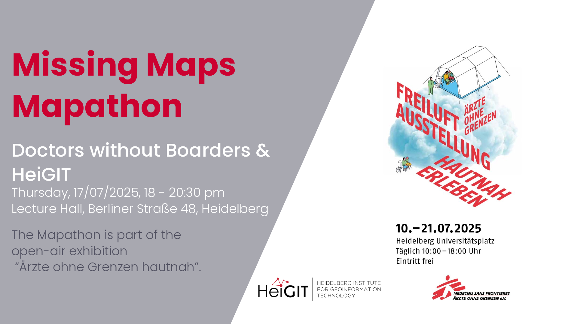
Mapathon with Doctors without Boarders
The lack of geographical data makes providing humanitarian aid more difficult. This is particularly the case in situations of disaster, when geographical data and routing data are crucial for coordinating help. In certain regions, however, this data still remains incomplete. During Mapathons, volunteers map these areas and provide the missing data. As part of this…
-
Mapathon – Silver Ways Project
This time, we will map smoothness and surface tags within the Mannheim area. This mapping effort will contribute to delivering the data needed for our ongoing Silverways project. Silver Ways is a project aiming to improve the mobility of senior citizens by developing an empirically informed and validated routing system tailored to their needs. The…
-
Mapathon on November 18
As part of the annual “Geography Awareness Week”, we are organizing a mapathon together with Doctors Without Borders, the German Red Cross and the University of Würzburg. When: Monday, November 18th, 7p.m. Where: Heidelberg, Berliner Straße 48 in the “Hörsaal” lecture hall What is a Mapathon?In order to be able to help people in crisis…
-
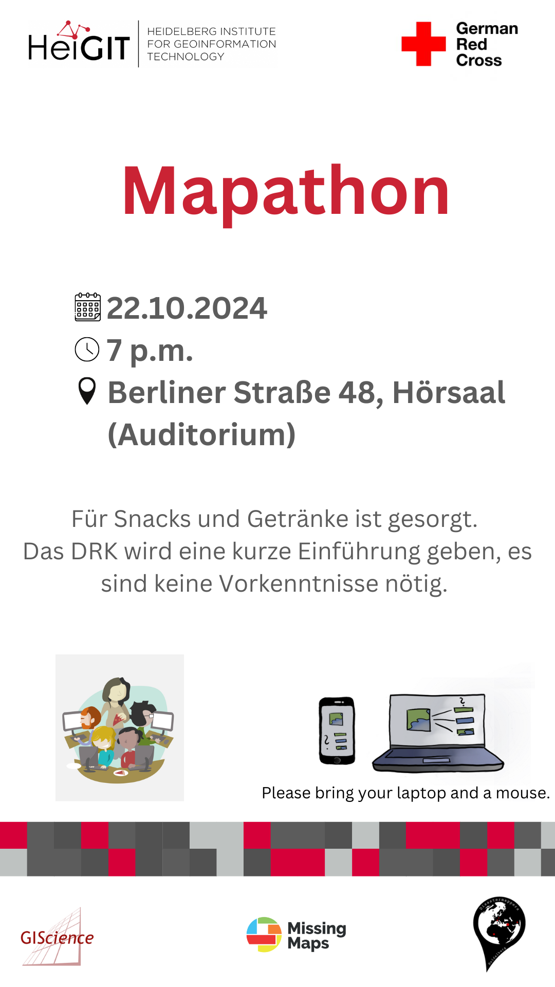
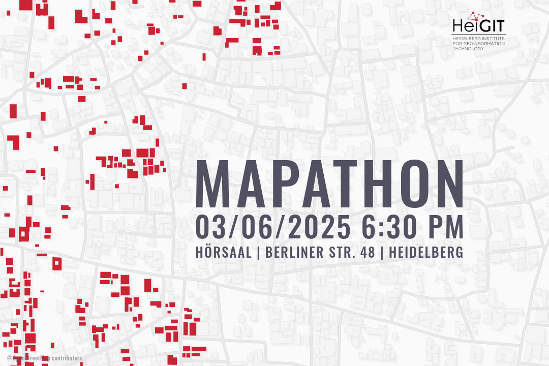
Mapathon on October 22
When: Tuesday, 22.10.2024, at 7 p.m. Where: Berliner Straße 48, Hörsaal After a short introduction into the region and subject of this mapping task, you will also get instructions how to map. The Mapathon will be a collaboration with the Missing Maps project. Everyone is welcome and no previous knowledge is needed!Do bring your laptop…
-
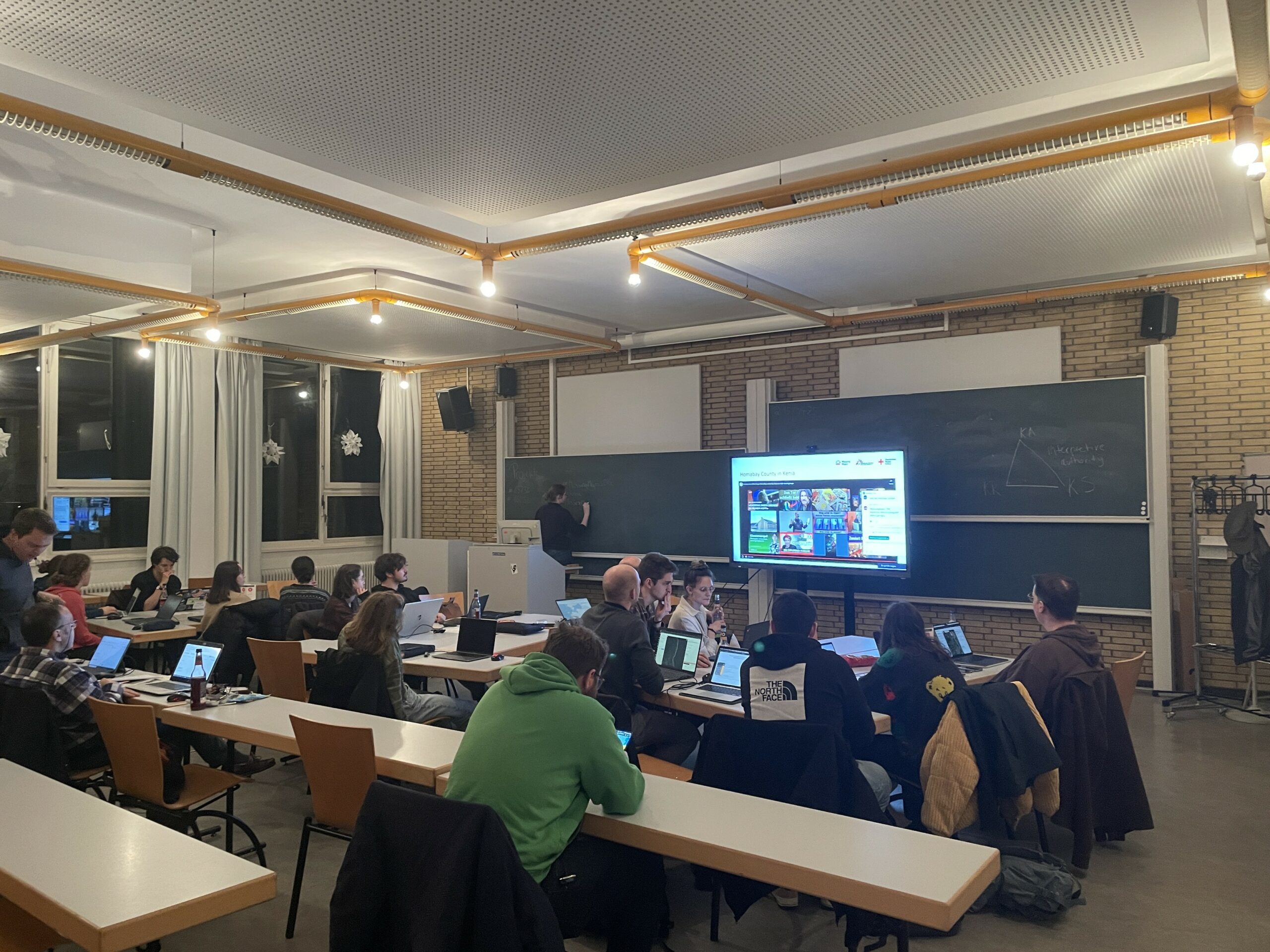
Mapping Progress in Real Time: Highlights from GeoNight 2024 Mapathon with HeiGIT and Mannheimer Mapathons
During GeoNight 2024, HeiGIT partnered with Mannheimer Mapathons to host a mapathon together. Mapathons are events where volunteers come together to map crucial features like roads, buildings or waterways on OpenStreetMap, often in response to specific needs or crises, such as post-earthquake or post-flood scenarios. We were privileged to connect with volunteers from OSM Ghana, gaining insight into…
-
GeoNight Mapathon on April 12th
Our next Mapathon is just around the corner, and this time, we’re joining forces with OpenStreetMap Ghana to improve coverage and to help disaster risk assessment.Join us and be a part of the GeoNight 2024 to celebrate geography together in all its forms and facets! Everyone is welcome and no previous knowledge is needed!Do bring your laptop and preferably…
-

Mapathon on February 7th
The first Mapathon this year will be on February 7th. When: Wednesday, 07.02.2024, at 7 p.m. Where: Berliner Straße 48, Hörsaal After a short introduction into the region and subject of this mapping task, you will also get instructions how to map. The Mapathon will be a collaboration with the German Red Cross (GRC) and…
-
A Successful Mapathon
We hosted a Mapathon on Thursday, the 26th of October, which saw the participation of students and researchers alike. We started mapping after a short introduction talk by Isabell Klipper on the usage of such data for example for the Sketch Map Tool. Around 30 participants collectively mapped about 4.000 buildings in Herat, Afghanistan, providing…
-
Recap Road Quality Mapathon
Last Monday, on July 31st, we hosted a road quality mapathon, which saw the participation of students and researchers alike. Their collective efforts led to the classification of nearly 50% of all the pre-selected road pictures in 34 African countries. These valuable data points will be instrumental in training machine learning algorithms to identify paved…
-
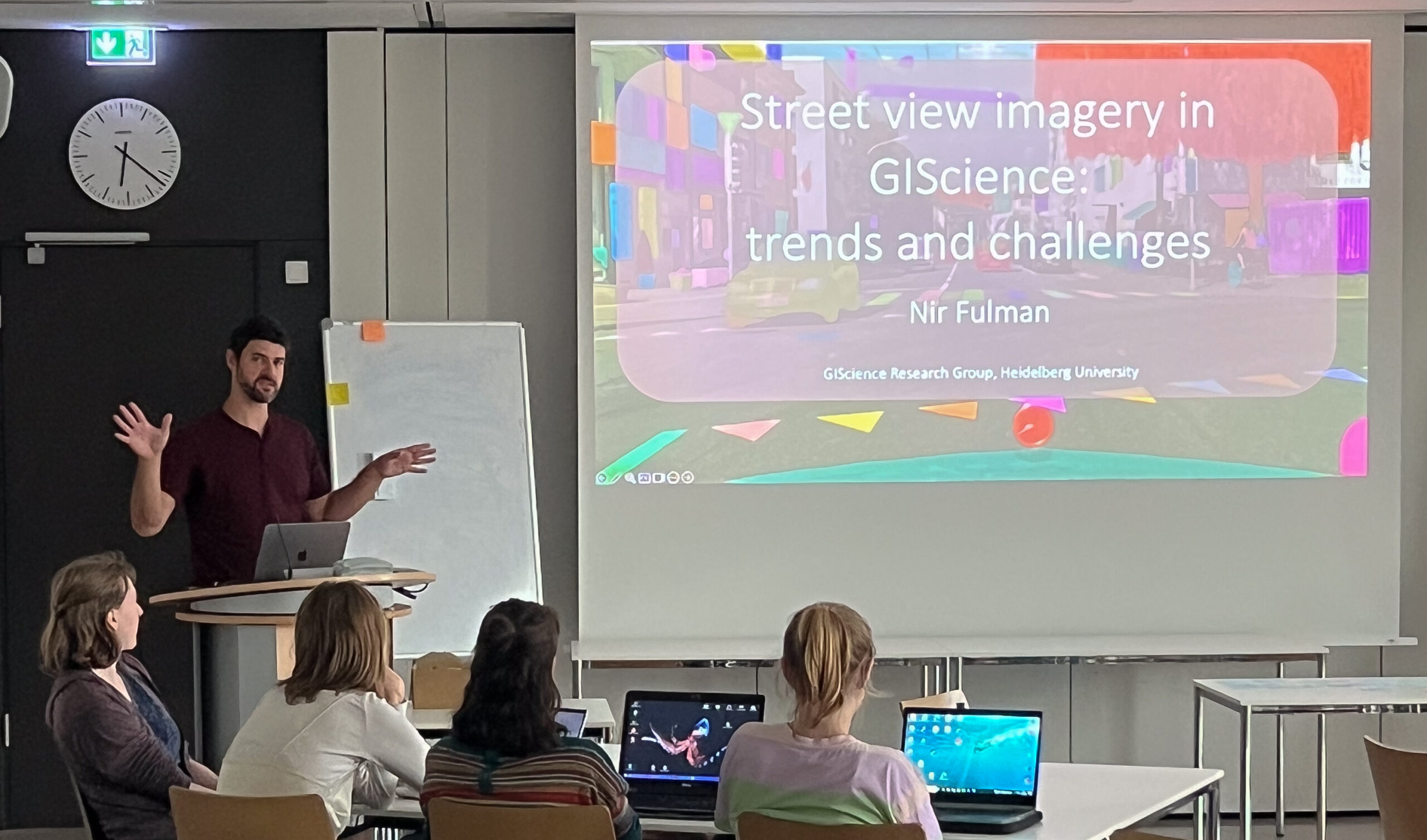
End of Semester Mapathon
At the end of the semester will be another Mapathon! When: Monday, 31.07.2023, at 6 p.m. Where: Mathematikon, INF 205, 5th floor, conference room After a short introduction by Dr. Nil Fulman on “Street view imagery in GIScience: trends and challenges” the street quality of freely available images will be assessed. For this purpose, the…
-
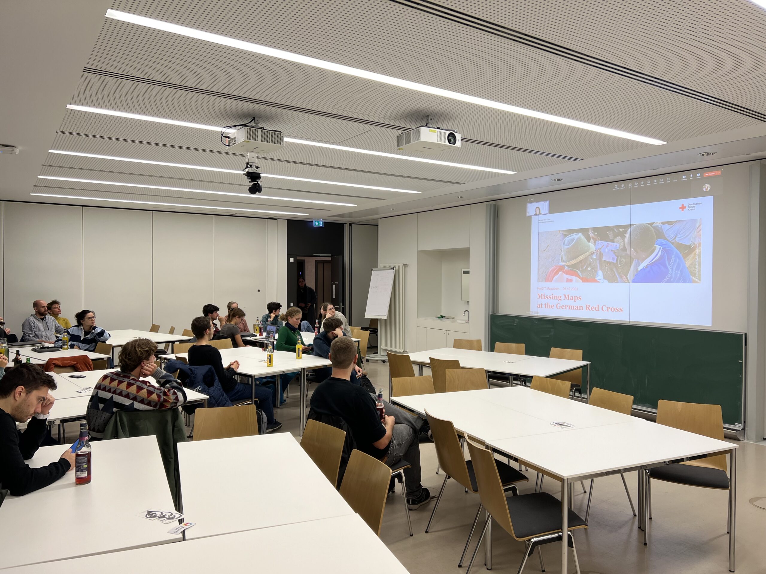
HeiGIT und Deutsches Rotes Kreuz Mapathon zur Unterstützung des Mozambique Red Cross
For english version see below HeiGIT und das Deutsche Rote Kreuz unterstützen das Mozambique Red Cross in einem Projekt zur Sensibilisierung für das Hochwasserrisiko und zum Aufbau von Kapazitäten zur Verringerung des Katastrophenrisikos in Maputo. Zur Verbesserung der Datenlage ist nun, relativ kurzfristig, ein Mapathon für kommenden Montag 23.05. ab 18 Uhr geplant. Zu Beginn…
-
Successful end of the 25 Mapathon Project
On October 12th the “25 Mapathon project” was finalized with an exceptionally successful public online mapathon. Around 20 participants with various professional backgrounds mapped 2273 buildings in three hours to support a flood preparedness project of the GRC in Togo. Furthermore, they shared their experiences and once more demonstrated how much fun it can be…