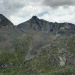
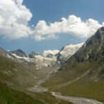
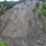
Very interesting terrestrial laser scanning and terrestrial and UAV image datasets of different Alpine sites in Austria have just been openly provided on PANGAEA. The data are related to the first (2015) and second (2017) edition of the Innsbruck Summer School of Alpine Research – Close Range Sensing Techniques in Alpine Terrain and can, for example, be used for surface change analyses between to epochs or the developement of new methods.
- Pfeiffer, J., Höfle, B., Hämmerle, M., Zahs, V., Rutzinger, M., Scaioni, M., Lindenbergh, R., Oude Elberink, S., Pirotti, F., Bremer, M., Wujanz, D. & Zieher, T. (2019): Terrestrial laser scanning data of the Äußeres Hochebenkar rock glacier close to Obergurgl, Austria acquired during the Innsbruck Summer School of Alpine Research. PANGAEA. DOI: https://doi.pangaea.de/10.1594/PANGAEA.902042.
2) Terrestrial and UAV images and point clouds and ground control points of the Rotmoos valley close to Obergurgl in Austria (2015, 2017)
- Pfeiffer, J., Scaioni, M., Rutzinger, M., Adams, M., Graf, A., Sotier, B., Höfle, B., Lindenbergh, R., Oude Elberink, S., Pirotti, F., Bremer, M., Zieher, T., Hämmerle, M. & Wujanz, D. (2019): Terrestrial and unmanned aerial vehicle images of the Rotmoos valley bottom near Obergurgl, Austria with coordinates of corresponding ground control points acquired during the Innsbruck Summer School of Alpine Research 2015 and 2017. PANGAEA. DOI: https://doi.pangaea.de/10.1594/PANGAEA.898939.
3) Multi-temporal terrestrial laser scanning data of the Nesslrinna landslide and its surrounding close to Obergurgl, Austria (2015, 2017)
- Pfeiffer, J., Wujanz, D., Zieher, T., Rutzinger, M., Scaioni, M., Höfle, B., Lindenbergh, R., Oude Elberink, S., Pirotti, F., Bremer, M. & Hämmerle, M. (2019): Terrestrial laser scanning data of the Nesslrinna landslide close to Obergurgl, Austria acquired during the Innsbruck Summer School of Alpine Research. PANGAEA. DOI: https://doi.pangaea.de/10.1594/PANGAEA.901293.
This June, the third edition of the Innsbruck Summer School of Alpine Research will take place in Obergurgl and the investigated sites might be revisited to extend the published datasets.
Interested in the Innsbruck Summer School of Alpine Research? Find more detailed information in the publications below:
- Rutzinger, M., Bremer, M., Höfle, B., Hämmerle, M., Lindenbergh, R., Oude Elberink, S., Pirotti, F., Scaioni, M., Wujanz, D. & Zieher, T. (2018): Training in Innovative Technologies for Close-Range Sensing in Alpine Terrain. ISPRS Annals of Photogrammetry, Remote Sensing and Spatial Information Sciences. Vol. IV-2, pp. 239-246.
- Rutzinger, M., Höfle, B., Lindenbergh, R., Oude Elberink, S., Pirotti, F., Sailer, R., Scaioni, M., Stötter, J. & Wujanz, D. (2016): Close-Range Sensing Techniques in Alpine Terrain. In: ISPRS Annals of Photogrammetry, Remote Sensing and Spatial Information Sciences. Vol. III-6, pp. 15-22.


