
Creating tools to map and navigate the urban (and not-so-urban) jungle has been a specialty of the HeiGIT and GIScience teams since their founding. We’ve plotted our way to the closest park through meinGrün, fostered awareness of barriers for limited-mobility travelers with CAP4Access, and helped find shortcuts through the unprecedented heat with HEAL. The latest addition to that list is Gefahrenstellen.de, which has been generating buzz and headlines in its native Bonn and beyond. The product of three enterprising brothers, the project seeks to help parents and schoolchildren select the path to school with the least traffic and risk, a task that currently weighs on parents’ minds as the new school year begins. For their routing service, the project employed ORS, the openrouteservice client developed by HeiGIT.
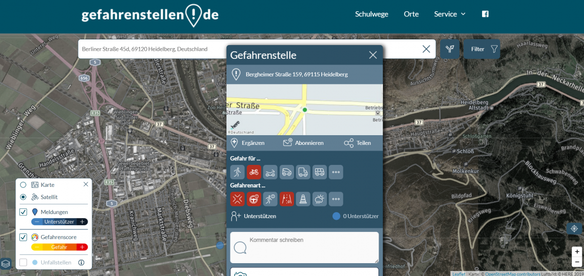
Fig. 1: Report Gefahrenstelle Interface
To learn more about the innovative and timely project, we spoke to Arno Wolter, one of the three founders and CEO of the Initiative for Safer Roads which developed Gefahrenstellen.de.
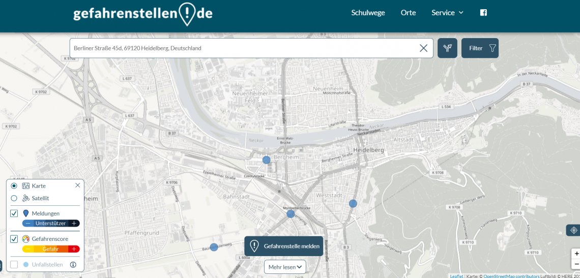
Fig. 2: Screenshot of gefahrenstellen.de
Can you describe your background?
We (I and my two brothers) have been working on developing our own web- and app-based projects for more than 20 years now. In that role, we have been working on user-friendly and needs-based solutions and have been crunching lots of data, but not so much in the traffic/mobility sector before, but in other areas such as travel, mobile phones, insurances.
What inspired you to develop Gefahrenstellen.de?
Due to painful experiences with road accidents in our personal environment a couple of years ago, we thought nowadays with the amount of data available and the existing technologies, it must be possible to invent solutions which tackle road safety more proactively and identify dangerous spots before accidents occur. That is exactly what we did with the research project FeGiS+ (or EDDA+ which stands for “Early Detection of Dangerous Areas in Road Traffic using Smart Data”). Gefahrenstellen.de is the result and platform of that research project.
What was it like working with your family on this project?
We have a well-structured split of responsibilities between the 3 brothers in the company: Henrik runs all the IT, Jörn is in charge of content and public relations, and I (Arno) look after planning, partnerships and collaborations, i.e., our activities and skills are complementary. Sometimes we have heated debates on strategies and directions, but that makes the result even better and more thought-through. We always end up with good solutions, as Gefahrenstellen.de shows.
What are your goals for the project?
Our goal is two-fold: on the one hand, we would like to raise awareness for dangerous areas in the road networks so that road users can avoid dangerous road sections or adapt their behaviour accordingly (and the safer routing option for school children is a good example for this). On the other hand, we would like to provide detailed insights on critical road sections to city authorities and to the police as additional input to prioritize their road safety work and adapt the road infrastructure before serious accidents happen.
What has been the response from users?
The user response has been extremely positive. The user reports on dangerous spots which we receive on Gefahrenstellen.de are of very high quality. A detailed study from RWTH Aachen University and the German Police University have confirmed the validity and relevance of the road user reports. Also, the new service to search the safest route to school has been already used more than 10,000 times in only six weeks after the introduction of the new service.

Fig. 3: Screenshot of routing option on gefahrenstellen.de
How did you incorporate ORS into the project?
Right now, we use ORS for the “safer school routing” on our platform. School children and their parents can search for the safest route on the platform, which avoids hazardous black spots and proposes alternative routes. Of course, such routing can only serve as a suggestion and first indication, and it is up to the parents to discuss the final school routing with their kids. ORS is the perfect fit for us as it also provides dedicated routes, e.g., cyclists also showing smaller streets or pathways.
What do you envision for the future of the project?
We will further develop the features of the platform. For example, we could also imagine a safer route navigation system for cars, as an additional option next to the already-existing fastest and fuel-optimized routes. Another priority will be the implementation of the Gefahrenstellen.de approach in other European countries. We are currently in discussion with two to three other countries which plan to introduce the approach for their road networks in 2023.
Is there anything else you would like to mention?
Every lost life in road traffic is a tragedy and, in general, accidents leave a long-lasting impact on all those involved. It remains our long-term ambition to make a contribution with this project to the VISION ZERO concept. We believe that in today’s advanced world it is not acceptable to have so many road fatalities and it is important to make best use of existing innovations and technologies to avoid accidents.
We look forward to seeing the project in use this coming school year, plugging in our own routes, and keeping up with the future innovations sure to come from Arno Wolter and his enterprising brothers.