

New data description paper on our tree point cloud dataset was just published
Today, our data description paper was published in the open access Journal Earth System Science Data:
Weiser, H., Schäfer, J., Winiwarter, L., Krašovec, N., Fassnacht, F. E., and Höfle, B. (2022): Individual tree point clouds and tree measurements from multi-platform laser scanning in German forests, Earth Syst. Sci. Data, 14, 2989–3012, https://doi.org/10.5194/essd-14-2989-2022.
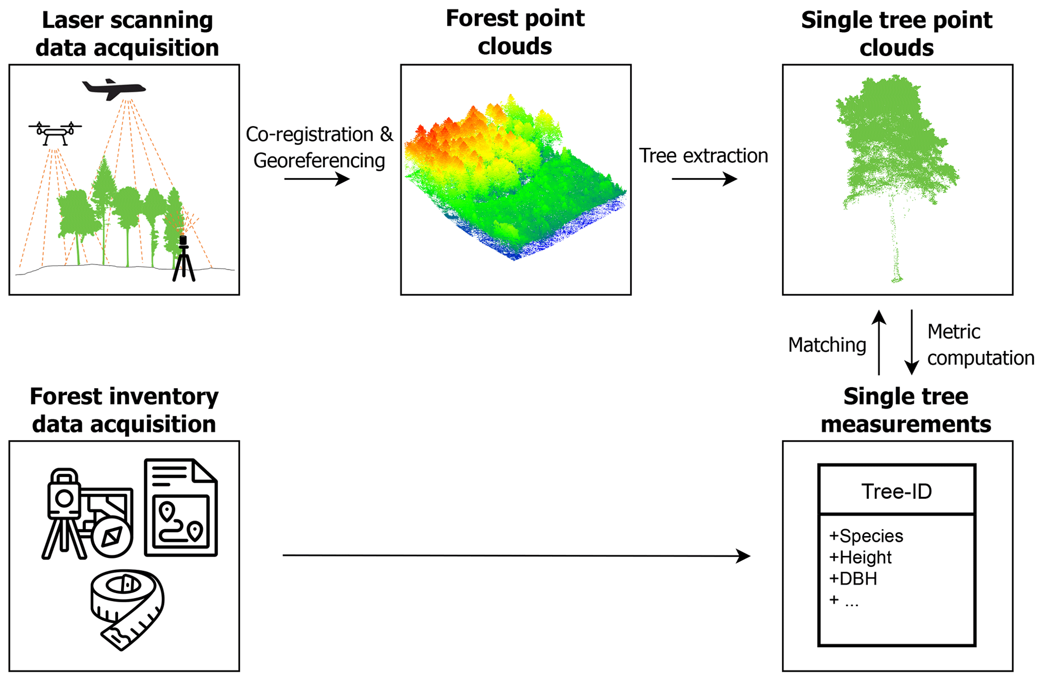
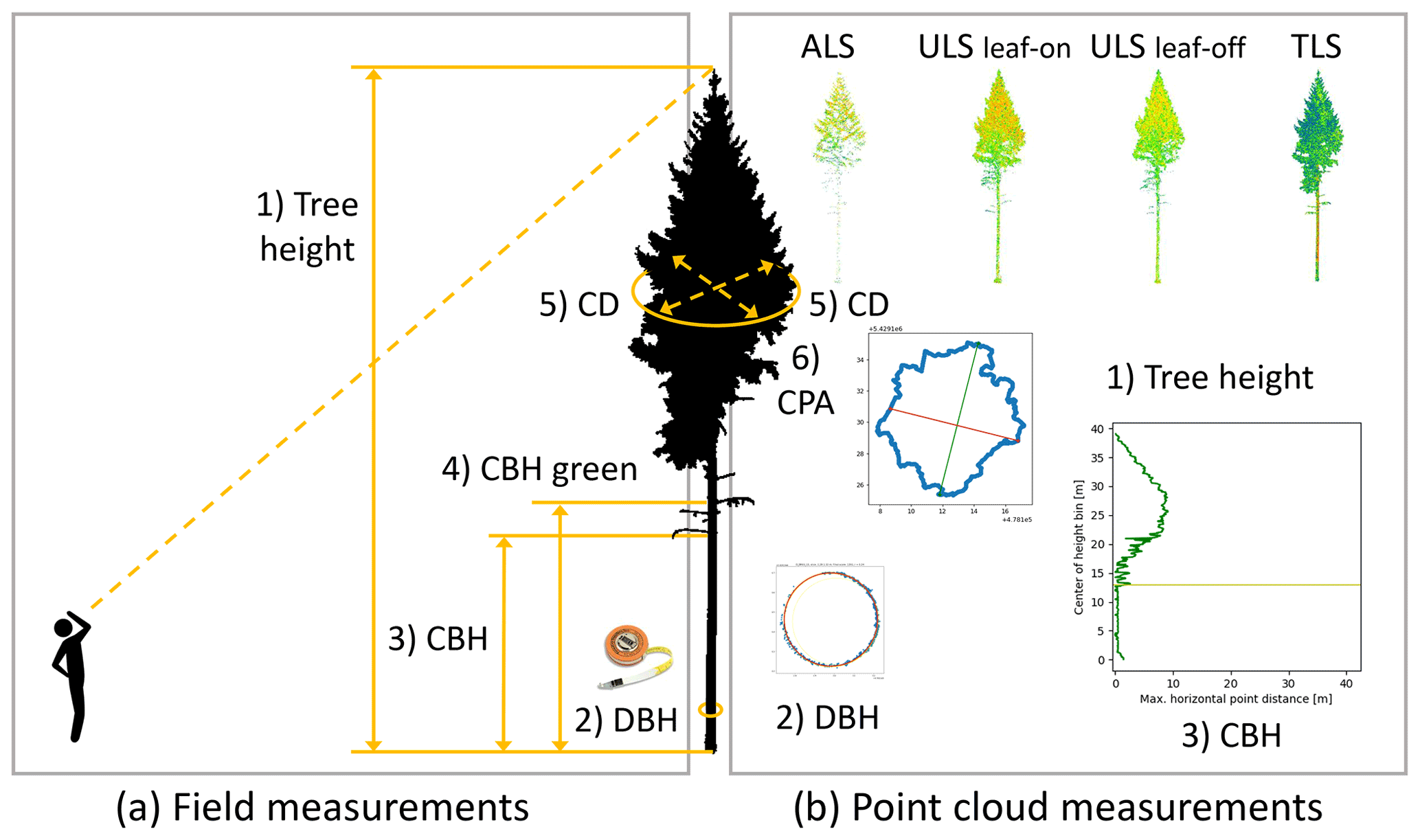
Laser scanning from different acquisition platforms allows the collection of 3D point clouds from different perspectives and with varying resolutions. These point clouds allow us to retrieve information about forest structure and individual tree properties. In the frame of the SYSSIFOSS project, we acquired airborne, UAV-borne and terrestrial laser scanning data in German mixed forests. From these overlapping point clouds, we generated a comprehensive database of individual tree point clouds and corresponding tree metrics.
Our dataset may serve as a benchmark dataset for algorithms in forestry research, in particular automated tree segmentation, tree species classification of forest inventory metric prediction.
With our data description paper, we enable the reuse of our dataset by providing important information on data collection and processing and by presenting a thorough quality analysis.
The dataset and supplementary metadata are available for download, hosted by the PANGAEA data publisher:
Weiser, H., Schäfer, J., Winiwarter, L., et al. (2021): Terrestrial, UAV-borne and airborne laser scanning point clouds of central European forest plots, Germany, with extracted individual trees and manual forest inventory measurements. PANGAEA, https://doi.org/10.1594/PANGAEA.942856.
The database of single tree point clouds and metrics is also available via https://pytreedb.geog.uni-heidelberg.de/, showcasing the web frontend of pytreedb, a Python software package providing a library and API for the storage and sharing of tree point clouds and measurements.

SYSSIFOSS is a joint project between the Institute of Geography and Geoecology (IFGG) of the Karlsruhe Institute of Technology (KIT) and the 3DGeo Research Group of Heidelberg University. The project is funded by the Deutsche Forschungsgemeinschaft (DFG, German Research Foundation) – project number: 411263134. Find further details about the SYSSIFOSS project on the project website, in recent blogposts, or on Twitter (#SYSSIFOSS).
![]()